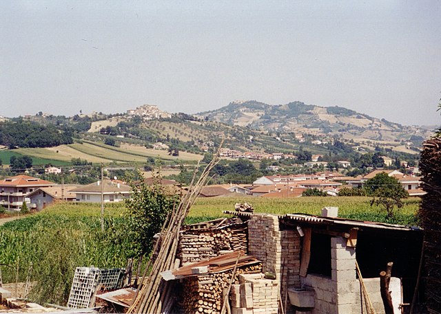
Teramo (Teramo)
.svg)
- Italian comune
 Hiking in Teramo
Teramo, located in the Abruzzo region of Italy, is an excellent destination for hiking enthusiasts. The area is characterized by its diverse landscapes, which include rugged mountains, rolling hills, and beautiful coastlines. Here are some highlights and considerations for hiking in and around Teramo:
1.
- Overview: This national park is home to the highest peaks in the Apennines, making it ideal for serious hikers and nature lovers.
- Trails: There are numerous trails ranging from easy walks to challenging hikes. Key routes include the ascent to Corno Grande (the highest peak) and various paths around the Campo Imperatore area.
- Flora and Fauna: Hikers can expect to see diverse plant species, and if lucky, wildlife such as wolves, deer, and various birds.
2.
- Overview: This mountain range offers beautiful trails with panoramic views, particularly along the ridges.
- Trails: Check out the trails leading to water sources like the "Cascate di Civitella" (Civitella Waterfalls) which provide stunning views and natural swimming spots during warmer months.
3.
- Tortoreto and Giulianova: These coastal towns offer relatively easy walking paths along the Adriatic Sea. Here, hikers can enjoy beach views and the tranquil sea atmosphere.
- Nature Reserves: The areas near the coast also have protected nature reserves that can be explored for both hiking and birdwatching.
4.
- Historical Trails: Many trails in Teramo lead to ancient towns and historical sites like Notaresco and Civitella del Tronto, allowing hikers to combine outdoor activity with cultural exploration.
- Local Cuisine: Don’t forget to sample local Abruzzese cuisine at charming mountain villages or coastal restaurants after your hike!
5.
- Spring and Fall: These seasons offer the best hiking conditions, with mild temperatures and beautiful scenery. Summer can be hot, especially in lower altitudes, while winter is perfect for snowshoeing in higher areas.
6.
- Gear: Make sure to wear proper hiking boots and carry essentials such as water, snacks, a map, and a first-aid kit.
- Guided Tours: For those unfamiliar with the area, consider joining a guided hike to learn more about the local flora and fauna and ensure navigational safety.
7.
- Many local associations and groups organize hiking events and provide up-to-date information on trails and conditions, which can be beneficial.
Diving into the natural beauty and cultural richness of Teramo through hiking can be an exhilarating experience. Make sure to plan ahead, respect nature, and enjoy your adventure!
- Country:

- Postal Code: 64100
- Local Dialing Code: 0861
- Licence Plate Code: TE
- Coordinates: 42° 39' 32" N, 13° 42' 14" E


- GPS tracks (wikiloc): [Link]
- AboveSeaLevel: 265 м m
- Area: 153 sq km
- Population: 54857
- Web site: http://www.comune.teramo.it
- Wikipedia en: wiki(en)
- Wikipedia: wiki(it)
- Wikidata storage: Wikidata: Q13137
- Wikipedia Commons Gallery: [Link]
- Wikipedia Commons Category: [Link]
- Freebase ID: [/m/044sqh]
- GeoNames ID: Alt: [6541856]
- VIAF ID: Alt: [138163693]
- OSM relation ID: [42107]
- GND ID: Alt: [4119563-2]
- archINFORM location ID: [5333]
- Library of Congress authority ID: Alt: [n82028282]
- MusicBrainz area ID: [3f9075cc-8324-4ee5-aedf-8d65db6e07a0]
- Quora topic ID: [Teramo]
- UN/LOCODE: [ITTEO]
- Encyclopædia Britannica Online ID: [place/Teramo-Italy]
- Facebook Places ID: [105583279474144]
- Digital Atlas of the Roman Empire ID: [16105]
- DMOZ ID: Alt: [Regional/Europe/Italy/Regions/Abruzzo/Localities/Teramo/]
- ISTAT ID: 067041
- Italian cadastre code: L103
- US National Archives Identifier: 10045151
Shares border with regions:
Basciano
- Italian comune
Hiking in Basciano
Basciano is a small town located in the Abruzzo region of Italy. While it may not be as widely known for hiking as some larger areas, it is surrounded by beautiful landscapes typical of the Abruzzo region, which is known for its natural parks, mountains, and outdoor activities....
- Country:
- Postal Code: 64030
- Local Dialing Code: 0861
- Licence Plate Code: TE
- Coordinates: 42° 35' 47" N, 13° 44' 8" E
- GPS tracks (wikiloc): [Link]
- AboveSeaLevel: 388 м m
- Area: 18.85 sq km
- Population: 2373
- Web site: [Link]

Bellante
- Italian comune
Hiking in Bellante
Bellante is a charming municipality located in the Teramo province of the Abruzzo region in Italy. The area boasts beautiful landscapes, rolling hills, and a rich cultural heritage, making it a great destination for hikers....
- Country:
- Postal Code: 64020
- Local Dialing Code: 0861
- Licence Plate Code: TE
- Coordinates: 42° 45' 0" N, 13° 48' 0" E
- GPS tracks (wikiloc): [Link]
- AboveSeaLevel: 354 м m
- Area: 50.04 sq km
- Population: 6997
- Web site: [Link]

Campli
- Italian comune
Hiking in Campli
Campli, a charming town located in the Abruzzo region of Italy, offers some beautiful hiking opportunities amidst stunning landscapes, historical sites, and natural parks. Here are some key points to consider if you are planning a hiking trip in and around Campli:...
- Country:
- Postal Code: 64012
- Local Dialing Code: 0861
- Licence Plate Code: TE
- Coordinates: 42° 43' 34" N, 13° 41' 10" E
- GPS tracks (wikiloc): [Link]
- AboveSeaLevel: 393 м m
- Area: 73.43 sq km
- Population: 7110
- Web site: [Link]

Canzano
- Italian comune
Hiking in Canzano
Canzano is a small town located in the Abruzzo region of Italy, known for its beautiful landscapes and proximity to the Gran Sasso e Monti della Laga National Park. The park offers a variety of hiking trails that cater to different experience levels, making it an excellent destination for hikers....
- Country:
- Postal Code: 64020
- Local Dialing Code: 0861
- Licence Plate Code: TE
- Coordinates: 42° 39' 0" N, 13° 48' 0" E
- GPS tracks (wikiloc): [Link]
- AboveSeaLevel: 448 м m
- Area: 16.74 sq km
- Population: 1901
- Web site: [Link]

Castellalto
- Italian comune
Hiking in Castellalto
Castellalto, located in the Abruzzo region of Italy, offers a variety of hiking opportunities that cater to different skill levels and preferences. The region is characterized by stunning landscapes, including hills, vineyards, and picturesque views of the surrounding mountains and valleys....
- Country:
- Postal Code: 64020
- Local Dialing Code: 0861
- Licence Plate Code: TE
- Coordinates: 42° 40' 38" N, 13° 49' 4" E
- GPS tracks (wikiloc): [Link]
- AboveSeaLevel: 492 м m
- Area: 34.18 sq km
- Population: 7578
- Web site: [Link]

Cermignano
- Italian comune
Hiking in Cermignano
Cermignano, a charming town located in the Teramo province of Italy, offers a unique blend of natural beauty and cultural heritage. Here are some aspects to consider for hiking in and around Cermignano:...
- Country:
- Postal Code: 64037
- Local Dialing Code: 0861
- Licence Plate Code: TE
- Coordinates: 42° 35' 0" N, 13° 48' 0" E
- GPS tracks (wikiloc): [Link]
- AboveSeaLevel: 563 м m
- Area: 26.36 sq km
- Population: 1591
- Web site: [Link]

Cortino
- Italian comune
Hiking in Cortino
Cortino, located in the province of Teramo in the Abruzzo region of Italy, is surrounded by beautiful natural landscapes, making it a great destination for hiking enthusiasts. The area is characterized by its stunning mountainous terrain, lush forests, and picturesque views of the Gran Sasso d'Italia and the Monti della Laga....
- Country:
- Postal Code: 64040
- Local Dialing Code: 0861
- Licence Plate Code: TE
- Coordinates: 42° 37' 19" N, 13° 30' 28" E
- GPS tracks (wikiloc): [Link]
- AboveSeaLevel: 892 м m
- Area: 62.95 sq km
- Population: 631
- Web site: [Link]
Montorio al Vomano
- Italian comune
Hiking in Montorio al Vomano
Montorio al Vomano is a charming town located in the Abruzzo region of Italy, surrounded by beautiful landscapes that make it an excellent destination for hiking enthusiasts. The area features a mix of mountainous terrain, lush forests, and scenic views, making it ideal for both casual hikers and more experienced trekkers....
- Country:
- Postal Code: 64046
- Local Dialing Code: 0861
- Licence Plate Code: TE
- Coordinates: 42° 35' 0" N, 13° 38' 0" E
- GPS tracks (wikiloc): [Link]
- AboveSeaLevel: 262 м m
- Area: 53.57 sq km
- Population: 8013
- Web site: [Link]
Penna Sant'Andrea
- Italian comune
Hiking in Penna Sant'Andrea
Penna Sant'Andrea, located in the Abruzzo region of Italy, is a hidden gem for hiking enthusiasts. Nestled in the picturesque Apennine Mountains, this area offers stunning landscapes, rich biodiversity, and a range of hiking trails suitable for different skill levels....
- Country:
- Postal Code: 64039
- Local Dialing Code: 0861
- Licence Plate Code: TE
- Coordinates: 42° 36' 0" N, 13° 46' 0" E
- GPS tracks (wikiloc): [Link]
- AboveSeaLevel: 413 м m
- Area: 11.1 sq km
- Population: 1763
- Web site: [Link]

Torricella Sicura
- Italian comune
Hiking in Torricella Sicura
Torricella Sicura, located in the Abruzzo region of Italy, offers a beautiful landscape for hiking enthusiasts. Surrounded by the stunning views of the Gran Sasso and Monti della Laga National Park, which is not far from the village, the area features rugged mountains, rolling hills, and picturesque valleys....
- Country:
- Postal Code: 64010
- Local Dialing Code: 0861
- Licence Plate Code: TE
- Coordinates: 42° 39' 33" N, 13° 39' 26" E
- GPS tracks (wikiloc): [Link]
- AboveSeaLevel: 437 м m
- Area: 54.38 sq km
- Population: 2621
- Web site: [Link]