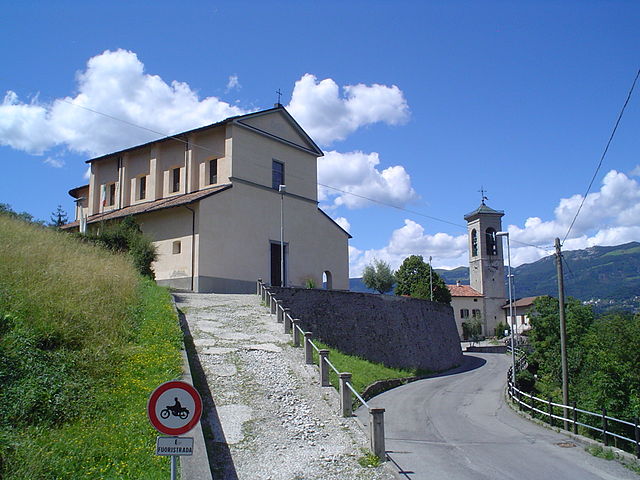
Costa Valle Imagna (Costa Valle Imagna)
.svg)
- Italian comune
 Hiking in Costa Valle Imagna
Costa Valle Imagna, located in the Lombardy region of Italy, offers a wonderful hiking experience characterized by picturesque landscapes, charming villages, and a rich cultural heritage. Here are some key points about hiking in this area:
Scenic Beauty
- Natural Landscapes: The region is known for its rolling hills, lush forests, and sweeping views of the surrounding mountains. The varied terrain provides plenty of opportunities for hikers of all skill levels.
- Wildlife: The area is home to diverse flora and fauna, making it a great spot for nature enthusiasts and bird watchers.
Hiking Trails
- Trail Diversity: Costa Valle Imagna features a network of well-marked trails ranging from easy, leisurely walks to more challenging hikes. Popular routes include paths leading to panoramic viewpoints and historical sites.
- Loop Trails: Many trails are looped, allowing hikers to explore without retracing steps. This offers a more enriching experience, passing through different environments and landscapes.
Cultural Sites
- Villages and Churches: Along the hiking routes, you can explore quaint villages and historical architecture, including ancient churches that reflect the local heritage.
- Food and Hospitality: After a hike, you can take advantage of local eateries and agriturismos (farm stays) that serve traditional Lombardy cuisine, providing a chance to experience the local culture.
Best Time to Hike
- Season: The best months for hiking are typically late spring (May to June) and early autumn (September to October) when the weather is mild and the trails are less crowded.
- Weather: Always check weather conditions before heading out, as mountain weather can change rapidly.
Preparation and Safety
- Gear: Wear good hiking shoes and bring appropriate gear, including water, snacks, a map, and a first-aid kit.
- Guided Tours: If you’re unfamiliar with the area, consider joining a guided hiking tour for expert insights and safety.
Additional Activities
- Cycling: Besides hiking, the area is also great for mountain biking, with trails that cater to various difficulty levels.
- Cultural Events: Look for local festivals or events that might coincide with your visit, as these can enhance your experience of the region.
Costa Valle Imagna is a gem for hikers looking to explore a beautiful and less-traveled part of Italy, combining outdoor adventure with cultural exploration. Enjoy your hike!
- Country:

- Postal Code: 24030
- Local Dialing Code: 035
- Licence Plate Code: BG
- Coordinates: 45° 48' 0" N, 9° 30' 0" E


- GPS tracks (wikiloc): [Link]
- AboveSeaLevel: 1014 м m
- Area: 4.21 sq km
- Population: 587
- Web site: http://www.comune.costavalleimagna.bg.it
- Wikipedia en: wiki(en)
- Wikipedia: wiki(it)
- Wikidata storage: Wikidata: Q100420
- Wikipedia Commons Gallery: [Link]
- Wikipedia Commons Category: [Link]
- Freebase ID: [/m/046k6x]
- GeoNames ID: Alt: [6537151]
- OSM relation ID: [46148]
- ISTAT ID: 016085
- Italian cadastre code: D103
Shares border with regions:


Roncola
- Italian comune
Hiking in Roncola
Roncola is a picturesque area in Italy, situated in the Lombardy region, near the beautiful Bergamo Alps. It's known for its stunning landscapes, rich history, and various hiking opportunities. Here are some key points to consider if you're planning a hiking trip in and around Roncola:...
- Country:
- Postal Code: 24030
- Local Dialing Code: 035
- Licence Plate Code: BG
- Coordinates: 45° 46' 0" N, 9° 33' 0" E
- GPS tracks (wikiloc): [Link]
- AboveSeaLevel: 854 м m
- Area: 5.07 sq km
- Population: 780
- Web site: [Link]


Sant'Omobono Terme
- Italian comune
Hiking in Sant'Omobono Terme
Sant'Omobono Terme is a charming town located in the province of Bergamo, Lombardy, Italy. It is well-known for its thermal springs and beautiful surrounding landscapes, making it an attractive destination for hikers and outdoor enthusiasts....
- Country:
- Postal Code: 24038
- Local Dialing Code: 035
- Licence Plate Code: BG
- Coordinates: 45° 48' 33" N, 9° 32' 14" E
- GPS tracks (wikiloc): [Link]
- AboveSeaLevel: 427 м m
- Area: 16.43 sq km
- Population: 3940
- Web site: [Link]


Carenno
- Italian comune
Hiking in Carenno
Carenno is a charming municipality located in the province of Lecco in the Lombardy region of Italy. It offers a variety of hiking opportunities, characterized by beautiful landscapes, lush vegetation, and picturesque views of the surrounding mountains and valleys. Here’s a general guide to hiking in Carenno:...
- Country:
- Postal Code: 23802
- Local Dialing Code: 0341
- Licence Plate Code: LC
- Coordinates: 45° 48' 0" N, 9° 28' 0" E
- GPS tracks (wikiloc): [Link]
- AboveSeaLevel: 635 м m
- Area: 7.79 sq km
- Population: 1474
- Web site: [Link]
Torre de' Busi
- Italian comune
Hiking in Torre de' Busi
Torre de' Busi is a small town located in the Lombardy region of Italy, nestled in the hills near the scenic area of Bergamo. The surrounding landscape offers numerous opportunities for hiking enthusiasts and nature lovers alike. Here’s a guide to hiking in Torre de' Busi and its surroundings:...
- Country:
- Postal Code: 24032; 23806
- Local Dialing Code: 035
- Licence Plate Code: BG
- Coordinates: 45° 46' 0" N, 9° 29' 0" E
- GPS tracks (wikiloc): [Link]
- AboveSeaLevel: 472 м m
- Area: 8.97 sq km
- Population: 2077
- Web site: [Link]

Bedulita
- Italian comune
Hiking in Bedulita
Bedulita is a small village located in the province of Bergamo, Lombardy, Italy. It is situated in the foothills of the Alps, making it a great starting point for hiking and exploring the natural beauty of the surrounding area....
- Country:
- Postal Code: 24030
- Local Dialing Code: 035
- Licence Plate Code: BG
- Coordinates: 45° 47' 29" N, 9° 33' 4" E
- GPS tracks (wikiloc): [Link]
- AboveSeaLevel: 600 м m
- Area: 4.27 sq km
- Population: 732
- Web site: [Link]