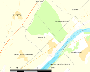
Cour-sur-Loire (Cour-sur-Loire)

- commune in Loir-et-Cher, France
- Country:

- Postal Code: 41500
- Coordinates: 47° 39' 19" N, 1° 25' 58" E


- GPS tracks (wikiloc): [Link]
- Area: 5.4 sq km
- Population: 282
- Wikipedia en: wiki(en)
- Wikipedia: wiki(fr)
- Wikidata storage: Wikidata: Q429644
- Wikipedia Commons Category: [Link]
- Freebase ID: [/m/03nv_vg]
- GeoNames ID: Alt: [3022939]
- SIREN number: [214100695]
- BnF ID: [152593456]
- INSEE municipality code: 41069
Shares border with regions:
Villerbon
- commune in Loir-et-Cher, France
- Country:
- Postal Code: 41000
- Coordinates: 47° 39' 44" N, 1° 22' 18" E
- GPS tracks (wikiloc): [Link]
- Area: 17.28 sq km
- Population: 793


Suèvres
- commune in Loir-et-Cher, France
- Country:
- Postal Code: 41500
- Coordinates: 47° 40' 0" N, 1° 27' 39" E
- GPS tracks (wikiloc): [Link]
- Area: 36.65 sq km
- Population: 1673

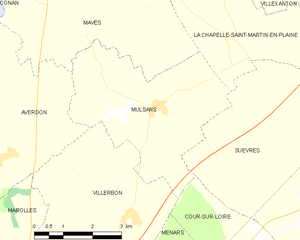
Mulsans
- commune in Loir-et-Cher, France
- Country:
- Postal Code: 41500
- Coordinates: 47° 41' 46" N, 1° 23' 6" E
- GPS tracks (wikiloc): [Link]
- Area: 16 sq km
- Population: 509


Saint-Claude-de-Diray
- commune in Loir-et-Cher, France
- Country:
- Postal Code: 41350
- Coordinates: 47° 36' 55" N, 1° 24' 57" E
- GPS tracks (wikiloc): [Link]
- Area: 9.17 sq km
- Population: 1762
- Web site: [Link]


Montlivault
- commune in Loir-et-Cher, France
- Country:
- Postal Code: 41350
- Coordinates: 47° 38' 23" N, 1° 26' 37" E
- GPS tracks (wikiloc): [Link]
- Area: 10.73 sq km
- Population: 1375

Menars
- commune in Loir-et-Cher, France
- Country:
- Postal Code: 41500
- Coordinates: 47° 38' 33" N, 1° 24' 31" E
- GPS tracks (wikiloc): [Link]
- Area: 4.5 sq km
- Population: 633