Courances (Courances)

- commune in Essonne, France
- Country:

- Postal Code: 91490
- Coordinates: 48° 26' 23" N, 2° 28' 29" E


- GPS tracks (wikiloc): [Link]
- Area: 8.31 sq km
- Population: 345
- Web site: http://www.courances.fr/
- Wikipedia en: wiki(en)
- Wikipedia: wiki(fr)
- Wikidata storage: Wikidata: Q266200
- Wikipedia Commons Category: [Link]
- Freebase ID: [/m/03mgdc8]
- Freebase ID: [/m/03mgdc8]
- GeoNames ID: Alt: [3023171]
- GeoNames ID: Alt: [3023171]
- SIREN number: [219101805]
- SIREN number: [219101805]
- BnF ID: [15280102t]
- BnF ID: [15280102t]
- VIAF ID: Alt: [127004868]
- VIAF ID: Alt: [127004868]
- archINFORM location ID: [15937]
- archINFORM location ID: [15937]
- Library of Congress authority ID: Alt: [no2005053423]
- Library of Congress authority ID: Alt: [no2005053423]
- INSEE municipality code: 91180
- INSEE municipality code: 91180
Shares border with regions:

Moigny-sur-École
- commune in Essonne, France
- Country:
- Postal Code: 91490
- Coordinates: 48° 25' 58" N, 2° 27' 25" E
- GPS tracks (wikiloc): [Link]
- Area: 12.23 sq km
- Population: 1265
- Web site: [Link]

Dannemois
- commune in Essonne, France
- Country:
- Postal Code: 91490
- Coordinates: 48° 27' 9" N, 2° 28' 36" E
- GPS tracks (wikiloc): [Link]
- Area: 8.43 sq km
- Population: 831
- Web site: [Link]


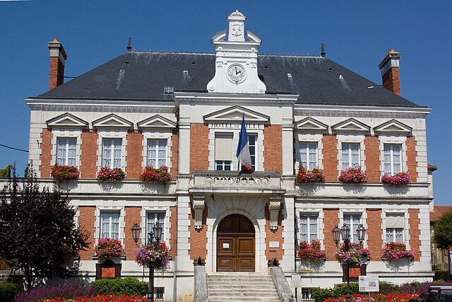
Cély
- commune in Seine-et-Marne, France
- Country:
- Postal Code: 77930
- Coordinates: 48° 27' 33" N, 2° 31' 54" E
- GPS tracks (wikiloc): [Link]
- AboveSeaLevel: 62 м m
- Area: 6.19 sq km
- Population: 1152
- Web site: [Link]
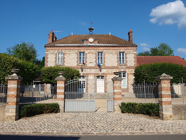
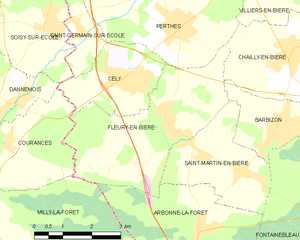
Fleury-en-Bière
- commune in Seine-et-Marne, France
- Country:
- Postal Code: 77930
- Coordinates: 48° 26' 52" N, 2° 32' 57" E
- GPS tracks (wikiloc): [Link]
- Area: 13.87 sq km
- Population: 661
Milly-la-Forêt
- commune in Essonne, France
- Country:
- Postal Code: 91490
- Coordinates: 48° 24' 15" N, 2° 28' 1" E
- GPS tracks (wikiloc): [Link]
- Area: 33.8 sq km
- Population: 4726
- Web site: [Link]