
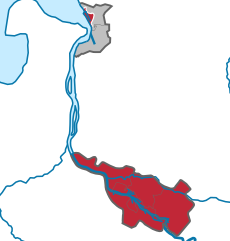
Delmenhorst (Delmenhorst)

- city in Lower Saxony, Germany
 Hiking in Delmenhorst
Delmenhorst is a town located in Lower Saxony, Germany, near Bremen. While it may not be as widely known for hiking as some other regions, it offers several opportunities for outdoor walking and nature exploration. Here are some insights about hiking in and around Delmenhorst:
Local Parks and Nature Areas
- Delmenhorst Stadtpark: This is a central park in Delmenhorst that features well-maintained paths, beautiful greenery, and a serene atmosphere, perfect for a leisurely walk.
- Weserufer: The banks of the Weser River offer scenic routes for walking and biking, allowing you to enjoy riverside views.
- Bremer Schweiz: A region near Delmenhorst known for its hilly landscapes that provide some variety in terrain and scenic views. There are paths winding through forests and fields.
Nearby Hiking Trails
- Wildeshausen Geest Nature Park: A short drive from Delmenhorst, this larger area has designated hiking trails that vary in difficulty. It includes beautiful landscapes, heathlands, and wooded areas.
- Packenbacher Moor: This nature reserve not far from Delmenhorst has marked trails and opportunities for observing local wildlife in a wetland environment.
Tips for Hiking in Delmenhorst
- Weather Prep: The weather can change quickly in this region, so dress in layers and check the forecast before heading out.
- Trail Maps: Consider using local maps or apps to navigate trails, as well-established paths can sometimes be hard to find.
- Safety: Inform someone about your hiking plans, especially if you choose more remote areas, and always carry water and snacks.
Local Hiking Groups
If you're looking to connect with other hikers, consider joining local hiking groups or clubs that organize regular outings and events. This can enhance your hiking experience through shared knowledge and companionship.
Overall, while Delmenhorst may not be a quintessential hiking destination, its parks, nearby nature areas, and community-led activities make it a pleasant spot for those who appreciate nature and want to enjoy the outdoors.
- Country:

- Postal Code: 27749–27755
- Local Dialing Code: 04221
- Licence Plate Code: DEL
- Coordinates: 53° 3' 2" N, 8° 37' 54" E


- GPS tracks (wikiloc): [Link]
- AboveSeaLevel: 7 м m
- Area: 62.45 sq km
- Population: 77045
- Web site: https://www.delmenhorst.de/
- Wikipedia en: wiki(en)
- Wikipedia: wiki(de)
- Wikidata storage: Wikidata: Q3907
- Wikipedia Commons Gallery: [Link]
- Wikipedia Commons Category: [Link]
- Freebase ID: [/m/03xgqm]
- GeoNames ID: Alt: [2938323]
- BnF ID: [11992308s]
- VIAF ID: Alt: [131941473]
- OSM relation ID: [62414]
- GND ID: Alt: [4011382-6]
- archINFORM location ID: [8199]
- Library of Congress authority ID: Alt: [n82274108]
- MusicBrainz area ID: [95a8c7fe-6aab-4fd2-81b7-f4a05e3ab994]
- WOEID: [644106]
- Quora topic ID: [Delmenhorst]
- Encyclopædia Britannica Online ID: [place/Delmenhorst]
- National Library of Israel ID: [000038385]
- NUTS code: [DE941]
- BabelNet ID: [03891791n]
- German municipality key: 03401000
- German district key: 03401
Includes regions:

Hasbergen
- human settlement in Germany
Hiking in Hasbergen
Hasbergen is a district in Delmenhorst, Germany, which is located near the larger city of Bremen. While it may not be as well-known for hiking as some mountainous regions in Germany, there are still opportunities for pleasant walks and hikes in the surrounding areas....
- Country:
- Postal Code: 27751
- Local Dialing Code: 04221
- Coordinates: 53° 4' 32" N, 8° 39' 36" E
- GPS tracks (wikiloc): [Link]
- AboveSeaLevel: 7 м m
- Area: 20.03 sq km
Stickgras
- human settlement in Germany
Hiking in Stickgras
It seems like "Stickgras" might be a typo or a less-known location, as it doesn’t appear to correspond to a widely recognized hiking area or trail. However, if you meant to refer to a specific location or region, such as a national park or a trail system, please clarify, and I'd be happy to provide information on that!...
- Country:
- Postal Code: 27751
- Local Dialing Code: 04221
- Coordinates: 53° 2' 59" N, 8° 40' 7" E
- GPS tracks (wikiloc): [Link]
- AboveSeaLevel: 6 м m
Shares border with regions:

Bremen
- city in the Bremen federated state, Germany
Hiking in Bremen
Bremen, while primarily known for its rich history and vibrant cultural scene, doesn't have the extensive hiking trails commonly found in more mountainous regions of Germany. However, there are some lovely outdoor areas and walking opportunities nearby that can satisfy those looking for a hiking experience....
- Country:
- Postal Code: 28779; 28777; 28759; 28757; 28755; 28719; 28717; 28359; 28357; 28355; 28329; 28327; 28325; 28309; 28307; 28279; 28277; 28259; 28239; 28237; 28219; 28217; 28215; 28213; 28211; 28209; 28207; 28205; 28203; 28201; 28199; 28197; 28195
- Local Dialing Code: 0421
- Licence Plate Code: HB
- Coordinates: 53° 4' 37" N, 8° 48' 32" E
- GPS tracks (wikiloc): [Link]
- AboveSeaLevel: 6 м m
- Area: 326.18 sq km
- Population: 568006
- Web site: [Link]


Wesermarsch
- district in Lower Saxony, Germany
Hiking in Wesermarsch
Wesermarsch is a fascinating region in Lower Saxony, Germany, known for its flat landscapes, unique marsh ecosystems, and rich cultural heritage. While it may not be as mountainous as other hiking destinations, it offers a variety of hiking trails suitable for all levels, especially for those who enjoy tranquil walks in nature and picturesque views....
- Country:
- Capital: Brake
- Licence Plate Code: BRA
- Coordinates: 53° 19' 48" N, 8° 19' 48" E
- GPS tracks (wikiloc): [Link]
- Area: 821.87 sq km
- Population: 89282
- Web site: [Link]


Oldenburg
- district of Lower Saxony, Germany
Hiking in Oldenburg
Oldenburg District, located in Lower Saxony, Germany, offers a variety of landscapes and trails suitable for hiking enthusiasts. While it may not be as mountainous as other regions in Germany, its scenic countryside, woodlands, and lakes provide a wonderful backdrop for outdoor activities....
- Country:
- Licence Plate Code: OL
- Coordinates: 53° 0' 0" N, 8° 25' 12" E
- GPS tracks (wikiloc): [Link]
- AboveSeaLevel: 25 м m
- Area: 1063.00 sq km
- Population: 129484
- Web site: [Link]


Diepholz
- district in Lower Saxony, Germany
Hiking in Diepholz
Diepholz is a district located in Lower Saxony, Germany, known for its scenic landscapes and outdoor recreational opportunities, including hiking. Here are some insights about hiking in and around Diepholz:...
- Country:
- Licence Plate Code: SY; DH
- Coordinates: 52° 40' 12" N, 8° 34' 48" E
- GPS tracks (wikiloc): [Link]
- AboveSeaLevel: 52 м m
- Area: 1987.00 sq km
- Population: 209671
- Web site: [Link]