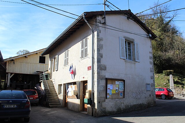
Dessia (Dessia)
- former commune in Jura, France
Dessia, often referred to as a hidden gem for hiking enthusiasts, offers a variety of trails suitable for all levels of hikers. Here’s what you need to know about hiking in this region:
Trails and Routes
- Beginner Trails: Dessia features several easier paths that are perfect for novice hikers. These trails often showcase the region's natural beauty without overwhelming those who are just starting out.
- Intermediate and Advanced Trails: For experienced hikers, there are more challenging routes that offer stunning views of the surrounding landscape. These trails may involve steeper inclines and rougher terrain.
Scenery and Flora/Fauna
- Expect to see a diverse range of plant species, with vibrant wildflowers in spring and lush greenery in summer.
- Wildlife enthusiasts may spot various birds and small mammals along the trails.
Best Hiking Season
- Spring and Fall: These seasons typically offer the most pleasant weather for hiking, with mild temperatures and fewer bugs.
- Summer: May be hotter, so starting hikes early in the morning is advisable.
- Winter: Depending on the altitude, some trails may be accessible, but it's essential to be prepared for colder weather and possible snow conditions.
Safety Tips
- Prepare for Weather: Always check the weather forecast before heading out, as conditions can change quickly.
- Stay Hydrated: Carry plenty of water, especially on longer hikes.
- Trail Etiquette: Stay on marked paths and respect wildlife by observing from a distance.
Amenities and Accessibility
- Many trails may have parking areas but check for any required permits in advance.
- Local visitors' centers can provide maps and additional information about trail conditions.
Conclusion
Hiking in Dessia can be a rewarding experience for those looking to connect with nature, be it for a leisurely stroll or a more rigorous hike. Always plan ahead, pack appropriately, and enjoy the stunning natural beauty this area has to offer!
- Country:

- Postal Code: 39320
- Coordinates: 46° 23' 6" N, 5° 30' 5" E


- GPS tracks (wikiloc): [Link]
- Area: 4.64 sq km
- Population: 62
- Wikipedia en: wiki(en)
- Wikipedia: wiki(fr)
- Wikidata storage: Wikidata: Q536414
- Wikipedia Commons Category: [Link]
- Freebase ID: [/m/03np7zv]
- GeoNames ID: Alt: [6433539]
- BnF ID: [152585596]
- INSEE municipality code: 39195
Shares border with regions:


Valfin-sur-Valouse
- former commune in Jura, France
Valfin-sur-Valouse is a charming village located in the Jura region of France, known for its stunning natural landscapes and outdoor activities, including hiking. The area features lush forests, rolling hills, and beautiful views of the surrounding countryside, making it an ideal destination for hikers of all skill levels....
- Country:

- Postal Code: 39240
- Coordinates: 46° 22' 10" N, 5° 31' 10" E


- GPS tracks (wikiloc): [Link]
- Area: 8.67 sq km
- Population: 82


Lains
- former commune in Jura, France
Lains, often referred to in the context of hiking, may relate to specific areas known for their scenic trails and natural beauty, but it's not clear which specific location you mean. If you are referring to Lainz, which is a district in Vienna, Austria, I can provide details about hiking in that area....
- Country:

- Postal Code: 39320
- Coordinates: 46° 23' 26" N, 5° 29' 14" E


- GPS tracks (wikiloc): [Link]
- Area: 9.81 sq km
- Population: 82


Dramelay
- commune in Jura, France
Dramelay is a lesser-known hiking destination that offers beautiful trails and a chance to immerse yourself in nature. If you're planning to hike in this area, here are some things you should know:...
- Country:

- Postal Code: 39240
- Coordinates: 46° 24' 24" N, 5° 32' 10" E


- GPS tracks (wikiloc): [Link]
- Area: 6.53 sq km
- Population: 29

