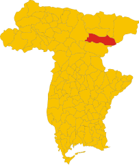
Dogna (Dogna)
.svg)
- Italian comune
 Hiking in Dogna
Dogna is a small town located in the Friuli Venezia Giulia region of northeastern Italy, nestled in the Julian Alps. It's known for its beautiful landscapes and outdoor recreational opportunities, including hiking. Here are some key points to consider if you're planning a hiking trip in the Dogna area:
Trails and Routes
-
Varied Terrain: The region around Dogna features diverse landscapes, including lush forests, rocky terrains, and alpine meadows. This provides hikers with numerous trail options, suitable for different skill levels.
-
Scenic Views: Many trails offer breathtaking views of the Julian Alps, valleys, and nearby mountains. Look for paths that lead to viewpoints, especially during sunrise or sunset for the best experiences.
-
Local Trails: Some popular hiking routes include paths leading to the nearby Sella Nevea area and trails that take you to the surrounding peaks. The “Strada delle Forre” is also a popular choice that showcases the natural beauty of the region.
-
Historical Trails: Consider exploring trails that have historical significance, such as World War I routes, which offer a glimpse into the area’s past and also provide informative signs along the way.
Tips for Hiking in Dogna
- Check Weather Conditions: The weather in the Alps can change rapidly. Make sure to check the forecast before heading out and prepare for varying conditions.
- Equipment: Wear appropriate hiking footwear and pack necessary equipment, such as water, snacks, first aid kits, and a map or GPS device.
- Respect Nature: Follow Leave No Trace principles to preserve the natural beauty of the trails and ensure they're available for future hikers.
- Local Guides: If you're unfamiliar with the area, consider hiring a local guide who can provide insights into the trails, flora, and fauna.
Accessibility
- Dogna is accessible by car, and there are parking areas available near popular trailheads. Public transportation options may be limited, so plan accordingly.
Best Times to Hike
- Summer (June to September): This is the most popular season for hiking, with good weather and long daylight hours.
- Autumn: It can be a wonderful time to hike, with beautiful fall foliage and fewer crowds.
- Spring: Early spring hikes may be limited due to snow at higher elevations, but lower trails can be pleasant.
Local Amenities
- Check for local accommodations and eateries in Dogna and nearby areas. After a long day of hiking, you might want to enjoy some local cuisine to refuel.
In summary, Dogna offers a variety of hiking opportunities set in stunning alpine scenery, making it a great destination for both novice and experienced hikers. Always ensure you have a good plan and respect the natural environment while you enjoy your adventure!
- Country:

- Postal Code: 33010
- Local Dialing Code: 0428
- Licence Plate Code: UD
- Coordinates: 46° 26' 53" N, 13° 18' 54" E


- GPS tracks (wikiloc): [Link]
- AboveSeaLevel: 430 м m
- Area: 70.37 sq km
- Population: 168
- Web site: http://www.comune.dogna.ud.it/
- Wikipedia en: wiki(en)
- Wikipedia: wiki(it)
- Wikidata storage: Wikidata: Q53253
- Wikipedia Commons Category: [Link]
- Freebase ID: [/m/0gk8tf]
- GeoNames ID: Alt: [6539647]
- VIAF ID: Alt: [298396066]
- OSM relation ID: [79123]
- ISTAT ID: 030033
- Italian cadastre code: D316
Shares border with regions:

Chiusaforte
- Italian comune
Hiking in Chiusaforte
Chiusaforte, located in the Friuli Venezia Giulia region of Italy, is a great destination for hiking enthusiasts. Nestled in the Julian Alps, this area offers a stunning landscape characterized by towering mountains, lush valleys, and clear rivers....
- Country:
- Postal Code: 33010
- Local Dialing Code: 0433
- Licence Plate Code: UD
- Coordinates: 46° 24' 0" N, 13° 19' 0" E
- GPS tracks (wikiloc): [Link]
- AboveSeaLevel: 391 м m
- Area: 100.2 sq km
- Population: 628
- Web site: [Link]


Malborghetto Valbruna
- Italian comune
Hiking in Malborghetto Valbruna
Malborghetto Valbruna is a picturesque village located in the Valcanale region of northeastern Italy, close to the Austrian border. It is surrounded by stunning Alpine scenery and offers a variety of hiking opportunities for all skill levels. Here are some highlights and tips for hiking in this area:...
- Country:
- Postal Code: 33010
- Local Dialing Code: 0428
- Licence Plate Code: UD
- Coordinates: 46° 30' 24" N, 13° 26' 22" E
- GPS tracks (wikiloc): [Link]
- AboveSeaLevel: 721 м m
- Area: 124.21 sq km
- Population: 919
- Web site: [Link]


Moggio Udinese
- Italian comune
Hiking in Moggio Udinese
Moggio Udinese, located in the Friuli-Venezia Giulia region of northeastern Italy, is a charming destination for hiking enthusiasts. Nestled in the Julian Alps, the area is characterized by lush landscapes, picturesque valleys, and majestic mountain views. Here are some highlights and tips for hiking in and around Moggio Udinese:...
- Country:
- Postal Code: 33015
- Local Dialing Code: 0433
- Licence Plate Code: UD
- Coordinates: 46° 25' 0" N, 13° 12' 0" E
- GPS tracks (wikiloc): [Link]
- AboveSeaLevel: 341 м m
- Area: 142.44 sq km
- Population: 1703
- Web site: [Link]


Pontebba
- Italian comune
Hiking in Pontebba
Pontebba, located in the Friuli Venezia Giulia region of northeastern Italy, is a fantastic destination for hiking enthusiasts. Nestled at the foot of the Julian Alps, it offers stunning landscapes, a variety of trails, and rich natural and cultural heritage....
- Country:
- Postal Code: 33016
- Local Dialing Code: 0428
- Licence Plate Code: UD
- Coordinates: 46° 30' 0" N, 13° 19' 0" E
- GPS tracks (wikiloc): [Link]
- AboveSeaLevel: 568 м m
- Area: 99.66 sq km
- Population: 1397
- Web site: [Link]