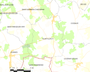
Dornes (Dornes)

- commune in Nièvre, France
- Country:

- Postal Code: 58390
- Coordinates: 46° 42' 54" N, 3° 21' 9" E


- GPS tracks (wikiloc): [Link]
- Area: 39.49 sq km
- Population: 1393
- Web site: http://www.dornes.fr
- Wikipedia en: wiki(en)
- Wikipedia: wiki(fr)
- Wikidata storage: Wikidata: Q371649
- Wikipedia Commons Category: [Link]
- Freebase ID: [/m/03qfcph]
- GeoNames ID: Alt: [6437970]
- SIREN number: [215801044]
- BnF ID: [15266369p]
- VIAF ID: Alt: [311593135]
- INSEE municipality code: 58104
Shares border with regions:

Saint-Ennemond
- commune in Allier, France
- Country:
- Postal Code: 03400
- Coordinates: 46° 40' 34" N, 3° 25' 21" E
- GPS tracks (wikiloc): [Link]
- Area: 38.08 sq km
- Population: 651

Toury-Lurcy
- commune in Nièvre, France
- Country:
- Postal Code: 58300
- Coordinates: 46° 44' 19" N, 3° 25' 31" E
- GPS tracks (wikiloc): [Link]
- Area: 25.54 sq km
- Population: 418
Toury-sur-Jour
- commune in Nièvre, France
- Country:
- Postal Code: 58240
- Coordinates: 46° 43' 44" N, 3° 14' 27" E
- GPS tracks (wikiloc): [Link]
- Area: 24.4 sq km
- Population: 121
Saint-Parize-en-Viry
- commune in Nièvre, France
- Country:
- Postal Code: 58300
- Coordinates: 46° 45' 8" N, 3° 21' 27" E
- GPS tracks (wikiloc): [Link]
- Area: 15.51 sq km
- Population: 163
Neuville-lès-Decize
- commune in Nièvre, France
- Country:
- Postal Code: 58300
- Coordinates: 46° 46' 13" N, 3° 18' 55" E
- GPS tracks (wikiloc): [Link]
- Area: 26.74 sq km
- Population: 247

Aurouër
- commune in Allier, France
- Country:
- Postal Code: 03460
- Coordinates: 46° 41' 13" N, 3° 17' 58" E
- GPS tracks (wikiloc): [Link]
- Area: 27.06 sq km
- Population: 420