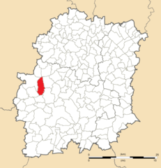
Dourdan (Dourdan)
- commune in Essonne, France
- Country:

- Postal Code: 91410
- Coordinates: 48° 31' 44" N, 2° 0' 39" E


- GPS tracks (wikiloc): [Link]
- Area: 30.64 sq km
- Population: 10673
- Web site: http://www.mairie-dourdan.fr
- Wikipedia en: wiki(en)
- Wikipedia: wiki(fr)
- Wikidata storage: Wikidata: Q646609
- Wikipedia Commons Category: [Link]
- Freebase ID: [/m/0dpv0n]
- Freebase ID: [/m/0dpv0n]
- GeoNames ID: Alt: [3020925]
- GeoNames ID: Alt: [3020925]
- SIREN number: [219102001]
- SIREN number: [219102001]
- BnF ID: [152801097]
- BnF ID: [152801097]
- VIAF ID: Alt: [167984975]
- VIAF ID: Alt: [167984975]
- GND ID: Alt: [4218950-0]
- GND ID: Alt: [4218950-0]
- Library of Congress authority ID: Alt: [n80163439]
- Library of Congress authority ID: Alt: [n80163439]
- PACTOLS thesaurus ID: [pcrtFTF9Pb00L7]
- PACTOLS thesaurus ID: [pcrtFTF9Pb00L7]
- MusicBrainz area ID: [f133554b-44a5-4bbf-8d6a-f5a376b2c100]
- MusicBrainz area ID: [f133554b-44a5-4bbf-8d6a-f5a376b2c100]
- WOEID: [589113]
- WOEID: [589113]
- Twitter username: Alt: [VilledeDourdan]
- Twitter username: Alt: [VilledeDourdan]
- INSEE municipality code: 91200
- INSEE municipality code: 91200
Shares border with regions:


Saint-Cyr-sous-Dourdan
- commune in Essonne, France
- Country:

- Postal Code: 91410
- Coordinates: 48° 34' 7" N, 2° 2' 10" E


- GPS tracks (wikiloc): [Link]
- Area: 9.89 sq km
- Population: 1003


Corbreuse
- commune in Essonne, France
- Country:

- Postal Code: 91410
- Coordinates: 48° 29' 56" N, 1° 57' 40" E


- GPS tracks (wikiloc): [Link]
- Area: 15.79 sq km
- Population: 1760
- Web site: [Link]


Longvilliers
- commune in Yvelines, France
- Country:

- Postal Code: 78730
- Coordinates: 48° 34' 44" N, 1° 59' 32" E


- GPS tracks (wikiloc): [Link]
- Area: 13.91 sq km
- Population: 498
- Web site: [Link]


Les Granges-le-Roi
- commune in Essonne, France
- Country:

- Postal Code: 91410
- Coordinates: 48° 30' 6" N, 2° 1' 9" E


- GPS tracks (wikiloc): [Link]
- Area: 12.68 sq km
- Population: 1201
- Web site: [Link]


Saint-Arnoult-en-Yvelines
- commune in Yvelines, France
- Country:

- Postal Code: 78730
- Coordinates: 48° 34' 18" N, 1° 56' 26" E


- GPS tracks (wikiloc): [Link]
- AboveSeaLevel: 104 м m
- Area: 12.55 sq km
- Population: 6086
- Web site: [Link]


Sainte-Mesme
- commune in Yvelines, France
- Country:

- Postal Code: 78730
- Coordinates: 48° 31' 50" N, 1° 57' 32" E


- GPS tracks (wikiloc): [Link]
- Area: 8.16 sq km
- Population: 920


Roinville
- commune in Essonne, France
- Country:

- Postal Code: 91410
- Coordinates: 48° 31' 53" N, 2° 2' 43" E


- GPS tracks (wikiloc): [Link]
- Area: 13.4 sq km
- Population: 1363
- Web site: [Link]
