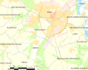
Dreux (Dreux)
- commune in Eure-et-Loir, France
- Country:

- Postal Code: 28100
- Coordinates: 48° 44' 11" N, 1° 21' 56" E


- GPS tracks (wikiloc): [Link]
- Area: 24.27 sq km
- Population: 30836
- Web site: http://www.dreux.com
- Wikipedia en: wiki(en)
- Wikipedia: wiki(fr)
- Wikidata storage: Wikidata: Q142410
- Wikipedia Commons Category: [Link]
- Freebase ID: [/m/035hms]
- Freebase ID: [/m/035hms]
- Freebase ID: [/m/035hms]
- GeoNames ID: Alt: [3020810]
- GeoNames ID: Alt: [3020810]
- GeoNames ID: Alt: [3020810]
- SIREN number: [212801344]
- SIREN number: [212801344]
- SIREN number: [212801344]
- BnF ID: [15254065s]
- BnF ID: [15254065s]
- BnF ID: [15254065s]
- VIAF ID: Alt: [149802348]
- VIAF ID: Alt: [149802348]
- VIAF ID: Alt: [149802348]
- GND ID: Alt: [4209729-0]
- GND ID: Alt: [4209729-0]
- GND ID: Alt: [4209729-0]
- archINFORM location ID: [673]
- archINFORM location ID: [673]
- archINFORM location ID: [673]
- Library of Congress authority ID: Alt: [n81071959]
- Library of Congress authority ID: Alt: [n81071959]
- Library of Congress authority ID: Alt: [n81071959]
- PACTOLS thesaurus ID: [pcrt0pSQw0Gzj6]
- PACTOLS thesaurus ID: [pcrt0pSQw0Gzj6]
- PACTOLS thesaurus ID: [pcrt0pSQw0Gzj6]
- MusicBrainz area ID: [3ad83e7d-39a7-4350-ae02-2248174e07f4]
- MusicBrainz area ID: [3ad83e7d-39a7-4350-ae02-2248174e07f4]
- MusicBrainz area ID: [3ad83e7d-39a7-4350-ae02-2248174e07f4]
- Quora topic ID: [Dreux]
- Quora topic ID: [Dreux]
- Quora topic ID: [Dreux]
- Encyclopædia Britannica Online ID: [place/Dreux]
- Encyclopædia Britannica Online ID: [place/Dreux]
- Encyclopædia Britannica Online ID: [place/Dreux]
- Gran Enciclopèdia Catalana ID: [0022978]
- Gran Enciclopèdia Catalana ID: [0022978]
- Gran Enciclopèdia Catalana ID: [0022978]
- data.gouv.fr org ID: [ville-de-dreux]
- data.gouv.fr org ID: [ville-de-dreux]
- data.gouv.fr org ID: [ville-de-dreux]
- INSEE municipality code: 28134
- INSEE municipality code: 28134
- INSEE municipality code: 28134
- US National Archives Identifier: 10045048
- US National Archives Identifier: 10045048
- US National Archives Identifier: 10045048
Shares border with regions:


Vert-en-Drouais
- commune in Eure-et-Loir, France
- Country:

- Postal Code: 28500
- Coordinates: 48° 45' 38" N, 1° 17' 41" E


- GPS tracks (wikiloc): [Link]
- Area: 9.7 sq km
- Population: 1114
- Web site: [Link]


Vernouillet
- commune in Eure-et-Loir, France
- Country:

- Postal Code: 28500
- Coordinates: 48° 43' 15" N, 1° 21' 38" E


- GPS tracks (wikiloc): [Link]
- Area: 12.11 sq km
- Population: 12572
- Web site: [Link]
