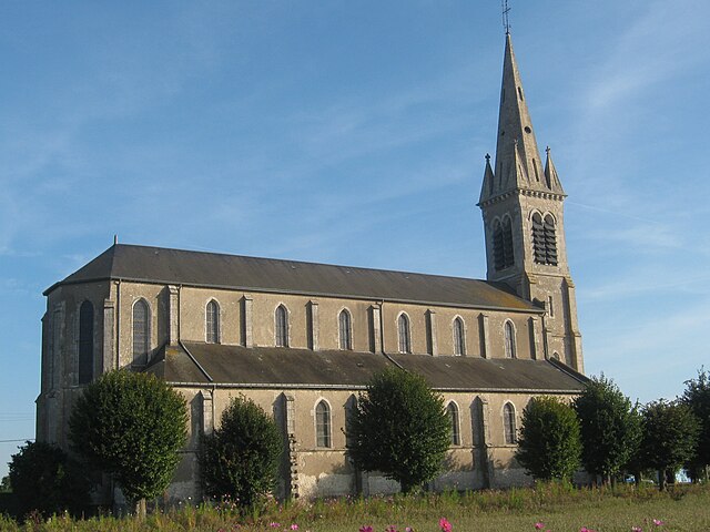
Dry (Dry)

- commune in Loiret, France
- Country:

- Postal Code: 45370
- Coordinates: 47° 47' 48" N, 1° 42' 50" E


- GPS tracks (wikiloc): [Link]
- Area: 22.64 sq km
- Population: 1398
- Wikipedia en: wiki(en)
- Wikipedia: wiki(fr)
- Wikidata storage: Wikidata: Q1470363
- Wikipedia Commons Category: [Link]
- Freebase ID: [/m/03nwjf3]
- GeoNames ID: Alt: [3020730]
- SIREN number: [214501306]
- BnF ID: [152605224]
- INSEE municipality code: 45130
Shares border with regions:

Baule
- commune in Loiret, France
- Country:
- Postal Code: 45130
- Coordinates: 47° 48' 39" N, 1° 40' 15" E
- GPS tracks (wikiloc): [Link]
- Area: 12.11 sq km
- Population: 2072
- Web site: [Link]


Lailly-en-Val
- commune in Loiret, France
- Country:
- Postal Code: 45740
- Coordinates: 47° 46' 11" N, 1° 41' 11" E
- GPS tracks (wikiloc): [Link]
- Area: 45.61 sq km
- Population: 3043
- Web site: [Link]

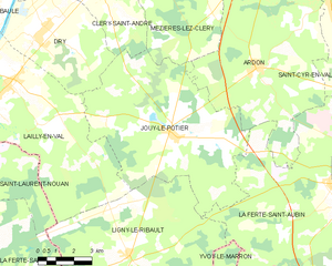
Jouy-le-Potier
- commune in Loiret, France
- Country:
- Postal Code: 45370
- Coordinates: 47° 44' 40" N, 1° 48' 41" E
- GPS tracks (wikiloc): [Link]
- Area: 50.4 sq km
- Population: 1342
- Web site: [Link]


Meung-sur-Loire
- commune in Loiret, France
- Country:
- Postal Code: 45130
- Coordinates: 47° 49' 43" N, 1° 41' 54" E
- GPS tracks (wikiloc): [Link]
- Area: 20.35 sq km
- Population: 6267
- Web site: [Link]

Cléry-Saint-André
- commune in Loiret, France
- Country:
- Postal Code: 45370
- Coordinates: 47° 49' 16" N, 1° 45' 24" E
- GPS tracks (wikiloc): [Link]
- Area: 18.13 sq km
- Population: 3410
- Web site: [Link]