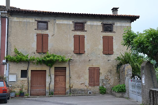
Dun (Dun)
- commune in Ariège, France
- Country:

- Postal Code: 09600
- Coordinates: 43° 1' 38" N, 1° 47' 57" E


- GPS tracks (wikiloc): [Link]
- Area: 41.41 sq km
- Population: 536
- Wikipedia en: wiki(en)
- Wikipedia: wiki(fr)
- Wikidata storage: Wikidata: Q1142187
- Wikipedia Commons Category: [Link]
- Freebase ID: [/m/0f9bvn]
- GeoNames ID: Alt: [3020700]
- SIREN number: [210901070]
- INSEE municipality code: 09107
Shares border with regions:

La Bastide-de-Bousignac
- commune in Ariège, France
- Country:
- Postal Code: 09500
- Coordinates: 43° 3' 13" N, 1° 53' 7" E
- GPS tracks (wikiloc): [Link]
- Area: 12.53 sq km
- Population: 335

Besset
- commune in Ariège, France
- Country:
- Postal Code: 09500
- Coordinates: 43° 4' 41" N, 1° 50' 12" E
- GPS tracks (wikiloc): [Link]
- Area: 8.13 sq km
- Population: 166
Calzan
- commune in Ariège, France
- Country:
- Postal Code: 09120
- Coordinates: 43° 2' 18" N, 1° 44' 15" E
- GPS tracks (wikiloc): [Link]
- Area: 3.99 sq km
- Population: 31
Coutens
- commune in Ariège, France
- Country:
- Postal Code: 09500
- Coordinates: 43° 4' 30" N, 1° 49' 25" E
- GPS tracks (wikiloc): [Link]
- Area: 4.19 sq km
- Population: 169

Limbrassac
- commune in Ariège, France
- Country:
- Postal Code: 09600
- Coordinates: 43° 1' 3" N, 1° 50' 38" E
- GPS tracks (wikiloc): [Link]
- Area: 12.42 sq km
- Population: 126


Vira
- commune in Ariège, France
- Country:
- Postal Code: 09120
- Coordinates: 43° 3' 5" N, 1° 45' 32" E
- GPS tracks (wikiloc): [Link]
- Area: 5.28 sq km
- Population: 164
- Web site: [Link]

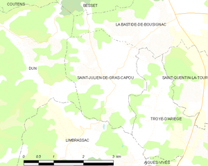
Saint-Julien-de-Gras-Capou
- commune in Ariège, France
- Country:
- Postal Code: 09500
- Coordinates: 43° 2' 14" N, 1° 51' 20" E
- GPS tracks (wikiloc): [Link]
- Area: 6.14 sq km
- Population: 58
Pradettes
- commune in Ariège, France
- Country:
- Postal Code: 09600
- Coordinates: 42° 59' 24" N, 1° 49' 13" E
- GPS tracks (wikiloc): [Link]
- Area: 3.52 sq km
- Population: 46
Ventenac
- commune in Ariège, France
- Country:
- Postal Code: 09120
- Coordinates: 43° 0' 21" N, 1° 43' 50" E
- GPS tracks (wikiloc): [Link]
- Area: 19.62 sq km
- Population: 231
Carla-de-Roquefort
- commune in Ariège, France
- Country:
- Postal Code: 09300
- Coordinates: 42° 58' 30" N, 1° 46' 5" E
- GPS tracks (wikiloc): [Link]
- Area: 9.34 sq km
- Population: 163


Viviès
- commune in Ariège, France
- Country:
- Postal Code: 09500
- Coordinates: 43° 3' 49" N, 1° 46' 58" E
- GPS tracks (wikiloc): [Link]
- Area: 4.4 sq km
- Population: 116

Lieurac
- commune in Ariège, France
- Country:
- Postal Code: 09300
- Coordinates: 42° 58' 54" N, 1° 47' 21" E
- GPS tracks (wikiloc): [Link]
- Area: 6.42 sq km
- Population: 181


Tourtrol
- commune in Ariège, France
- Country:
- Postal Code: 09500
- Coordinates: 43° 4' 9" N, 1° 47' 54" E
- GPS tracks (wikiloc): [Link]
- Area: 4.97 sq km
- Population: 280