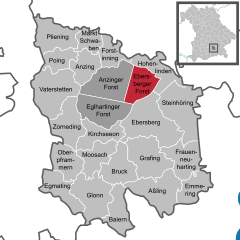
Ebersberg (Landkreis Ebersberg)

- district of Bavaria, Germany
 Hiking in Ebersberg
Ebersberg District, located in Bavaria, Germany, is a fantastic destination for hiking enthusiasts. This region offers a mix of lush forests, rolling hills, picturesque landscapes, and scenic views, making it perfect for both casual walkers and more experienced hikers.
Key Features of Hiking in Ebersberg District:
-
Trails: There are numerous well-marked trails in the Ebersberg District that cater to different skill levels. The paths meander through forests, past lakes, and along hills, providing both serene natural experiences and opportunities for more challenging hikes.
-
Ebersberger Forst: This large forest area is a major highlight for hikers. It features several trails that allow you to explore its diverse flora and fauna. The forest is not only great for hiking but also for wildlife spotting.
-
Views and Landmarks: Many hiking routes offer stunning views of the surrounding countryside, particularly the rolling hills and the scenic valley of the Ebersberg region. The area is dotted with historical landmarks, such as the Ebersberg Monastery and various lookout points that enhance the hiking experience.
-
Lakes: The district is home to several lakes, such as the Ebersberger See, which are perfect for a relaxing break during your hike. Some trails circle these lakes, providing a lovely backdrop for a picnic or rest.
-
Accessibility: The hiking trails are generally well-marked and accessible. Public transport links from nearby cities like Munich make it easier for hikers to reach the start of the trails.
-
Seasonal Hiking: Each season offers a different experience in Ebersberg District. Spring and summer bring lush greenery and wildflowers, while autumn offers stunning foliage. Winter hiking can also be an option, but be prepared for snow and icy conditions.
-
Facilities: Many of the popular hiking areas have facilities such as parking, restrooms, and even cafes or huts where you can enjoy refreshments after a long hike.
Tips for Hiking in Ebersberg District:
- Plan Your Route: Before heading out, take some time to plan your route based on your experience level and the time you have available.
- Proper Gear: Wear sturdy hiking boots and appropriate clothing for the weather. Bring water, snacks, and a map or GPS device.
- Respect Nature: Stay on marked trails to protect the environment and wildlife. Always follow local regulations regarding wildlife and plant conservation.
- Weather: Check the weather forecast before your hike, as conditions can change rapidly, especially in more mountainous areas.
Overall, Ebersberg District is a charming hiking destination with a lot to offer for outdoor enthusiasts. Enjoy your hike!
- Country:

- Capital: Ebersberg
- Licence Plate Code: EBE
- Coordinates: 48° 4' 48" N, 11° 55' 12" E


- GPS tracks (wikiloc): [Link]
- AboveSeaLevel: 601 м m
- Area: 549.30 sq km
- Population: 96283
- Web site: http://www.lra-ebe.de/
- Wikipedia en: wiki(en)
- Wikipedia: wiki(de)
- Wikidata storage: Wikidata: Q10541
- Wikipedia Commons Category: [Link]
- Wikipedia Commons Maps Category: [Link]
- Freebase ID: [/m/01lnpm]
- GeoNames ID: Alt: [2933937]
- VIAF ID: Alt: [132542642]
- OSM relation ID: [2168230]
- GND ID: Alt: [4013448-9]
- archINFORM location ID: [2394]
- Library of Congress authority ID: Alt: [n82044522]
- TGN ID: [7198484]
- Historical Gazetteer (GOV) ID: [adm_139175]
- Bavarikon ID: [ODB_A00002346]
- NUTS code: [DE218]
- BabelNet ID: [01886200n]
- German district key: 09175
Includes regions:

Ebersberger Forst
- unincorporated area in Germany
Hiking in Ebersberger Forst
Ebersberger Forst, located just east of Munich in Bavaria, Germany, is a beautiful and expansive forest area that offers a variety of hiking opportunities. Here are some key points to consider when hiking in this area:...
- Country:
- Coordinates: 48° 8' 5" N, 11° 57' 51" E
- GPS tracks (wikiloc): [Link]
Eglhartinger Forst
- unincorporated area in Germany
Hiking in Eglhartinger Forst
Eglhartinger Forst, located in Bavaria, Germany, is a beautiful forest area that offers various hiking trails suitable for all skill levels. Here are some key points to know about hiking in Eglhartinger Forst:...
- Country:
- Coordinates: 48° 5' 48" N, 11° 53' 25" E
- GPS tracks (wikiloc): [Link]

Zorneding
- municipality of Germany near the city of Munich
Hiking in Zorneding
Zorneding is a small municipality located in Bavaria, Germany, not far from Munich. While it may not be as well-known as larger hiking destinations, it offers various opportunities for outdoor activities, including hiking....
- Country:
- Postal Code: 85604
- Local Dialing Code: 08106
- Licence Plate Code: EBE
- Coordinates: 48° 5' 0" N, 11° 50' 0" E
- GPS tracks (wikiloc): [Link]
- AboveSeaLevel: 555 м m
- Area: 23.77 sq km
- Population: 6743
- Web site: [Link]

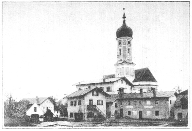
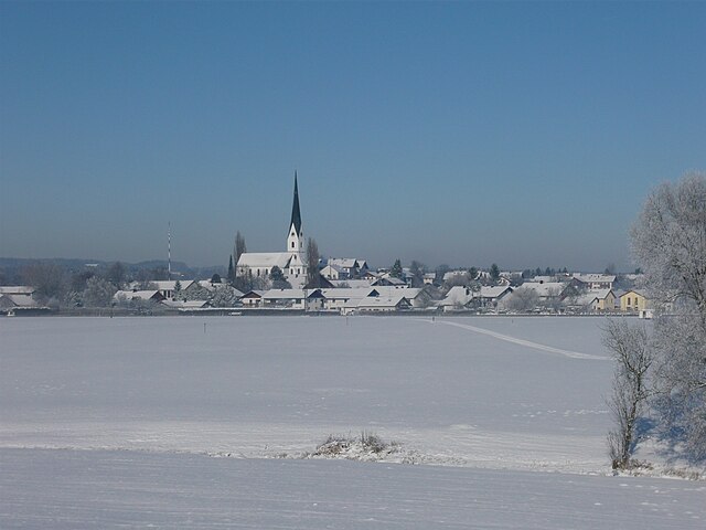
Ebersberg
- town in Bavaria, Germany
Hiking in Ebersberg
Ebersberg, located in Bavaria, Germany, offers a variety of hiking opportunities that showcase its beautiful landscapes, forests, and local wildlife. The region is especially known for the Ebersberger Forst, a large forest area that is perfect for hiking enthusiasts....
- Country:
- Postal Code: 85560
- Local Dialing Code: 08092
- Licence Plate Code: EBE
- Coordinates: 48° 5' 8" N, 11° 58' 30" E
- GPS tracks (wikiloc): [Link]
- AboveSeaLevel: 538 м m
- Area: 40.84 sq km
- Population: 12116
- Web site: [Link]

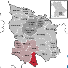
Baiern
- municipality of Germany
Hiking in Baiern
Baiern, a picturesque region in Germany, offers a range of hiking opportunities that cater to both beginners and experienced hikers. Nestled in the beautiful state of Bavaria, Baiern is known for its stunning landscapes, rich cultural heritage, and diverse ecosystems. Here are some highlights to consider when exploring the hiking trails in Baiern:...
- Country:
- Postal Code: 85625
- Local Dialing Code: 08093
- Licence Plate Code: EBE
- Coordinates: 47° 57' 0" N, 11° 54' 0" E
- GPS tracks (wikiloc): [Link]
- AboveSeaLevel: 570 м m
- Area: 19.96 sq km
- Population: 1048
- Web site: [Link]

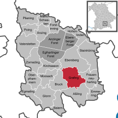
Grafing
- town in Bavaria, Germany
Hiking in Grafing
Grafing, located in Bavaria, Germany, is surrounded by beautiful landscapes that are perfect for hiking enthusiasts. The region features a mix of lush forests, rolling hills, and scenic fields, making it an excellent destination for outdoor activities....
- Country:
- Postal Code: 85567
- Local Dialing Code: 08092
- Licence Plate Code: EBE
- Coordinates: 48° 3' 0" N, 11° 58' 0" E
- GPS tracks (wikiloc): [Link]
- AboveSeaLevel: 526 м m
- Area: 29.57 sq km
- Population: 11039
- Web site: [Link]


Poing
- municipality of Germany
Hiking in Poing
Poing, located in Bavaria, Germany, is a charming village that offers various opportunities for outdoor enthusiasts, especially hikers. While it's not as famous as some mountainous regions in Bavaria, it has its unique features that can make for an enjoyable hiking experience....
- Country:
- Postal Code: 85586
- Local Dialing Code: 08121
- Licence Plate Code: EBE
- Coordinates: 48° 10' 0" N, 11° 49' 0" E
- GPS tracks (wikiloc): [Link]
- AboveSeaLevel: 518 м m
- Area: 12.89 sq km
- Population: 6152
- Web site: [Link]


Forstinning
- municipality of Germany
Hiking in Forstinning
Forstinning, located in Bavaria, Germany, offers a variety of outdoor activities, including hiking, that can cater to different skill levels and preferences. Here are some highlights and tips for hiking in and around Forstinning:...
- Country:
- Postal Code: 85661
- Local Dialing Code: 08121
- Licence Plate Code: EBE
- Coordinates: 48° 10' 0" N, 11° 55' 0" E
- GPS tracks (wikiloc): [Link]
- AboveSeaLevel: 512 м m
- Area: 12.26 sq km
- Population: 2638
- Web site: [Link]


Oberpframmern
- municipality of Germany
Hiking in Oberpframmern
Oberpframmern is a picturesque village located in Bavaria, Germany, not far from the city of Munich. The area is surrounded by beautiful landscapes, making it a great spot for hiking enthusiasts. Here are some key points about hiking in Oberpframmern:...
- Country:
- Postal Code: 85667
- Local Dialing Code: 08093
- Licence Plate Code: EBE
- Coordinates: 48° 1' 0" N, 11° 49' 0" E
- GPS tracks (wikiloc): [Link]
- AboveSeaLevel: 614 м m
- Area: 18.47 sq km
- Population: 1522
- Web site: [Link]


Steinhöring
- German municipality
Hiking in Steinhöring
Steinhöring, located in Bavaria, Germany, offers a delightful experience for hikers and nature enthusiasts alike. Nestled in a picturesque landscape, this area is characterized by rolling hills, lush meadows, and scenic forests, providing a refreshing escape into nature. Here are some key points to consider if you're planning a hiking trip to Steinhöring:...
- Country:
- Postal Code: 85643
- Local Dialing Code: 08094
- Licence Plate Code: EBE
- Coordinates: 48° 5' 12" N, 12° 1' 53" E
- GPS tracks (wikiloc): [Link]
- AboveSeaLevel: 519 м m
- Area: 36.29 sq km
- Population: 3912
- Web site: [Link]

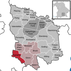
Egmating
- municipality of Germany
Hiking in Egmating
Egmating is a small town in Bavaria, Germany, that offers a charming environment for hiking enthusiasts. The area has a mix of scenic trails, beautiful landscapes, and easy access to nature, making it a great spot for both novice and experienced hikers. Here are a few things to consider when hiking in Egmating:...
- Country:
- Postal Code: 85658
- Local Dialing Code: 08095
- Licence Plate Code: EBE
- Coordinates: 48° 0' 0" N, 11° 48' 0" E
- GPS tracks (wikiloc): [Link]
- AboveSeaLevel: 622 м m
- Area: 19.16 sq km
- Population: 1388
- Web site: [Link]


Aßling
- Municipality in Bavaria, Germany
Hiking in Aßling
Aßling is a charming municipality located in Bavaria, Germany, surrounded by picturesque landscapes that offer various hiking opportunities. The area features rolling hills, meadows, and woodlands, making it an excellent destination for both casual walkers and experienced hikers....
- Country:
- Postal Code: 85617
- Local Dialing Code: 08092
- Licence Plate Code: EBE
- Coordinates: 47° 59' 35" N, 12° 0' 23" E
- GPS tracks (wikiloc): [Link]
- AboveSeaLevel: 489 м m
- Area: 31.38 sq km
- Population: 3319
- Web site: [Link]


Kirchseeon
- municipality of Germany
Hiking in Kirchseeon
Kirchseeon is a charming municipality located in Bavaria, Germany, surrounded by picturesque landscapes ideal for hiking enthusiasts. The area offers a variety of trails that cater to different skill levels, from leisurely walks to more challenging hikes....
- Country:
- Postal Code: 85614
- Local Dialing Code: 08091
- Licence Plate Code: EBE
- Coordinates: 48° 4' 23" N, 11° 53' 10" E
- GPS tracks (wikiloc): [Link]
- AboveSeaLevel: 564 м m
- Area: 17.91 sq km
- Population: 7255
- Web site: [Link]

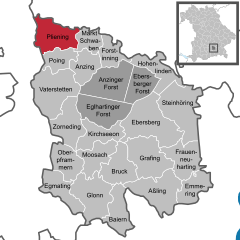
Pliening
- location near Munich, Germany
Hiking in Pliening
Pliening, located in Bavaria, Germany, offers a variety of scenic hiking opportunities for outdoor enthusiasts. While it's a small town, its vicinity to natural areas and trails can provide a peaceful and enjoyable hiking experience. Here are some aspects to consider when hiking in and around Pliening:...
- Country:
- Postal Code: 85652
- Local Dialing Code: 089; 08121
- Licence Plate Code: EBE
- Coordinates: 48° 12' 0" N, 11° 48' 0" E
- GPS tracks (wikiloc): [Link]
- AboveSeaLevel: 504 м m
- Area: 22.80 sq km
- Population: 3296
- Web site: [Link]


Anzing
- municipality of Germany
Hiking in Anzing
Anzing is a small municipality located in the Bavaria region of Germany, not far from Munich. It has a charming countryside and provides a serene environment for hiking enthusiasts. The area is characterized by rolling hills, lush forests, and picturesque landscapes. Here are some key points to consider if you're looking to hike in Anzing:...
- Country:
- Postal Code: 85646
- Local Dialing Code: 08121
- Licence Plate Code: EBE
- Coordinates: 48° 9' 0" N, 11° 51' 0" E
- GPS tracks (wikiloc): [Link]
- AboveSeaLevel: 519 м m
- Area: 16.18 sq km
- Population: 3077
- Web site: [Link]


Hohenlinden
- municipality of Germany
Hiking in Hohenlinden
Hohenlinden is a quaint town located in Bavaria, Germany, known for its picturesque landscapes and access to beautiful hiking routes. As part of the countryside in Upper Bavaria, it offers a variety of outdoor activities, including hiking, cycling, and nature exploration....
- Country:
- Postal Code: 85664
- Local Dialing Code: 08124
- Licence Plate Code: EBE
- Coordinates: 48° 9' 0" N, 12° 0' 0" E
- GPS tracks (wikiloc): [Link]
- AboveSeaLevel: 540 м m
- Area: 17.32 sq km
- Population: 2149
- Web site: [Link]


Moosach
- municipality in Germany
Hiking in Moosach
Moosach, located in the district of Dachau in Bavaria, Germany, offers a variety of hiking opportunities surrounded by beautiful landscapes and rich natural beauty. While it's not as widely known as some major hiking destinations in the region, it has charm and provides a diverse range of trails suitable for different skill levels....
- Country:
- Postal Code: 85665
- Local Dialing Code: 08091
- Licence Plate Code: EBE
- Coordinates: 48° 2' 0" N, 11° 53' 0" E
- GPS tracks (wikiloc): [Link]
- AboveSeaLevel: 529 м m
- Area: 18.21 sq km
- Population: 1100
- Web site: [Link]
Frauenneuharting
- municipality of Germany
Hiking in Frauenneuharting
Frauenneuharting is a small municipality in Bavaria, Germany, which offers a scenic environment perfect for hiking enthusiasts. Surrounded by picturesque landscapes, including forests, fields, and gentle hills, it provides various trails suitable for different hiking levels....
- Country:
- Postal Code: 83539; 83565; 83553
- Local Dialing Code: 08092
- Coordinates: 48° 2' 0" N, 12° 3' 0" E
- GPS tracks (wikiloc): [Link]
- AboveSeaLevel: 530 м m
- Area: 22.68 sq km
- Population: 1571
- Web site: [Link]


Vaterstetten
- municipality southwest of Munich
Hiking in Vaterstetten
Vaterstetten is a charming community located in Bavaria, Germany, just a short distance from Munich. While it might not be as famous as some other hiking destinations, it offers some great opportunities for outdoor activities, including hiking....
- Country:
- Postal Code: 85591
- Local Dialing Code: 08106
- Licence Plate Code: EBE
- Coordinates: 48° 6' 19" N, 11° 46' 6" E
- GPS tracks (wikiloc): [Link]
- AboveSeaLevel: 528 м m
- Area: 34.18 sq km
- Population: 17843
- Web site: [Link]


Markt Schwaben
- municipality of Germany
Hiking in Markt Schwaben
Markt Schwaben is a small town located in Bavaria, Germany, not far from Munich. While it may not be a widely recognized hiking destination, there are several opportunities for outdoor enthusiasts in and around the area....
- Country:
- Postal Code: 85570
- Local Dialing Code: 08121
- Licence Plate Code: EBE
- Coordinates: 48° 11' 30" N, 11° 52' 5" E
- GPS tracks (wikiloc): [Link]
- AboveSeaLevel: 509 м m
- Area: 10.86 sq km
- Population: 8719
- Web site: [Link]


Bruck
- municipality of Germany
Hiking in Bruck
Bruck, a charming village in Upper Bavaria, offers various hiking opportunities that cater to different skill levels and preferences. Here are some details to help you plan your hiking adventure in this beautiful region:...
- Country:
- Postal Code: 85567
- Local Dialing Code: 08093; 08092; 08091
- Licence Plate Code: EBE
- Coordinates: 48° 1' 0" N, 11° 55' 0" E
- GPS tracks (wikiloc): [Link]
- AboveSeaLevel: 507 м m
- Area: 21.60 sq km
- Population: 908
- Web site: [Link]
Anzinger Forst
- unincorporated area in Germany
Hiking in Anzinger Forst
Anzinger Forst is a beautiful forest area located in Bavaria, Germany, near the town of Anzing. It offers a variety of trails that are suitable for hikers of different skill levels. Here are a few key points about hiking in Anzinger Forst:...
- Country:
- Coordinates: 48° 8' 12" N, 11° 54' 16" E
- GPS tracks (wikiloc): [Link]


Glonn
- municipality of Germany
Hiking in Glonn
Glonn, located in Bavaria, Germany, is surrounded by beautiful landscapes that offer delightful hiking opportunities. The area is characterized by rolling hills, forests, and picturesque countryside, making it ideal for both casual walkers and more experienced hikers....
- Country:
- Postal Code: 85625
- Local Dialing Code: 08093
- Licence Plate Code: EBE
- Coordinates: 47° 59' 0" N, 11° 52' 0" E
- GPS tracks (wikiloc): [Link]
- AboveSeaLevel: 536 м m
- Area: 30.24 sq km
- Population: 4890
- Web site: [Link]
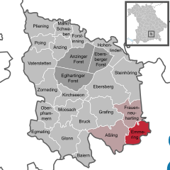
Emmering
- human settlement in Germany
Hiking in Emmering
Emmering, located in the Ebersberg district of Bavaria, Germany, offers a variety of hiking opportunities amidst picturesque landscapes and natural beauty. The region is characterized by rolling hills, dense forests, and scenic views, making it an ideal destination for outdoor enthusiasts. Here are some details to consider about hiking in this area:...
- Country:
- Postal Code: 83550
- Local Dialing Code: 08039
- Licence Plate Code: EBE
- Coordinates: 48° 0' 0" N, 12° 3' 0" E
- GPS tracks (wikiloc): [Link]
- AboveSeaLevel: 515 м m
- Area: 17.22 sq km
- Population: 1205
- Web site: [Link]
Shares border with regions:

Rosenheim
- district of Bavaria, Germany
Hiking in Rosenheim
Rosenheim district, located in Bavaria, Germany, offers a diverse range of hiking opportunities amidst beautiful landscapes, charming villages, and stunning natural scenery. Here are some highlights for hiking in the region:...
- Country:
- Capital: Rosenheim
- Licence Plate Code: WS; RO; AIB
- Coordinates: 47° 55' 12" N, 12° 10' 12" E
- GPS tracks (wikiloc): [Link]
- AboveSeaLevel: 512 м m
- Area: 1439.40 sq km
- Population: 190104
- Web site: [Link]

Mühldorf
- district of Bavaria, Germany
Hiking in Mühldorf
Mühldorf District, located in Bavaria, Germany, offers a range of hiking opportunities that cater to different skill levels and preferences. The area features scenic landscapes, including rolling hills, forests, and rivers, making it an attractive destination for nature lovers and outdoor enthusiasts....
- Country:
- Capital: Mühldorf
- Licence Plate Code: MÜ
- Coordinates: 48° 15' 0" N, 12° 25' 12" E
- GPS tracks (wikiloc): [Link]
- AboveSeaLevel: 447 м m
- Area: 805.32 sq km
- Population: 92882

District of Erding
- district of Bavaria, Germany
Hiking in District of Erding
Erding, located in Bavaria, Germany, offers a variety of hiking opportunities for enthusiasts of all skill levels. This district is characterized by its beautiful landscapes, rolling hills, and picturesque villages, making it a wonderful destination for outdoor activities....
- Country:
- Licence Plate Code: ED
- Coordinates: 48° 19' 48" N, 11° 55' 12" E
- GPS tracks (wikiloc): [Link]
- AboveSeaLevel: 480 м m
- Area: 870.44 sq km
- Population: 89190
- Web site: [Link]

Munich
- district of Bavaria, Germany
Hiking in Munich
Hiking in and around Munich, the capital of Bavaria, offers a wonderful blend of urban landscapes and stunning natural scenery. While Munich itself is a vibrant city with parks and green spaces, many hiking opportunities are just a short distance away in the surrounding region....
- Country:
- Capital: Munich
- Local Dialing Code: 089
- Licence Plate Code: WOR; M; AIB
- Coordinates: 48° 0' 0" N, 11° 40' 12" E
- GPS tracks (wikiloc): [Link]
- AboveSeaLevel: 513 м m
- Area: 52020.58 sq km
- Population: 343405
- Web site: [Link]