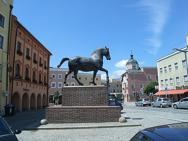
Mühldorf (Landkreis Mühldorf am Inn)

- district of Bavaria, Germany
 Hiking in Mühldorf
Mühldorf District, located in Bavaria, Germany, offers a range of hiking opportunities that cater to different skill levels and preferences. The area features scenic landscapes, including rolling hills, forests, and rivers, making it an attractive destination for nature lovers and outdoor enthusiasts.
Key Hiking Areas:
-
Inn Valley:
- The Inn River provides a beautiful backdrop for hiking trails. The valley is characterized by its lush meadows and views of the surrounding hills.
-
Altmühltal Nature Park:
- Although mostly associated with the Altmühltal region, parts extend into Mühldorf, allowing hikers access to stunning rock formations and diverse ecosystems. The trails here range from easy walks to more challenging hikes with fascinating geological features.
-
Bavarian Forest:
- Just a bit further from Mühldorf, you can access paths leading into the Bavarian Forest. This area is well-known for its dense forests and wildlife, offering a more rugged and nature-focused hiking experience.
-
Village and Countryside Trails:
- Many smaller villages in the district have their own hiking routes, which often connect to longer trails. These paths typically wind through picturesque landscapes, passing fields, farms, and quaint rural settings.
Tips for Hiking in Mühldorf:
-
Trail Maps: Make sure to have a good map or hiking app on your smartphone. Trails might not always be marked well, and having a GPS or printed map can be helpful.
-
Season Considerations: Hiking in spring and fall can offer the most pleasant weather and beautiful scenery with blooming flowers or autumn leaves. Summer can be hot, and sometimes winter trails may become icy or snow-covered, presenting additional challenges.
-
Local Insights: Consider reaching out to local hiking clubs or tourism offices for guided hikes or recommendations on trails that may not be widely publicized.
-
Safety Precautions: Ensure you're well-prepared with appropriate footwear, water, snacks, and a first aid kit. Weather can change quickly, so layering clothing is advisable.
Conclusion:
Hiking in Mühldorf District provides a delightful mix of nature, charm, and adventure. Whether you prefer leisurely strolls or more rigorous treks, you'll find beautiful spots to explore in this scenic part of Bavaria. Enjoy your hike!
- Country:

- Capital: Mühldorf
- Licence Plate Code: MÜ
- Coordinates: 48° 15' 0" N, 12° 25' 12" E


- GPS tracks (wikiloc): [Link]
- AboveSeaLevel: 447 м m
- Area: 805.32 sq km
- Population: 92882
- Wikipedia en: wiki(en)
- Wikipedia: wiki(de)
- Wikidata storage: Wikidata: Q10537
- Wikipedia Commons Gallery: [Link]
- Wikipedia Commons Category: [Link]
- Freebase ID: [/m/023b0d]
- GeoNames ID: Alt: [3220836]
- VIAF ID: Alt: [242980478]
- OSM relation ID: [2168232]
- GND ID: Alt: [4040456-0]
- archINFORM location ID: [2525]
- TGN ID: [7077294]
- Historical Gazetteer (GOV) ID: [adm_139183]
- Bavarikon ID: [ODB_A00002355]
- NUTS code: [DE21G]
- German district key: 09183
Includes regions:

Zangberg
- municipality of Germany
Hiking in Zangberg
Zangberg is a beautiful area located in the southeastern region of Germany, specifically in Bavaria. It's well-known for its picturesque landscapes, diverse hiking trails, and natural beauty. Here are some key points to consider if you're planning a hiking trip in Zangberg:...
- Country:
- Postal Code: 84539
- Local Dialing Code: 08637; 08636
- Coordinates: 48° 16' 29" N, 12° 25' 31" E
- GPS tracks (wikiloc): [Link]
- AboveSeaLevel: 430 м m
- Area: 9.84 sq km
- Population: 1082
- Web site: [Link]

Heldenstein
- municipality of Germany
Hiking in Heldenstein
Heldenstein is a beautiful area in Bavaria, Germany, known for its picturesque landscapes, rich history, and variety of hiking trails. Here are some highlights to consider when planning a hike in Heldenstein:...
- Country:
- Postal Code: 84431
- Local Dialing Code: 08636
- Coordinates: 48° 15' 0" N, 12° 22' 0" E
- GPS tracks (wikiloc): [Link]
- AboveSeaLevel: 450 м m
- Area: 19.85 sq km
- Population: 1812
- Web site: [Link]

Neumarkt-Sankt Veit
- town in Bavaria, Germany
Hiking in Neumarkt-Sankt Veit
Neumarkt-Sankt Veit, located in Bavaria, Germany, is a charming town surrounded by beautiful landscapes that are perfect for hiking enthusiasts. The region offers a variety of hiking trails that cater to different skill levels, from leisurely walks to more challenging hikes, making it suitable for families, beginners, and experienced hikers alike....
- Country:
- Postal Code: 84494
- Local Dialing Code: 08639
- Coordinates: 48° 22' 0" N, 12° 30' 0" E
- GPS tracks (wikiloc): [Link]
- AboveSeaLevel: 442 м m
- Area: 61.07 sq km
- Population: 6053
- Web site: [Link]

Maitenbeth
- municipality of Germany
Hiking in Maitenbeth
Maitenbeth is a quaint municipality located in Bavaria, Germany, known for its beautiful landscapes and outdoor activities, including hiking. Nestled in the foothills of the Alps, the area offers a wide range of trails suitable for hikers of all levels, from gentle walks to more challenging treks....
- Country:
- Postal Code: 83558
- Local Dialing Code: 08076
- Coordinates: 48° 9' 0" N, 12° 5' 30" E
- GPS tracks (wikiloc): [Link]
- AboveSeaLevel: 609 м m
- Area: 30.94 sq km
- Population: 1585
- Web site: [Link]

Mühldorfer Hart
- unincorporated area in Germany
Hiking in Mühldorfer Hart
Mühldorfer Hart is a beautiful area located in the region of Bavaria, Germany, known for its scenic landscapes, diverse flora and fauna, and extensive walking trails. Hiking in this region offers a wonderful opportunity to explore unspoiled nature, while also enjoying historical and cultural aspects of the area....
- Country:
- Coordinates: 48° 13' 27" N, 12° 26' 11" E
- GPS tracks (wikiloc): [Link]

Erharting
- municipality of Germany
Hiking in Erharting
Erharting is a small municipality located in Bavaria, Germany, which is not typically known as a major hiking destination compared to larger natural parks or mountainous areas. However, it is surrounded by beautiful Bavarian countryside, making it suitable for local hiking experiences....
- Country:
- Postal Code: 84513
- Local Dialing Code: 08635; 08631
- Coordinates: 48° 17' 0" N, 12° 35' 0" E
- GPS tracks (wikiloc): [Link]
- AboveSeaLevel: 450 м m
- Area: 13.68 sq km
- Population: 820
- Web site: [Link]
Niederbergkirchen
- municipality of Germany
Hiking in Niederbergkirchen
Niederbergkirchen is a small municipality in Bavaria, Germany, surrounded by beautiful landscapes that are ideal for hiking enthusiasts. Here's what you can expect when hiking in and around Niederbergkirchen:...
- Country:
- Postal Code: 84494
- Local Dialing Code: 08639; 08637; 08635; 08631
- Coordinates: 48° 18' 46" N, 12° 30' 15" E
- GPS tracks (wikiloc): [Link]
- AboveSeaLevel: 489 м m
- Area: 24.70 sq km
- Population: 1099
- Web site: [Link]

Kraiburg
- municipality of Germany
Hiking in Kraiburg
Kraiburg am Inn is a small town located in Bavaria, Germany, close to the banks of the River Inn. The surrounding area offers beautiful landscapes and opportunities for hiking, making it an appealing destination for outdoor enthusiasts....
- Country:
- Postal Code: 84559
- Local Dialing Code: 08638
- Coordinates: 48° 11' 0" N, 12° 26' 0" E
- GPS tracks (wikiloc): [Link]
- AboveSeaLevel: 413 м m
- Area: 27.56 sq km
- Population: 2876
- Web site: [Link]
Waldkraiburg
- town in Bavaria, Germany
Hiking in Waldkraiburg
Waldkraiburg, located in Bavaria, Germany, offers a range of hiking opportunities set against a picturesque backdrop of rolling hills, forests, and rivers. Here are some key points to consider when hiking in and around Waldkraiburg:...
- Country:
- Postal Code: 84478
- Local Dialing Code: 08638
- Coordinates: 48° 13' 0" N, 12° 24' 0" E
- GPS tracks (wikiloc): [Link]
- AboveSeaLevel: 436 м m
- Area: 21.56 sq km
- Population: 22672
- Web site: [Link]
Kirchdorf
- human settlement in Germany
Hiking in Kirchdorf
Kirchdorf is a charming village located in Upper Bavaria, Germany, nestled in the beautiful foothills of the Alps. It offers a unique blend of natural beauty, cultural heritage, and a variety of hiking opportunities suitable for various skill levels....
- Country:
- Postal Code: 83527
- Local Dialing Code: 08072
- Coordinates: 48° 10' 31" N, 12° 11' 45" E
- GPS tracks (wikiloc): [Link]
- AboveSeaLevel: 551 м m
- Area: 21.03 sq km
- Population: 1162
- Web site: [Link]

Ampfing
- municipality of Germany
Hiking in Ampfing
Ampfing, located in Bavaria, Germany, offers some charming hiking opportunities amidst beautiful landscapes. Here’s what you can expect when hiking in and around Ampfing:...
- Country:
- Postal Code: 84539
- Local Dialing Code: 08636
- Coordinates: 48° 16' 0" N, 12° 25' 0" E
- GPS tracks (wikiloc): [Link]
- AboveSeaLevel: 416 м m
- Area: 31.14 sq km
- Population: 4890
- Web site: [Link]

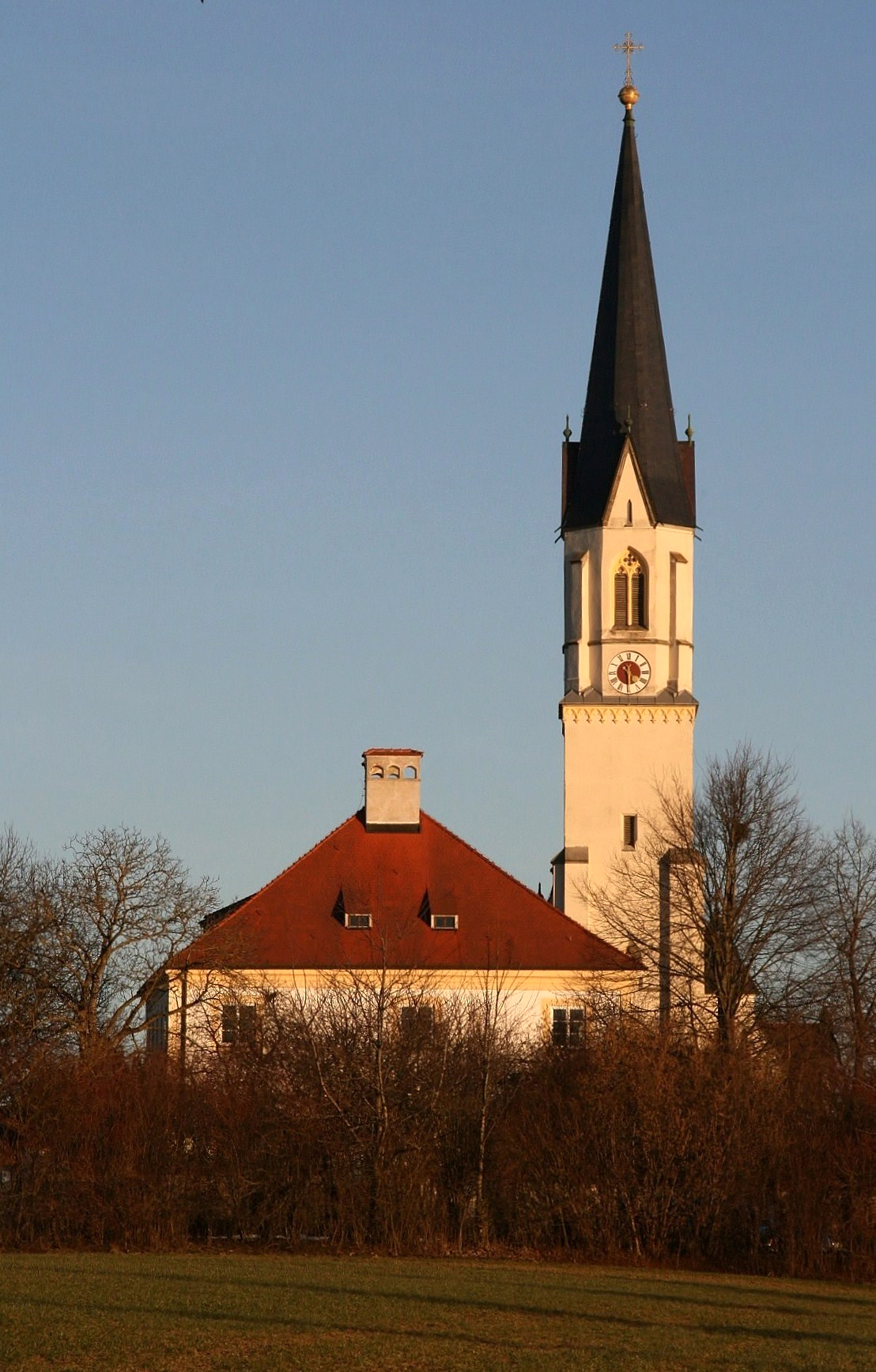
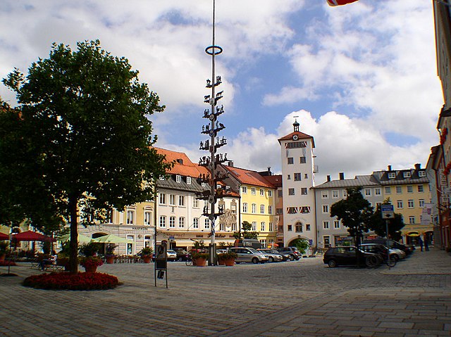
Mühldorf
- town in Bavaria, Germany
Hiking in Mühldorf
Mühldorf, located in Bavaria, Germany, is surrounded by stunning natural landscapes that provide excellent opportunities for hiking enthusiasts. The region is characterized by rolling hills, meadows, and forests, making it a perfect destination for both novice and experienced hikers. Here are some highlights of hiking in and around Mühldorf:...
- Country:
- Postal Code: 84453
- Local Dialing Code: 08631
- Coordinates: 48° 14' 44" N, 12° 31' 22" E
- GPS tracks (wikiloc): [Link]
- AboveSeaLevel: 384 м m
- Area: 29.42 sq km
- Population: 20123
- Web site: [Link]

Schwindegg
- municipality of Germany
Hiking in Schwindegg
Schwindegg, a charming village in the Mühldorf district of Bavaria, Germany, offers various hiking opportunities that allow outdoor enthusiasts to explore the picturesque Bavarian countryside. Here are some highlights about hiking in and around Schwindegg:...
- Country:
- Postal Code: 84419
- Local Dialing Code: 08082
- Coordinates: 48° 16' 0" N, 12° 15' 0" E
- GPS tracks (wikiloc): [Link]
- AboveSeaLevel: 431 м m
- Area: 20.77 sq km
- Population: 2661
- Web site: [Link]

Jettenbach
- municipality of Germany
Hiking in Jettenbach
Jettenbach, located in Germany, is surrounded by beautiful natural landscapes that are ideal for hiking enthusiasts. The region offers a variety of trails that cater to different skill levels, making it a great destination for both beginners and experienced hikers....
- Country:
- Postal Code: 84555
- Local Dialing Code: 08638
- Coordinates: 48° 10' 0" N, 12° 23' 0" E
- GPS tracks (wikiloc): [Link]
- AboveSeaLevel: 418 м m
- Area: 9.18 sq km
- Population: 722
- Web site: [Link]

Oberbergkirchen
- municipality of Germany
Hiking in Oberbergkirchen
Oberbergkirchen, located in Bavaria, Germany, offers a charming backdrop for hiking enthusiasts. The region is characterized by rolling hills, lush forests, and scenic views that are typical of the Bavarian countryside. Here are some highlights and tips for hiking in Oberbergkirchen:...
- Country:
- Postal Code: 84564
- Local Dialing Code: 08637
- Coordinates: 48° 17' 0" N, 12° 22' 0" E
- GPS tracks (wikiloc): [Link]
- AboveSeaLevel: 485 м m
- Area: 27.54 sq km
- Population: 1606
- Web site: [Link]

Obertaufkirchen
- municipality of Germany
Hiking in Obertaufkirchen
Obertaufkirchen is a charming village in Bavaria, Germany, and while it may not be as widely known for hiking as some more prominent locations in the region, it offers a variety of scenic trails and beautiful landscapes to explore....
- Country:
- Postal Code: 84419
- Local Dialing Code: 08082
- Coordinates: 48° 16' 0" N, 12° 17' 0" E
- GPS tracks (wikiloc): [Link]
- AboveSeaLevel: 457 м m
- Area: 31.64 sq km
- Population: 1722
- Web site: [Link]
Rattenkirchen
- municipality of Germany
Hiking in Rattenkirchen
Rattenkirchen is a small town in Bavaria, Germany, surrounded by picturesque landscapes that are perfect for hiking enthusiasts. While it may not be as well-known as some larger hiking destinations, it offers various trails and natural beauty worth exploring....
- Country:
- Postal Code: 84431
- Local Dialing Code: 08636; 08082
- Coordinates: 48° 15' 0" N, 12° 19' 0" E
- GPS tracks (wikiloc): [Link]
- AboveSeaLevel: 474 м m
- Area: 19.87 sq km
- Population: 764
- Web site: [Link]

Niedertaufkirchen
- municipality of Germany
Hiking in Niedertaufkirchen
Niedertaufkirchen is a small village located in the region of Bavaria, Germany. While it may not be as well-known as some major hiking destinations, it offers beautiful landscapes and serene walking paths that can appeal to hikers looking for a quieter experience....
- Country:
- Postal Code: 84494
- Local Dialing Code: 08639
- Coordinates: 48° 20' 0" N, 12° 33' 0" E
- GPS tracks (wikiloc): [Link]
- AboveSeaLevel: 442 м m
- Area: 26.69 sq km
- Population: 1083
- Web site: [Link]

Reichertsheim
- municipality of Germany
Hiking in Reichertsheim
Reichertsheim, a small town in Bavaria, Germany, is surrounded by picturesque landscapes that make it a wonderful destination for hiking enthusiasts. The area features various trails that cater to different skill levels, offering opportunities for both leisurely walks and more challenging hikes....
- Country:
- Postal Code: 84437
- Local Dialing Code: 08073
- Coordinates: 48° 12' 0" N, 12° 17' 0" E
- GPS tracks (wikiloc): [Link]
- AboveSeaLevel: 521 м m
- Area: 31.38 sq km
- Population: 1455
- Web site: [Link]

Egglkofen
- municipality of Germany
Hiking in Egglkofen
Egglkofen, located in Bavaria, Germany, is a picturesque area that offers a variety of hiking opportunities for both beginners and experienced hikers. The region is characterized by scenic landscapes, rolling hills, and lush forests, making it a perfect spot for outdoor activities....
- Country:
- Postal Code: 84546
- Local Dialing Code: 08639
- Coordinates: 48° 24' 0" N, 12° 27' 0" E
- GPS tracks (wikiloc): [Link]
- AboveSeaLevel: 453 м m
- Area: 13.98 sq km
- Population: 984
- Web site: [Link]

Haag in Oberbayern
- municipality of Germany
Hiking in Haag in Oberbayern
Haag in Oberbayern is a charming small town located in Upper Bavaria, Germany. It's an ideal spot for outdoor enthusiasts, especially for those who enjoy hiking. The region is known for its picturesque landscapes, rolling hills, and scenic views, making it a great base for exploring the Bavarian countryside....
- Country:
- Postal Code: 83527
- Local Dialing Code: 08072
- Coordinates: 48° 9' 43" N, 12° 10' 46" E
- GPS tracks (wikiloc): [Link]
- AboveSeaLevel: 540 м m
- Area: 20.43 sq km
- Population: 4775
- Web site: [Link]

Rechtmehring
- municipality of Germany
Hiking in Rechtmehring
Rechtmehring, located in Bavaria, Germany, is a charming village surrounded by picturesque landscapes ideal for hiking enthusiasts. The area offers a variety of hiking trails ranging from easy walks to more challenging routes, providing options for all skill levels....
- Country:
- Postal Code: 83562
- Local Dialing Code: 08076
- Coordinates: 48° 7' 0" N, 12° 10' 0" E
- GPS tracks (wikiloc): [Link]
- AboveSeaLevel: 505 м m
- Area: 24.39 sq km
- Population: 1330
- Web site: [Link]
Aschau am Inn
- german village
Hiking in Aschau am Inn
Aschau am Inn is a charming village located in Bavaria, Germany, and is known for its scenic landscapes and outdoor opportunities, including hiking. The surrounding countryside offers a variety of trails that cater to different skill levels, making it an excellent destination for hikers of all experience levels. Here are some highlights of hiking in Aschau am Inn:...
- Country:
- Postal Code: 84544
- Local Dialing Code: 08638
- Coordinates: 48° 12' 0" N, 12° 21' 0" E
- GPS tracks (wikiloc): [Link]
- AboveSeaLevel: 457 м m
- Area: 20.79 sq km
- Population: 3108
- Web site: [Link]

Schönberg
- municipality in the district of Mühldorf in Bavaria in Germany
Hiking in Schönberg
Schönberg, located in Upper Bavaria, offers a stunning backdrop for hiking enthusiasts. Nestled in the foothills of the Alps, the area is characterized by its picturesque landscapes, rolling hills, dense forests, and vibrant meadows. Here are some highlights and tips for hiking in Schönberg:...
- Country:
- Postal Code: 84573
- Local Dialing Code: 08637
- Coordinates: 48° 20' 0" N, 12° 26' 0" E
- GPS tracks (wikiloc): [Link]
- AboveSeaLevel: 474 м m
- Area: 25.33 sq km
- Population: 909
- Web site: [Link]

Mettenheim
- municipality of Germany
Hiking in Mettenheim
Mettenheim is a lovely area that offers scenic hiking opportunities, particularly in the beautiful landscapes of Germany. Nestled in the state of Bavaria, the region features a mix of rolling hills, lush woodlands, and charming fields that are perfect for outdoor enthusiasts....
- Country:
- Postal Code: 84562
- Local Dialing Code: 08631
- Coordinates: 48° 16' 0" N, 12° 28' 0" E
- GPS tracks (wikiloc): [Link]
- AboveSeaLevel: 411 м m
- Area: 27.24 sq km
- Population: 2015
- Web site: [Link]

Buchbach
- municipality of Germany
Hiking in Buchbach
Buchbach, a small town in Bavaria, Germany, is surrounded by picturesque landscapes and offers various hiking opportunities for outdoor enthusiasts. Here are some key points to consider when hiking in and around Buchbach:...
- Country:
- Postal Code: 84428
- Local Dialing Code: 08086
- Coordinates: 48° 19' 0" N, 12° 17' 0" E
- GPS tracks (wikiloc): [Link]
- AboveSeaLevel: 449 м m
- Area: 28.85 sq km
- Population: 2475
- Web site: [Link]
Oberneukirchen
- municipality of Germany
Hiking in Oberneukirchen
Oberneukirchen, located in Bavaria, Germany, is a delightful destination for hiking enthusiasts. It is surrounded by picturesque landscapes, lush forests, and rolling hills, making it an ideal spot for outdoor activities....
- Country:
- Postal Code: 84565
- Local Dialing Code: 08630
- Coordinates: 48° 11' 0" N, 12° 31' 0" E
- GPS tracks (wikiloc): [Link]
- AboveSeaLevel: 461 м m
- Area: 19.59 sq km
- Population: 684
- Web site: [Link]

Gars
- municipality of Germany
Hiking in Gars
Gars am Inn is a charming village located in Bavaria, Germany, known for its beautiful natural scenery and outdoor recreational opportunities, making it a great destination for hiking....
- Country:
- Postal Code: 83559; 83555; 83546; 83536
- Local Dialing Code: 08073
- Coordinates: 48° 9' 0" N, 12° 17' 0" E
- GPS tracks (wikiloc): [Link]
- AboveSeaLevel: 419 м m
- Area: 4.366 sq km
- Population: 3585
- Web site: [Link]

Lohkirchen
- municipality of Germany
Hiking in Lohkirchen
Lohkirchen is a small village in Bavaria, Germany, and while it may not be as well-known for hiking as some larger regions, it offers beautiful landscapes and a tranquil setting for outdoor enthusiasts. The surrounding areas provide various trails suitable for different skill levels, allowing hikers to explore the natural beauty of the Bavarian countryside....
- Country:
- Postal Code: 84494
- Local Dialing Code: 08637
- Coordinates: 48° 19' 0" N, 12° 27' 0" E
- GPS tracks (wikiloc): [Link]
- AboveSeaLevel: 490 м m
- Area: 14.88 sq km
- Population: 602
- Web site: [Link]

Taufkirchen
- place in Bavaria, Germany
Hiking in Taufkirchen
Taufkirchen, located in the district of Mühldorf in Bavaria, Germany, offers a variety of hiking opportunities that showcase the beautiful Bavarian countryside. The region is characterized by its rolling hills, lush forests, and picturesque agricultural landscapes....
- Country:
- Postal Code: 84574
- Local Dialing Code: 08638; 08630; 08622
- Coordinates: 48° 12' 0" N, 12° 30' 0" E
- GPS tracks (wikiloc): [Link]
- AboveSeaLevel: 468 м m
- Area: 25.33 sq km
- Population: 1184
- Web site: [Link]

Unterreit
- municipality of Germany
Hiking in Unterreit
Unterreit is a small municipality located in Bavaria, Germany, known for its picturesque landscapes and natural beauty. While it might not be as well-known as other hiking destinations in Germany, it offers a variety of scenic trails suitable for various skill levels....
- Country:
- Postal Code: 83567
- Local Dialing Code: 08073
- Coordinates: 48° 7' 0" N, 12° 20' 0" E
- GPS tracks (wikiloc): [Link]
- AboveSeaLevel: 493 м m
- Area: 32.20 sq km
- Population: 1354
- Web site: [Link]
Shares border with regions:

Landshut
- district in Bavaria, Germany
Hiking in Landshut
Landshut district, located in Bavaria, Germany, offers a variety of hiking opportunities that cater to different skill levels and preferences. The landscape is characterized by rolling hills, picturesque villages, and lush forests, providing a beautiful backdrop for outdoor activities....
- Country:
- Capital: Landshut
- Licence Plate Code: LA
- Coordinates: 48° 34' 14" N, 12° 10' 50" E
- GPS tracks (wikiloc): [Link]
- AboveSeaLevel: 383 м m
- Area: 1348 sq km
- Population: 115644
- Web site: [Link]
Rottal-Inn
- district of Bavaria, Germany
Hiking in Rottal-Inn
Rottal-Inn, located in Bavaria, Germany, is a picturesque area known for its natural beauty and diverse landscapes, making it an excellent destination for hiking enthusiasts. The region is characterized by rolling hills, lush forests, and charming villages, providing a variety of hiking trails suitable for all skill levels. Here are some highlights to consider when hiking in Rottal-Inn:...
- Country:
- Capital: Pfarrkirchen
- Licence Plate Code: PAN; VIB; GRI; EG
- Coordinates: 48° 25' 12" N, 12° 55' 12" E
- GPS tracks (wikiloc): [Link]
- AboveSeaLevel: 461 м m
- Area: 1.28 sq km
- Population: 104013
- Web site: [Link]

Rosenheim
- district of Bavaria, Germany
Hiking in Rosenheim
Rosenheim district, located in Bavaria, Germany, offers a diverse range of hiking opportunities amidst beautiful landscapes, charming villages, and stunning natural scenery. Here are some highlights for hiking in the region:...
- Country:
- Capital: Rosenheim
- Licence Plate Code: WS; RO; AIB
- Coordinates: 47° 55' 12" N, 12° 10' 12" E
- GPS tracks (wikiloc): [Link]
- AboveSeaLevel: 512 м m
- Area: 1439.40 sq km
- Population: 190104
- Web site: [Link]
Traunstein
- district of Bavaria, Germany
Hiking in Traunstein
Traunstein, located in Bavaria, Germany, is a beautiful area known for its picturesque landscapes, charming villages, and a variety of hiking opportunities. The region is characterized by its rolling hills, mountains, and lakes, making it ideal for outdoor enthusiasts. Here are some highlights for hiking in Traunstein:...
- Country:
- Capital: Traunstein
- Licence Plate Code: TS
- Coordinates: 47° 53' 24" N, 12° 34' 48" E
- GPS tracks (wikiloc): [Link]
- AboveSeaLevel: 560 м m
- Area: 1533.92 sq km
- Population: 145408
- Web site: [Link]

Altötting
- district of Bavaria, Germany
Hiking in Altötting
Altötting, located in Bavaria, Germany, is known for its historical significance as a pilgrimage site, but it also offers beautiful landscapes ideal for hiking enthusiasts. Here are some key highlights about hiking in the Altötting district:...
- Country:
- Capital: Altötting
- Licence Plate Code: AÖ
- Coordinates: 48° 15' 0" N, 12° 45' 0" E
- GPS tracks (wikiloc): [Link]
- AboveSeaLevel: 436 м m
- Area: 569.41 sq km
- Population: 94216
- Web site: [Link]

District of Erding
- district of Bavaria, Germany
Hiking in District of Erding
Erding, located in Bavaria, Germany, offers a variety of hiking opportunities for enthusiasts of all skill levels. This district is characterized by its beautiful landscapes, rolling hills, and picturesque villages, making it a wonderful destination for outdoor activities....
- Country:
- Licence Plate Code: ED
- Coordinates: 48° 19' 48" N, 11° 55' 12" E
- GPS tracks (wikiloc): [Link]
- AboveSeaLevel: 480 м m
- Area: 870.44 sq km
- Population: 89190
- Web site: [Link]

Ebersberg
- district of Bavaria, Germany
Hiking in Ebersberg
Ebersberg District, located in Bavaria, Germany, is a fantastic destination for hiking enthusiasts. This region offers a mix of lush forests, rolling hills, picturesque landscapes, and scenic views, making it perfect for both casual walkers and more experienced hikers....
- Country:
- Capital: Ebersberg
- Licence Plate Code: EBE
- Coordinates: 48° 4' 48" N, 11° 55' 12" E
- GPS tracks (wikiloc): [Link]
- AboveSeaLevel: 601 м m
- Area: 549.30 sq km
- Population: 96283
- Web site: [Link]