Engerwitzdorf (Engerwitzdorf)
- municipality in Austria
 Hiking in Engerwitzdorf
Engerwitzdorf, located in Austria, offers a variety of scenic hiking opportunities for both casual walkers and more experienced hikers. The region is characterized by its picturesque landscapes, lush forests, and rolling hills, making it an ideal destination for nature lovers.
Popular Hiking Trails in Engerwitzdorf:
-
Mühlviertel Region Trails: The Mühlviertel area surrounding Engerwitzdorf is known for its extensive trail network. You can find well-marked paths that range from easy to moderate difficulty, suitable for families or those looking for a leisurely hike.
-
Local Forest Trails: Engerwitzdorf features numerous trails that weave through beautiful forests. These often provide a peaceful atmosphere and the opportunity to experience local flora and fauna.
-
Riverside Paths: Exploring the routes along the nearby rivers can be a great way to enjoy the natural beauty. These paths often have spots for picnicking and gentle walking, ideal for a more relaxed experience.
Tips for Hiking in Engerwitzdorf:
-
Check the Weather: The weather can change rapidly in the area, so it's essential to check the forecast before you head out. Dress in layers and carry waterproof gear if necessary.
-
Stay Hydrated: Always carry enough water, especially on warmer days or if you plan to hike for an extended period.
-
Use Trail Maps: While many trails are well-marked, having a map or a GPS-enabled device can help prevent getting lost.
-
Hiking Gear: Wear appropriate hiking footwear and bring essentials like snacks, a first-aid kit, and sun protection.
-
Respect Nature: Stay on marked trails and practice Leave No Trace principles to help preserve the natural environment.
Nearby Attractions:
If you have extra time, consider visiting nearby attractions such as local historical sites, charming villages, or cultural landmarks. This can enhance your hiking experience by adding a bit of adventure and exploration beyond the trails.
Overall, hiking in Engerwitzdorf can be a truly rewarding experience, combining physical activity with the beauty of the Austrian countryside. Enjoy your hike!
- Country:

- Postal Code: 4209
- Local Dialing Code: 0 72 35
- Licence Plate Code: UU
- Coordinates: 48° 20' 23" N, 14° 25' 32" E


- GPS tracks (wikiloc): [Link]
- AboveSeaLevel: 333 м m
- Area: 41.09 sq km
- Population: 8790
- Web site: http://www.engerwitzdorf.gv.at/
- Wikipedia en: wiki(en)
- Wikipedia: wiki(de)
- Wikidata storage: Wikidata: Q515199
- Wikipedia Commons Category: [Link]
- Freebase ID: [/m/03gvcrx]
- GeoNames ID: Alt: [2780057]
- VIAF ID: Alt: [236140170]
- GND ID: Alt: [4811149-1]
- archINFORM location ID: [10362]
- Austrian municipality key: [41605]
Shares border with regions:

Sankt Georgen an der Gusen
- municipality in Austria
Hiking in Sankt Georgen an der Gusen
Sankt Georgen an der Gusen is a picturesque town located in Austria, known for its historical significance and beautiful landscapes. While it may not be as popular as some other hiking destinations in the region, it offers a variety of trails and outdoor activities for hiking enthusiasts....
- Country:
- Local Dialing Code: 07237
- Licence Plate Code: PE
- Coordinates: 48° 16' 18" N, 14° 26' 54" E
- GPS tracks (wikiloc): [Link]
- AboveSeaLevel: 262 м m
- Area: 7.12 sq km
- Population: 4119
- Web site: [Link]

Unterweitersdorf
- municipality in Austria
Hiking in Unterweitersdorf
Unterweitersdorf is a picturesque village located in Austria, surrounded by beautiful landscapes that offer a variety of hiking opportunities. When exploring this area, you can find trails that wind through forests, fields, and along rivers, showcasing the stunning natural scenery of the region....
- Country:
- Postal Code: 4210
- Local Dialing Code: 07235
- Licence Plate Code: FR
- Coordinates: 48° 22' 0" N, 14° 28' 0" E
- GPS tracks (wikiloc): [Link]
- AboveSeaLevel: 333 м m
- Area: 11.4 sq km
- Population: 2082
- Web site: [Link]
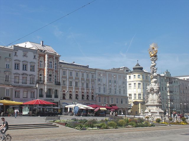

Linz
- capital city of Upper Austria, Austria
Hiking in Linz
Linz, the third-largest city in Austria, offers a variety of beautiful hiking opportunities in and around the area. Here are some highlights for hiking in and around Linz:...
- Country:
- Postal Code: 4030–4039; 4020–4029; 4040–4049; 4010
- Local Dialing Code: 0732
- Licence Plate Code: L
- Coordinates: 48° 18' 0" N, 14° 17' 0" E
- GPS tracks (wikiloc): [Link]
- AboveSeaLevel: 261 м m
- Area: 95.99 sq km
- Population: 204846
- Web site: [Link]

Altenberg bei Linz
- municipality in Austria
Hiking in Altenberg bei Linz
Altenberg bei Linz, located in Austria, offers a beautiful backdrop for hiking enthusiasts. Nestled in the Upper Austria region, this area is characterized by its lush forests, rolling hills, and scenic landscapes, making it a fantastic destination for outdoor activities....
- Country:
- Postal Code: 4203
- Local Dialing Code: 07230
- Licence Plate Code: UU
- Coordinates: 48° 22' 23" N, 14° 21' 1" E
- GPS tracks (wikiloc): [Link]
- AboveSeaLevel: 592 м m
- Area: 36.2 sq km
- Population: 4553
- Web site: [Link]


Steyregg
- municipality in Austria
Hiking in Steyregg
Steyregg is a charming municipality located in Upper Austria, near the city of Linz. It possesses a variety of beautiful landscapes and hiking trails suitable for different skill levels, making it an excellent destination for outdoor enthusiasts....
- Country:
- Postal Code: 4221
- Local Dialing Code: 0732
- Licence Plate Code: UU
- Coordinates: 48° 17' 1" N, 14° 22' 0" E
- GPS tracks (wikiloc): [Link]
- AboveSeaLevel: 259 м m
- Area: 33.07 sq km
- Population: 4889
- Web site: [Link]


Gallneukirchen
- municipality in Austria
Hiking in Gallneukirchen
Gallneukirchen is located in Austria, near the beautiful natural landscapes of the Mühlviertel region of Upper Austria. This area offers a variety of hiking opportunities, with trails that cater to different skill levels and preferences. Here are some highlights for hiking in and around Gallneukirchen:...
- Country:
- Postal Code: 4210
- Local Dialing Code: 07235
- Licence Plate Code: UU
- Coordinates: 48° 21' 11" N, 14° 24' 57" E
- GPS tracks (wikiloc): [Link]
- AboveSeaLevel: 336 м m
- Area: 5.18 sq km
- Population: 6492
- Web site: [Link]

Katsdorf
- municipality in Austria
Hiking in Katsdorf
Katsdorf, located in the Upper Austria region, offers several charming hiking opportunities. The area is characterized by beautiful countryside, rolling hills, and scenic views, making it ideal for both beginners and experienced hikers....
- Country:
- Postal Code: 4223
- Local Dialing Code: 07235
- Licence Plate Code: PE
- Coordinates: 48° 19' 1" N, 14° 28' 27" E
- GPS tracks (wikiloc): [Link]
- AboveSeaLevel: 306 м m
- Area: 14.66 sq km
- Population: 3086
- Web site: [Link]

Luftenberg an der Donau
- municipality in Austria
Hiking in Luftenberg an der Donau
Luftenberg an der Donau is a picturesque village located in Austria, along the beautiful Danube River. The area offers a variety of hiking opportunities, showcasing stunning landscapes, historical sites, and well-marked trails suited for various skill levels....
- Country:
- Postal Code: 4225
- Local Dialing Code: 07237
- Licence Plate Code: PE
- Coordinates: 48° 16' 32" N, 14° 25' 45" E
- GPS tracks (wikiloc): [Link]
- AboveSeaLevel: 295 м m
- Area: 16.86 sq km
- Population: 4057
- Web site: [Link]


Alberndorf in der Riedmark
- municipality in Austria
Hiking in Alberndorf in der Riedmark
Alberndorf in der Riedmark is a picturesque municipality located in the Mauthausen district of Austria, nestled in a beautiful region characterized by rolling hills, lush forests, and charming rural landscapes. While it's not particularly known as a major hiking destination, it offers a variety of local trails suitable for hiking enthusiasts looking for scenic walks and outdoor experiences....
- Country:
- Postal Code: 4211
- Local Dialing Code: 07235
- Licence Plate Code: UU
- Coordinates: 48° 24' 24" N, 14° 25' 1" E
- GPS tracks (wikiloc): [Link]
- AboveSeaLevel: 570 м m
- Area: 41 sq km
- Population: 4083
- Web site: [Link]

Wartberg ob der Aist
- municipality in Austria
Hiking in Wartberg ob der Aist
Wartberg ob der Aist is a charming municipality located in the northern region of Upper Austria, surrounded by beautiful landscapes that make it an excellent destination for hiking enthusiasts. The area is characterized by scenic hills, lush forests, and tranquil rivers, providing a variety of hiking trails suitable for different skill levels....
- Country:
- Postal Code: 4224
- Local Dialing Code: 07236
- Licence Plate Code: FR
- Coordinates: 48° 20' 50" N, 14° 30' 30" E
- GPS tracks (wikiloc): [Link]
- AboveSeaLevel: 477 м m
- Area: 19.4 sq km
- Population: 4222
- Web site: [Link]