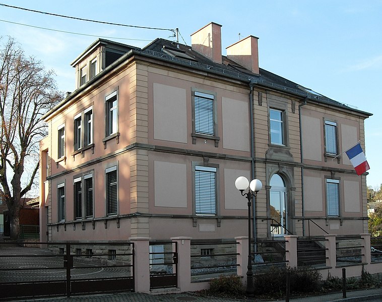
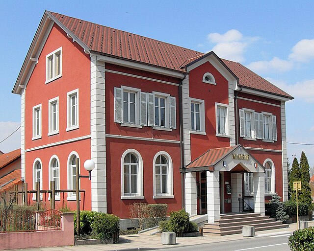
Eschentzwiller (Eschentzwiller)
- commune in Haut-Rhin, France
Eschentzwiller is a small commune located in the Haut-Rhin department of the Grand Est Region in France, close to the border with Switzerland. While it may not be widely known for extensive hiking trails, it offers a tranquil environment for those looking to explore the scenic beauty of the region. Here are a few key points to consider about hiking in and around Eschentzwiller:
-
Scenic Routes: The area around Eschentzwiller boasts picturesque landscapes, including rolling hills, forests, and agricultural fields. You may find small footpaths and trails suitable for walking and exploration.
-
Nearby Nature Parks: Just a short drive from Eschentzwiller, you can discover larger nature reserves and parks. The Parc Naturel Régional des Ballons des Vosges and the nearby Jura Mountains offer more extensive hiking opportunities with a variety of trail difficulties.
-
Cultural Sites: A hike in Eschentzwiller can also allow for exploration of local cultural sites, charming villages, and vineyards in the Alsace region. The area's unique architectural style and local cuisine add an enriching experience to your outdoor endeavors.
-
Flora and Fauna: Keep an eye out for local wildlife, as you might encounter various species of birds and other animals. The region is known for its floral diversity as well, particularly in the spring and summer.
-
Accessibility: The region is accessible from major cities like Mulhouse, which makes it convenient for day hikes. Public transport options are often available, enabling you to reach trailheads without needing a car.
-
Trail Recommendations: While specific hiking trails in Eschentzwiller may not be well-documented, you can look for local walking maps or resources that highlight rural paths or seek advice from local tourist information centers.
Before heading out, make sure to check trail conditions, weather forecasts, and local regulations, and always carry essential hiking gear. Happy hiking!
- Country:

- Postal Code: 68440
- Coordinates: 47° 42' 46" N, 7° 23' 55" E


- GPS tracks (wikiloc): [Link]
- Area: 3.19 sq km
- Population: 1505
- Wikipedia en: wiki(en)
- Wikipedia: wiki(fr)
- Wikidata storage: Wikidata: Q457090
- Wikipedia Commons Category: [Link]
- Freebase ID: [/m/03nss8z]
- Freebase ID: [/m/03nss8z]
- GeoNames ID: Alt: [6450699]
- GeoNames ID: Alt: [6450699]
- SIREN number: [216800847]
- SIREN number: [216800847]
- BnF ID: [15271786c]
- BnF ID: [15271786c]
- VIAF ID: Alt: [236992198]
- VIAF ID: Alt: [236992198]
- INSEE municipality code: 68084
- INSEE municipality code: 68084
Shares border with regions:


Landser
- commune in Haut-Rhin, France
Landser, located in the Haut-Rhin department of France, is a charming town that offers a variety of hiking opportunities. Nestled in the Alsace region, near the foothills of the Vosges Mountains, Landser is surrounded by picturesque landscapes, vineyards, and forests, making it a great destination for outdoor enthusiasts....
- Country:

- Postal Code: 68440
- Coordinates: 47° 41' 6" N, 7° 23' 27" E


- GPS tracks (wikiloc): [Link]
- Area: 3.04 sq km
- Population: 1567


Zimmersheim
- commune in Haut-Rhin, France
Zimmersheim is a small village located in the Alsace region of France, near the larger city of Mulhouse. While it may not be a well-known hiking destination, the surrounding area offers beautiful landscapes and opportunities for outdoor activities. Here are some insights about hiking in and around Zimmersheim:...
- Country:

- Postal Code: 68440
- Coordinates: 47° 43' 11" N, 7° 23' 17" E


- GPS tracks (wikiloc): [Link]
- Area: 3.15 sq km
- Population: 1042


Habsheim
- commune in Haut-Rhin, France
Habsheim, located in the Alsace region of France, offers a charming backdrop for hiking enthusiasts. The area around Habsheim features a mix of flatlands, rolling hills, and wooded areas, making it suitable for hikers of all levels. While Habsheim itself is a small commune, you can explore a variety of trails and natural landscapes in the surrounding region....
- Country:

- Postal Code: 68440
- Coordinates: 47° 43' 46" N, 7° 25' 8" E


- GPS tracks (wikiloc): [Link]
- Area: 15.63 sq km
- Population: 4758
- Web site: [Link]


Bruebach
- commune in Haut-Rhin, France
Bruebach is a charming village located in the Haut-Rhin department of Alsace, France. It offers a range of hiking opportunities that allow you to explore the beautiful landscapes of the surrounding region, which is characterized by scenic hills, vineyards, and forests....
- Country:

- Postal Code: 68440
- Coordinates: 47° 41' 59" N, 7° 21' 35" E


- GPS tracks (wikiloc): [Link]
- Area: 7.01 sq km
- Population: 1059


Dietwiller
- commune in Haut-Rhin, France
Dietwiller is a small commune located in the Alsace region of France, near Mulhouse. While it may not be widely known as a hiking destination, there are several opportunities to enjoy nature and explore the local landscape. Here are some points to consider if you're planning a hike in and around Dietwiller:...
- Country:

- Postal Code: 68440
- Coordinates: 47° 41' 29" N, 7° 24' 5" E


- GPS tracks (wikiloc): [Link]
- Area: 11.06 sq km
- Population: 1442
- Web site: [Link]


Hombourg
- commune in Haut-Rhin, France
Hombourg, located in Belgium, is known for its picturesque landscapes and charming countryside, making it an excellent destination for hiking enthusiasts. The region is characterized by its rolling hills, dense forests, and beautiful valleys, which offer a variety of hiking trails suitable for different skill levels....
- Country:

- Postal Code: 68490
- Coordinates: 47° 45' 32" N, 7° 30' 20" E


- GPS tracks (wikiloc): [Link]
- Area: 15.32 sq km
- Population: 1304

