Espinasse (Espinasse)

- commune in Cantal, France
- Country:

- Postal Code: 15110
- Coordinates: 44° 52' 19" N, 2° 56' 30" E


- GPS tracks (wikiloc): [Link]
- AboveSeaLevel: 900 м m
- Area: 16.72 sq km
- Population: 78
- Wikipedia en: wiki(en)
- Wikipedia: wiki(fr)
- Wikidata storage: Wikidata: Q805280
- Wikipedia Commons Category: [Link]
- Freebase ID: [/m/03mb77v]
- GeoNames ID: Alt: [6615936]
- SIREN number: [211500657]
- BnF ID: [152482355]
- INSEE municipality code: 15065
Shares border with regions:


Chaudes-Aigues
- commune in Cantal, France
- Country:
- Postal Code: 15110
- Coordinates: 44° 51' 16" N, 3° 0' 15" E
- GPS tracks (wikiloc): [Link]
- Area: 53.16 sq km
- Population: 891


Neuvéglise
- former commune in Cantal, France
- Country:
- Postal Code: 15260
- Coordinates: 44° 55' 41" N, 2° 59' 0" E
- GPS tracks (wikiloc): [Link]
- Area: 54.7 sq km
- Population: 1113
- Web site: [Link]

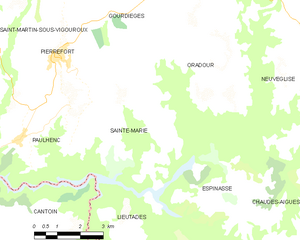
Sainte-Marie
- commune in Cantal, France
- Country:
- Postal Code: 15230
- Coordinates: 44° 52' 39" N, 2° 53' 8" E
- GPS tracks (wikiloc): [Link]
- Area: 17.87 sq km
- Population: 111


Jabrun
- commune in Cantal, France
- Country:
- Postal Code: 15110
- Coordinates: 44° 48' 28" N, 2° 57' 40" E
- GPS tracks (wikiloc): [Link]
- Area: 34.03 sq km
- Population: 161


Lieutadès
- commune in Cantal, France
- Country:
- Postal Code: 15110
- Coordinates: 44° 50' 23" N, 2° 53' 56" E
- GPS tracks (wikiloc): [Link]
- Area: 39.91 sq km
- Population: 165


Oradour
- former commune in Cantal, France
- Country:
- Postal Code: 15260
- Coordinates: 44° 55' 9" N, 2° 56' 4" E
- GPS tracks (wikiloc): [Link]
- Area: 33.77 sq km
- Population: 243