Sainte-Marie (Sainte-Marie)

- commune in Cantal, France
- Country:

- Postal Code: 15230
- Coordinates: 44° 52' 39" N, 2° 53' 8" E


- GPS tracks (wikiloc): [Link]
- Area: 17.87 sq km
- Population: 111
- Wikipedia en: wiki(en)
- Wikipedia: wiki(fr)
- Wikidata storage: Wikidata: Q270696
- Wikipedia Commons Category: [Link]
- Freebase ID: [/m/03mb9sz]
- GeoNames ID: Alt: [6427640]
- SIREN number: [211501986]
- BnF ID: [15248368d]
- INSEE municipality code: 15198
Shares border with regions:


Cantoin
- commune in Aveyron, France
- Country:
- Postal Code: 12420
- Coordinates: 44° 50' 10" N, 2° 48' 45" E
- GPS tracks (wikiloc): [Link]
- Area: 42.37 sq km
- Population: 309
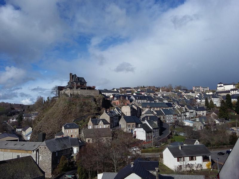
Pierrefort
- commune in Cantal, France
- Country:
- Postal Code: 15230
- Coordinates: 44° 55' 18" N, 2° 50' 17" E
- GPS tracks (wikiloc): [Link]
- Area: 24.59 sq km
- Population: 909
- Web site: [Link]


Espinasse
- commune in Cantal, France
- Country:
- Postal Code: 15110
- Coordinates: 44° 52' 19" N, 2° 56' 30" E
- GPS tracks (wikiloc): [Link]
- AboveSeaLevel: 900 м m
- Area: 16.72 sq km
- Population: 78
Gourdièges
- commune in Cantal, France
- Country:
- Postal Code: 15230
- Coordinates: 44° 56' 13" N, 2° 52' 50" E
- GPS tracks (wikiloc): [Link]
- Area: 8.46 sq km
- Population: 55


Lieutadès
- commune in Cantal, France
- Country:
- Postal Code: 15110
- Coordinates: 44° 50' 23" N, 2° 53' 56" E
- GPS tracks (wikiloc): [Link]
- Area: 39.91 sq km
- Population: 165


Oradour
- former commune in Cantal, France
- Country:
- Postal Code: 15260
- Coordinates: 44° 55' 9" N, 2° 56' 4" E
- GPS tracks (wikiloc): [Link]
- Area: 33.77 sq km
- Population: 243

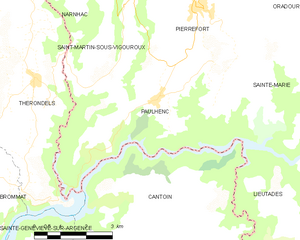
Paulhenc
- commune in Cantal, France
- Country:
- Postal Code: 15230
- Coordinates: 44° 53' 23" N, 2° 49' 2" E
- GPS tracks (wikiloc): [Link]
- Area: 23.69 sq km
- Population: 246