Establet (Establet)

- commune in Drôme, France
 Hiking in Establet
Establet is not widely recognized, so it might be a less well-known location. However, if you meant "Establés," a typical area in the broader regions of Spain such as the Sierra de Espuña or other mountainous regions, I can provide guidance on hiking in similar terrains.
Here are some general tips on hiking in mountainous or less-frequented areas:
1.
- Look for established trails and maps to help you navigate. Websites like AllTrails or local outdoor community websites can have valuable information.
2.
- Pack the essentials: water, snacks, first aid kit, compass/GPS, and suitable clothing for the weather conditions.
- Dress in layers, as temperatures can change quickly in the mountains.
3.
- Familiarize yourself with the landscape. Mountainous areas may have steep paths, rocky sections, or various elevations.
4.
- Before you head out, always check the weather forecast. Conditions can change rapidly, especially in mountainous regions.
5.
- Hike with a partner or group when possible. Inform someone of your plans and expected return time.
- If you're on a less-traveled path, it’s good to carry a whistle, a mirror for signaling, and a headlamp in case you need to hike after dark.
6.
- Be sure to follow Leave No Trace principles to minimize your impact on the environment. Pack out everything you bring in.
7.
- Be aware of the local wildlife. Know how to behave if you encounter animals like snakes, bears, or other wildlife native to the area.
If Establet is a specific location you meant to refer to, feel free to provide more context, and I can give more targeted advice!
- Country:

- Postal Code: 26470
- Coordinates: 44° 30' 22" N, 5° 26' 17" E


- GPS tracks (wikiloc): [Link]
- Area: 12.58 sq km
- Population: 29
- Wikipedia en: wiki(en)
- Wikipedia: wiki(fr)
- Wikidata storage: Wikidata: Q1009436
- Wikipedia Commons Category: [Link]
- Freebase ID: [/m/03mhg7q]
- GeoNames ID: Alt: [6430084]
- SIREN number: [212601231]
- BnF ID: [152529842]
- INSEE municipality code: 26123
Shares border with regions:

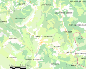
La Motte-Chalancon
- commune in Drôme, France
Hiking in La Motte-Chalancon
La Motte-Chalancon is a charming village located in the Drôme department in the Auvergne-Rhône-Alpes region of southeastern France. It's a beautiful area for hiking, offering a blend of picturesque landscapes, diverse trails, and a rich natural environment....
- Country:
- Postal Code: 26470
- Coordinates: 44° 29' 7" N, 5° 22' 46" E
- GPS tracks (wikiloc): [Link]
- Area: 22.83 sq km
- Population: 417


Bellegarde-en-Diois
- commune in Drôme, France
Hiking in Bellegarde-en-Diois
Bellegarde-en-Diois is a charming village located in the picturesque Diois region of the Drôme department in southeastern France. This area is known for its stunning natural landscapes, offering a variety of hiking opportunities suitable for all levels of hikers....
- Country:
- Postal Code: 26470
- Coordinates: 44° 32' 18" N, 5° 25' 40" E
- GPS tracks (wikiloc): [Link]
- Area: 26.04 sq km
- Population: 81


Rottier
- commune in Drôme, France
Hiking in Rottier
Rottier, while less commonly known than some other hiking destinations, offers scenic beauty and various trails suitable for hikers of different skill levels. If you're looking to hike in Rottier, here are some key points to consider:...
- Country:
- Postal Code: 26470
- Coordinates: 44° 28' 28" N, 5° 24' 47" E
- GPS tracks (wikiloc): [Link]
- Area: 8.54 sq km
- Population: 22


Saint-Dizier-en-Diois
- commune in Drôme, France
Hiking in Saint-Dizier-en-Diois
Saint-Dizier-en-Diois is a charming commune located in the Drôme department of southeastern France, nestled in the picturesque landscapes of the Diois region. The area is well-known for its stunning natural beauty, making it an appealing destination for hiking enthusiasts....
- Country:
- Postal Code: 26310
- Coordinates: 44° 30' 51" N, 5° 28' 38" E
- GPS tracks (wikiloc): [Link]
- Area: 13.94 sq km
- Population: 47

Bruis
- former commune in Hautes-Alpes, France
Hiking in Bruis
Bruis, a charming village in France's Hautes-Alpes region, offers a range of beautiful hiking opportunities that take advantage of the stunning Alpine scenery. Here are some key points to consider when hiking in and around Bruis:...
- Country:
- Postal Code: 05150
- Coordinates: 44° 28' 5" N, 5° 30' 49" E
- GPS tracks (wikiloc): [Link]
- Area: 25.15 sq km
- Population: 77
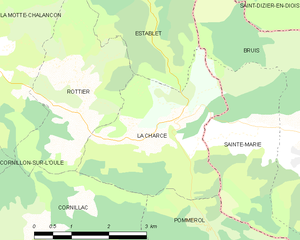
La Charce
- commune in Drôme, France
Hiking in La Charce
La Charce is a beautiful area located in the southern region of the Drôme department in France. It's known for its stunning landscapes, diverse flora and fauna, and serene hiking trails. Here’s some information to help you plan your hiking adventure in La Charce:...
- Country:
- Postal Code: 26470
- Coordinates: 44° 28' 14" N, 5° 27' 3" E
- GPS tracks (wikiloc): [Link]
- Area: 9.43 sq km
- Population: 35