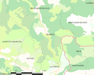
La Charce (La Charce)

- commune in Drôme, France
 Hiking in La Charce
La Charce is a beautiful area located in the southern region of the Drôme department in France. It's known for its stunning landscapes, diverse flora and fauna, and serene hiking trails. Here’s some information to help you plan your hiking adventure in La Charce:
Trails
-
Scenic Views: Many trails in La Charce offer breathtaking views of the surrounding mountains and valleys. Look out for paths that lead to viewpoints or historical landmarks.
-
Diversity of Terrain: The area features a mix of terrains—from gentle slopes and meadows to more challenging rocky paths. This makes it suitable for various skill levels, whether you're a beginner or an experienced hiker.
-
Loops and Circuits: There are several loop trails that allow you to explore different aspects of the region without backtracking. These can be great for discovering hidden gems in the area.
Nature and Wildlife
-
Biodiversity: The region is rich in biodiversity. Keep your eyes peeled for various species of birds, butterflies, and other wildlife, as well as a variety of plant species.
-
Seasonal Changes: Depending on the time of year, the scenery can change dramatically—from vibrant wildflowers in spring to the stunning colors of autumn leaves.
Recommendations
- Preparation: Always check the weather before heading out and wear appropriate clothing and sturdy hiking boots.
- Hydration and Snacks: Carry enough water and snacks, especially on longer hikes, as facilities may be limited.
- Maps and Navigation: Take a detailed map of the region or use a hiking app for navigation. Some trails may not be well-marked.
- Leave No Trace: Follow Leave No Trace principles to help preserve the natural beauty of La Charce.
Nearby Attractions
Consider also exploring nearby attractions, such as historical sites, small villages, and local markets where you can experience the culture and cuisine of the region.
Hiking in La Charce can be a rewarding experience, both for the physical activity and the opportunity to connect with nature. Enjoy your adventure!
- Country:

- Postal Code: 26470
- Coordinates: 44° 28' 14" N, 5° 27' 3" E


- GPS tracks (wikiloc): [Link]
- Area: 9.43 sq km
- Population: 35
- Wikipedia en: wiki(en)
- Wikipedia: wiki(fr)
- Wikidata storage: Wikidata: Q863596
- Wikipedia Commons Category: [Link]
- Freebase ID: [/m/03mhflr]
- GeoNames ID: Alt: [6614779]
- SIREN number: [212600753]
- BnF ID: [152529366]
- WOEID: [597593]
- INSEE municipality code: 26075
Shares border with regions:

Establet
- commune in Drôme, France
Hiking in Establet
Establet is not widely recognized, so it might be a less well-known location. However, if you meant "Establés," a typical area in the broader regions of Spain such as the Sierra de Espuña or other mountainous regions, I can provide guidance on hiking in similar terrains....
- Country:
- Postal Code: 26470
- Coordinates: 44° 30' 22" N, 5° 26' 17" E
- GPS tracks (wikiloc): [Link]
- Area: 12.58 sq km
- Population: 29


Rottier
- commune in Drôme, France
Hiking in Rottier
Rottier, while less commonly known than some other hiking destinations, offers scenic beauty and various trails suitable for hikers of different skill levels. If you're looking to hike in Rottier, here are some key points to consider:...
- Country:
- Postal Code: 26470
- Coordinates: 44° 28' 28" N, 5° 24' 47" E
- GPS tracks (wikiloc): [Link]
- Area: 8.54 sq km
- Population: 22

Sainte-Marie
- former commune in Hautes-Alpes, France
Hiking in Sainte-Marie
Sainte-Marie, located in the Hautes-Alpes department in southeastern France, is a beautiful area known for its stunning alpine landscapes, clear lakes, and diverse flora and fauna. Here are some highlights and tips for hiking in and around Sainte-Marie:...
- Country:
- Postal Code: 05150
- Coordinates: 44° 27' 56" N, 5° 28' 30" E
- GPS tracks (wikiloc): [Link]
- Area: 7.5 sq km
- Population: 40

Bruis
- former commune in Hautes-Alpes, France
Hiking in Bruis
Bruis, a charming village in France's Hautes-Alpes region, offers a range of beautiful hiking opportunities that take advantage of the stunning Alpine scenery. Here are some key points to consider when hiking in and around Bruis:...
- Country:
- Postal Code: 05150
- Coordinates: 44° 28' 5" N, 5° 30' 49" E
- GPS tracks (wikiloc): [Link]
- Area: 25.15 sq km
- Population: 77


Pommerol
- commune in Drôme, France
Hiking in Pommerol
Pommerol, located in the heart of the French Alps, is a charming destination for hiking enthusiasts. The region is known for its stunning landscapes, diverse terrains, and picturesque villages. Here are some highlights and tips for hiking in Pommerol:...
- Country:
- Postal Code: 26470
- Coordinates: 44° 26' 46" N, 5° 27' 8" E
- GPS tracks (wikiloc): [Link]
- AboveSeaLevel: 890 м m
- Area: 9.83 sq km
- Population: 20


Cornillac
- commune in Drôme, France
Hiking in Cornillac
Cornillac is a lesser-known gem located in the French Alps, making it an ideal destination for hiking enthusiasts seeking scenic views and challenging trails. While not as crowded as some more popular destinations, it offers a variety of hiking opportunities suitable for different skill levels....
- Country:
- Postal Code: 26510
- Coordinates: 44° 26' 35" N, 5° 23' 11" E
- GPS tracks (wikiloc): [Link]
- Area: 19.44 sq km
- Population: 81