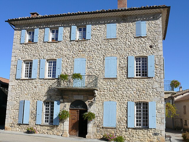
Eyguians (Eyguians)

- former commune in Hautes-Alpes, France
 Hiking in Eyguians
Eyguians, a charming village located in the French Alps, offers a range of hiking opportunities for outdoor enthusiasts of various skill levels. Nestled in the Hautes-Alpes department, this region is characterized by stunning mountain scenery, lush forests, and diverse wildlife.
Trails and Routes
-
Vallée de l'Eygues: This area features several trails, including paths along the river that are perfect for leisurely hikes and family outings. The scenery is picturesque, with plenty of spots for picnicking.
-
GR 94: This long-distance hiking trail passes nearby and offers an opportunity for more experienced hikers to embark on multi-day treks. It connects various towns and showcases beautiful alpine landscapes.
-
Local Circuits: There are numerous shorter circuits around Eyguians that take you through meadows, forests, and up to viewpoints that provide breathtaking panoramas of the surrounding mountains.
Best Times to Hike
- Spring (April to June): Nature begins to bloom, and the temperatures are generally mild. It's a great time for wildflower viewing and enjoying the fresh greenery.
- Summer (July to August): Peak season for hiking, this is when the weather is most stable. However, trails can get crowded.
- Fall (September to October): Autumn colors create a stunning landscape. Temperatures may start to cool, and the trails are less crowded, making it a great time to explore.
- Winter: While main hiking trails may be covered in snow, certain routes are suitable for snowshoeing and winter hiking for those seeking snow-covered landscapes.
Preparation and Safety
- Gear: Wear proper hiking boots, and dress in layers to accommodate changing temperatures. Don’t forget a hat, sunscreen, and insect repellent during the warmer months.
- Hydration: Carry enough water, as some trails may lack reliable water sources.
- Maps and Navigation: Familiarize yourself with trail maps and consider downloading hiking apps that can provide GPS support.
- Local Regulations: Check for any local guidelines or restrictions, especially in protected areas.
Wildlife and Flora
While hiking in Eyguians, you may encounter diverse wildlife such as deer, chamois, and a variety of bird species. The area is also rich in flora, with various alpine flowers and unique plant species.
Eyguians offers a beautiful escape into nature, making it an attractive destination for hikers looking to enjoy the beauty of the French Alps. Always remember to follow Leave No Trace principles to keep the environment pristine for others!
- Country:

- Postal Code: 05300
- Coordinates: 44° 20' 47" N, 5° 46' 21" E


- GPS tracks (wikiloc): [Link]
- Area: 9.37 sq km
- Population: 229
- Wikipedia en: wiki(en)
- Wikipedia: wiki(fr)
- Wikidata storage: Wikidata: Q1017887
- Wikipedia Commons Category: [Link]
- Freebase ID: [/m/03mfl5z]
- Freebase ID: [/m/03mfl5z]
- GeoNames ID: Alt: [6446641]
- GeoNames ID: Alt: [6446641]
- PACTOLS thesaurus ID: [pcrtYB42tOKsY7]
- PACTOLS thesaurus ID: [pcrtYB42tOKsY7]
- INSEE municipality code: 05053
- INSEE municipality code: 05053
Shares border with regions:

Saint-Genis
- former commune in Hautes-Alpes, France
Hiking in Saint-Genis
Saint-Genis in the Hautes-Alpes region of France is a picturesque village surrounded by stunning mountainous landscapes, making it an excellent location for hiking enthusiasts. The area features a variety of trails that cater to different skill levels, offering opportunities for both casual walkers and seasoned hikers....
- Country:
- Coordinates: 44° 22' 46" N, 5° 46' 7" E
- GPS tracks (wikiloc): [Link]
- Area: 18.32 sq km
- Population: 50

Laragne-Montéglin
- commune in Hautes-Alpes, France
Hiking in Laragne-Montéglin
Laragne-Montéglin is a charming commune located in the Hautes-Alpes department of southeastern France. It's surrounded by stunning natural landscapes, making it a great destination for hiking enthusiasts. Here are some highlights and tips for hiking in this area:...
- Country:
- Postal Code: 05300
- Coordinates: 44° 18' 54" N, 5° 49' 18" E
- GPS tracks (wikiloc): [Link]
- Area: 23.51 sq km
- Population: 3455
- Web site: [Link]

Saléon
- commune in Hautes-Alpes, France
Hiking in Saléon
Saléon, nestled in the picturesque countryside of France, offers a range of hiking opportunities for outdoor enthusiasts. The region is characterized by its stunning landscapes, including rolling hills, verdant forests, and scenic valleys. Here are some key highlights and tips for hiking in Saléon:...
- Country:
- Postal Code: 05300
- Coordinates: 44° 19' 55" N, 5° 46' 33" E
- GPS tracks (wikiloc): [Link]
- Area: 9.86 sq km
- Population: 91
Lagrand
- former commune in Hautes-Alpes, France
Hiking in Lagrand
Lagrand is not a widely known hiking location, so I assume you might be referring to an area such as Lagrande in the U.S. state of Oregon or possibly another place with a similar name....
- Country:
- Postal Code: 05300
- Coordinates: 44° 20' 29" N, 5° 45' 21" E
- GPS tracks (wikiloc): [Link]
- Area: 6.92 sq km
- Population: 267

Trescléoux
- commune in Hautes-Alpes, France
Hiking in Trescléoux
Trescléoux, located in the Hautes-Alpes department of France, offers a unique hiking experience with stunning landscapes and diverse trails. Nestled in the foothills of the Alps, it provides hikers with access to beautiful natural features, including rolling hills, rocky outcrops, and alpine meadows....
- Country:
- Postal Code: 05700
- Coordinates: 44° 21' 15" N, 5° 42' 31" E
- GPS tracks (wikiloc): [Link]
- Area: 18.68 sq km
- Population: 318
- Web site: [Link]