Falera (Falera)
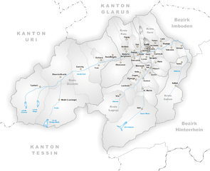
- municipality in Switzerland
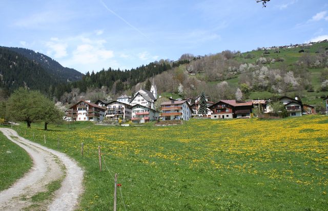
Falera is a picturesque village in the Swiss Alps, located in the canton of Graubünden. The region is known for its breathtaking landscapes, rich history, and excellent hiking opportunities. Here’s what you should know about hiking in Falera:
Hiking Trails
-
Accessibility: The area around Falera features a variety of well-marked trails suitable for hikers of all experience levels. From easy strolls to challenging alpine hikes, there’s something for everyone.
-
Popular Trails:
- Flims - Falera - Laax Trail: A scenic hike that connects the three villages, offering stunning views of the surrounding mountains and lakes.
- Il Spir Trail: This is a famous viewpoint that overlooks the Rhine Gorge, often referred to as the "Grand Canyon of Switzerland." The trail features several viewpoints and is moderately challenging.
- Aussichtsweg (View Trail): A relatively easy trail that provides excellent views of the region and is perfect for families or those looking for a leisurely hike.
-
Elevation: Many trails in this area feature significant elevation changes, allowing for breathtaking panoramic views. Be prepared for steep sections and varying terrain.
Nature and Wildlife
- Flora and Fauna: Hikers can expect to see a variety of alpine flora, including wildflowers in summer. Wildlife sightings can include chamois, marmots, and various birds of prey.
- Lakes and Rivers: Along many trails, you’ll encounter glacial lakes and rivers, ideal for relaxing breaks or picnics.
Best Time to Hike
- Summer (June to September): The most popular time for hiking due to the stable weather and fully accessible trails. The scenery is particularly beautiful with vibrant alpine flowers.
- Autumn (October): Offers stunning fall foliage, but be mindful of earlier snowfall in higher elevations, which could impact trail accessibility.
Safety Tips
- Weather: Always check the weather conditions before heading out, as mountain weather can change rapidly.
- Equipment: Wear sturdy hiking boots and bring appropriate gear for varying conditions (e.g., rain jacket, hat, sunscreen).
- Trail Maps: While trails are generally well-marked, having a physical map or GPS device can help prevent getting lost, especially on less frequented paths.
- Stay Hydrated and Energized: Bring plenty of water and snacks, particularly for longer hikes.
Local Amenities
Falera offers a range of accommodations, from hotels to cabins, as well as restaurants where hikers can enjoy local cuisine after a day on the trails. The village also hosts various cultural events and activities throughout the year, enhancing the hiking experience.
Whether you’re a seasoned hiker or a beginner, Falera offers an unforgettable experience in nature, with ample opportunities for exploration and adventure.
- Country:

- Postal Code: 7153
- Local Dialing Code: 081
- Licence Plate Code: GR
- Coordinates: 46° 49' 38" N, 9° 12' 31" E


- GPS tracks (wikiloc): [Link]
- AboveSeaLevel: 1982 м m
- Area: 22.36 sq km
- Population: 623
- Web site: http://www.falera.net
- Wikipedia en: wiki(en)
- Wikipedia: wiki(de)
- Wikidata storage: Wikidata: Q65086
- Wikipedia Commons Category: [Link]
- Freebase ID: [/m/0d63mb]
- GeoNames ID: Alt: [7285793]
- VIAF ID: Alt: [246639404]
- OSM relation ID: [1684074]
- HDS ID: [1435]
- Swiss municipality code: [3572]
- Lexicon istoric retic ID: [255]
Shares border with regions:


Ladir
- former municipality of Switzerland
Ladir is a stunning destination for hikers, known for its breathtaking landscapes and diverse trails. Whether you're seeking challenging mountain hikes or serene walks through lush valleys, Ladir offers a variety of options to suit all skill levels....
- Country:

- Postal Code: 7155
- Local Dialing Code: 081
- Licence Plate Code: GR
- Coordinates: 46° 46' 59" N, 9° 11' 59" E


- GPS tracks (wikiloc): [Link]
- AboveSeaLevel: 1276 м m
- Area: 7.19 sq km
- Web site: [Link]


Schluein
- municipality in Switzerland
Schluein is a picturesque village in the Graubünden region of Switzerland, nestled in the scenic Surselva area. It offers a variety of hiking opportunities, with stunning landscapes that include lush valleys, rugged mountains, and serene rivers....
- Country:

- Postal Code: 7151
- Local Dialing Code: 081
- Licence Plate Code: GR
- Coordinates: 46° 46' 59" N, 9° 13' 59" E


- GPS tracks (wikiloc): [Link]
- AboveSeaLevel: 762 м m
- Area: 4.79 sq km
- Population: 623
- Web site: [Link]


Sagogn
- municipality in Switzerland
Sagogn is a charming village located in the Swiss canton of Graubünden, nestled amid stunning alpine scenery. It's an excellent destination for hiking enthusiasts, offering a variety of trails suitable for different skill levels. Here are some key points to consider when hiking in and around Sagogn:...
- Country:

- Postal Code: 7152
- Local Dialing Code: 081
- Licence Plate Code: GR
- Coordinates: 46° 47' 32" N, 9° 15' 21" E


- GPS tracks (wikiloc): [Link]
- AboveSeaLevel: 809 м m
- Area: 6.92 sq km
- Population: 686
- Web site: [Link]


Schnaus
- former municipality of Switzerland
Schnaus, located in the Swiss region of Graubünden, is renowned for its picturesque landscapes and diverse hiking trails. While specific trail information may vary, here’s a general guide to help you enjoy hiking in this beautiful area:...
- Country:

- Postal Code: 7130
- Local Dialing Code: 081
- Licence Plate Code: GR
- Coordinates: 46° 45' 59" N, 9° 9' 59" E


- GPS tracks (wikiloc): [Link]
- AboveSeaLevel: 720 м m
- Area: 2.97 sq km


Ruschein
- former municipality of Switzerland
Ruschein, located in the Grisons region of Switzerland, offers beautiful landscapes and a variety of hiking trails suitable for all levels of experience. The area is characterized by stunning alpine scenery, including lush meadows, rugged mountains, and picturesque valleys....
- Country:

- Postal Code: 7154
- Local Dialing Code: 081
- Licence Plate Code: GR
- Coordinates: 46° 46' 59" N, 9° 11' 0" E


- GPS tracks (wikiloc): [Link]
- AboveSeaLevel: 1155 м m
- Area: 12.54 sq km
- Web site: [Link]


Laax
- municipality in Switzerland
Laax, located in the Swiss Alps in the canton of Graubünden, is a fantastic destination for hiking enthusiasts. Known for its breathtaking landscapes, diverse trails, and stunning alpine scenery, Laax offers hiking options for all skill levels. Here are some key aspects to consider if you're planning to hike in Laax:...
- Country:

- Postal Code: 7031
- Local Dialing Code: 081
- Licence Plate Code: GR
- Coordinates: 46° 50' 45" N, 9° 13' 40" E


- GPS tracks (wikiloc): [Link]
- AboveSeaLevel: 1685 м m
- Area: 31.68 sq km
- Population: 1755
- Web site: [Link]

