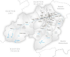
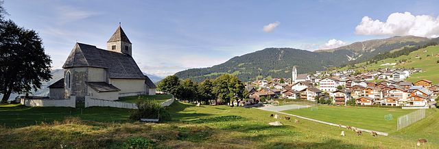
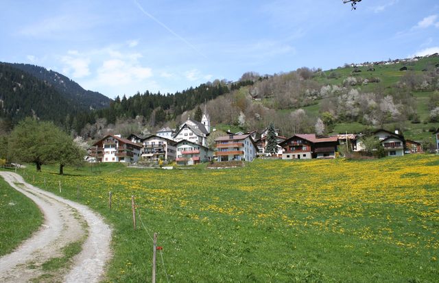
Ilanz (Kreis Ilanz)
- subdistrict in the canton of Graubünden, Switzerland
Ilanz, located in the canton of Graubünden in Switzerland, is a fantastic destination for hiking enthusiasts. Nestled in the Rhine Valley, Ilanz offers a diverse range of trails suitable for various skill levels, making it an excellent choice for both novice and experienced hikers.
Key Highlights of Hiking in Ilanz (Kreis):
-
Scenic Trails:
- The area offers breathtaking views of the surrounding mountains, valleys, and the Rhine River.
- Trails weave through alpine meadows, forests, and rugged terrain, providing a glimpse of the diverse flora and fauna of the region.
-
Popular Routes:
- Ilanz to Flims: This is a well-loved route that connects Ilanz to Flims, offering stunning views of the Rhine Gorge, often called the "Grand Canyon of Switzerland."
- Arosa-Lenzerheide: A longer trek that connects various alpine landscapes, perfect for those looking for a day-long hike.
-
Family-Friendly Options:
- Several trails are suitable for families and children, often with shorter distances and gentle inclines, making it easy for everyone to enjoy the outdoors.
-
Seasonal Hiking:
- Depending on the time of year, the experience changes; summer offers lush greenery and wildflowers, while autumn provides vibrant colors. Winter hiking with snowshoes is also popular in nearby areas.
-
Local Culture and History:
- As you hike, you may encounter charming villages and historical sites that provide insight into the local culture and traditions of the region.
-
Accessibility:
- Ilanz is accessible by public transportation, including trains and buses, making it easy to start your hiking adventure without needing a car.
-
Safety and Preparation:
- Always check the weather conditions before heading out, as mountain weather can change rapidly.
- Proper gear, including sturdy hiking shoes, clothing in layers, a map, and sufficient water, is essential for a safe hiking experience.
Whether you're looking for a leisurely walk or a challenging hike, Ilanz offers a variety of options that cater to all preferences. Be sure to take your time and immerse yourself in the stunning landscapes and tranquility that this beautiful part of Switzerland has to offer!
- Country:

- Coordinates: 46° 45' 54" N, 9° 12' 0" E


- GPS tracks (wikiloc): [Link]
- Wikipedia en: wiki(en)
- Wikipedia: wiki(de)
- Wikidata storage: Wikidata: Q870364
- Wikipedia Commons Category: [Link]
Includes regions:


Ilanz
- former municipality of Switzerland
Ilanz, located in the beautiful Surselva region of the Swiss canton of Graubünden, offers a range of stunning hiking opportunities. Known as the "Gateway to the Rhine Canyon," Ilanz serves as a great base for exploring the surrounding natural landscapes. Here are some highlights and tips for hiking in the Ilanz area:...
- Country:

- Postal Code: 7130
- Local Dialing Code: 081
- Coordinates: 46° 45' 59" N, 9° 12' 0" E


- GPS tracks (wikiloc): [Link]
- AboveSeaLevel: 702 м m
- Area: 4.67 sq km
- Web site: [Link]


Ladir
- former municipality of Switzerland
Ladir is a stunning destination for hikers, known for its breathtaking landscapes and diverse trails. Whether you're seeking challenging mountain hikes or serene walks through lush valleys, Ladir offers a variety of options to suit all skill levels....
- Country:

- Postal Code: 7155
- Local Dialing Code: 081
- Licence Plate Code: GR
- Coordinates: 46° 46' 59" N, 9° 11' 59" E


- GPS tracks (wikiloc): [Link]
- AboveSeaLevel: 1276 м m
- Area: 7.19 sq km
- Web site: [Link]


Pitasch
- former municipality of Switzerland
Pitasch is a picturesque alpine region in the Swiss canton of Grisons (Graubünden), known for its beautiful landscapes and excellent hiking opportunities. The surrounding area offers a variety of trails suitable for all skill levels, from leisurely walks to challenging mountain hikes. Here are some highlights of hiking in Pitasch:...
- Country:

- Postal Code: 7111
- Local Dialing Code: 081
- Licence Plate Code: GR
- Coordinates: 46° 42' 59" N, 9° 13' 0" E


- GPS tracks (wikiloc): [Link]
- AboveSeaLevel: 1060 м m
- Area: 10.79 sq km
- Web site: [Link]


Falera
- municipality in Switzerland
Falera is a picturesque village in the Swiss Alps, located in the canton of Graubünden. The region is known for its breathtaking landscapes, rich history, and excellent hiking opportunities. Here’s what you should know about hiking in Falera:...
- Country:

- Postal Code: 7153
- Local Dialing Code: 081
- Licence Plate Code: GR
- Coordinates: 46° 49' 38" N, 9° 12' 31" E


- GPS tracks (wikiloc): [Link]
- AboveSeaLevel: 1982 м m
- Area: 22.36 sq km
- Population: 623
- Web site: [Link]


Schluein
- municipality in Switzerland
Schluein is a picturesque village in the Graubünden region of Switzerland, nestled in the scenic Surselva area. It offers a variety of hiking opportunities, with stunning landscapes that include lush valleys, rugged mountains, and serene rivers....
- Country:

- Postal Code: 7151
- Local Dialing Code: 081
- Licence Plate Code: GR
- Coordinates: 46° 46' 59" N, 9° 13' 59" E


- GPS tracks (wikiloc): [Link]
- AboveSeaLevel: 762 м m
- Area: 4.79 sq km
- Population: 623
- Web site: [Link]


Riein
- former municipality of Switzerland
Riein, located in the Aosta Valley region of Italy, is a picturesque area that offers a variety of hiking opportunities. The region is characterized by its stunning alpine scenery, charming villages, and rich natural diversity. Here are some highlights and tips for hiking in and around Riein:...
- Country:

- Postal Code: 7128
- Local Dialing Code: 081
- Licence Plate Code: GR
- Coordinates: 46° 43' 59" N, 9° 13' 0" E


- GPS tracks (wikiloc): [Link]
- AboveSeaLevel: 1270 м m
- Area: 15.88 sq km


Castrisch
- former municipality of Switzerland
Castrisch is a small village in the Surselva region of Switzerland, known for its beautiful landscapes and access to various hiking trails. Here are some key points to consider if you're planning a hiking trip in and around Castrisch:...
- Country:

- Postal Code: 7126
- Local Dialing Code: 081
- Licence Plate Code: GR
- Coordinates: 46° 45' 59" N, 9° 13' 0" E


- GPS tracks (wikiloc): [Link]
- AboveSeaLevel: 722 м m
- Area: 7.19 sq km
- Web site: [Link]


Sagogn
- municipality in Switzerland
Sagogn is a charming village located in the Swiss canton of Graubünden, nestled amid stunning alpine scenery. It's an excellent destination for hiking enthusiasts, offering a variety of trails suitable for different skill levels. Here are some key points to consider when hiking in and around Sagogn:...
- Country:

- Postal Code: 7152
- Local Dialing Code: 081
- Licence Plate Code: GR
- Coordinates: 46° 47' 32" N, 9° 15' 21" E


- GPS tracks (wikiloc): [Link]
- AboveSeaLevel: 809 м m
- Area: 6.92 sq km
- Population: 686
- Web site: [Link]


Schnaus
- former municipality of Switzerland
Schnaus, located in the Swiss region of Graubünden, is renowned for its picturesque landscapes and diverse hiking trails. While specific trail information may vary, here’s a general guide to help you enjoy hiking in this beautiful area:...
- Country:

- Postal Code: 7130
- Local Dialing Code: 081
- Licence Plate Code: GR
- Coordinates: 46° 45' 59" N, 9° 9' 59" E


- GPS tracks (wikiloc): [Link]
- AboveSeaLevel: 720 м m
- Area: 2.97 sq km


Sevgein
- former municipality of Switzerland
Sevgein is a charming village located in the Canton of Graubünden in Switzerland, nestled in a picturesque alpine landscape. Hiking in this area is quite rewarding, combining stunning views, varied terrain, and the opportunity to experience Swiss nature and culture....
- Country:

- Postal Code: 7127
- Local Dialing Code: 081
- Licence Plate Code: GR
- Coordinates: 46° 44' 59" N, 9° 13' 0" E


- GPS tracks (wikiloc): [Link]
- AboveSeaLevel: 861 м m
- Area: 4.55 sq km


Ruschein
- former municipality of Switzerland
Ruschein, located in the Grisons region of Switzerland, offers beautiful landscapes and a variety of hiking trails suitable for all levels of experience. The area is characterized by stunning alpine scenery, including lush meadows, rugged mountains, and picturesque valleys....
- Country:

- Postal Code: 7154
- Local Dialing Code: 081
- Licence Plate Code: GR
- Coordinates: 46° 46' 59" N, 9° 11' 0" E


- GPS tracks (wikiloc): [Link]
- AboveSeaLevel: 1155 м m
- Area: 12.54 sq km
- Web site: [Link]


Luven
- former municipality of Switzerland
Luven, or Leuven, is a beautiful city in Belgium that offers a variety of hiking opportunities in and around its picturesque landscapes. Although it’s primarily known for its vibrant student life and historic architecture, there are several trails and parks worth exploring....
- Country:

- Postal Code: 7141
- Local Dialing Code: 081
- Licence Plate Code: GR
- Coordinates: 46° 45' 0" N, 9° 11' 0" E


- GPS tracks (wikiloc): [Link]
- AboveSeaLevel: 998 м m
- Area: 6.63 sq km
- Web site: [Link]


Laax
- municipality in Switzerland
Laax, located in the Swiss Alps in the canton of Graubünden, is a fantastic destination for hiking enthusiasts. Known for its breathtaking landscapes, diverse trails, and stunning alpine scenery, Laax offers hiking options for all skill levels. Here are some key aspects to consider if you're planning to hike in Laax:...
- Country:

- Postal Code: 7031
- Local Dialing Code: 081
- Licence Plate Code: GR
- Coordinates: 46° 50' 45" N, 9° 13' 40" E


- GPS tracks (wikiloc): [Link]
- AboveSeaLevel: 1685 м m
- Area: 31.68 sq km
- Population: 1755
- Web site: [Link]


Mundaun
- municipality in Switzerland
Mundaun is a beautiful region in the Swiss Alps, known for its stunning landscapes, diverse flora and fauna, and well-marked hiking trails. Located in the canton of Graubünden, Mundaun offers a range of hiking experiences suitable for various skill levels. Here’s what you can expect when hiking in Mundaun:...
- Country:

- Postal Code: 7137
- Local Dialing Code: 081
- Licence Plate Code: GR
- Coordinates: 46° 45' 0" N, 9° 8' 0" E


- GPS tracks (wikiloc): [Link]
- AboveSeaLevel: 1072 м m
- Area: 8.59 sq km
- Web site: [Link]
