Farébersviller (Farébersviller)

- commune in Moselle, France
- Country:

- Postal Code: 57450
- Coordinates: 49° 6' 53" N, 6° 51' 49" E


- GPS tracks (wikiloc): [Link]
- Area: 6.88 sq km
- Population: 5531
- Web site: http://www.farebersviller.com/
- Wikipedia en: wiki(en)
- Wikipedia: wiki(fr)
- Wikidata storage: Wikidata: Q22179
- Wikipedia Commons Category: [Link]
- Freebase ID: [/m/03nq73p]
- Freebase ID: [/m/03nq73p]
- GeoNames ID: Alt: [6437498]
- GeoNames ID: Alt: [6437498]
- SIREN number: [215702077]
- SIREN number: [215702077]
- BnF ID: [152657148]
- BnF ID: [152657148]
- VIAF ID: Alt: [244711803]
- VIAF ID: Alt: [244711803]
- INSEE municipality code: 57207
- INSEE municipality code: 57207
Shares border with regions:

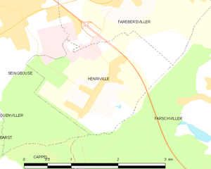
Henriville
- commune in Moselle, France
- Country:
- Postal Code: 57450
- Coordinates: 49° 5' 44" N, 6° 51' 13" E
- GPS tracks (wikiloc): [Link]
- Area: 3.95 sq km
- Population: 761


Béning-lès-Saint-Avold
- commune in Moselle, France
- Country:
- Postal Code: 57800
- Coordinates: 49° 7' 55" N, 6° 50' 21" E
- GPS tracks (wikiloc): [Link]
- Area: 3.69 sq km
- Population: 1147


Seingbouse
- commune in Moselle, France
- Country:
- Postal Code: 57455
- Coordinates: 49° 6' 48" N, 6° 49' 52" E
- GPS tracks (wikiloc): [Link]
- Area: 8.05 sq km
- Population: 1857
- Web site: [Link]


Farschviller
- commune in Moselle, France
- Country:
- Postal Code: 57450
- Coordinates: 49° 5' 36" N, 6° 53' 39" E
- GPS tracks (wikiloc): [Link]
- Area: 11.25 sq km
- Population: 1433


Théding
- commune in Moselle, France
- Country:
- Postal Code: 57450
- Coordinates: 49° 7' 42" N, 6° 53' 35" E
- GPS tracks (wikiloc): [Link]
- Area: 8.13 sq km
- Population: 2503


Cocheren
- commune in Moselle, France
- Country:
- Postal Code: 57800
- Coordinates: 49° 8' 36" N, 6° 51' 23" E
- GPS tracks (wikiloc): [Link]
- Area: 5.62 sq km
- Population: 3528