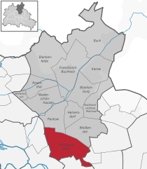
Fennpfuhl (Fennpfuhl)

- locality of Berlin
 Hiking in Fennpfuhl
Fennpfuhl is a neighborhood in Berlin, Germany, known more for urban exploration than traditional hiking. However, if you're looking for green spaces or walking routes, there are some nearby parks and pathways that can provide a nice urban escape.
-
Green Spaces: The area around Fennpfuhl has several parks, such as the Fennpfuhlpark, which offers walking paths and spots for relaxation. While not a traditional hiking destination, these parks provide opportunities for leisure walks and enjoying nature in an urban setting.
-
Nearby Nature: If you are willing to venture a little further, East Berlin has several larger parks, such as the Treptower Park or Ernst-Thälmann-Park, which have more expansive trails suitable for hiking and longer walks.
-
Walking Routes: You can also explore the numerous walking and biking paths along the Berlin Wall Trail, which is not too far away. This trail runs through various neighborhoods and past historical sites, providing a unique city hiking experience.
-
Public Transportation: Berlin's efficient public transportation system makes it easy to access more extensive hiking areas outside of the city. Consider taking a short trip to nearby natural reserves or forests, like the Grunewald or Müggelberge.
If you're planning to hike in urban settings, make sure to bring comfortable shoes, stay hydrated, and be aware of your surroundings. Enjoy your time exploring Fennpfuhl and the surrounding areas!
- Country:

- Coordinates: 52° 31' 42" N, 13° 28' 27" E


- GPS tracks (wikiloc): [Link]
- AboveSeaLevel: 64 м m
- Area: 2.12 sq km
- Wikipedia en: wiki(en)
- Wikipedia: wiki(de)
- Wikidata storage: Wikidata: Q566387
- Wikipedia Commons Gallery: [Link]
- Wikipedia Commons Category: [Link]
- Wikipedia Commons Maps Category: [Link]
- Freebase ID: [/m/0bs1qsj]
- GeoNames ID: Alt: [8334625]
- archINFORM location ID: [43233]
Shares border with regions:

Prenzlauer Berg
- locality of Berlin
Hiking in Prenzlauer Berg
Prenzlauer Berg, a vibrant district in Berlin, is primarily known for its urban environment, charming architecture, and lively atmosphere rather than traditional hiking trails. However, there are plenty of opportunities for enjoyable walks and exploration in this area. Here are some aspects to consider if you're looking to hike or walk in Prenzlauer Berg:...
- Country:
- Coordinates: 52° 32' 3" N, 13° 25' 7" E
- GPS tracks (wikiloc): [Link]
- AboveSeaLevel: 54 м m
- Area: 11 sq km
- Population: 156910


Alt-Hohenschönhausen
- locality of Berlin
Hiking in Alt-Hohenschönhausen
Alt-Hohenschönhausen, a district in the northeastern part of Berlin, Germany, may not be a traditional hiking destination, but it does offer some good opportunities for walking and exploring green spaces. Here are some points to consider if you're looking to hike or walk in this area:...
- Country:
- Coordinates: 52° 32' 55" N, 13° 30' 27" E
- GPS tracks (wikiloc): [Link]
- AboveSeaLevel: 55 м m
- Area: 9.33 sq km
- Population: 42609


Weissensee
- locality of Berlin
Hiking in Weissensee
Weissensee is a district in the northeastern part of Berlin, known for its large lake, Weissensee, which is a popular destination for both locals and tourists looking to enjoy nature and outdoor activities. While Weissensee is not traditionally associated with extensive hiking trails like some of the larger natural parks or forested areas, it offers some lovely spots for walking and enjoying the outdoors....
- Country:
- Coordinates: 52° 33' 0" N, 13° 28' 0" E
- GPS tracks (wikiloc): [Link]
- AboveSeaLevel: 53 м m
- Area: 7.93 sq km
- Population: 51699
- Web site: [Link]


Lichtenberg
- locality of borough Lichtenberg of Berlin, Germany
Hiking in Lichtenberg
Lichtenberg is a picturesque locality located in the region of Brandenburg, Germany. It is situated near the capital city, Berlin, making it a popular destination for day-trippers and hikers looking to escape the urban environment....
- Country:
- Coordinates: 52° 31' 16" N, 13° 28' 48" E
- GPS tracks (wikiloc): [Link]
- AboveSeaLevel: 52 м m
- Area: 7.22 sq km
- Population: 39121