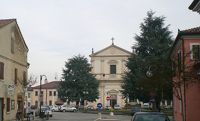
Gaiba (Gaiba)
.svg)
- comune of Italy
 Hiking in Gaiba
Gaiba is a small town located in the Province of Rovigo in the Veneto region of Italy. While it may not be as famous for hiking as some other areas in Italy, it still offers beautiful landscapes and trails for those looking for a quieter hiking experience.
Hiking Opportunities in Gaiba
-
Surrounding Nature: The area around Gaiba is characterized by its scenic countryside, with rolling hills, fields, and rivers. The local terrain can offer gentle hikes, ideal for families or casual walkers.
-
Nearby Natural Parks: Consider exploring the nearby natural parks and nature reserves, like the Po Delta Regional Park. This park is home to diverse ecosystems, including wetlands, riverbanks, and rich wildlife, which can provide various hiking options.
-
Cultural Exploration: While hiking in Gaiba, you can also visit historical sites, local farms, and charming villages. Combining hiking with a bit of cultural exploration can enhance your experience.
-
Walking and Biking Trails: Many walking and biking paths are available in the region, often used by locals for leisure. These trails can provide a unique way to experience the local flora and fauna.
Tips for Hiking in Gaiba
-
Preparation: Make sure to dress appropriately for the weather and wear suitable footwear. Always carry enough water and snacks.
-
Maps and Routes: Local tourist information centers can provide maps and information about the best hiking routes. Utilizing GPS tools or hiking apps can also be beneficial.
-
Respect Nature: Follow Leave No Trace principles to protect the natural beauty of the area and its wildlife.
-
Check Local Regulations: Some trails may have specific regulations or may require permission, especially if they go through private land.
If you're looking for a more rugged hiking experience, you might consider traveling to nearby mountain regions in the Dolomites or the Alps, which offer a variety of trails ranging from easy walks to challenging climbs.
- Country:

- Postal Code: 45030
- Local Dialing Code: 0425
- Licence Plate Code: RO
- Coordinates: 44° 57' 0" N, 11° 29' 0" E


- GPS tracks (wikiloc): [Link]
- AboveSeaLevel: 9 м m
- Area: 11.99 sq km
- Population: 1037
- Web site: http://www.comune.gaiba.ro.it/
- Wikipedia en: wiki(en)
- Wikipedia: wiki(it)
- Wikidata storage: Wikidata: Q34593
- Wikipedia Commons Category: [Link]
- Freebase ID: [/m/0gk6vs]
- GeoNames ID: Alt: [6541011]
- VIAF ID: Alt: [247018426]
- OSM relation ID: [43841]
- ISTAT ID: 029025
- Italian cadastre code: D855
Shares border with regions:


Ferrara
- Italian comune
Hiking in Ferrara
Ferrara, located in the Emilia-Romagna region of Italy, is not typically renowned for traditional hiking in mountainous terrains, as it features a mostly flat landscape. However, the area offers some beautiful walking and biking routes that allow you to enjoy the countryside, historical architecture, and natural beauty....
- Country:
- Postal Code: 44121-44122-44123-44124
- Local Dialing Code: 0532
- Licence Plate Code: FE
- Coordinates: 44° 50' 7" N, 11° 37' 12" E
- GPS tracks (wikiloc): [Link]
- AboveSeaLevel: 9 м m
- Area: 404.38 sq km
- Population: 132009
- Web site: [Link]


Bagnolo di Po
- Italian comune
Hiking in Bagnolo di Po
Bagnolo di Po is a small municipality located in the province of Mantua, in the Lombardy region of northern Italy. While it may not be widely known as a hiking destination like some of Italy's larger national parks or mountains, the surrounding area offers lovely opportunities for outdoor enthusiasts. Here's some information that could enhance your hiking experience in and around Bagnolo di Po:...
- Country:
- Postal Code: 45022
- Local Dialing Code: 0425
- Licence Plate Code: RO
- Coordinates: 45° 1' 0" N, 11° 30' 0" E
- GPS tracks (wikiloc): [Link]
- AboveSeaLevel: 7 м m
- Area: 21.36 sq km
- Population: 1225
- Web site: [Link]


Ficarolo
- Italian comune
Hiking in Ficarolo
Ficarolo is a small municipality in Italy, located in the province of Mantua, Lombardy. While it may not be as widely known as some of Italy’s larger national parks or mountainous regions, it can offer a unique hiking experience, especially for those interested in exploring the countryside and local landscapes....
- Country:
- Postal Code: 45036
- Local Dialing Code: 0425
- Licence Plate Code: RO
- Coordinates: 44° 57' 0" N, 11° 26' 0" E
- GPS tracks (wikiloc): [Link]
- AboveSeaLevel: 10 м m
- Area: 18.08 sq km
- Population: 2407
- Web site: [Link]

Stienta
- Italian comune
Hiking in Stienta
Stienta, a small town in the province of Ferrara in Italy, may not be widely recognized as a hiking destination, but the surrounding region offers a unique experience for outdoor enthusiasts. Here are some aspects to consider when hiking in and around Stienta:...
- Country:
- Postal Code: 45039
- Local Dialing Code: 0425
- Licence Plate Code: RO
- Coordinates: 44° 56' 0" N, 11° 33' 0" E
- GPS tracks (wikiloc): [Link]
- AboveSeaLevel: 9 м m
- Area: 24.02 sq km
- Population: 3239
- Web site: [Link]