Fessenheim (Fessenheim)

- commune in Haut-Rhin, France
 Hiking in Fessenheim
Fessenheim, a small commune located in the Alsace region of France, near the border with Germany and Switzerland, offers a serene hiking experience amidst picturesque landscapes. While the town itself is not widely known for extensive hiking trails, there are several options in the surrounding areas that hikers can explore. Here are some key points to consider when hiking around Fessenheim:
Nearby Hiking Opportunities:
-
Grand Ried Nature Reserve: Just a short distance from Fessenheim, this area features wetlands and diverse flora and fauna. The trails here are usually flat and accessible, making it suitable for all levels of hikers. Look out for birds and other wildlife.
-
Alsace Wine Route: The Alsace region is famous for its vineyards. You can hike along parts of the wine route, enjoying scenic views of the vineyards and tasting local wines at village wineries. The paths here vary in difficulty, with some being more challenging than others.
-
Haut-Rhin Trails: The nearby Haut-Rhin department features a range of hiking trails through vineyards, forests, and mountains. Popular spots include the Vosges Mountains, where you can find trails suited for all levels of experience.
Trail Suggestions:
- Circuit du Ried: A relatively easy loop trail that will take you through the wetlands and charming villages in the region. It's perfect for a relaxed day hike.
- Colmar to Fessenheim Trail: For those looking for more of a challenge, consider starting from the town of Colmar and making your way towards Fessenheim. This would give you the chance to experience both urban and rural views.
Tips for Hiking in Fessenheim:
- Weather Preparedness: The weather can change quickly, especially in the wetlands, so check forecasts and dress in layers.
- Water and Snacks: Carry sufficient water and snacks, especially for longer hikes. Some trails may not have facilities nearby.
- Observe Nature: The area is rich in wildlife, so bring binoculars if you’re interested in birdwatching or observing other animals.
- Respect Local Guidelines: Some trails may have specific rules or guidelines, especially in protected areas. Always follow local regulations regarding access and wildlife.
Accessibility:
- Transport Links: Fessenheim is accessible by train and bus from larger cities like Mulhouse or Colmar, making it a viable option for a day trip.
Conclusion:
While Fessenheim might not be a hiking hotspot, its proximity to beautiful natural reserves and regional trails makes it a lovely starting point for outdoor adventures in Alsace. Whether you're looking for gentle walks or more challenging hikes, you'll find plenty of options to explore the natural beauty of the region. Always ensure to plan ahead, check trail conditions, and prepare appropriately for your hike. Happy hiking!
- Country:

- Postal Code: 68740
- Coordinates: 47° 54' 55" N, 7° 32' 9" E


- GPS tracks (wikiloc): [Link]
- Area: 18.4 sq km
- Population: 2389
- Wikipedia en: wiki(en)
- Wikipedia: wiki(fr)
- Wikidata storage: Wikidata: Q269186
- Wikipedia Commons Category: [Link]
- Freebase ID: [/m/03nssc0]
- Freebase ID: [/m/03nssc0]
- GeoNames ID: Alt: [6455230]
- GeoNames ID: Alt: [6455230]
- SIREN number: [216800912]
- SIREN number: [216800912]
- BnF ID: [15271793n]
- BnF ID: [15271793n]
- VIAF ID: Alt: [246506114]
- VIAF ID: Alt: [246506114]
- INSEE municipality code: 68091
- INSEE municipality code: 68091
Shares border with regions:

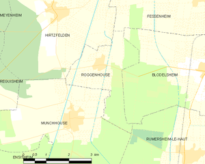
Roggenhouse
- commune in Haut-Rhin, France
Hiking in Roggenhouse
Roggenhouse, a picturesque location, offers a variety of hiking opportunities amidst beautiful landscapes. Although specific trails and conditions can vary, here are some general insights and tips for hiking in this area:...
- Country:
- Postal Code: 68740
- Coordinates: 47° 53' 23" N, 7° 28' 15" E
- GPS tracks (wikiloc): [Link]
- Area: 6.45 sq km
- Population: 469

Balgau
- commune in Haut-Rhin, France
- Country:
- Postal Code: 68740
- Coordinates: 47° 55' 41" N, 7° 32' 24" E
- GPS tracks (wikiloc): [Link]
- Area: 9.49 sq km
- Population: 960
- Web site: [Link]

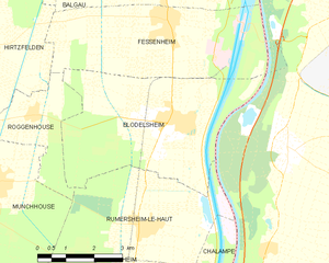
Blodelsheim
- commune in Haut-Rhin, France
Hiking in Blodelsheim
Blodelsheim is a small commune located in the Alsace region of northeastern France, near the border with Germany. While not as widely known as some larger hiking destinations, it offers a charming landscape and access to several scenic trails in the surrounding areas....
- Country:
- Postal Code: 68740
- Coordinates: 47° 53' 6" N, 7° 32' 17" E
- GPS tracks (wikiloc): [Link]
- Area: 20.69 sq km
- Population: 1824
- Web site: [Link]

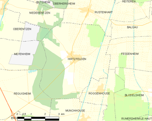
Hirtzfelden
- commune in Haut-Rhin, France
- Country:
- Postal Code: 68740
- Coordinates: 47° 54' 42" N, 7° 26' 43" E
- GPS tracks (wikiloc): [Link]
- Area: 22.1 sq km
- Population: 1217