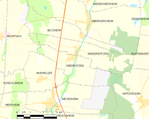
canton of Ensisheim (canton d'Ensisheim)

- canton of France
 Hiking in canton of Ensisheim
The Canton of Ensisheim, located in the Alsace region of France, offers a variety of outdoor activities, including hiking. This area is characterized by its charming landscapes, quaint villages, and a blend of natural and cultural attractions.
Hiking Highlights in the Canton of Ensisheim:
-
Scenic Trails: The canton offers numerous well-marked trails that showcase the picturesque Alsace countryside, including vineyards, forests, and rolling hills. These trails cater to varying skill levels, from easy walks for families to more challenging hikes for experienced trekkers.
-
Vignobles d'Alsace: Hiking through the vineyards is a unique experience. Walking along the wine routes allows you to enjoy not only the stunning landscapes but also the opportunity to stop at local wineries for tastings of Alsace's famous white wines.
-
Nature Reserves: The region has several nature reserves, such as the Parc naturel régional des Ballons des Vosges. These areas provide diverse ecosystems and beautiful vistas, ideal for both hiking and birdwatching.
-
Cultural Trails: Some hiking paths connect historical sites and charming villages, showcasing the rich cultural heritage of the region. You may encounter half-timbered houses, ancient churches, and local markets as you hike.
-
Seasonal Hiking: Each season in the Canton of Ensisheim transforms the landscape. Spring and summer offer lush green trails, while autumn showcases vibrant foliage. Winter hiking can also be enjoyable, though you'll want to check conditions and prepare for colder weather.
Essential Tips for Hiking in the Canton of Ensisheim:
- Trail Maps: Utilize local maps and guides for up-to-date trail information, as conditions can vary.
- Footwear: Wear durable hiking shoes to tackle different terrains comfortably.
- Stay Hydrated: Bring sufficient water, especially on warmer days, as some trails may not have sources of fresh water.
- Weather Considerations: Be mindful of the weather and dress in layers; conditions can change quickly in the region.
- Respect Nature: Follow the principles of Leave No Trace to keep the trails and environment pristine.
Whether you're looking for a leisurely stroll or a more vigorous hike, the Canton of Ensisheim provides a beautiful backdrop for exploring the great outdoors. Don't forget to take in the local culture and cuisine to round out your hiking adventure!
- Country:

- Capital: Ensisheim
- Coordinates: 47° 52' 0" N, 7° 21' 0" E


- GPS tracks (wikiloc): [Link]
- Population: 48196
- Wikipedia en: wiki(en)
- Wikipedia: wiki(fr)
- Wikidata storage: Wikidata: Q1395248
- INSEE canton code: [6806]
Includes regions:

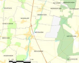
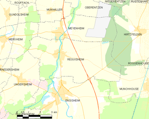
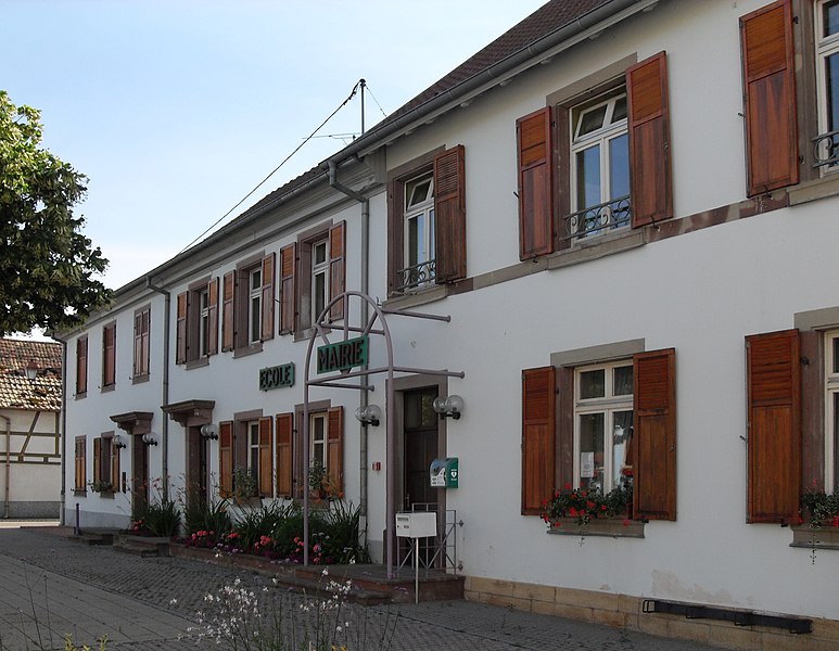
Meyenheim
- commune in Haut-Rhin, France
- Country:
- Postal Code: 68890
- Coordinates: 47° 54' 48" N, 7° 21' 21" E
- GPS tracks (wikiloc): [Link]
- Area: 12.78 sq km
- Population: 1455


Niederhergheim
- commune in Haut-Rhin, France
- Country:
- Postal Code: 68127
- Coordinates: 47° 59' 5" N, 7° 23' 57" E
- GPS tracks (wikiloc): [Link]
- Area: 12.51 sq km
- Population: 1111


Oberhergheim
- commune in Haut-Rhin, France
- Country:
- Postal Code: 68127
- Coordinates: 47° 57' 59" N, 7° 23' 43" E
- GPS tracks (wikiloc): [Link]
- Area: 19.86 sq km
- Population: 1204


Niederentzen
- commune in Haut-Rhin, France
- Country:
- Postal Code: 68127
- Coordinates: 47° 56' 52" N, 7° 22' 52" E
- GPS tracks (wikiloc): [Link]
- Area: 8.81 sq km
- Population: 709
- Web site: [Link]

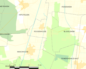
Roggenhouse
- commune in Haut-Rhin, France
Hiking in Roggenhouse
Roggenhouse, a picturesque location, offers a variety of hiking opportunities amidst beautiful landscapes. Although specific trails and conditions can vary, here are some general insights and tips for hiking in this area:...
- Country:
- Postal Code: 68740
- Coordinates: 47° 53' 23" N, 7° 28' 15" E
- GPS tracks (wikiloc): [Link]
- Area: 6.45 sq km
- Population: 469

Réguisheim
- commune in Haut-Rhin, France
- Country:
- Postal Code: 68890
- Coordinates: 47° 53' 50" N, 7° 21' 21" E
- GPS tracks (wikiloc): [Link]
- Area: 23.87 sq km
- Population: 1851

Rumersheim-le-Haut
- commune in Haut-Rhin, France
Hiking in Rumersheim-le-Haut
Rumersheim-le-Haut is a small commune located in the Grand Est region of northeastern France, specifically in the Bas-Rhin department. While it may not be a widely known hiking destination, the surrounding areas offer some lovely trails and beautiful landscapes typical of the Alsatian countryside....
- Country:
- Postal Code: 68740
- Coordinates: 47° 51' 7" N, 7° 31' 19" E
- GPS tracks (wikiloc): [Link]
- Area: 16.67 sq km
- Population: 1095


Rustenhart
- commune in Haut-Rhin, France
- Country:
- Postal Code: 68740
- Coordinates: 47° 56' 31" N, 7° 27' 41" E
- GPS tracks (wikiloc): [Link]
- Area: 12.22 sq km
- Population: 846


Munchhouse
- commune in Haut-Rhin, France
Hiking in Munchhouse
Munchhouse is a quaint and lesser-known destination for hiking enthusiasts, nestled in the natural beauty of the surrounding landscapes. While it may not be as popular as other hiking areas, it offers a unique experience for those willing to explore its trails. Here are some key points to consider when hiking in Munchhouse:...
- Country:
- Postal Code: 68740
- Coordinates: 47° 52' 6" N, 7° 27' 3" E
- GPS tracks (wikiloc): [Link]
- Area: 24.05 sq km
- Population: 1574


Pulversheim
- commune in Haut-Rhin, France
- Country:
- Postal Code: 68840
- Coordinates: 47° 50' 13" N, 7° 18' 20" E
- GPS tracks (wikiloc): [Link]
- Area: 8.54 sq km
- Population: 2921

Oberentzen
- commune in Haut-Rhin, France
- Country:
- Postal Code: 68127
- Coordinates: 47° 56' 37" N, 7° 22' 40" E
- GPS tracks (wikiloc): [Link]
- Area: 8.81 sq km
- Population: 614

Munwiller
- commune in Haut-Rhin, France
- Country:
- Postal Code: 68250
- Coordinates: 47° 55' 50" N, 7° 20' 42" E
- GPS tracks (wikiloc): [Link]
- Area: 6.74 sq km
- Population: 485


Fessenheim
- commune in Haut-Rhin, France
Hiking in Fessenheim
Fessenheim, a small commune located in the Alsace region of France, near the border with Germany and Switzerland, offers a serene hiking experience amidst picturesque landscapes. While the town itself is not widely known for extensive hiking trails, there are several options in the surrounding areas that hikers can explore. Here are some key points to consider when hiking around Fessenheim:...
- Country:
- Postal Code: 68740
- Coordinates: 47° 54' 55" N, 7° 32' 9" E
- GPS tracks (wikiloc): [Link]
- Area: 18.4 sq km
- Population: 2389

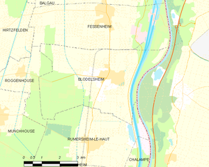
Blodelsheim
- commune in Haut-Rhin, France
Hiking in Blodelsheim
Blodelsheim is a small commune located in the Alsace region of northeastern France, near the border with Germany. While not as widely known as some larger hiking destinations, it offers a charming landscape and access to several scenic trails in the surrounding areas....
- Country:
- Postal Code: 68740
- Coordinates: 47° 53' 6" N, 7° 32' 17" E
- GPS tracks (wikiloc): [Link]
- Area: 20.69 sq km
- Population: 1824
- Web site: [Link]


Biltzheim
- commune in Haut-Rhin, France
- Country:
- Postal Code: 68127
- Coordinates: 47° 57' 28" N, 7° 23' 17" E
- GPS tracks (wikiloc): [Link]
- AboveSeaLevel: 202 м m
- Area: 7.15 sq km
- Population: 409
- Web site: [Link]

Hirtzfelden
- commune in Haut-Rhin, France
- Country:
- Postal Code: 68740
- Coordinates: 47° 54' 42" N, 7° 26' 43" E
- GPS tracks (wikiloc): [Link]
- Area: 22.1 sq km
- Population: 1217


Ensisheim
- commune in Haut-Rhin, France
- Country:
- Postal Code: 68190
- Coordinates: 47° 51' 56" N, 7° 21' 9" E
- GPS tracks (wikiloc): [Link]
- Area: 36.59 sq km
- Population: 7423
- Web site: [Link]