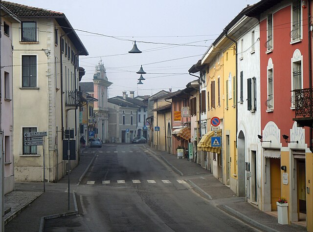
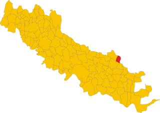
Fiesse (Fiesse)
.svg)
- Italian comune
 Hiking in Fiesse
Fiesse is a small town located in the province of Brescia, Lombardy, Italy. While it may not be a well-known hiking destination compared to some of the larger national parks or regions in Italy, it is situated within a beautiful area that offers access to various hiking opportunities in the surrounding countryside and the larger Lombardy region.
Hiking Opportunities in the Surrounding Areas
-
Parco dell'Adamello: This national park is located not too far from Fiesse and is known for its stunning landscapes, offering a range of trails suitable for various skill levels. You can explore rugged mountains, valleys, and glacial lakes.
-
Monte Baldo: Located a little farther away, Monte Baldo offers breathtaking views of Lake Garda and a variety of trails that cater to both casual hikers and experienced trekkers. The area is known for its lush flora and fauna.
-
Val Sabbia: This valley, situated near Fiesse, is ideal for nature lovers and is characterized by its beautiful landscapes, waterfalls, and diverse trails. There are many paths to choose from, catering to those looking for peaceful walks or more challenging hikes.
Tips for Hiking in Fiesse and Surrounding Areas
- Trail Maps: It’s essential to have up-to-date maps or a reliable app for navigation. Some trails may not be well-marked.
- Local Guidelines: Always respect local rules and regulations, especially in protected areas. Leave no trace and stick to designated paths.
- Check Weather Reports: The weather can change quickly, especially in mountainous regions, so check forecasts and be prepared for changing conditions.
- Proper Gear: Wear appropriate hiking boots, and dress in layers. Consider carrying trekking poles if you are hiking on more difficult terrain.
- Hydration and Snacks: Carry plenty of water and snacks, especially on longer hikes where amenities may be scarce.
- Wildlife: Be aware of local wildlife. Make noise while hiking to avoid surprising animals.
Conclusion
While Fiesse itself may not have specific hiking trails, its proximity to several natural parks and scenic regions makes it a great base for exploring the beautiful landscapes of Lombardy. Whether you're an experienced hiker or a beginner, there's something to enjoy in the area—just remember to plan ahead and stay safe on your adventures!
- Country:

- Postal Code: 25020
- Local Dialing Code: 030
- Licence Plate Code: BS
- Coordinates: 45° 13' 57" N, 10° 19' 31" E


- GPS tracks (wikiloc): [Link]
- AboveSeaLevel: 39 м m
- Area: 16.02 sq km
- Population: 2041
- Web site: http://www.comune.fiesse.bs.it/
- Wikipedia en: wiki(en)
- Wikipedia: wiki(it)
- Wikidata storage: Wikidata: Q104598
- Wikipedia Commons Category: [Link]
- Freebase ID: [/m/041wt6]
- GeoNames ID: Alt: [6537170]
- VIAF ID: Alt: [156393641]
- OSM relation ID: [44469]
- UN/LOCODE: [ITFSE]
- ISTAT ID: 017071
- Italian cadastre code: D576
Shares border with regions:
Gambara
- Italian comune
Hiking in Gambara
Gambara is a small town located in the Lombardy region of Italy, known for its picturesque countryside, charming landscapes, and proximity to various natural areas suitable for hiking. While Gambara itself may not have extensive hiking trails, it serves as a great gateway to explore the surrounding areas that offer beautiful hiking experiences....
- Country:
- Postal Code: 25020
- Local Dialing Code: 030
- Licence Plate Code: BS
- Coordinates: 45° 15' 22" N, 10° 17' 40" E
- GPS tracks (wikiloc): [Link]
- AboveSeaLevel: 51 м m
- Area: 31.59 sq km
- Population: 4743
- Web site: [Link]
Remedello
- Italian comune
Hiking in Remedello
Remedello is a small town in the Lombardy region of northern Italy, surrounded by scenic landscapes that can offer enjoyable hiking opportunities. While the area is not as widely known for hiking as some other regions in Italy, it does feature beautiful natural surroundings, including rolling hills, vineyards, and picturesque views of the countryside....
- Country:
- Postal Code: 25010
- Local Dialing Code: 030
- Licence Plate Code: BS
- Coordinates: 45° 16' 45" N, 10° 22' 22" E
- GPS tracks (wikiloc): [Link]
- AboveSeaLevel: 47 м m
- Area: 21.46 sq km
- Population: 3384
- Web site: [Link]


Casalromano
- Italian comune
Hiking in Casalromano
Casalromano is a small village located in the Lombardy region of Italy, surrounded by beautiful landscapes that are great for hiking enthusiasts. While it may not be as well-known as larger towns or national parks, the area does offer some charming trails and scenic vistas that capture the essence of the Italian countryside....
- Country:
- Postal Code: 46040
- Local Dialing Code: 0376
- Licence Plate Code: MN
- Coordinates: 45° 12' 0" N, 10° 22' 0" E
- GPS tracks (wikiloc): [Link]
- AboveSeaLevel: 42 м m
- Area: 12.03 sq km
- Population: 1510
- Web site: [Link]


Asola
- Italian comune
Hiking in Asola
Asola, located in the Lombardy region of Italy, offers various hiking opportunities that beautifully showcase the area's natural landscapes and cultural heritage. While it may not be as renowned as some of the bigger hiking destinations in Italy, it provides a more tranquil and less crowded experience for those who wish to explore the countryside....
- Country:
- Postal Code: 46041
- Local Dialing Code: 0376
- Licence Plate Code: MN
- Coordinates: 45° 13' 0" N, 10° 25' 0" E
- GPS tracks (wikiloc): [Link]
- AboveSeaLevel: 42 м m
- Area: 73.48 sq km
- Population: 10069
- Web site: [Link]

Volongo
- Italian comune
Hiking in Volongo
Volongo isn't a widely recognized hiking destination, and it seems there might be some confusion regarding its location or its prominence in hiking circles. However, if you're looking for information about hiking in a specific place—perhaps a region, a park, or a mountain range in a country—please provide more details so I can assist you better....
- Country:
- Postal Code: 26030
- Local Dialing Code: 0372
- Licence Plate Code: CR
- Coordinates: 45° 12' 42" N, 10° 18' 9" E
- GPS tracks (wikiloc): [Link]
- AboveSeaLevel: 43 м m
- Area: 8.12 sq km
- Population: 525
- Web site: [Link]