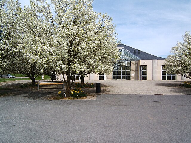
Flavin (Flavin)

- commune in Aveyron, France
- Country:

- Postal Code: 12450
- Coordinates: 44° 17' 20" N, 2° 36' 22" E


- GPS tracks (wikiloc): [Link]
- Area: 50.77 sq km
- Population: 2308
- Web site: http://flavin-aveyron.fr/
- Wikipedia en: wiki(en)
- Wikipedia: wiki(fr)
- Wikidata storage: Wikidata: Q1153322
- Wikipedia Commons Category: [Link]
- Freebase ID: [/m/03m93x5]
- GeoNames ID: Alt: [6426929]
- SIREN number: [211201025]
- BnF ID: [15247078n]
- INSEE municipality code: 12102
Shares border with regions:


Comps-la-Grand-Ville
- commune in Aveyron, France
- Country:
- Postal Code: 12120
- Coordinates: 44° 13' 51" N, 2° 34' 2" E
- GPS tracks (wikiloc): [Link]
- Area: 21.95 sq km
- Population: 611
- Web site: [Link]


Pont-de-Salars
- commune in Aveyron, France
- Country:
- Postal Code: 12290
- Coordinates: 44° 16' 52" N, 2° 43' 40" E
- GPS tracks (wikiloc): [Link]
- Area: 44.9 sq km
- Population: 1661


Le Monastère
- commune in Aveyron, France
- Country:
- Postal Code: 12000
- Coordinates: 44° 20' 34" N, 2° 34' 42" E
- GPS tracks (wikiloc): [Link]
- Area: 6.73 sq km
- Population: 2185
- Web site: [Link]
Trémouilles
- commune in Aveyron, France
- Country:
- Postal Code: 12290
- Coordinates: 44° 14' 40" N, 2° 38' 39" E
- GPS tracks (wikiloc): [Link]
- Area: 28.83 sq km
- Population: 505


Calmont
- commune in Aveyron, France
- Country:
- Postal Code: 12450
- Coordinates: 44° 14' 55" N, 2° 30' 45" E
- GPS tracks (wikiloc): [Link]
- AboveSeaLevel: 755 м m
- Area: 30.89 sq km
- Population: 2006
- Web site: [Link]

Olemps
- commune in Aveyron, France
- Country:
- Postal Code: 12510
- Coordinates: 44° 20' 46" N, 2° 33' 10" E
- GPS tracks (wikiloc): [Link]
- Area: 12.79 sq km
- Population: 3359
- Web site: [Link]

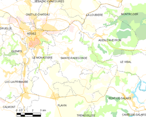
Sainte-Radegonde
- commune in Aveyron, France
- Country:
- Postal Code: 12850
- Coordinates: 44° 20' 14" N, 2° 37' 36" E
- GPS tracks (wikiloc): [Link]
- Area: 30.48 sq km
- Population: 1779
- Web site: [Link]

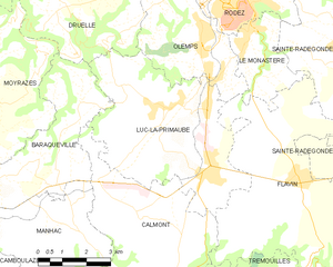
Luc-la-Primaube
- commune in Aveyron, France
- Country:
- Postal Code: 12450
- Coordinates: 44° 18' 50" N, 2° 32' 6" E
- GPS tracks (wikiloc): [Link]
- Area: 26.85 sq km
- Population: 5918
- Web site: [Link]


Le Vibal
- commune in Aveyron, France
- Country:
- Postal Code: 12290
- Coordinates: 44° 18' 54" N, 2° 45' 19" E
- GPS tracks (wikiloc): [Link]
- Area: 25.92 sq km
- Population: 507
- Web site: [Link]