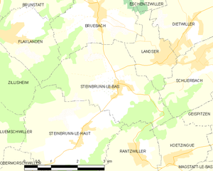
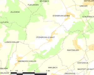
Flaxlanden (Flaxlanden)
- commune in Haut-Rhin, France
Flaxlanden is a small village located in the Grand Est region of France, near the city of Mulhouse. While it may not be as well-known as some major hiking destinations, there are still opportunities to explore the scenic countryside and nearby nature.
Hiking Opportunities:
-
Local Trails: The area around Flaxlanden offers picturesque views of the Vosges mountains and the Alsatian plain. You can find local walking paths perfect for short hikes and leisurely strolls.
-
Forest Hikes: The nearby forests, such as the Forest of Vosges, provide trails suited for various hiking levels. These paths allow for a delightful experience in nature, with ample opportunities for birdwatching and enjoying local flora and fauna.
-
Regional Parks: Consider venturing a bit further to explore the Parc Naturel Régional des Ballons des Vosges. This regional park features well-marked trails, ranging from easy walks to more challenging hikes, all offering stunning landscapes.
-
Cultural and Historical Sites: While hiking in the area, you may also encounter charming villages or historical landmarks, allowing for a richer experience. Take time to explore local culture and cuisine in the stops along your route.
Tips for Hiking in Flaxlanden:
-
Plan Your Route: Familiarize yourself with local maps and trail guides. Consider downloading a GPS app or a hiking app that works in Europe to help navigate.
-
Be Prepared for Weather Changes: The weather in the region can change rapidly, so dressing in layers and being prepared for rain is advisable.
-
Stay Hydrated and Nourished: Bring enough water and snacks, as facilities may be limited on some trails.
-
Respect Nature: Stick to marked paths to minimize the impact on the environment and avoid disturbing wildlife.
-
Follow Local Regulations: Always check regulations concerning access to trails, as some may have seasonal restrictions or require permits.
If you enjoy the outdoors, hiking near Flaxlanden can be a rewarding experience filled with beautiful landscapes and a chance to connect with nature.
- Country:

- Postal Code: 68720
- Coordinates: 47° 41' 45" N, 7° 18' 55" E


- GPS tracks (wikiloc): [Link]
- Area: 4.33 sq km
- Population: 1454
- Wikipedia en: wiki(en)
- Wikipedia: wiki(fr)
- Wikidata storage: Wikidata: Q392089
- Wikipedia Commons Category: [Link]
- Freebase ID: [/m/03nssd1]
- Freebase ID: [/m/03nssd1]
- GeoNames ID: Alt: [6450705]
- GeoNames ID: Alt: [6450705]
- SIREN number: [216800938]
- SIREN number: [216800938]
- BnF ID: [15271795b]
- BnF ID: [15271795b]
- VIAF ID: Alt: [138191196]
- VIAF ID: Alt: [138191196]
- INSEE municipality code: 68093
- INSEE municipality code: 68093
Shares border with regions:


Zillisheim
- commune in Haut-Rhin, France
Zillisheim is a quaint village located in the Alsace region of France, not far from the city of Mulhouse. The area is characterized by its beautiful landscapes, rolling hills, and scenic views, making it a great destination for hiking enthusiasts....
- Country:

- Postal Code: 68720
- Coordinates: 47° 41' 43" N, 7° 17' 44" E


- GPS tracks (wikiloc): [Link]
- Area: 8.22 sq km
- Population: 2607


Brunstatt
- former commune in Haut-Rhin, France
Brunstatt is a charming municipality located in the Alsace region of France, near the border with Germany. While it's not as widely known for hiking as some other areas, there are a few lovely opportunities for outdoor activities and exploring nature in and around Brunstatt....
- Country:

- Postal Code: 68350
- Coordinates: 47° 43' 24" N, 7° 19' 22" E


- GPS tracks (wikiloc): [Link]
- AboveSeaLevel: 284.5 м m
- Area: 9.66 sq km
- Population: 6175
- Web site: [Link]


Bruebach
- commune in Haut-Rhin, France
Bruebach is a charming village located in the Haut-Rhin department of Alsace, France. It offers a range of hiking opportunities that allow you to explore the beautiful landscapes of the surrounding region, which is characterized by scenic hills, vineyards, and forests....
- Country:

- Postal Code: 68440
- Coordinates: 47° 41' 59" N, 7° 21' 35" E


- GPS tracks (wikiloc): [Link]
- Area: 7.01 sq km
- Population: 1059


Hochstatt
- commune in Haut-Rhin, France
Hochstatt is a small town in Germany that may not be widely known for its hiking trails, but the surrounding regions offer some beautiful landscapes and outdoor opportunities. While the immediate area may have limited dedicated hiking paths, there are several nearby locations that are worth exploring for hiking enthusiasts....
- Country:

- Postal Code: 68720
- Coordinates: 47° 42' 7" N, 7° 16' 33" E


- GPS tracks (wikiloc): [Link]
- Area: 8.55 sq km
- Population: 2095


Steinbrunn-le-Bas
- commune in Haut-Rhin, France
Steinbrunn-le-Bas is a small village located in the Alsace region of France, near the border with Germany. This area is characterized by its scenic countryside, vineyards, and picturesque landscapes, making it a great spot for hiking enthusiasts....
- Country:

- Postal Code: 68440
- Coordinates: 47° 40' 33" N, 7° 22' 2" E


- GPS tracks (wikiloc): [Link]
- Area: 8.58 sq km
- Population: 688


Steinbrunn-le-Haut
- commune in Haut-Rhin, France
Steinbrunn-le-Haut is a charming village located in the Alsace region of France, close to the German border. While it may not be as well-known as some of the larger hiking destinations, it offers a serene environment and access to beautiful natural landscapes....
- Country:

- Postal Code: 68440
- Coordinates: 47° 39' 41" N, 7° 20' 54" E


- GPS tracks (wikiloc): [Link]
- Area: 9.21 sq km
- Population: 580
- Web site: [Link]

