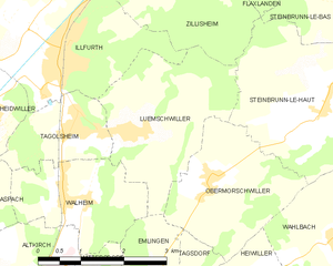
Zillisheim (Zillisheim)

- commune in Haut-Rhin, France
 Hiking in Zillisheim
Zillisheim is a quaint village located in the Alsace region of France, not far from the city of Mulhouse. The area is characterized by its beautiful landscapes, rolling hills, and scenic views, making it a great destination for hiking enthusiasts.
Hiking Trails
-
Local Trails: Zillisheim and its surrounding areas offer several local trails that are suitable for hikers of all levels. These trails often weave through picturesque vineyards, forests, and farmland, providing a taste of the local scenery and culture.
-
Regional Hiking Paths: The region is also part of larger hiking networks that connect to the Alsace Wine Route. These paths allow hikers to explore charming villages, traditional Alsatian architecture, and vineyards, providing opportunities for tasting local wines.
-
Nature Reserves: Nearby natural parks and reserves offer more challenging hikes with diverse flora and fauna. These areas are perfect for those looking to immerse themselves in nature, with trails that may lead to lookout points or hidden gems.
Best Time to Hike
- Spring (March to June): Ideal for enjoying wildflowers and mild weather.
- Fall (September to November): The autumn foliage creates stunning landscapes, and it’s also the harvest season in the vineyards.
Tips for Hiking in Zillisheim
- Prepare Adequately: Check the weather and wear suitable clothing and footwear. Trails can vary in difficulty.
- Stay Hydrated and Nourished: Bring enough water and snacks, especially for longer hikes.
- Respect Nature: Follow the Leave No Trace principles. Stay on marked trails and respect wildlife.
- Explore Local Culture: Consider combining your hike with visits to local wineries or bistros for a full Alsatian experience.
Additional Activities
- Cycling: The area is also bike-friendly, and cycling routes complement the hiking trails.
- Cultural Experiences: Explore nearby towns or cities, such as Mulhouse or Colmar, which are rich in history and cuisine.
Hiking in Zillisheim offers a blend of natural beauty, cultural experiences, and the charm of the Alsace region, making it a worthy destination for outdoor enthusiasts. Always ensure you have a reliable map or GPS, and feel free to seek advice from local hiking organizations for the best routes and experiences!
- Country:

- Postal Code: 68720
- Coordinates: 47° 41' 43" N, 7° 17' 44" E


- GPS tracks (wikiloc): [Link]
- Area: 8.22 sq km
- Population: 2607
- Wikipedia en: wiki(en)
- Wikipedia: wiki(fr)
- Wikidata storage: Wikidata: Q203238
- Wikipedia Commons Category: [Link]
- Freebase ID: [/m/03nph4z]
- Freebase ID: [/m/03nph4z]
- GeoNames ID: Alt: [2967139]
- GeoNames ID: Alt: [2967139]
- SIREN number: [216803841]
- SIREN number: [216803841]
- BnF ID: [15272086p]
- BnF ID: [15272086p]
- VIAF ID: Alt: [243852189]
- VIAF ID: Alt: [243852189]
- GND ID: Alt: [4491868-9]
- GND ID: Alt: [4491868-9]
- INSEE municipality code: 68384
- INSEE municipality code: 68384
Shares border with regions:

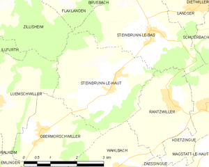
Luemschwiller
- commune in Haut-Rhin, France
Hiking in Luemschwiller
Luemschwiller is a picturesque village located in the Alsace region of France, close to the border with Switzerland. This area is known for its charming landscapes, gentle hills, and scenic views, making it an attractive destination for hiking enthusiasts....
- Country:
- Postal Code: 68720
- Coordinates: 47° 39' 19" N, 7° 17' 21" E
- GPS tracks (wikiloc): [Link]
- Area: 7.27 sq km
- Population: 768


Hochstatt
- commune in Haut-Rhin, France
Hiking in Hochstatt
Hochstatt is a small town in Germany that may not be widely known for its hiking trails, but the surrounding regions offer some beautiful landscapes and outdoor opportunities. While the immediate area may have limited dedicated hiking paths, there are several nearby locations that are worth exploring for hiking enthusiasts....
- Country:
- Postal Code: 68720
- Coordinates: 47° 42' 7" N, 7° 16' 33" E
- GPS tracks (wikiloc): [Link]
- Area: 8.55 sq km
- Population: 2095


Didenheim
- former commune in Haut-Rhin, France
Hiking in Didenheim
Didenheim is a small village located in France, near the German border, and is part of the Alsace region. While it may not be as well-known as some of the larger hiking destinations, the surrounding area offers beautiful landscapes and opportunities for hiking enthusiasts....
- Country:
- Postal Code: 68350
- Coordinates: 47° 43' 8" N, 7° 18' 3" E
- GPS tracks (wikiloc): [Link]
- Area: 4.44 sq km
- Population: 1691
- Web site: [Link]


Flaxlanden
- commune in Haut-Rhin, France
Hiking in Flaxlanden
Flaxlanden is a small village located in the Grand Est region of France, near the city of Mulhouse. While it may not be as well-known as some major hiking destinations, there are still opportunities to explore the scenic countryside and nearby nature....
- Country:
- Postal Code: 68720
- Coordinates: 47° 41' 45" N, 7° 18' 55" E
- GPS tracks (wikiloc): [Link]
- Area: 4.33 sq km
- Population: 1454


Frœningen
- commune in Haut-Rhin, France
Hiking in Frœningen
Frœningen is a picturesque location in the Swiss Alps, known for its stunning landscapes and diverse hiking opportunities. It is situated near the charming village of Frœningen, which serves as a great base for outdoor enthusiasts. When hiking in this area, you can expect beautiful mountain vistas, lush meadows, and clear alpine lakes....
- Country:
- Postal Code: 68720
- Coordinates: 47° 41' 27" N, 7° 16' 11" E
- GPS tracks (wikiloc): [Link]
- Area: 4.44 sq km
- Population: 695

Steinbrunn-le-Haut
- commune in Haut-Rhin, France
Hiking in Steinbrunn-le-Haut
Steinbrunn-le-Haut is a charming village located in the Alsace region of France, close to the German border. While it may not be as well-known as some of the larger hiking destinations, it offers a serene environment and access to beautiful natural landscapes....
- Country:
- Postal Code: 68440
- Coordinates: 47° 39' 41" N, 7° 20' 54" E
- GPS tracks (wikiloc): [Link]
- Area: 9.21 sq km
- Population: 580
- Web site: [Link]


Illfurth
- commune in Haut-Rhin, France
Hiking in Illfurth
Illfurth is a picturesque village located in the Alsace region of France, near the border with Germany. While it may not be as widely known as some other hiking destinations, it offers access to serene landscapes and scenic trails that are perfect for nature lovers and hiking enthusiasts....
- Country:
- Postal Code: 68720
- Coordinates: 47° 40' 21" N, 7° 15' 54" E
- GPS tracks (wikiloc): [Link]
- Area: 9.16 sq km
- Population: 2486
- Web site: [Link]