Forchheim (Landkreis Forchheim)
- district in Bavaria, Germany
Forchheim, located in Bavaria, Germany, is a charming district known for its picturesque landscapes, historical sites, and access to various hiking trails. Here’s an overview of what you can expect when hiking in this region:
Scenic Trails
Forchheim offers a mix of hiking experiences, from easy strolls to more challenging treks. The area is characterized by its beautiful countryside, rolling hills, forests, and the nearby Franconian Switzerland region, which is famous for its stunning rock formations and quaint villages.
-
Franconian Switzerland: This area is just a short distance from Forchheim and is ideal for hiking enthusiasts. You can explore numerous marked trails that take you through lush forests, over rugged cliffs, and past idyllic villages. The region is also famous for its limestone formations, caves, and castles.
-
Local Trails: There are various local trails that can be accessed directly from Forchheim. Some popular hikes include paths along the Regnitz River and routes that connect to nearby towns and villages, allowing you to experience the local culture and cuisine.
-
The Fränkische Kapellenweg: This is one of the thematic trails that takes you past various chapels and churches in the region. It combines hiking with a cultural aspect, allowing you to appreciate the heritage of Forchheim and its surroundings.
Difficulty Levels
You can find trails suitable for all fitness levels. For beginners, there are gentle paths that are well-marked and suitable for families. More experienced hikers can tackle steeper trails in the Franconian Switzerland, where you might encounter more challenging terrain.
Best Time to Hike
The best time for hiking in Forchheim generally falls between late spring (May to June) and early autumn (September to October). During these months, the weather is usually mild, and the landscapes are particularly beautiful with blooming flowers in spring and colorful foliage in autumn.
Facilities and Recommendations
- Maps and Guides: It’s advisable to pick up hiking maps and local guides from the Forchheim tourism office or online sources to help navigate the trails.
- Gear: Depending on the trail, make sure to wear appropriate hiking gear, including sturdy shoes, weather-appropriate clothing, and carry enough water and snacks.
- Local Amenities: After hiking, take the opportunity to explore Forchheim Center, where you can relax in cafés, enjoy Bavarian cuisine, and visit local landmarks.
Conclusion
Hiking in Forchheim district offers a wonderful way to experience the natural beauty and cultural richness of Bavaria. Whether you’re looking for a leisurely hike or a more challenging adventure, you’ll find ample opportunities in this stunning area.
- Country:

- Licence Plate Code: PEG; FO; EBS
- Coordinates: 49° 45' 0" N, 11° 5' 0" E


- GPS tracks (wikiloc): [Link]
- AboveSeaLevel: 377 м m
- Area: 643.00 sq km
- Population: 97433
- Web site: http://www.landkreis-forchheim.de/
- Wikipedia en: wiki(en)
- Wikipedia: wiki(de)
- Wikidata storage: Wikidata: Q10445
- Wikipedia Commons Category: [Link]
- Freebase ID: [/m/01n9m1]
- GeoNames ID: Alt: [3220848]
- VIAF ID: Alt: [239868055]
- OSM relation ID: [62687]
- GND ID: Alt: [4017818-3]
- archINFORM location ID: [2412]
- Quora topic ID: [Forchheim]
- TGN ID: [7077104]
- Historical Gazetteer (GOV) ID: [adm_139474]
- Bavarikon ID: [ODB_A00002030]
- NUTS code: [DE248]
- BabelNet ID: [02009010n]
- German district key: 09474
Includes regions:
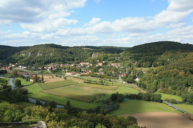

Wiesenttal
- municipality in Landkreis Forchheim in Germany
Wiesenttal, located in Bavaria, Germany, is a picturesque valley known for its stunning natural beauty, making it a fantastic destination for hiking enthusiasts. The valley is characterized by lush forests, rolling hills, and the gently flowing Wiesent River, providing hikers with both scenic views and a variety of trails to explore....
- Country:

- Postal Code: 91346
- Local Dialing Code: 09196
- Licence Plate Code: FO
- Coordinates: 49° 47' 0" N, 11° 16' 0" E


- GPS tracks (wikiloc): [Link]
- AboveSeaLevel: 433 м m
- Area: 45.90 sq km
- Population: 2512
- Web site: [Link]


Forchheim
- town in Landkreis Forchheim in Germany
Forchheim, located in Bavaria, Germany, is a beautiful area that offers a variety of hiking opportunities, thanks to its picturesque landscapes, historical sites, and varied terrain. Here are some key highlights and tips for hiking in and around Forchheim:...
- Country:

- Postal Code: 91301
- Local Dialing Code: 09191
- Licence Plate Code: FO
- Coordinates: 49° 43' 11" N, 11° 3' 29" E


- GPS tracks (wikiloc): [Link]
- AboveSeaLevel: 266 м m
- Area: 44.46 sq km
- Population: 31651
- Web site: [Link]


Neunkirchen am Brand
- municipality in Landkreis Forchheim in Germany
 Hiking in Neunkirchen am Brand
Neunkirchen am Brand, located in Bavaria, Germany, is a charming village surrounded by beautiful natural landscapes that are perfect for hiking enthusiasts. The region offers a variety of trails suitable for different skill levels, from easy walks to more challenging hikes....
- Country:

- Postal Code: 91077
- Local Dialing Code: 09134
- Licence Plate Code: FO
- Coordinates: 49° 36' 43" N, 11° 7' 47" E


- GPS tracks (wikiloc): [Link]
- AboveSeaLevel: 317 м m
- Area: 26.39 sq km
- Population: 6335
- Web site: [Link]


Hausen, Upper Franconia
- municipality in Landkreis Forchheim in Germany
 Hiking in Hausen, Upper Franconia
Hausen, located in Upper Franconia, Germany, is a charming village surrounded by picturesque landscapes, making it an excellent destination for hiking enthusiasts. The region features a mix of rolling hills, dense forests, and farmland, offering diverse trails that cater to various skill levels. Here are some highlights for hiking in and around Hausen:...
- Country:

- Postal Code: 91353
- Local Dialing Code: 09191
- Licence Plate Code: FO
- Coordinates: 49° 41' 0" N, 11° 2' 0" E


- GPS tracks (wikiloc): [Link]
- AboveSeaLevel: 271 м m
- Area: 13.52 sq km
- Population: 3667
- Web site: [Link]


Gräfenberg
- town in Landkreis Forchheim in Germany
Gräfenberg is a charming town located in Bavaria, Germany, known for its scenic landscapes and access to various hiking trails. The region is characterized by its rolling hills, picturesque forests, and quaint villages, making it an ideal destination for hikers of all skill levels....
- Country:

- Postal Code: 91322
- Local Dialing Code: 09192
- Licence Plate Code: FO
- Coordinates: 49° 38' 40" N, 11° 14' 58" E


- GPS tracks (wikiloc): [Link]
- AboveSeaLevel: 433 м m
- Area: 37.88 sq km
- Population: 4071
- Web site: [Link]
Igensdorf
- municipality in Landkreis Forchheim in Germany
Igensdorf is a charming village located in Bavaria, Germany, surrounded by beautiful landscapes that make it a fantastic destination for hiking enthusiasts. Here are some highlights to consider if you're planning a hiking trip to this area:...
- Country:

- Postal Code: 91338
- Local Dialing Code: 09192; 09126
- Licence Plate Code: FO
- Coordinates: 49° 37' 18" N, 11° 13' 55" E


- GPS tracks (wikiloc): [Link]
- AboveSeaLevel: 336 м m
- Area: 28.83 sq km
- Population: 3118
- Web site: [Link]


Obertrubach
- municipality in Landkreis Forchheim in Germany
Obertrubach is a charming village located in the beautiful Franconian Switzerland region of Germany, known for its stunning landscapes, rocky cliffs, and lush forests. It offers a variety of hiking opportunities suitable for different skill levels. Here are some key highlights for hiking in Obertrubach:...
- Country:

- Postal Code: 91286
- Local Dialing Code: 09245
- Licence Plate Code: FO
- Coordinates: 49° 41' 42" N, 11° 20' 58" E


- GPS tracks (wikiloc): [Link]
- AboveSeaLevel: 434 м m
- Area: 21.14 sq km
- Population: 1882
- Web site: [Link]


Hallerndorf
- municipality in Landkreis Forchheim in Germany
Hallerndorf, located in the district of Forchheim in Bavaria, Germany, offers a picturesque setting for hiking enthusiasts. The region is characterized by its rolling hills, lush forests, and charming villages, making it an excellent destination for outdoor activities....
- Country:

- Postal Code: 91352
- Local Dialing Code: 09545
- Licence Plate Code: FO
- Coordinates: 49° 46' 0" N, 10° 58' 59" E


- GPS tracks (wikiloc): [Link]
- AboveSeaLevel: 282 м m
- Area: 41.33 sq km
- Population: 4077
- Web site: [Link]
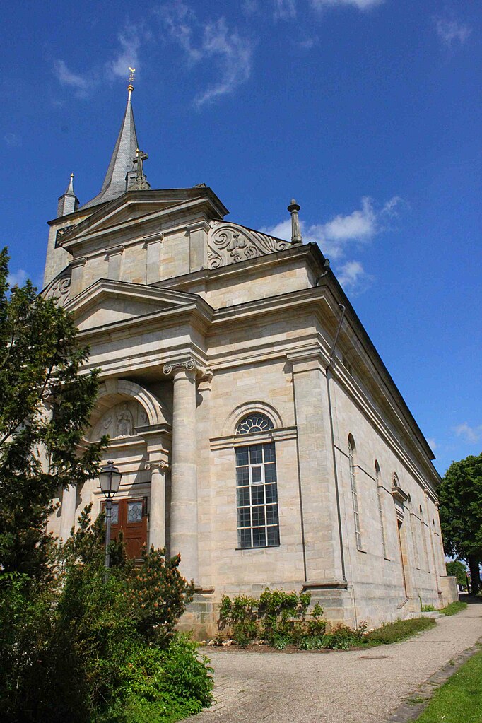

Eggolsheim
- municipality in Landkreis Forchheim in Germany
Eggolsheim is a small town located in Bavaria, Germany, offering a quaint backdrop for hiking enthusiasts and outdoor adventurers. While the town itself is not a major hiking destination, its location provides access to several trails and scenic routes in the surrounding areas, especially within the Franconian Switzerland region....
- Country:

- Postal Code: 91330
- Local Dialing Code: 09545
- Licence Plate Code: FO
- Coordinates: 49° 46' 15" N, 11° 3' 29" E


- GPS tracks (wikiloc): [Link]
- AboveSeaLevel: 255 м m
- Area: 48.90 sq km
- Population: 6487
- Web site: [Link]

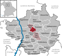
Kirchehrenbach
- municipality in Landkreis Forchheim in Germany
Kirchehrenbach is a beautiful village located in Bavaria, Germany, offering a variety of hiking opportunities set against a picturesque backdrop of rolling hills, forests, and meadows. Here are some highlights for hiking in and around Kirchehrenbach:...
- Country:

- Postal Code: 91356
- Local Dialing Code: 09191
- Licence Plate Code: FO
- Coordinates: 49° 43' 59" N, 11° 9' 0" E


- GPS tracks (wikiloc): [Link]
- AboveSeaLevel: 282 м m
- Area: 8.21 sq km
- Population: 2095
- Web site: [Link]


Heroldsbach
- municipality in Landkreis Forchheim in Germany
Heroldsbach, located in Bavaria, Germany, is a charming village that offers several beautiful hiking opportunities. The surrounding natural landscape features rolling hills, forests, and scenic views, making it ideal for outdoor enthusiasts....
- Country:

- Postal Code: 91336
- Local Dialing Code: 09190
- Licence Plate Code: FO
- Coordinates: 49° 42' 0" N, 11° 0' 0" E


- GPS tracks (wikiloc): [Link]
- AboveSeaLevel: 280 м m
- Area: 15.59 sq km
- Population: 5107
- Web site: [Link]


Egloffstein
- municipality in Landkreis Forchheim in Germany
Egloffstein is a picturesque village located in the Franconian Switzerland region of Bavaria, Germany. This area is known for its stunning natural beauty, featuring rugged limestone cliffs, lush forests, and charming traditional villages. Hiking in Egloffstein is popular due to the well-maintained trails that offer a range of experiences for all hiking levels....
- Country:

- Postal Code: 91349
- Local Dialing Code: 09197
- Licence Plate Code: FO
- Coordinates: 49° 42' 0" N, 11° 15' 0" E


- GPS tracks (wikiloc): [Link]
- AboveSeaLevel: 450 м m
- Area: 28.06 sq km
- Population: 2054
- Web site: [Link]


Dormitz
- municipality of Germany
Dormitz, a small municipality located in the district of Erlangen-Höchstadt in Bavaria, Germany, offers a charming environment for hiking enthusiasts. While it may not be as well-known as other hiking destinations in Bavaria, it is surrounded by beautiful natural landscapes and provides opportunities for peaceful walks and trails....
- Country:

- Postal Code: 91077
- Local Dialing Code: 09134
- Licence Plate Code: FO
- Coordinates: 49° 36' 0" N, 11° 7' 0" E


- GPS tracks (wikiloc): [Link]
- AboveSeaLevel: 305 м m
- Area: 4.58 sq km
- Population: 1540
- Web site: [Link]


Hiltpoltstein
- municipality in Landkreis Forchheim in Germany
Hiltpoltstein is a charming village in the Franconian region of Bavaria, Germany, known for its picturesque landscapes and outdoor activities, including hiking. Nestled in the Franconian Switzerland region, it is surrounded by striking natural formations, rolling hills, and scenic trails that cater to various skill levels....
- Country:

- Postal Code: 91355
- Local Dialing Code: 09192
- Licence Plate Code: FO
- Coordinates: 49° 39' 36" N, 11° 19' 15" E


- GPS tracks (wikiloc): [Link]
- AboveSeaLevel: 518 м m
- Area: 25.54 sq km
- Population: 1433
- Web site: [Link]


Wiesenthau
- municipality in Landkreis Forchheim in Germany
Wiesenthau is a picturesque village located in Bavaria, Germany, in the district of Erlangen-Höchstadt. It is surrounded by beautiful landscapes that make it an excellent destination for hiking enthusiasts. Here are some key points about hiking in Wiesenthau:...
- Country:

- Postal Code: 91369
- Local Dialing Code: 09191
- Licence Plate Code: FO
- Coordinates: 49° 43' 0" N, 11° 7' 59" E


- GPS tracks (wikiloc): [Link]
- AboveSeaLevel: 305 м m
- Area: 6.41 sq km
- Population: 1620
- Web site: [Link]


Pinzberg
- municipality in Landkreis Forchheim in Germany
Pinzberg is a picturesque area in Bavaria, Germany, known for its beautiful landscapes and hiking opportunities. Nestled near the Fränkische Schweiz (Franconian Switzerland) region, Pinzberg offers a variety of trails suitable for all levels of hikers....
- Country:

- Postal Code: 91361
- Local Dialing Code: 09191
- Licence Plate Code: FO
- Coordinates: 49° 42' 0" N, 11° 6' 0" E


- GPS tracks (wikiloc): [Link]
- AboveSeaLevel: 336 м m
- Area: 13.33 sq km
- Population: 1696
- Web site: [Link]


Kleinsendelbach
- municipality in Landkreis Forchheim in Germany
Kleinsendelbach is a charming village located in Bavaria, Germany, known for its scenic landscapes and proximity to various hiking trails. If you're interested in hiking in this region, here are some highlights and essential tips:...
- Country:

- Postal Code: 91077
- Local Dialing Code: 09126
- Licence Plate Code: FO
- Coordinates: 49° 37' 0" N, 11° 10' 0" E


- GPS tracks (wikiloc): [Link]
- AboveSeaLevel: 312 м m
- Area: 7.50 sq km
- Population: 1480
- Web site: [Link]

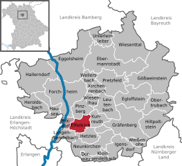
Effeltrich
- municipality in Landkreis Forchheim in Germany
Effeltrich is a small village located in Bavaria, Germany, known for its picturesque landscapes and opportunities for outdoor activities like hiking. Here are some key points to consider when hiking in and around Effeltrich:...
- Country:

- Postal Code: 91090
- Local Dialing Code: 09133
- Licence Plate Code: FO
- Coordinates: 49° 39' 35" N, 11° 5' 32" E


- GPS tracks (wikiloc): [Link]
- AboveSeaLevel: 303 м m
- Area: 11.92 sq km
- Population: 1976
- Web site: [Link]

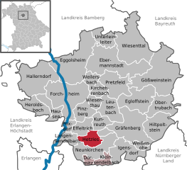
Hetzles
- municipality in Landkreis Forchheim in Germany
Hetzles is a small village located in Bavaria, Germany. While it may not be as widely recognized as some of the larger hiking destinations in the region, it can serve as a great starting point for exploring the beautiful landscapes and trails of the surrounding areas. Here are a few things to consider if you're planning to hike near Hetzles:...
- Country:

- Postal Code: 91077
- Local Dialing Code: 09134
- Licence Plate Code: FO
- Coordinates: 49° 38' 0" N, 11° 8' 0" E


- GPS tracks (wikiloc): [Link]
- AboveSeaLevel: 340 м m
- Area: 11.74 sq km
- Population: 1089
- Web site: [Link]


Ebermannstadt
- town of Germany
Ebermannstadt, located in the picturesque Franconian Switzerland region of Germany, offers a range of hiking opportunities that cater to various skill levels. This charming town is surrounded by striking landscapes, characterized by limestone cliffs, lush forests, and quaint villages....
- Country:

- Postal Code: 91320
- Local Dialing Code: 09242; 09194
- Coordinates: 49° 46' 0" N, 11° 10' 0" E


- GPS tracks (wikiloc): [Link]
- AboveSeaLevel: 292 м m
- Area: 49.97 sq km
- Population: 6904
- Web site: [Link]

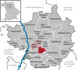
Kunreuth
- municipality in Landkreis Forchheim in Germany
Kunreuth, a picturesque village in Bavaria, Germany, is surrounded by beautiful landscapes that make it an excellent location for hiking enthusiasts. The region features a mix of rolling hills, lush forests, and scenic meadows, providing various trails for all skill levels....
- Country:

- Postal Code: 91358
- Local Dialing Code: 09199
- Licence Plate Code: FO
- Coordinates: 49° 40' 59" N, 11° 9' 0" E


- GPS tracks (wikiloc): [Link]
- AboveSeaLevel: 313 м m
- Area: 9.82 sq km
- Population: 1241
- Web site: [Link]
Weilersbach
- municipality in Landkreis Forchheim in Germany
Weilersbach is a small community in Germany located in the beautiful landscapes of Bavaria. The surrounding area offers a variety of hiking opportunities that cater to different skill levels, from leisurely walks to more challenging treks. Here are some highlights for hiking in and around Weilersbach:...
- Country:

- Postal Code: 91365
- Local Dialing Code: 09191
- Licence Plate Code: FO
- Coordinates: 49° 45' 0" N, 11° 7' 0" E


- GPS tracks (wikiloc): [Link]
- AboveSeaLevel: 295 м m
- Area: 8.62 sq km
- Population: 1767
- Web site: [Link]


Pretzfeld
- municipality in Landkreis Forchheim in Germany
Pretzfeld is a charming village located in the Franconian region of Bavaria, Germany, surrounded by picturesque landscapes that are perfect for hiking enthusiasts. The area offers a variety of trails suitable for different skill levels, each showcasing the natural beauty and cultural heritage of the region....
- Country:

- Postal Code: 91362
- Local Dialing Code: 09194
- Licence Plate Code: FO
- Coordinates: 49° 45' 0" N, 11° 10' 0" E


- GPS tracks (wikiloc): [Link]
- AboveSeaLevel: 293 м m
- Area: 24.21 sq km
- Population: 2426
- Web site: [Link]


Poxdorf
- municipality in Landkreis Forchheim in Germany
Poxdorf is a small village located in Bavaria, Germany, and offers opportunities for hiking enthusiasts to explore scenic trails and enjoy the surrounding landscapes. Here are some highlights and considerations for hiking in and around Poxdorf:...
- Country:

- Postal Code: 91099
- Local Dialing Code: 09133
- Licence Plate Code: FO
- Coordinates: 49° 40' 0" N, 11° 4' 0" E


- GPS tracks (wikiloc): [Link]
- AboveSeaLevel: 280 м m
- Area: 5.16 sq km
- Population: 1282
- Web site: [Link]
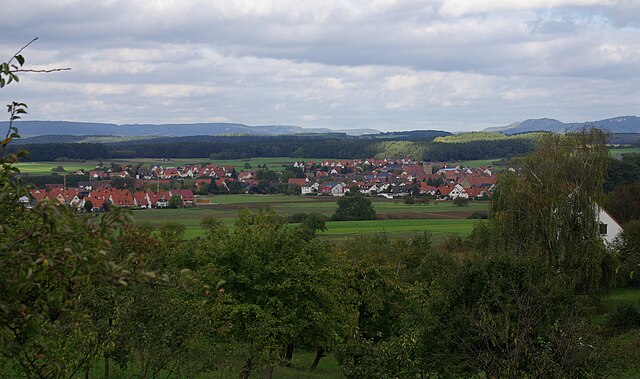
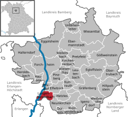
Langensendelbach
- municipality in Landkreis Forchheim in Germany
Langensendelbach is a small municipality located in Bavaria, Germany, and offers picturesque landscapes ideal for hiking enthusiasts. The surrounding area features a mix of forests, fields, and scenic paths, making it a great spot for both casual walks and more challenging hikes....
- Country:

- Postal Code: 91094
- Local Dialing Code: 09133
- Licence Plate Code: FO
- Coordinates: 49° 38' 23" N, 11° 4' 12" E


- GPS tracks (wikiloc): [Link]
- AboveSeaLevel: 296 м m
- Area: 9.59 sq km
- Population: 2413
- Web site: [Link]
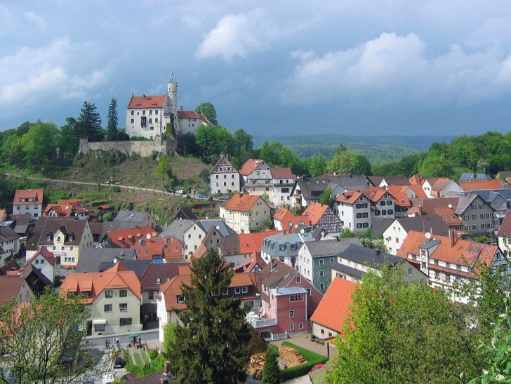

Gößweinstein
- town in Landkreis Forchheim in Germany
Gößweinstein is a picturesque town located in the Franconian Switzerland region of Bavaria, Germany. It's known for its beautiful landscapes, charming castles, and extensive hiking trails that cater to various skill levels....
- Country:

- Postal Code: 91327
- Local Dialing Code: 09242
- Licence Plate Code: FO
- Coordinates: 49° 46' 0" N, 11° 19' 0" E


- GPS tracks (wikiloc): [Link]
- AboveSeaLevel: 443 м m
- Area: 57.70 sq km
- Population: 4022
- Web site: [Link]


Leutenbach
- municipality in Landkreis Forchheim in Germany
Leutenbach in Bavaria is a scenic location that offers several trails for hikers of varying skill levels. Nestled within the beautiful landscapes of southern Germany, including forests, hills, and meadows, hiking here can provide a refreshing outdoor experience. Here are some highlights and tips for hiking in this area:...
- Country:

- Postal Code: 91359
- Local Dialing Code: 09199
- Licence Plate Code: FO
- Coordinates: 49° 42' 47" N, 11° 10' 20" E


- GPS tracks (wikiloc): [Link]
- AboveSeaLevel: 339 м m
- Area: 19.46 sq km
- Population: 1491
- Web site: [Link]
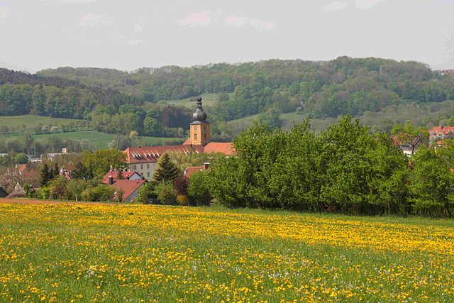

Weißenohe
- municipality in Landkreis Forchheim in Germany
Weißenohe is a small town in Bavaria, Germany, known for its picturesque landscapes and natural beauty, making it a great location for hiking enthusiasts. The area is surrounded by forests, meadows, and hills, providing a variety of trails suitable for different skill levels....
- Country:

- Postal Code: 91367
- Local Dialing Code: 09192
- Licence Plate Code: FO
- Coordinates: 49° 37' 51" N, 11° 15' 19" E


- GPS tracks (wikiloc): [Link]
- AboveSeaLevel: 358 м m
- Area: 4.71 sq km
- Population: 1095
- Web site: [Link]


Unterleinleiter
- municipality in Landkreis Forchheim in Germany
Unterleinleiter is a picturesque village located in Bavaria, Germany, nestled in the Fränkische Schweiz (Franconian Switzerland) region. This area is known for its stunning landscapes, rugged cliffs, and charming rural scenery, making it an excellent destination for hiking enthusiasts....
- Country:

- Postal Code: 91364
- Local Dialing Code: 09194
- Licence Plate Code: FO
- Coordinates: 49° 49' 0" N, 11° 10' 59" E


- GPS tracks (wikiloc): [Link]
- AboveSeaLevel: 319 м m
- Area: 12.48 sq km
- Population: 1219
- Web site: [Link]
Shares border with regions:


Bayreuth
- district in Bavaria, Germany
Bayreuth, located in the northern part of Bavaria, Germany, offers a diverse range of hiking opportunities set against a backdrop of beautiful landscapes, forests, and cultural sites. The region is known for its rich history, stunning scenery, and well-marked trails suitable for hikers of all levels....
- Country:

- Capital: Bayreuth
- Licence Plate Code: PEG; MÜB; KEM; ESB; EBS; BT
- Coordinates: 49° 55' 12" N, 11° 30' 0" E


- GPS tracks (wikiloc): [Link]
- AboveSeaLevel: 507 м m
- Area: 1273.00 sq km
- Population: 96772
- Web site: [Link]
Bamberg
- district in Bavaria, Germany
Bamberg district, located in Bavaria, Germany, offers a variety of scenic hiking opportunities amidst its charming landscapes, historical sites, and cultural attractions. Here’s an overview of what you can expect when hiking in the region:...
- Country:

- Capital: Bamberg
- Licence Plate Code: BA
- Coordinates: 49° 49' 48" N, 10° 49' 48" E


- GPS tracks (wikiloc): [Link]
- AboveSeaLevel: 275 м m
- Area: 1168.00 sq km
- Population: 119829
- Web site: [Link]


Erlangen-Höchstadt
- district in Bavaria, Germany
Erlangen-Höchstadt is a scenic district in Bavaria, Germany, known for its beautiful landscapes and opportunities for outdoor activities, including hiking. The region offers a mix of rolling hills, woodlands, and agricultural fields, making it suitable for both casual and more adventurous hikers....
- Country:

- Capital: Erlangen
- Licence Plate Code: ERH
- Coordinates: 49° 40' 12" N, 10° 49' 48" E


- GPS tracks (wikiloc): [Link]
- AboveSeaLevel: 287 м m
- Area: 56465.80 sq km
- Population: 134136
- Web site: [Link]
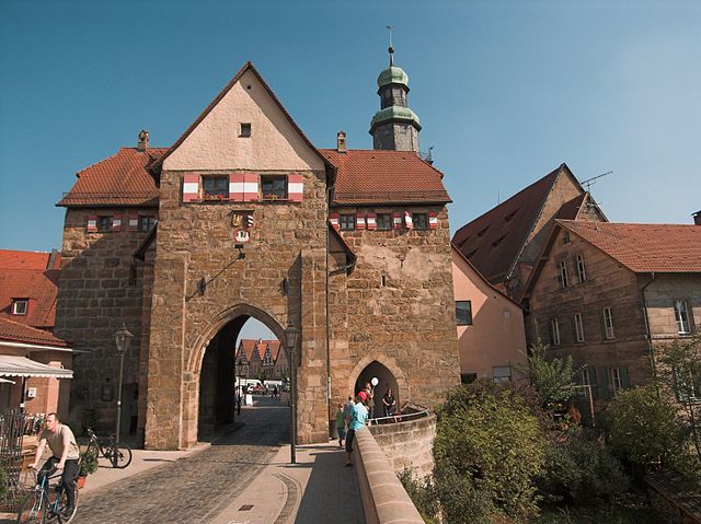

Nürnberger Land
- district in Bavaria, Germany
Nürnberger Land, located in Bavaria, Germany, is a fantastic area for hiking enthusiasts. It features a diverse landscape that includes forests, hills, and picturesque valleys, making it ideal for both casual walkers and seasoned hikers. Here are some key points about hiking in Nürnberger Land:...
- Country:

- Capital: Lauf an der Pegnitz
- Licence Plate Code: PEG; N; LAU; HEB; ESB
- Coordinates: 49° 30' 0" N, 11° 22' 0" E


- GPS tracks (wikiloc): [Link]
- AboveSeaLevel: 355 м m
- Area: 800.00 sq km
- Population: 149127
- Web site: [Link]
