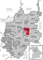
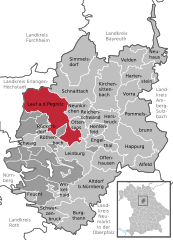
Nürnberger Land (Landkreis Nürnberger Land)

- district in Bavaria, Germany
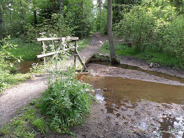
 Hiking in Nürnberger Land
Nürnberger Land, located in Bavaria, Germany, is a fantastic area for hiking enthusiasts. It features a diverse landscape that includes forests, hills, and picturesque valleys, making it ideal for both casual walkers and seasoned hikers. Here are some key points about hiking in Nürnberger Land:
Scenic Trails
-
Explore the Franconian Switzerland: Nearby, you'll find Franconian Switzerland, a region known for its unique rock formations, limestone cliffs, and charming villages. The trails here offer stunning views and a variety of terrains.
-
Nürnberger Land Circular Hiking Trails: There are numerous circular trails that allow hikers to experience different sections of the region without retracing their steps. These trails often lead through forests, past rivers, and to historical sites.
-
The European Long-Distance Path E6: This trail passes through the Nürnberger Land and connects various European regions, providing a more extended hiking experience for those looking for a challenge.
Nature and Wildlife
The Nürnberger Land area is rich in biodiversity, and hikers can often spot various species of birds, deer, and other wildlife along the trails. The region's forests are primarily composed of deciduous and coniferous trees, offering tranquil and shaded hiking experiences.
Historical Significance
Hiking in Nürnberger Land also provides opportunities to explore historical sites, such as castles and ruins. The area has a rich history that can be discovered while trekking through its scenic landscapes.
Tips for Hiking in Nürnberger Land
- Weather: Check the weather before your hike, as conditions can change rapidly, especially in the mountains.
- Footwear: Wear appropriate hiking boots for uneven terrain.
- Maps and Guides: Although trails are generally well-marked, consider bringing a map or a hiking app for navigation.
- Local Amenities: Many trails have nearby villages that offer refreshments and accommodations, making it easy to plan multi-day hikes.
Accessibility
The Nürnberger Land area is easily accessible from larger cities like Nuremberg, making it a great destination for day trips or weekend hiking excursions. Public transportation options are available for those who prefer not to drive.
In summary, hiking in Nürnberger Land offers a variety of trails and experiences in a beautiful, natural setting. Be sure to take advantage of the diverse landscapes, rich history, and local culture as you explore this lovely region.
- Country:

- Capital: Lauf an der Pegnitz
- Licence Plate Code: PEG; N; LAU; HEB; ESB
- Coordinates: 49° 30' 0" N, 11° 22' 0" E


- GPS tracks (wikiloc): [Link]
- AboveSeaLevel: 355 м m
- Area: 800.00 sq km
- Population: 149127
- Web site: http://www.nuernberger-land.de/
- Wikipedia en: wiki(en)
- Wikipedia: wiki(de)
- Wikidata storage: Wikidata: Q10449
- Wikipedia Commons Category: [Link]
- Wikipedia Commons Maps Category: [Link]
- Freebase ID: [/m/026rqw]
- GeoNames ID: Alt: [3220804]
- VIAF ID: Alt: [132546869]
- OSM relation ID: [62744]
- GND ID: Alt: [4075528-9]
- archINFORM location ID: [2540]
- Library of Congress authority ID: Alt: [n82094497]
- TGN ID: [7077314]
- Bavarikon ID: [ODB_A00000112]
- NUTS code: [DE259]
- German district key: 09574
Includes regions:

Fischbach
- unincorporated area in in Germany
Hiking in Fischbach
Fischbach is a charming area located in the northern part of the Black Forest in Germany, known for its natural beauty, tranquility, and diverse hiking trails. Here are a few points to consider when planning a hike in Fischbach:...
- Country:
- Coordinates: 49° 24' 30" N, 11° 12' 11" E
- GPS tracks (wikiloc): [Link]

Engelthaler Forst
- unincorporated area in in Germany
Hiking in Engelthaler Forst
Engelthaler Forst, located in the beautiful region of Germany, is known for its picturesque landscapes and serene nature, making it a great destination for hiking enthusiasts. Here are some key points to consider when hiking in Engelthaler Forst:...
- Country:
- Coordinates: 49° 27' 39" N, 11° 22' 26" E
- GPS tracks (wikiloc): [Link]


Feuchter Forst
- unincorporated area in in Germany
Hiking in Feuchter Forst
Feuchter Forst, located near the town of Feucht in Bavaria, Germany, is a beautiful area that offers a mix of woodland trails, scenic landscapes, and a chance to connect with nature. Here are some key points about hiking in this forest:...
- Country:
- Coordinates: 49° 22' 55" N, 11° 14' 35" E
- GPS tracks (wikiloc): [Link]


Forsthof
- unincorporated area in in Germany
Hiking in Forsthof
Forsthof, located in a gemeindefreies Gebiet in Germany, offers a unique experience for hikers looking to explore natural landscapes free from urban development. This area is characterized by its pristine forests, diverse flora and fauna, and a network of trails that cater to varying skill levels....
- Country:
- Coordinates: 49° 25' 40" N, 11° 9' 20" E
- GPS tracks (wikiloc): [Link]


Laufamholzer Forst
- unincorporated area in in Germany
Hiking in Laufamholzer Forst
Laufamholzer Forst is a beautiful forest area located near Nuremberg, Germany, known for its scenic landscapes and diverse trails, making it an excellent destination for hiking enthusiasts. Here are some highlights of hiking in Laufamholzer Forst:...
- Country:
- Coordinates: 49° 26' 39" N, 11° 11' 47" E
- GPS tracks (wikiloc): [Link]

Winkelhaid
- unincorporated area in Germany
Hiking in Winkelhaid
Winkelhaid, located in Bavaria, Germany, is situated in a region known for its scenic landscapes and outdoor activities. Although Winkelhaid itself may not have extensive hiking trails directly within its borders due to its status as a gemeindefreies Gebiet (municipality-free area), there are still opportunities for hiking in the surrounding areas....
- Country:
- Coordinates: 49° 24' 15" N, 11° 17' 56" E
- GPS tracks (wikiloc): [Link]

Haimendorfer Forst
- unincorporated area in in Germany
Hiking in Haimendorfer Forst
Haimendorfer Forst is a charming forest area located in Germany, often appealing to hiking enthusiasts for its serene environment and natural beauty. While it may not be as widely known as some of Germany's larger national parks, it offers a variety of trails that cater to different skill levels, from leisurely walks to more challenging hikes....
- Country:
- Coordinates: 49° 27' 0" N, 11° 14' 0" E
- GPS tracks (wikiloc): [Link]

Leinburg
- unincorporated area in in Germany
Hiking in Leinburg
Leinburg, located in Bavaria, Germany, offers a variety of hiking opportunities in a picturesque landscape. Although it is a gemeindefreies Gebiet (a community-free area), it is surrounded by beautiful natural scenery, including forests, hills, and meadows that make for excellent hiking terrain....
- Country:
- Coordinates: 49° 26' 0" N, 11° 18' 0" E
- GPS tracks (wikiloc): [Link]
Schönberg
- unincorporated area in Germany
Hiking in Schönberg
Schönberg is a picturesque area located in Bavaria, Germany, known for its stunning landscapes and outdoor activities. While it may not be as famous as some other hiking destinations, it offers a variety of trails that cater to different skill levels, making it a great option for hikers looking to explore the beauty of nature in a less commercialized environment....
- Country:
- Coordinates: 49° 29' 0" N, 11° 17' 0" E
- GPS tracks (wikiloc): [Link]
Günthersbühler Forst
- unincorporated area in in Germany
Hiking in Günthersbühler Forst
Günthersbühler Forst is a beautiful forest area located in Germany, near the town of Mainhardt in the state of Baden-Württemberg. This serene and lush forest offers a variety of hiking opportunities for both beginners and experienced hikers. Here’s what you should know about hiking in Günthersbühler Forst:...
- Country:
- Coordinates: 49° 31' 23" N, 11° 12' 16" E
- GPS tracks (wikiloc): [Link]


Zerzabelshofer Forst
- unincorporated area in Germany
Hiking in Zerzabelshofer Forst
Zerzabelshofer Forst is a beautiful forest area located in the region of Bavaria, Germany, known for its serene landscapes and excellent hiking trails. Here are some key points to consider if you're planning a hike in Zerzabelshofer Forst:...
- Country:
- Coordinates: 49° 26' 46" N, 11° 10' 9" E
- GPS tracks (wikiloc): [Link]
Rückersdorfer Forst
- unincorporated area in Germany
Hiking in Rückersdorfer Forst
Rückersdorfer Forst is a picturesque forest area located near the town of Rückersdorf, in Germany. Known for its scenic beauty and tranquility, this forest offers a variety of hiking trails suitable for all levels of hikers. Here are some details to help you plan a hike in Rückersdorfer Forst:...
- Country:
- Coordinates: 49° 31' 9" N, 11° 14' 9" E
- GPS tracks (wikiloc): [Link]


Kirchensittenbach
- municipality in Landkreis Nürnberger Land in Germany
Hiking in Kirchensittenbach
Kirchensittenbach is a picturesque village located in the Franconian region of Bavaria, Germany, known for its scenic landscapes and outdoor activities, especially hiking. The area is surrounded by beautiful natural features, including dense forests, rolling hills, and charming villages....
- Country:
- Postal Code: 91241
- Local Dialing Code: 09151
- Coordinates: 49° 32' 59" N, 11° 25' 0" E
- GPS tracks (wikiloc): [Link]
- AboveSeaLevel: 386 м m
- Area: 43.21 sq km
- Population: 2020
- Web site: [Link]


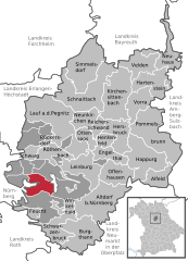
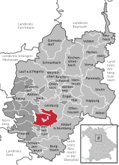
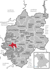
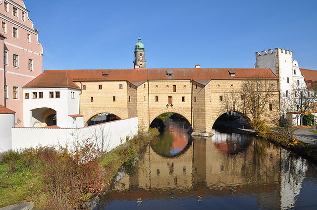
Altdorf bei Nürnberg
- city in Landkreis Nürnberger Land in Germany
Hiking in Altdorf bei Nürnberg
Altdorf bei Nürnberg, located in Bavaria, Germany, offers a delightful mix of natural beauty and cultural heritage, making it a great location for hiking enthusiasts. Here are some insights about hiking in the area:...
- Country:
- Postal Code: 90518
- Local Dialing Code: 09187
- Licence Plate Code: LAU
- Coordinates: 49° 23' 15" N, 11° 21' 26" E
- GPS tracks (wikiloc): [Link]
- AboveSeaLevel: 437 м m
- Area: 48.59 sq km
- Population: 12612
- Web site: [Link]
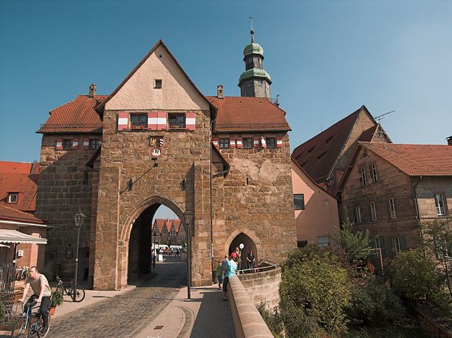
Hersbruck
- city in Landkreis Nürnberger Land in Germany
Hiking in Hersbruck
Hersbruck is a charming town located in Bavaria, Germany, known for its beautiful landscapes and outdoor recreation opportunities, making it a great destination for hiking enthusiasts. The surrounding area is part of the Franconian Switzerland region, which is characterized by picturesque hills, rugged rock formations, and lush forests....
- Country:
- Postal Code: 91217
- Local Dialing Code: 09151
- Coordinates: 49° 30' 29" N, 11° 25' 58" E
- GPS tracks (wikiloc): [Link]
- AboveSeaLevel: 336 м m
- Area: 22.91 sq km
- Population: 11479
- Web site: [Link]
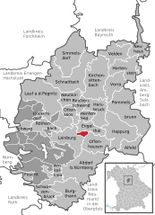
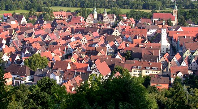
Lauf an der Pegnitz
- city in Landkreis Nürnberger Land in Germany
Hiking in Lauf an der Pegnitz
Lauf an der Pegnitz, located in Bavaria, Germany, is a charming town that offers a variety of hiking opportunities amidst picturesque landscapes. Situated near the Pegnitz River, the region is characterized by its scenic beauty, lush forests, and rolling hills. Here are some highlights and tips for hiking in and around Lauf an der Pegnitz:...
- Country:
- Postal Code: 91207
- Local Dialing Code: 09126; 09123
- Licence Plate Code: LAU
- Coordinates: 49° 30' 37" N, 11° 16' 38" E
- GPS tracks (wikiloc): [Link]
- AboveSeaLevel: 327 м m
- Area: 59.80 sq km
- Population: 25993
- Web site: [Link]


Schwaig
- municipality in Landkreis Nürnberger Land in Germany
Hiking in Schwaig
Schwaig, a charming village located in Bavaria, Germany, is surrounded by beautiful natural landscapes ideal for hiking enthusiasts. The region offers a variety of trails that cater to different fitness levels, making it accessible for families, beginners, and experienced hikers alike....
- Country:
- Postal Code: 90571
- Local Dialing Code: 0911
- Licence Plate Code: LAU
- Coordinates: 49° 28' 9" N, 11° 12' 3" E
- GPS tracks (wikiloc): [Link]
- AboveSeaLevel: 320 м m
- Area: 5.89 sq km
- Population: 8175
- Web site: [Link]

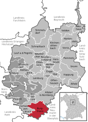
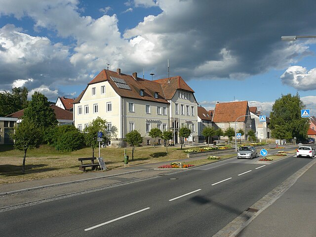
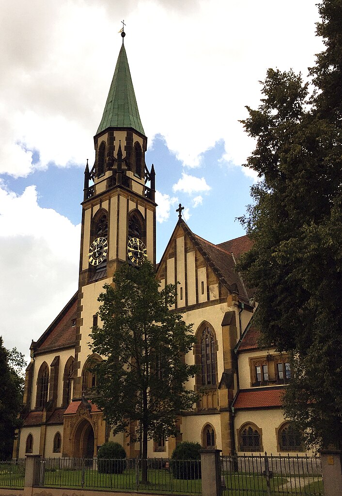
Burgthann
- municipality in Landkreis Nürnberger Land in Germany
Hiking in Burgthann
Burgthann is a charming municipality located in Bavaria, Germany, situated near the cities of Nuremberg and Schwabach. This area offers a variety of hiking opportunities, particularly in the surrounding natural landscapes and nearby parks. Here are some key aspects of hiking in Burgthann:...
- Country:
- Postal Code: 90559
- Local Dialing Code: 09183
- Licence Plate Code: LAU
- Coordinates: 49° 21' 0" N, 11° 18' 0" E
- GPS tracks (wikiloc): [Link]
- AboveSeaLevel: 400 м m
- Area: 39.19 sq km
- Population: 9029
- Web site: [Link]

Reichenschwand
- municipality in Landkreis Nürnberger Land in Germany
Hiking in Reichenschwand
Reichenschwand, a charming village located in the state of Bavaria, Germany, offers beautiful hiking opportunities for outdoor enthusiasts. Nestled in a scenic landscape, it is bordered by lush forests and meandering rivers that provide a picturesque backdrop for hikers....
- Country:
- Postal Code: 91244
- Local Dialing Code: 09151
- Licence Plate Code: LAU
- Coordinates: 49° 30' 54" N, 11° 22' 19" E
- GPS tracks (wikiloc): [Link]
- AboveSeaLevel: 345 м m
- Area: 6.84 sq km
- Population: 2050
- Web site: [Link]


Pommelsbrunn
- municipality in Landkreis Nürnberger Land in Germany
Hiking in Pommelsbrunn
Pommelsbrunn, located in Bavaria, Germany, is a charming area that offers scenic hiking opportunities for outdoor enthusiasts. Nestled in the Franconian region, it features picturesque landscapes, including lush forests, rolling hills, and beautiful meadows....
- Country:
- Postal Code: 91224
- Local Dialing Code: 09154
- Licence Plate Code: LAU
- Coordinates: 49° 30' 0" N, 11° 31' 0" E
- GPS tracks (wikiloc): [Link]
- AboveSeaLevel: 468 м m
- Area: 50.04 sq km
- Population: 4786
- Web site: [Link]


Schwarzenbruck
- municipality in Landkreis Nürnberger Land in Germany
Hiking in Schwarzenbruck
Schwarzenbruck, located in Bavaria, Germany, is surrounded by beautiful landscapes and offers a variety of hiking opportunities. The region is characterized by its charming mix of wooded areas, rolling hills, and picturesque villages. Here are some suggestions and tips for hiking in and around Schwarzenbruck:...
- Country:
- Postal Code: 90592
- Local Dialing Code: 09128
- Licence Plate Code: LAU
- Coordinates: 49° 21' 0" N, 11° 14' 0" E
- GPS tracks (wikiloc): [Link]
- AboveSeaLevel: 365 м m
- Area: 22.21 sq km
- Population: 7800
- Web site: [Link]


Feucht
- municipality in Landkreis Nürnberger Land in Germany
Hiking in Feucht
Feucht, a town located in Bavaria, Germany, offers a pleasant environment for hiking enthusiasts. The surrounding area is characterized by picturesque landscapes, forests, and agricultural fields, making it ideal for both casual walks and more vigorous hikes....
- Country:
- Postal Code: 90537
- Local Dialing Code: 09128
- Licence Plate Code: LAU
- Coordinates: 49° 22' 33" N, 11° 12' 47" E
- GPS tracks (wikiloc): [Link]
- AboveSeaLevel: 360 м m
- Area: 9.59 sq km
- Population: 13491
- Web site: [Link]


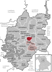
Offenhausen
- municipality in Landkreis Nürnberger Land in Germany
Hiking in Offenhausen
Offenhausen, located in the beautiful region of Bavaria, Germany, offers a variety of hiking opportunities amidst stunning natural landscapes. The area is characterized by rolling hills, lush forests, and picturesque views, making it ideal for outdoor enthusiasts....
- Country:
- Postal Code: 91238
- Local Dialing Code: 09158
- Licence Plate Code: LAU
- Coordinates: 49° 27' 0" N, 11° 25' 0" E
- GPS tracks (wikiloc): [Link]
- AboveSeaLevel: 387 м m
- Area: 22.50 sq km
- Population: 1348
- Web site: [Link]


Schnaittach
- municipality in Landkreis Nürnberger Land in Germany
Hiking in Schnaittach
Schnaittach, a charming town in Bavaria, Germany, offers a variety of hiking opportunities that cater to different skill levels and preferences. With its picturesque landscapes, rich history, and well-marked trails, hiking in this region can be both enjoyable and educational. Here are some highlights to consider:...
- Country:
- Postal Code: 91220
- Local Dialing Code: 09153
- Licence Plate Code: LAU
- Coordinates: 49° 33' 33" N, 11° 20' 35" E
- GPS tracks (wikiloc): [Link]
- AboveSeaLevel: 355 м m
- Area: 49.36 sq km
- Population: 6990
- Web site: [Link]

Röthenbach an der Pegnitz
- city in Landkreis Nürnberger Land in Germany
Hiking in Röthenbach an der Pegnitz
Röthenbach an der Pegnitz is a charming town in Bavaria, Germany, located near the Pegnitz River and surrounded by beautiful landscapes that are perfect for hiking enthusiasts. The area offers a variety of trails that cater to different skill levels, ranging from leisurely walks to more challenging hikes, making it a great destination for both beginners and experienced hikers....
- Country:
- Postal Code: 90552
- Local Dialing Code: 0911
- Licence Plate Code: LAU
- Coordinates: 49° 29' 5" N, 11° 14' 51" E
- GPS tracks (wikiloc): [Link]
- AboveSeaLevel: 329 м m
- Area: 14.27 sq km
- Population: 11899
- Web site: [Link]

Henfenfeld
- municipality in Landkreis Nürnberger Land in Germany
Hiking in Henfenfeld
Henfenfeld is a small village located in Bavaria, Germany, and is surrounded by picturesque landscapes, making it a great location for hiking enthusiasts. The area is characterized by rolling hills, forests, and charming rural scenery, providing a variety of trails suitable for different skill levels....
- Country:
- Postal Code: 91239
- Local Dialing Code: 09151
- Licence Plate Code: LAU
- Coordinates: 49° 30' 0" N, 11° 22' 59" E
- GPS tracks (wikiloc): [Link]
- AboveSeaLevel: 345 м m
- Area: 6.64 sq km
- Population: 1668
- Web site: [Link]


Winkelhaid
- municipality in Landkreis Nürnberger Land in Germany
Hiking in Winkelhaid
Winkelhaid, located in Bavaria, Germany, offers a variety of hiking opportunities, showcasing the scenic landscapes and natural beauty of the region. Although it's a small village, it serves as a great starting point for exploring nearby trails and nature reserves....
- Country:
- Postal Code: 90610
- Local Dialing Code: 09187
- Licence Plate Code: LAU
- Coordinates: 49° 23' 0" N, 11° 18' 0" E
- GPS tracks (wikiloc): [Link]
- AboveSeaLevel: 427 м m
- Area: 6.54 sq km
- Population: 3381
- Web site: [Link]


Neunkirchen am Sand
- municipality in Landkreis Nürnberger Land in Germany
Hiking in Neunkirchen am Sand
Neunkirchen am Sand, located in Bavaria, Germany, is an excellent destination for hiking enthusiasts. The area is known for its stunning natural landscapes, including forests, rolling hills, and scenic views. Here are some highlights and considerations for hiking in this region:...
- Country:
- Postal Code: 91233
- Local Dialing Code: 09153; 09123
- Licence Plate Code: LAU
- Coordinates: 49° 31' 0" N, 11° 19' 0" E
- GPS tracks (wikiloc): [Link]
- AboveSeaLevel: 331 м m
- Area: 14.14 sq km
- Population: 4265
- Web site: [Link]


Engelthal
- municipality in Landkreis Nürnberger Land in Germany
Hiking in Engelthal
Engelthal, located in Bavaria, Germany, is a charming area known for its beautiful landscapes and serene nature, making it a lovely destination for hiking enthusiasts. Here are some key points about hiking in Engelthal:...
- Country:
- Postal Code: 91238
- Local Dialing Code: 09158
- Licence Plate Code: LAU
- Coordinates: 49° 28' 0" N, 11° 24' 0" E
- GPS tracks (wikiloc): [Link]
- AboveSeaLevel: 372 м m
- Area: 13.63 sq km
- Population: 1031
- Web site: [Link]


Ottensoos
- municipality in Landkreis Nürnberger Land in Germany
Hiking in Ottensoos
Ottensoos is a small, picturesque village in the region of Bavaria, Germany, known for its beautiful landscapes and access to several hiking trails. While the village itself is quaint, the surrounding countryside offers various outdoor activities, including hiking. Here are some highlights for hiking in and around Ottensoos:...
- Country:
- Postal Code: 91242
- Local Dialing Code: 09123
- Licence Plate Code: LAU
- Coordinates: 49° 31' 0" N, 11° 20' 59" E
- GPS tracks (wikiloc): [Link]
- AboveSeaLevel: 336 м m
- Area: 10.01 sq km
- Population: 1661
- Web site: [Link]

Rückersdorf
- municipality in Landkreis Nürnberger Land in Germany
Hiking in Rückersdorf
Rückersdorf, located in Bavaria, Germany, offers a delightful setting for hikers looking for varied trails and beautiful landscapes. The area is characterized by its rolling hills, lush forests, and charming villages, making it an appealing destination for outdoor enthusiasts....
- Country:
- Postal Code: 90607
- Local Dialing Code: 09123; 0911
- Licence Plate Code: LAU
- Coordinates: 49° 30' 0" N, 11° 15' 0" E
- GPS tracks (wikiloc): [Link]
- AboveSeaLevel: 321 м m
- Area: 3.57 sq km
- Population: 4020
- Web site: [Link]

Hartenstein
- municipality in Landkreis Nürnberger Land in Germany
Hiking in Hartenstein
Hartenstein is a lovely village in Bavaria, Germany, known for its picturesque landscapes and quaint atmosphere. Hiking in and around Hartenstein offers several opportunities to explore the natural beauty of the region, making it a great destination for outdoor enthusiasts....
- Country:
- Postal Code: 91235
- Local Dialing Code: 09152
- Licence Plate Code: LAU
- Coordinates: 49° 35' 45" N, 11° 31' 26" E
- GPS tracks (wikiloc): [Link]
- AboveSeaLevel: 500 м m
- Area: 24.76 sq km
- Population: 1307
- Web site: [Link]


Leinburg
- municipality in Landkreis Nürnberger Land in Germany
Hiking in Leinburg
Leinburg, located in the state of Bavaria, Germany, is a picturesque area that offers various opportunities for hiking enthusiasts. While Leinburg itself is a smaller town, it serves as a great starting point to explore the surrounding landscapes, including parts of the Franconian Jura and the scenic regions around the Nuremberg metropolitan area....
- Country:
- Postal Code: 91227
- Local Dialing Code: 09187; 09158; 09120
- Licence Plate Code: LAU
- Coordinates: 49° 27' 6" N, 11° 18' 36" E
- GPS tracks (wikiloc): [Link]
- AboveSeaLevel: 392 м m
- Area: 29.42 sq km
- Population: 5370
- Web site: [Link]


Simmelsdorf
- municipality in Landkreis Nürnberger Land in Germany
Hiking in Simmelsdorf
Simmelsdorf, situated in the Franconian region of Bavaria, Germany, offers beautiful landscapes and a variety of hiking opportunities. Here are some highlights and tips for hiking in and around Simmelsdorf:...
- Country:
- Postal Code: 91245
- Local Dialing Code: 09155
- Licence Plate Code: LAU
- Coordinates: 49° 36' 0" N, 11° 21' 0" E
- GPS tracks (wikiloc): [Link]
- AboveSeaLevel: 375 м m
- Area: 40.85 sq km
- Population: 3008
- Web site: [Link]


Happurg
- municipality in Landkreis Nürnberger Land in Germany
Hiking in Happurg
Happurg, a small town located in Bavaria, Germany, is surrounded by beautiful natural scenery and offers various hiking opportunities for outdoor enthusiasts. Here are some key points about hiking in and around Happurg:...
- Country:
- Postal Code: 91230
- Local Dialing Code: 09151
- Licence Plate Code: LAU
- Coordinates: 49° 29' 35" N, 11° 28' 16" E
- GPS tracks (wikiloc): [Link]
- AboveSeaLevel: 353 м m
- Area: 42.57 sq km
- Population: 3396
- Web site: [Link]


Neuhaus an der Pegnitz
- municipality in Landkreis Nürnberger Land in Germany
Hiking in Neuhaus an der Pegnitz
Neuhaus an der Pegnitz is a charming town located in Bavaria, Germany, and is surrounded by picturesque landscapes, making it an excellent destination for hiking enthusiasts. The area is characterized by its beautiful natural scenery, featuring woodlands, meadows, and the banks of the Pegnitz River....
- Country:
- Postal Code: 91284
- Local Dialing Code: 09156
- Licence Plate Code: LAU
- Coordinates: 49° 37' 42" N, 11° 33' 6" E
- GPS tracks (wikiloc): [Link]
- AboveSeaLevel: 395 м m
- Area: 23.96 sq km
- Population: 2917
- Web site: [Link]

Vorra
- municipality in Landkreis Nürnberger Land in Germany
Hiking in Vorra
Vorra is a charming village located in the region of Bavaria, Germany, and offers a range of hiking opportunities. When hiking in Vorra, you can expect beautiful landscapes, lush forests, and scenic views of the surrounding countryside. Here are some highlights and tips for hiking in this area:...
- Country:
- Postal Code: 91247
- Local Dialing Code: 09152
- Licence Plate Code: LAU
- Coordinates: 49° 32' 0" N, 11° 30' 0" E
- GPS tracks (wikiloc): [Link]
- AboveSeaLevel: 365 м m
- Area: 22.08 sq km
- Population: 1694
- Web site: [Link]


Velden
- city in Landkreis Nürnberger Land in Germany
Hiking in Velden
Velden (Pegnitz) is a picturesque town located in the Franconian region of Bavaria, Germany. It's surrounded by beautiful landscapes, making it a great starting point for various hiking routes. Here’s what you can expect when hiking in and around Velden:...
- Country:
- Postal Code: 91235
- Local Dialing Code: 09152
- Licence Plate Code: LAU
- Coordinates: 49° 37' 0" N, 11° 31' 0" E
- GPS tracks (wikiloc): [Link]
- AboveSeaLevel: 377 м m
- Area: 21.32 sq km
- Population: 1702
- Web site: [Link]


Alfeld
- municipality in Landkreis Nürnberger Land in Germany
Hiking in Alfeld
Alfeld, located in the picturesque region of Bavaria, Germany, offers a serene environment for hiking enthusiasts. The area is characterized by its rolling hills, dense forests, and stunning vistas of the surrounding landscapes. Here are some highlights and tips for hiking in and around Alfeld:...
- Country:
- Postal Code: 91236
- Local Dialing Code: 09157
- Licence Plate Code: LAU
- Coordinates: 49° 26' 0" N, 11° 33' 0" E
- GPS tracks (wikiloc): [Link]
- AboveSeaLevel: 485 м m
- Area: 17.95 sq km
- Population: 1059
- Web site: [Link]


Behringersdorfer Forst
- unincorporated area in Germany
Hiking in Behringersdorfer Forst
Behringersdorfer Forst is a forested area located near Behringersdorf in Bavaria, Germany. It offers a range of hiking opportunities in a scenic and tranquil setting. Here's what you can expect when hiking in Behringersdorfer Forst:...
- Country:
- Coordinates: 49° 29' 50" N, 11° 12' 11" E
- GPS tracks (wikiloc): [Link]
Brunn
- unincorporated area in in Germany
Hiking in Brunn
Brunn, located in the gemeindefreies Gebiet in Germany, is an area known for its natural beauty and outdoor activities, including hiking. While it may not be as well-known as some national parks or popular hiking destinations, it offers a peaceful environment for hikers looking to explore nature away from the crowds....
- Country:
- Coordinates: 49° 26' 13" N, 11° 14' 16" E
- GPS tracks (wikiloc): [Link]
Shares border with regions:
Amberg-Sulzbach
- district of Bavaria, Germany
Hiking in Amberg-Sulzbach
Amberg-Sulzbach, located in Bavaria, Germany, is a picturesque district known for its beautiful landscapes, rich culture, and numerous outdoor activities, including hiking. The area offers a variety of hiking trails that cater to different skill levels, from easy walks suitable for families to more challenging paths for experienced hikers....
- Country:
- Capital: Amberg
- Licence Plate Code: SUL; NAB; ESB; BUL; AS
- Coordinates: 49° 30' 0" N, 11° 45' 0" E
- GPS tracks (wikiloc): [Link]
- AboveSeaLevel: 380 м m
- Area: 1255.00 sq km
- Population: 94617
- Web site: [Link]

Neumarkt
- district of Bavaria, Germany
Hiking in Neumarkt
Neumarkt in der Oberpfalz, a district in Bavaria, Germany, is known for its picturesque landscapes and varied hiking opportunities. Set against a backdrop of rolling hills, lush forests, and charming villages, this area is ideal for both casual walkers and seasoned hikers....
- Country:
- Capital: Neumarkt in der Oberpfalz
- Licence Plate Code: PAR; NM
- Coordinates: 49° 15' 0" N, 11° 30' 0" E
- GPS tracks (wikiloc): [Link]
- AboveSeaLevel: 445 м m
- Area: 1344.00 sq km
- Population: 105346
- Web site: [Link]

Bayreuth
- district in Bavaria, Germany
Hiking in Bayreuth
Bayreuth, located in the northern part of Bavaria, Germany, offers a diverse range of hiking opportunities set against a backdrop of beautiful landscapes, forests, and cultural sites. The region is known for its rich history, stunning scenery, and well-marked trails suitable for hikers of all levels....
- Country:
- Capital: Bayreuth
- Licence Plate Code: PEG; MÜB; KEM; ESB; EBS; BT
- Coordinates: 49° 55' 12" N, 11° 30' 0" E
- GPS tracks (wikiloc): [Link]
- AboveSeaLevel: 507 м m
- Area: 1273.00 sq km
- Population: 96772
- Web site: [Link]

Forchheim
- district in Bavaria, Germany
Hiking in Forchheim
Forchheim, located in Bavaria, Germany, is a charming district known for its picturesque landscapes, historical sites, and access to various hiking trails. Here’s an overview of what you can expect when hiking in this region:...
- Country:
- Licence Plate Code: PEG; FO; EBS
- Coordinates: 49° 45' 0" N, 11° 5' 0" E
- GPS tracks (wikiloc): [Link]
- AboveSeaLevel: 377 м m
- Area: 643.00 sq km
- Population: 97433
- Web site: [Link]

Erlangen-Höchstadt
- district in Bavaria, Germany
Hiking in Erlangen-Höchstadt
Erlangen-Höchstadt is a scenic district in Bavaria, Germany, known for its beautiful landscapes and opportunities for outdoor activities, including hiking. The region offers a mix of rolling hills, woodlands, and agricultural fields, making it suitable for both casual and more adventurous hikers....
- Country:
- Capital: Erlangen
- Licence Plate Code: ERH
- Coordinates: 49° 40' 12" N, 10° 49' 48" E
- GPS tracks (wikiloc): [Link]
- AboveSeaLevel: 287 м m
- Area: 56465.80 sq km
- Population: 134136
- Web site: [Link]

Roth
- district in Bavaria, Germany
Hiking in Roth
Roth district, located in Bavaria, Germany, offers a variety of beautiful landscapes and hiking opportunities that appeal to both novice and experienced hikers. The area is characterized by rolling hills, forests, and picturesque views. Here are some highlights and tips for hiking in Roth:...
- Country:
- Capital: Roth
- Licence Plate Code: RH; HIP
- Coordinates: 49° 15' 0" N, 11° 4' 48" E
- GPS tracks (wikiloc): [Link]
- AboveSeaLevel: 355 м m
- Area: 895.00 sq km
- Population: 103944
- Web site: [Link]

Nuremberg
- city in the German state of Bavaria
Hiking in Nuremberg
Hiking in and around Nuremberg can offer a remarkable blend of urban exploration and natural beauty. Though Nuremberg itself is a city with a rich history, it is surrounded by picturesque landscapes that are perfect for hiking enthusiasts. Here are some highlights and tips for hiking in the region:...
- Country:
- Postal Code: 90402–90491
- Local Dialing Code: 0911
- Licence Plate Code: N
- Coordinates: 49° 27' 10" N, 11° 4' 40" E
- GPS tracks (wikiloc): [Link]
- AboveSeaLevel: 209 м m
- Area: 186.45 sq km
- Population: 515201
- Web site: [Link]