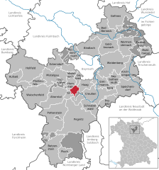
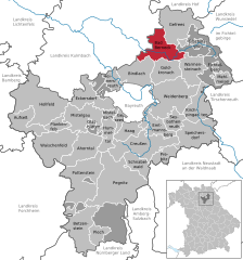
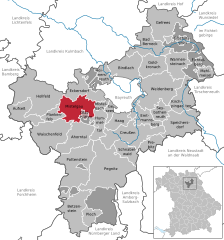
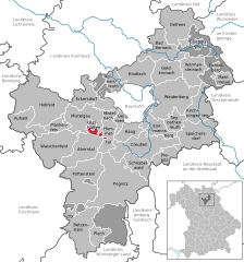
Bayreuth (Landkreis Bayreuth)
.svg)
- district in Bavaria, Germany
 Hiking in Bayreuth
Bayreuth, located in the northern part of Bavaria, Germany, offers a diverse range of hiking opportunities set against a backdrop of beautiful landscapes, forests, and cultural sites. The region is known for its rich history, stunning scenery, and well-marked trails suitable for hikers of all levels.
Key Hiking Areas and Trails:
-
Frankenwald Nature Park: This park features numerous hiking trails that wind through dense forests, along rivers, and up to scenic viewpoints. The trails vary in difficulty, making it accessible for everyone from casual walkers to experienced hikers.
-
Fichtelberg Mountains: Located just southeast of Bayreuth, the Fichtelberg area is known for more challenging hikes, featuring rugged terrain and stunning views. The region is home to several marked trails, including a popular route to the peak of the Fichtelberg itself, which provides panoramic vistas.
-
Waldstein Mountain: This area offers a mix of historical sites and natural beauty. There are trails leading to the ruins of the Waldstein Castle, as well as paths that take you through picturesque forested areas.
-
The Red Trail (Roter Weg): This trail is popular among local hikers and offers a well-marked route that connects various points of interest in the surroundings of Bayreuth, including scenic viewpoints and natural attractions.
-
Bayreuth City Parks: For those looking for a more leisurely experience, the parks and gardens within the city itself, like the Hofgarten and the Eremitage, provide lovely walking paths amidst historical architecture and well-maintained landscapes.
Hiking Recommendations:
- Season: Spring and early fall are ideal for hiking in the Bayreuth area, as the weather is usually mild, and the scenery is particularly beautiful during these times when flora is in bloom or foliage is changing colors.
- Preparation: Always check the weather conditions before heading out, and ensure you have proper hiking gear, including sturdy footwear, sufficient water, and snacks. Some trails can be steep, so be prepared for varied terrain.
- Guided Tours: For those unfamiliar with the area, consider joining a guided hiking tour. Local guides can provide insights into the region's history, flora, and fauna, enhancing your hiking experience.
Cultural Aspects:
Bayreuth is also famous for its cultural offerings, most notably the Bayreuth Festival dedicated to Wagner. Incorporating visits to cultural sites, such as the Margravial Opera House or the Richard Wagner Museum, can enrich your hiking experience by allowing you to immerse yourself in the local heritage.
Whether you are looking for a day hike in nature or a more extended exploration of the scenic landscapes, Bayreuth offers a variety of options to suit every hiker's interests.
- Country:

- Capital: Bayreuth
- Licence Plate Code: PEG; MÜB; KEM; ESB; EBS; BT
- Coordinates: 49° 55' 12" N, 11° 30' 0" E


- GPS tracks (wikiloc): [Link]
- AboveSeaLevel: 507 м m
- Area: 1273.00 sq km
- Population: 96772
- Web site: http://www.landkreis-bayreuth.de/
- Wikipedia en: wiki(en)
- Wikipedia: wiki(de)
- Wikidata storage: Wikidata: Q10439
- Wikipedia Commons Gallery: [Link]
- Wikipedia Commons Category: [Link]
- Wikipedia Commons Maps Category: [Link]
- Freebase ID: [/m/01dg0z]
- GeoNames ID: Alt: [3220846]
- VIAF ID: Alt: [128990346]
- OSM relation ID: [62378]
- GND ID: Alt: [4005057-9]
- archINFORM location ID: [6287]
- Library of Congress authority ID: Alt: [n79035882]
- TGN ID: [7077284]
- Historical Gazetteer (GOV) ID: [adm_139472]
- Bavarikon ID: [ODB_A00001978]
- NUTS code: [DE246]
- BabelNet ID: [01345572n]
- German district key: 09472
Includes regions:


Langweiler Wald
- unincorporated area in Germany
Hiking in Langweiler Wald
Langweiler Wald is a beautiful area for hiking, located in Germany, particularly known for its serene landscapes, dense forests, and rich biodiversity. Here’s what you can expect when hiking in Langweiler Wald:...
- Country:
- Coordinates: 49° 52' 0" N, 11° 25' 0" E
- GPS tracks (wikiloc): [Link]

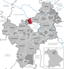
Lindenhardter Forst-Nordwest
- unincorporated area in Germany
Hiking in Lindenhardter Forst-Nordwest
Lindenhardter Forst-Nordwest is a beautiful forested area located in Germany, particularly known for its scenic trails and tranquil nature. Here are some things to consider when hiking in this area:...
- Country:
- Coordinates: 49° 51' 0" N, 11° 31' 0" E
- GPS tracks (wikiloc): [Link]

Lindenhardter Forst-Südost
- unincorporated area in Germany
Hiking in Lindenhardter Forst-Südost
Lindenhardter Forst-Südost is a beautiful forest area in Germany, located in the state of Baden-Württemberg. It offers a variety of hiking trails that provide an excellent opportunity to immerse yourself in nature, enjoy scenic views, and experience the tranquility of the woods....
- Country:
- Coordinates: 49° 51' 0" N, 11° 32' 0" E
- GPS tracks (wikiloc): [Link]
Prüll
- unincorporated area in Germany
Hiking in Prüll
Prüll, located in Landkreis Bayreuth, Bavaria, offers a variety of hiking opportunities for outdoor enthusiasts. The region is characterized by picturesque landscapes, including lush forests, rolling hills, and charming villages, making it an inviting destination for hikers....
- Country:
- Coordinates: 49° 46' 0" N, 11° 26' 0" E
- GPS tracks (wikiloc): [Link]

Goldkronacher Forst
- unincorporated area in Germany
Hiking in Goldkronacher Forst
Goldkronacher Forst is a beautiful forested area located near the town of Goldkronach in Bavaria, Germany. It offers a variety of hiking opportunities amidst picturesque landscapes filled with rich flora and fauna....
- Country:
- Coordinates: 50° 1' 0" N, 11° 44' 29" E
- GPS tracks (wikiloc): [Link]


Betzenstein
- town in Landkreis Bayreuth in Germany
Hiking in Betzenstein
Betzenstein, located in the picturesque region of Franconia in Germany, offers a variety of hiking trails that cater to different skill levels, making it an excellent destination for outdoor enthusiasts. The area is known for its scenic landscapes, including lush forests, rolling hills, and charming vistas....
- Country:
- Postal Code: 91282
- Local Dialing Code: 09244
- Licence Plate Code: BT
- Coordinates: 49° 40' 49" N, 11° 25' 3" E
- GPS tracks (wikiloc): [Link]
- AboveSeaLevel: 511 м m
- Area: 51.84 sq km
- Population: 2507
- Web site: [Link]


Bischofsgrüner Forst
- unincorporated area in Germany
Hiking in Bischofsgrüner Forst
Bischofsgrüner Forst is located in the beautiful Bavarian region of Germany and is known for its picturesque landscapes and rich natural environment. Here are some key points to consider when hiking in this area:...
- Country:
- Coordinates: 50° 2' 16" N, 11° 47' 48" E
- GPS tracks (wikiloc): [Link]


Heinersreuther Forst in Upper Franconia
- unincorporated area in Germany
Hiking in Heinersreuther Forst in Upper Franconia
Heinersreuther Forst is a beautiful forest area located in Bavaria, Germany, not far from various towns and attractions. It offers a range of hiking opportunities with scenic views, diverse landscapes, and a tranquil atmosphere ideal for both casual walkers and serious hikers....
- Country:
- Coordinates: 49° 57' 0" N, 11° 29' 0" E
- GPS tracks (wikiloc): [Link]


Neubauer Forst-Nord
- unincorporated area in Germany
Hiking in Neubauer Forst-Nord
Neubauer Forst-Nord is a part of the larger Neubauer Forest region, which is great for hiking and outdoor activities. Here are some key points to consider when hiking in Neubauer Forst-Nord:...
- Country:
- Coordinates: 50° 2' 0" N, 11° 51' 0" E
- GPS tracks (wikiloc): [Link]


Veldensteiner Forst
- unincorporated area in Germany
Hiking in Veldensteiner Forst
Veldenstein Forest (Veldensteiner Wald) is a beautiful natural area located in Bavaria, Germany, known for its diverse landscapes, rich flora and fauna, and a network of hiking trails that cater to different skill levels....
- Country:
- Coordinates: 49° 41' 4" N, 11° 31' 9" E
- GPS tracks (wikiloc): [Link]

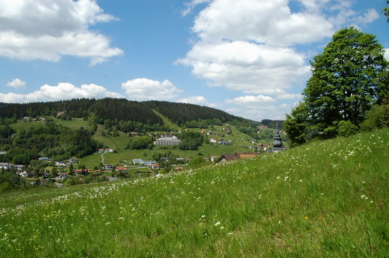
Bischofsgrün
- municipality in Landkreis Bayreuth in Germany
Hiking in Bischofsgrün
Bischofsgrün is a charming village located in the Fichtelgebirge region of Bavaria, Germany, known for its beautiful landscapes, dense forests, and well-maintained hiking trails. Here are some highlights about hiking in and around Bischofsgrün:...
- Country:
- Postal Code: 95493
- Local Dialing Code: 09276
- Licence Plate Code: BT
- Coordinates: 50° 3' 0" N, 11° 47' 0" E
- GPS tracks (wikiloc): [Link]
- AboveSeaLevel: 676 м m
- Area: 8.39 sq km
- Population: 1885
- Web site: [Link]


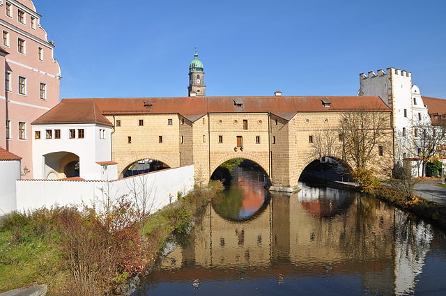
Pegnitz
- town in Landkreis Bayreuth in Germany
Hiking in Pegnitz
Pegnitz, located in the Franconian region of Bavaria, Germany, is a charming town that offers a variety of hiking opportunities set against the backdrop of the beautiful landscapes of the Fichtelgebirge and the Franconian Switzerland. Here are some highlights to consider when hiking in and around Pegnitz:...
- Country:
- Postal Code: 91257
- Local Dialing Code: 09241
- Coordinates: 49° 45' 23" N, 11° 32' 42" E
- GPS tracks (wikiloc): [Link]
- AboveSeaLevel: 422 м m
- Area: 100.03 sq km
- Population: 13356
- Web site: [Link]


Ahorntal
- municipality in Landkreis Bayreuth in Germany
Hiking in Ahorntal
Ahorntal is a scenic region located in Bavaria, Germany, known for its beautiful landscapes, lush forests, and diverse hiking trails. Here are some key points to know about hiking in Ahorntal:...
- Country:
- Postal Code: 95491
- Local Dialing Code: 09202
- Licence Plate Code: BT
- Coordinates: 49° 51' 0" N, 11° 26' 0" E
- GPS tracks (wikiloc): [Link]
- AboveSeaLevel: 400 м m
- Area: 41.70 sq km
- Population: 2182
- Web site: [Link]


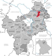
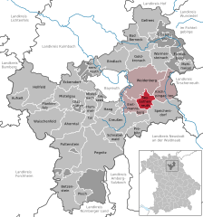
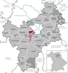
Emtmannsberg
- municipality in Landkreis Bayreuth in Germany
Hiking in Emtmannsberg
Emtmannsberg, located in Germany, offers a wonderful experience for hiking enthusiasts. The region is characterized by its picturesque landscapes, featuring rolling hills, dense forests, and quaint villages. Here are some key aspects to consider when hiking in Emtmannsberg:...
- Country:
- Postal Code: 95517
- Local Dialing Code: 09209
- Licence Plate Code: BT
- Coordinates: 49° 53' 29" N, 11° 38' 41" E
- GPS tracks (wikiloc): [Link]
- AboveSeaLevel: 469 м m
- Area: 22.31 sq km
- Population: 1051
- Web site: [Link]


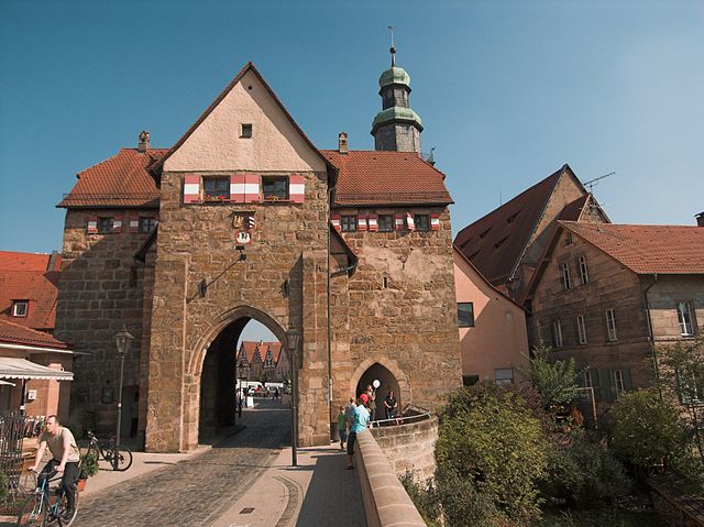
Plech
- municipality in Landkreis Bayreuth in Germany
Hiking in Plech
Plech, a region that may refer to several locations, doesn’t appear in widely recognized hiking maps or guides as a specific hiking area. It’s possible you are referring to a local area or a lesser-known hike that hasn't gained widespread attention....
- Country:
- Postal Code: 91287
- Local Dialing Code: 09244
- Licence Plate Code: BT
- Coordinates: 49° 38' 8" N, 11° 28' 9" E
- GPS tracks (wikiloc): [Link]
- AboveSeaLevel: 461 м m
- Area: 15.29 sq km
- Population: 1303
- Web site: [Link]


Creußen
- municipality in Landkreis Bayreuth in Germany
Hiking in Creußen
Creußen, located in Bavaria, Germany, is a charming town surrounded by beautiful landscapes that make it a great spot for hiking enthusiasts. Here’s what you can expect when hiking in and around Creußen:...
- Country:
- Postal Code: 95473
- Local Dialing Code: 09270
- Licence Plate Code: BT
- Coordinates: 49° 50' 38" N, 11° 37' 22" E
- GPS tracks (wikiloc): [Link]
- AboveSeaLevel: 442 м m
- Area: 60.47 sq km
- Population: 4883
- Web site: [Link]


Hollfeld
- town in Landkreis Bayreuth in Germany
Hiking in Hollfeld
Hollfeld is a charming town located in Bavaria, Germany, known for its beautiful landscapes and historic architecture. It is situated in the Franconian region, surrounded by rolling hills, forests, and scenic countryside, making it a great destination for hiking enthusiasts....
- Country:
- Postal Code: 96142
- Local Dialing Code: 09274
- Licence Plate Code: BT
- Coordinates: 49° 56' 13" N, 11° 17' 27" E
- GPS tracks (wikiloc): [Link]
- AboveSeaLevel: 403 м m
- Area: 80.65 sq km
- Population: 5111
- Web site: [Link]


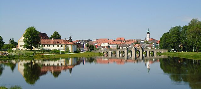
Waischenfeld
- town in Landkreis Bayreuth in Germany
Hiking in Waischenfeld
Waischenfeld, located in the Franconian Switzerland region of Germany, is a beautiful destination for hiking enthusiasts. Here are some highlights and tips for hiking in this picturesque area:...
- Country:
- Postal Code: 91344
- Local Dialing Code: 09202
- Licence Plate Code: BT
- Coordinates: 49° 51' 0" N, 11° 20' 0" E
- GPS tracks (wikiloc): [Link]
- AboveSeaLevel: 372 м m
- Area: 55.65 sq km
- Population: 3071
- Web site: [Link]
Goldkronach
- municipality in Landkreis Bayreuth in Germany
Hiking in Goldkronach
Goldkronach, located in Bavaria, Germany, is a picturesque town surrounded by beautiful landscapes, making it a great destination for hiking enthusiasts. The region is characterized by rolling hills, dense forests, and scenic views, which provide a variety of hiking opportunities for all skill levels....
- Country:
- Postal Code: 95497
- Local Dialing Code: 09273
- Licence Plate Code: BT
- Coordinates: 50° 0' 41" N, 11° 41' 14" E
- GPS tracks (wikiloc): [Link]
- AboveSeaLevel: 443 м m
- Area: 23.24 sq km
- Population: 3536
- Web site: [Link]


Plankenfels
- municipality in Landkreis Bayreuth in Germany
Hiking in Plankenfels
Plankenfels is a picturesque village located in the Franconian Switzerland region of Germany, known for its stunning landscapes, charming villages, and numerous hiking trails. Here are some highlights and tips for hiking in Plankenfels:...
- Country:
- Postal Code: 95515
- Local Dialing Code: 09204
- Licence Plate Code: BT
- Coordinates: 49° 53' 0" N, 11° 20' 0" E
- GPS tracks (wikiloc): [Link]
- AboveSeaLevel: 390 м m
- Area: 14.01 sq km
- Population: 798
- Web site: [Link]


Speichersdorf
- municipality in Landkreis Bayreuth in Germany
Hiking in Speichersdorf
Speichersdorf is a charming municipality located in Bavaria, Germany, surrounded by the scenic beauty of the Franconian countryside. While it may not be as widely known as some larger hiking destinations, it offers a variety of outdoor activities and hiking opportunities for enthusiasts of all levels....
- Country:
- Postal Code: 95469
- Local Dialing Code: 09275
- Licence Plate Code: BT
- Coordinates: 49° 52' 0" N, 11° 46' 0" E
- GPS tracks (wikiloc): [Link]
- AboveSeaLevel: 462 м m
- Area: 52.91 sq km
- Population: 5809
- Web site: [Link]
Prebitz
- municipality in Landkreis Bayreuth in Germany
Hiking in Prebitz
Prebitz is a small village located in the picturesque region of Bavaria, Germany. Although it's not as widely known as some other hiking destinations, it offers access to beautiful landscapes and a number of hiking trails. Here are some highlights for hiking in and around Prebitz:...
- Country:
- Postal Code: 95473
- Local Dialing Code: 09270
- Licence Plate Code: BT
- Coordinates: 49° 50' 3" N, 11° 41' 6" E
- GPS tracks (wikiloc): [Link]
- AboveSeaLevel: 419 м m
- Area: 20.99 sq km
- Population: 979
- Web site: [Link]


Mehlmeisel
- municipality in Landkreis Bayreuth in Germany
Hiking in Mehlmeisel
Mehlmeisel is a charming village located in the Fichtelgebirge region of Bavaria, Germany, known for its stunning natural landscapes and outdoor recreational opportunities, particularly hiking. Here are some highlights for hiking in and around Mehlmeisel:...
- Country:
- Postal Code: 95694
- Local Dialing Code: 09272
- Licence Plate Code: BT
- Coordinates: 49° 58' 34" N, 11° 51' 18" E
- GPS tracks (wikiloc): [Link]
- AboveSeaLevel: 621 м m
- Area: 13.23 sq km
- Population: 1321
- Web site: [Link]


Kirchenpingarten
- municipality in Landkreis Bayreuth in Germany
Hiking in Kirchenpingarten
Kirchenpingarten is a small village located in Bavaria, Germany, nestled in the stunning landscape of the Franconian Forest and the surrounding areas. This region is known for its beautiful hiking trails, diverse flora and fauna, and picturesque views....
- Country:
- Postal Code: 95466
- Local Dialing Code: 09278
- Licence Plate Code: BT
- Coordinates: 49° 55' 18" N, 11° 47' 12" E
- GPS tracks (wikiloc): [Link]
- AboveSeaLevel: 525 м m
- Area: 33.55 sq km
- Population: 1244
- Web site: [Link]

Schnabelwaid
- municipality in Landkreis Bayreuth in Germany
Hiking in Schnabelwaid
Schnabelwaid is a quaint village in the Franconian region of Bavaria, Germany, surrounded by beautiful natural scenery that makes it a great spot for hiking enthusiasts. The area features a variety of trails that cater to different skill levels, offering everything from easy walks to more challenging hikes....
- Country:
- Postal Code: 91289
- Local Dialing Code: 09270
- Licence Plate Code: BT
- Coordinates: 49° 49' 0" N, 11° 34' 0" E
- GPS tracks (wikiloc): [Link]
- AboveSeaLevel: 451 м m
- Area: 21.28 sq km
- Population: 893
- Web site: [Link]

Warmensteinach
- municipality in Landkreis Bayreuth in Germany
Hiking in Warmensteinach
Warmensteinach is a beautiful village located in the Fichtel Mountains of Bavaria, Germany. It offers a variety of hiking opportunities that cater to different skill levels and preferences. Here are some highlights about hiking in Warmensteinach:...
- Country:
- Postal Code: 95485
- Local Dialing Code: 09277
- Licence Plate Code: BT
- Coordinates: 49° 59' 0" N, 11° 47' 0" E
- GPS tracks (wikiloc): [Link]
- AboveSeaLevel: 628 м m
- Area: 17.53 sq km
- Population: 2571
- Web site: [Link]

Bad Berneck im Fichtelgebirge
- town in Landkreis Bayreuth in Germany
Hiking in Bad Berneck im Fichtelgebirge
Bad Berneck im Fichtelgebirge is a charming town located in northern Bavaria, Germany, surrounded by the scenic landscapes of the Fichtelgebirge mountain range. This area is known for its natural beauty, rich history, and outdoor recreational opportunities, making it a great destination for hikers....
- Country:
- Postal Code: 95460
- Local Dialing Code: 09273
- Licence Plate Code: BT
- Coordinates: 50° 2' 44" N, 11° 40' 21" E
- GPS tracks (wikiloc): [Link]
- AboveSeaLevel: 412 м m
- Area: 33.58 sq km
- Population: 4257
- Web site: [Link]


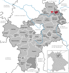
Gefrees
- town in Landkreis Bayreuth in Germany
Hiking in Gefrees
Gefrees is a picturesque town located in Bavaria, Germany, surrounded by beautiful landscapes and forests, making it an ideal location for hiking enthusiasts. Here are some key highlights and tips for hiking in and around Gefrees:...
- Country:
- Postal Code: 95482
- Local Dialing Code: 09254
- Coordinates: 50° 5' 43" N, 11° 44' 23" E
- GPS tracks (wikiloc): [Link]
- AboveSeaLevel: 500 м m
- Area: 50.08 sq km
- Population: 4467
- Web site: [Link]
Seybothenreuth
- municipality in Landkreis Bayreuth in Germany
Hiking in Seybothenreuth
Seybothenreuth is a quaint village in Bavaria, Germany, located in the picturesque Fichtelgebirge region, which offers stunning landscapes and diverse natural scenery perfect for hiking enthusiasts. Here’s an overview of what you can expect when hiking in and around Seybothenreuth:...
- Country:
- Postal Code: 95517
- Local Dialing Code: 09278; 09275
- Licence Plate Code: BT
- Coordinates: 49° 53' 0" N, 11° 43' 0" E
- GPS tracks (wikiloc): [Link]
- AboveSeaLevel: 420 м m
- Area: 17.43 sq km
- Population: 1266
- Web site: [Link]


Pottenstein
- town in Landkreis Bayreuth in Germany
Hiking in Pottenstein
Pottenstein, located in the Franconian Switzerland region of Bavaria, Germany, is a picturesque destination known for its stunning natural landscapes, unique rock formations, and a wide variety of hiking trails suitable for all levels of experience....
- Country:
- Postal Code: 91278
- Local Dialing Code: 09243
- Licence Plate Code: BT
- Coordinates: 49° 46' 20" N, 11° 24' 41" E
- GPS tracks (wikiloc): [Link]
- AboveSeaLevel: 368 м m
- Area: 73.24 sq km
- Population: 4995
- Web site: [Link]


Bindlach
- municipality in Landkreis Bayreuth in Germany
Hiking in Bindlach
Bindlach, a municipality in Germany located in the state of Bavaria, offers a variety of hiking opportunities that cater to different skill levels and preferences. The area is characterized by its picturesque landscapes, comprising forests, rolling hills, and quaint villages. Here are some highlights about hiking in Bindlach:...
- Country:
- Postal Code: 95463
- Local Dialing Code: 09208
- Licence Plate Code: BT
- Coordinates: 49° 58' 52" N, 11° 36' 41" E
- GPS tracks (wikiloc): [Link]
- AboveSeaLevel: 362 м m
- Area: 37.60 sq km
- Population: 7237
- Web site: [Link]

Heinersreuth
- municipality in Landkreis Bayreuth in Germany
Hiking in Heinersreuth
Heinersreuth, located in Bavaria, Germany, offers beautiful landscapes and hiking opportunities for outdoor enthusiasts. The region is characterized by rolling hills, forests, and scenic valleys, making it suitable for various hiking experiences, from easy walks to more challenging trails....
- Country:
- Postal Code: 95500
- Local Dialing Code: 0921
- Licence Plate Code: BT
- Coordinates: 49° 58' 3" N, 11° 31' 57" E
- GPS tracks (wikiloc): [Link]
- AboveSeaLevel: 340 м m
- Area: 14.63 sq km
- Population: 3760
- Web site: [Link]

Mistelgau
- municipality in Landkreis Bayreuth in Germany
Hiking in Mistelgau
Mistelgau is a picturesque village located in Bavaria, Germany, and offers a range of hiking opportunities in a beautiful natural landscape. Here are some highlights for hiking in and around Mistelgau:...
- Country:
- Postal Code: 95490
- Local Dialing Code: 09279
- Licence Plate Code: BT
- Coordinates: 49° 55' 0" N, 11° 28' 0" E
- GPS tracks (wikiloc): [Link]
- AboveSeaLevel: 435 м m
- Area: 39.43 sq km
- Population: 3775
- Web site: [Link]


Hummeltal
- municipality in Landkreis Bayreuth in Germany
Hiking in Hummeltal
Hummeltal is a scenic valley located in Germany, particularly known for its beautiful landscapes and outdoor activities, including hiking. Nestled in the Bavarian region, Hummeltal offers a variety of hiking trails suitable for different skill levels, making it an ideal destination for both beginners and experienced hikers....
- Country:
- Postal Code: 95503
- Local Dialing Code: 09201
- Licence Plate Code: BT
- Coordinates: 49° 53' 25" N, 11° 30' 37" E
- GPS tracks (wikiloc): [Link]
- AboveSeaLevel: 407 м m
- Area: 18.41 sq km
- Population: 1897
- Web site: [Link]
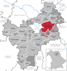
Eckersdorf
- municipality in Landkreis Bayreuth in Germany
Hiking in Eckersdorf
Eckersdorf is a picturesque town located in Bavaria, Germany, near the larger city of Bayreuth. The region around Eckersdorf offers a variety of hiking opportunities for both beginners and seasoned hikers, making it a great place to explore nature....
- Country:
- Postal Code: 95488
- Local Dialing Code: 0921
- Licence Plate Code: BT
- Coordinates: 49° 55' 58" N, 11° 30' 4" E
- GPS tracks (wikiloc): [Link]
- AboveSeaLevel: 416 м m
- Area: 36.17 sq km
- Population: 4773
- Web site: [Link]


Aufseß
- municipality in Landkreis Bayreuth in Germany
Hiking in Aufseß
Aufseß is a small municipality located in Bavaria, Germany, surrounded by beautiful landscapes that offer a plethora of hiking opportunities. The region features a combination of scenic trails through lush forests, rolling hills, and picturesque countryside, making it an attractive destination for hiking enthusiasts....
- Country:
- Postal Code: 91347
- Local Dialing Code: 09274; 09204; 09198
- Licence Plate Code: BT
- Coordinates: 49° 54' 0" N, 11° 13' 0" E
- GPS tracks (wikiloc): [Link]
- AboveSeaLevel: 414 м m
- Area: 29.41 sq km
- Population: 1343
- Web site: [Link]


Haag
- municipality in Landkreis Bayreuth in Germany
Hiking in Haag
Haag in Upper Franconia is a charming area known for its scenic landscapes and outdoor activities, including hiking. The region is characterized by its rolling hills, lush forests, and picturesque villages, making it an appealing destination for nature lovers and hikers....
- Country:
- Postal Code: 95473
- Local Dialing Code: 09201
- Licence Plate Code: BT
- Coordinates: 49° 52' 11" N, 11° 33' 45" E
- GPS tracks (wikiloc): [Link]
- AboveSeaLevel: 485 м m
- Area: 13.29 sq km
- Population: 952
- Web site: [Link]


Gesees
- municipality in Landkreis Bayreuth in Germany
Hiking in Gesees
Gesees, a small village located in the municipality of Pullenreuth in Bavaria, Germany, is nestled amidst picturesque landscapes that make it a lovely destination for hiking enthusiasts. The surrounding region boasts a mix of lush forests, rolling hills, and charming countryside, making it a great spot for outdoor activities....
- Country:
- Postal Code: 95494
- Local Dialing Code: 09201
- Licence Plate Code: BT
- Coordinates: 49° 53' 58" N, 11° 32' 16" E
- GPS tracks (wikiloc): [Link]
- AboveSeaLevel: 450 м m
- Area: 9.90 sq km
- Population: 989
- Web site: [Link]

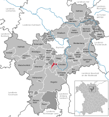
Mistelbach
- municipality in Landkreis Bayreuth in Germany
Hiking in Mistelbach
Mistelbach, situated in Bavaria, Germany, offers picturesque hiking opportunities for nature enthusiasts at all levels. The region is known for its stunning landscapes, charming villages, and well-marked trails that lead through forests, fields, and along rivers....
- Country:
- Postal Code: 95511
- Local Dialing Code: 09201
- Licence Plate Code: BT
- Coordinates: 49° 55' 0" N, 11° 31' 0" E
- GPS tracks (wikiloc): [Link]
- AboveSeaLevel: 408 м m
- Area: 6.12 sq km
- Population: 1593
- Web site: [Link]

Weidenberg
- municipality in Landkreis Bayreuth in Germany
Hiking in Weidenberg
Weidenberg is a charming village located in Bavaria, Germany, and offers a variety of outdoor activities, including hiking. The area is characterized by picturesque landscapes, lush forests, and rolling hills, making it an excellent destination for hikers of all levels....
- Country:
- Postal Code: 95466
- Local Dialing Code: 09278; 0921; 09209
- Licence Plate Code: BT
- Coordinates: 49° 56' 32" N, 11° 43' 13" E
- GPS tracks (wikiloc): [Link]
- AboveSeaLevel: 439 м m
- Area: 68.91 sq km
- Population: 5995
- Web site: [Link]


Glashütten
- municipality in Landkreis Bayreuth in Germany
Hiking in Glashütten
Glashütten, located in Bavaria, Germany, is a charming destination for hiking enthusiasts. Nestled in the picturesque landscape of the Franconian Forest, it offers a range of trails suitable for various skill levels. Here are some key points about hiking in the area:...
- Country:
- Postal Code: 95496
- Local Dialing Code: 09279
- Licence Plate Code: BT
- Coordinates: 49° 53' 20" N, 11° 26' 55" E
- GPS tracks (wikiloc): [Link]
- AboveSeaLevel: 421 м m
- Area: 3.53 sq km
- Population: 1412
- Web site: [Link]
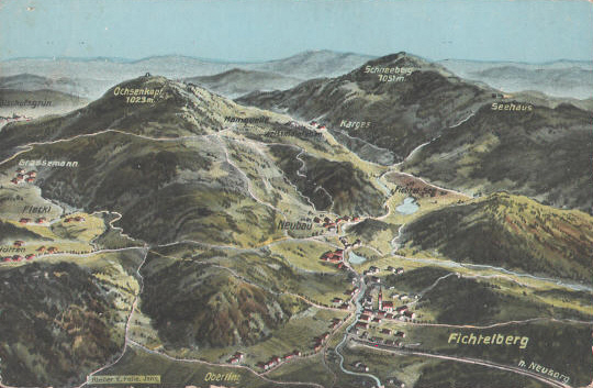

Fichtelberg
- municipality in Landkreis Bayreuth in Germany
Hiking in Fichtelberg
Fichtelberg, located in Bavaria, is a beautiful destination for hiking enthusiasts. It is situated in the Fichtel Mountains, an area known for its stunning landscapes, dense forests, and unique rock formations. Here are some highlights and tips for hiking in the Fichtelberg region:...
- Country:
- Postal Code: 95686
- Local Dialing Code: 09272
- Licence Plate Code: BT
- Coordinates: 49° 59' 58" N, 11° 51' 5" E
- GPS tracks (wikiloc): [Link]
- AboveSeaLevel: 685 м m
- Area: 5.17 sq km
- Population: 2192
- Web site: [Link]
Fichtelberg
- unincorporated area in Germany
Hiking in Fichtelberg
Gemeindefreies Gebiet Fichtelberg, located in Germany, is a unique and picturesque area known for its natural beauty and diverse hiking opportunities. The region encompasses parts of the Fichtel Mountains, which are characterized by their stunning landscapes, dense forests, and rocky outcrops....
- Country:
- Coordinates: 49° 59' 0" N, 11° 49' 0" E
- GPS tracks (wikiloc): [Link]
Forst Neustädtlein am Forst
- unincorporated area in Germany
Hiking in Forst Neustädtlein am Forst
Forst Neustädtlein am Forst is a picturesque area that offers a variety of hiking opportunities, with trails suitable for different skill levels. Here are some key highlights for hiking in this region:...
- Country:
- Coordinates: 49° 58' 0" N, 11° 28' 0" E
- GPS tracks (wikiloc): [Link]

Glashüttener Forst
- unincorporated area in in Germany
Hiking in Glashüttener Forst
Glashüttener Forst, located in the picturesque region of Hesse, Germany, is a fantastic destination for hiking enthusiasts. The area is characterized by its dense forests, rolling hills, and diverse flora and fauna, making it a perfect spot for outdoor activities....
- Country:
- Coordinates: 49° 52' 0" N, 11° 27' 0" E
- GPS tracks (wikiloc): [Link]
Waidacher Forst
- unincorporated area in Germany
Hiking in Waidacher Forst
Waidacher Forst is a beautiful forest area that offers a range of hiking opportunities, suitable for various skill levels. It's located in the Austrian region of Tyrol, which is known for its stunning natural landscapes. Here are some key details about hiking in Waidacher Forst:...
- Country:
- Coordinates: 49° 43' 0" N, 11° 24' 0" E
- GPS tracks (wikiloc): [Link]
Warmensteinacher Forst-Nord
- unincorporated area in Germany
Hiking in Warmensteinacher Forst-Nord
Warmensteinacher Forst-Nord is a beautiful area in Germany, known for its diverse landscape and rich flora and fauna. It’s part of the larger Franconian Forest region, which offers a variety of hiking opportunities suitable for different skill levels. Here are some key points to consider when planning a hike in this area:...
- Country:
- Coordinates: 50° 0' 0" N, 11° 46' 0" E
- GPS tracks (wikiloc): [Link]
Shares border with regions:
Tirschenreuth
- district of Bavaria, Germany
Hiking in Tirschenreuth
Tirschenreuth is a district in Bavaria, Germany, known for its picturesque landscapes, forests, and numerous hiking trails. If you're planning to hike in this district, here's what you need to know:...
- Country:
- Capital: Tirschenreuth
- Licence Plate Code: TIR; KEM
- Coordinates: 49° 54' 0" N, 12° 12' 0" E
- GPS tracks (wikiloc): [Link]
- AboveSeaLevel: 499 м m
- Area: 1085.08 sq km
- Population: 77865
- Web site: [Link]

Neustadt an der Waldnaab
- district of Bavaria, Germany
Hiking in Neustadt an der Waldnaab
Neustadt an der Waldnaab, located in the Upper Palatinate region of Bavaria, Germany, is known for its picturesque scenery and natural beauty, making it an excellent destination for hiking enthusiasts. Here are some highlights and insights into hiking in this area:...
- Country:
- Capital: Neustadt an der Waldnaab
- Licence Plate Code: VOH; NEW; ESB
- Coordinates: 49° 40' 12" N, 12° 0' 0" E
- GPS tracks (wikiloc): [Link]
- AboveSeaLevel: 450 м m
- Area: 1430.00 sq km
- Population: 94486
- Web site: [Link]
Amberg-Sulzbach
- district of Bavaria, Germany
Hiking in Amberg-Sulzbach
Amberg-Sulzbach, located in Bavaria, Germany, is a picturesque district known for its beautiful landscapes, rich culture, and numerous outdoor activities, including hiking. The area offers a variety of hiking trails that cater to different skill levels, from easy walks suitable for families to more challenging paths for experienced hikers....
- Country:
- Capital: Amberg
- Licence Plate Code: SUL; NAB; ESB; BUL; AS
- Coordinates: 49° 30' 0" N, 11° 45' 0" E
- GPS tracks (wikiloc): [Link]
- AboveSeaLevel: 380 м m
- Area: 1255.00 sq km
- Population: 94617
- Web site: [Link]

Hof
- district in Bavaria, Germany
Hiking in Hof
Hof is a district located in Bavaria, Germany, known for its scenic landscapes, charming towns, and outdoor recreational opportunities. The region offers various hiking trails that cater to different skill levels, making it a great destination for both beginners and experienced hikers....
- Country:
- Capital: Hof
- Licence Plate Code: SAN; REH; NAI; MÜB; HO
- Coordinates: 50° 15' 0" N, 11° 49' 48" E
- GPS tracks (wikiloc): [Link]
- AboveSeaLevel: 581 м m
- Area: 893.00 sq km
- Population: 105628
- Web site: [Link]

Wunsiedel
- district of Bavaria, Germany
Hiking in Wunsiedel
Wunsiedel is a picturesque district located in the Upper Franconia region of Bavaria, Germany. It's renowned for its beautiful landscapes, rich history, and a variety of hiking trails suitable for different skill levels. Here are some highlights of hiking in Wunsiedel:...
- Country:
- Licence Plate Code: SEL; REH; MAK; WUN
- Coordinates: 50° 5' 24" N, 12° 2' 24" E
- GPS tracks (wikiloc): [Link]
- AboveSeaLevel: 558 м m
- Area: 606.40 sq km
- Population: 87941
- Web site: [Link]

Kulmbach
- district in Bavaria, Germany
Hiking in Kulmbach
Kulmbach district, located in Bavaria, Germany, offers a variety of hiking opportunities that showcase the region’s scenic beauty, rich history, and diverse landscapes. Here are some highlights and tips for hiking in Kulmbach:...
- Country:
- Capital: Kulmbach
- Licence Plate Code: SAN; KU; EBS
- Coordinates: 50° 5' 12" N, 11° 23' 50" E
- GPS tracks (wikiloc): [Link]
- AboveSeaLevel: 391 м m
- Area: 656.00 sq km
- Population: 73055
- Web site: [Link]

Lichtenfels
- district in Bavaria, Germany
Hiking in Lichtenfels
Lichtenfels is a district in Bavaria, Germany, known for its picturesque landscapes and scenic hiking trails. Nestled in the heart of the Franconian region, it offers a variety of hiking opportunities suitable for different skill levels and preferences. Here are some key points about hiking in Lichtenfels:...
- Country:
- Capital: Lichtenfels
- Licence Plate Code: STE; LIF
- Coordinates: 50° 6' 36" N, 11° 7' 12" E
- GPS tracks (wikiloc): [Link]
- AboveSeaLevel: 422 м m
- Area: 552.00 sq km
- Population: 65602
- Web site: [Link]
Bamberg
- district in Bavaria, Germany
Hiking in Bamberg
Bamberg district, located in Bavaria, Germany, offers a variety of scenic hiking opportunities amidst its charming landscapes, historical sites, and cultural attractions. Here’s an overview of what you can expect when hiking in the region:...
- Country:
- Capital: Bamberg
- Licence Plate Code: BA
- Coordinates: 49° 49' 48" N, 10° 49' 48" E
- GPS tracks (wikiloc): [Link]
- AboveSeaLevel: 275 м m
- Area: 1168.00 sq km
- Population: 119829
- Web site: [Link]

Forchheim
- district in Bavaria, Germany
Hiking in Forchheim
Forchheim, located in Bavaria, Germany, is a charming district known for its picturesque landscapes, historical sites, and access to various hiking trails. Here’s an overview of what you can expect when hiking in this region:...
- Country:
- Licence Plate Code: PEG; FO; EBS
- Coordinates: 49° 45' 0" N, 11° 5' 0" E
- GPS tracks (wikiloc): [Link]
- AboveSeaLevel: 377 м m
- Area: 643.00 sq km
- Population: 97433
- Web site: [Link]
Nürnberger Land
- district in Bavaria, Germany
Hiking in Nürnberger Land
Nürnberger Land, located in Bavaria, Germany, is a fantastic area for hiking enthusiasts. It features a diverse landscape that includes forests, hills, and picturesque valleys, making it ideal for both casual walkers and seasoned hikers. Here are some key points about hiking in Nürnberger Land:...
- Country:
- Capital: Lauf an der Pegnitz
- Licence Plate Code: PEG; N; LAU; HEB; ESB
- Coordinates: 49° 30' 0" N, 11° 22' 0" E
- GPS tracks (wikiloc): [Link]
- AboveSeaLevel: 355 м m
- Area: 800.00 sq km
- Population: 149127
- Web site: [Link]

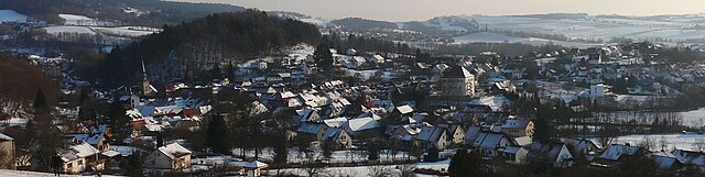
Bayreuth
- town in Bavaria, Germany
Hiking in Bayreuth
Bayreuth, located in Bavaria, Germany, offers a variety of hiking opportunities suitable for different skill levels, with scenic landscapes rich in history and natural beauty. Here are some highlights and recommendations for hiking in the Bayreuth area:...
- Country:
- Postal Code: 95401–95448
- Local Dialing Code: 9209; 9201; 921
- Licence Plate Code: BT
- Coordinates: 49° 56' 53" N, 11° 34' 42" E
- GPS tracks (wikiloc): [Link]
- AboveSeaLevel: 344 м m
- Area: 66.92 sq km
- Population: 71572
- Web site: [Link]