Fresnois-la-Montagne (Fresnois-la-Montagne)

- commune in Meurthe-et-Moselle, France
- Country:

- Postal Code: 54260
- Coordinates: 49° 29' 40" N, 5° 38' 45" E


- GPS tracks (wikiloc): [Link]
- Area: 8.59 sq km
- Population: 412
- Web site: http://www.fresnois.fr
- Wikipedia en: wiki(en)
- Wikipedia: wiki(fr)
- Wikidata storage: Wikidata: Q1062207
- Wikipedia Commons Category: [Link]
- Freebase ID: [/m/03qdhj8]
- Freebase ID: [/m/03qdhj8]
- Freebase ID: [/m/03qdhj8]
- GeoNames ID: Alt: [6436618]
- GeoNames ID: Alt: [6436618]
- GeoNames ID: Alt: [6436618]
- SIREN number: [215402124]
- SIREN number: [215402124]
- SIREN number: [215402124]
- BnF ID: [15264281s]
- BnF ID: [15264281s]
- BnF ID: [15264281s]
- INSEE municipality code: 54212
- INSEE municipality code: 54212
- INSEE municipality code: 54212
Shares border with regions:


Cons-la-Grandville
- commune in Meurthe-et-Moselle, France
- Country:
- Postal Code: 54870
- Coordinates: 49° 29' 3" N, 5° 42' 4" E
- GPS tracks (wikiloc): [Link]
- Area: 8.25 sq km
- Population: 544

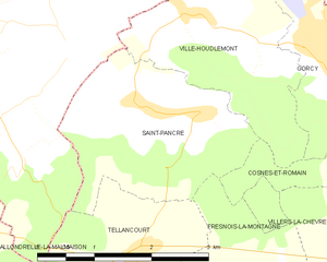
Saint-Pancré
- commune in Meurthe-et-Moselle, France
- Country:
- Postal Code: 54730
- Coordinates: 49° 31' 45" N, 5° 38' 54" E
- GPS tracks (wikiloc): [Link]
- Area: 6.13 sq km
- Population: 325


Viviers-sur-Chiers
- commune in Meurthe-et-Moselle, France
- Country:
- Postal Code: 54260
- Coordinates: 49° 28' 23" N, 5° 38' 1" E
- GPS tracks (wikiloc): [Link]
- Area: 16.24 sq km
- Population: 640

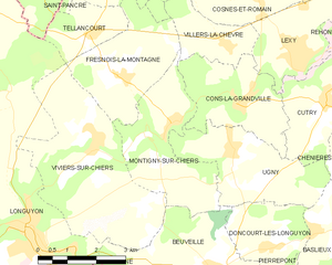
Montigny-sur-Chiers
- commune in Meurthe-et-Moselle, France
- Country:
- Postal Code: 54870
- Coordinates: 49° 28' 47" N, 5° 40' 9" E
- GPS tracks (wikiloc): [Link]
- Area: 9.36 sq km
- Population: 499


Villers-la-Chèvre
- commune in Meurthe-et-Moselle, France
- Country:
- Postal Code: 54870
- Coordinates: 49° 30' 16" N, 5° 41' 37" E
- GPS tracks (wikiloc): [Link]
- Area: 4.02 sq km
- Population: 568


Tellancourt
- commune in Meurthe-et-Moselle, France
- Country:
- Postal Code: 54260
- Coordinates: 49° 30' 29" N, 5° 38' 0" E
- GPS tracks (wikiloc): [Link]
- Area: 3.76 sq km
- Population: 551


Cosnes-et-Romain
- commune in Meurthe-et-Moselle, France
- Country:
- Postal Code: 54400
- Coordinates: 49° 31' 9" N, 5° 42' 40" E
- GPS tracks (wikiloc): [Link]
- Area: 16.23 sq km
- Population: 2652
- Web site: [Link]