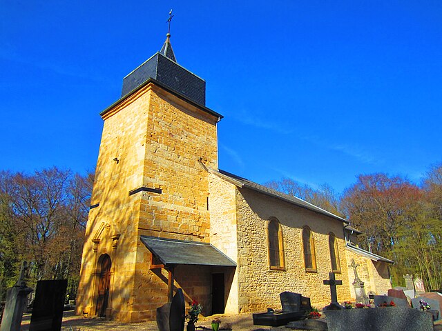
Saint-Pancré (Saint-Pancré)

- commune in Meurthe-et-Moselle, France
- Country:

- Postal Code: 54730
- Coordinates: 49° 31' 45" N, 5° 38' 54" E


- GPS tracks (wikiloc): [Link]
- Area: 6.13 sq km
- Population: 325
- Wikipedia en: wiki(en)
- Wikipedia: wiki(fr)
- Wikidata storage: Wikidata: Q1049422
- Wikipedia Commons Category: [Link]
- Freebase ID: [/m/03qdmz0]
- Freebase ID: [/m/03qdmz0]
- Freebase ID: [/m/03qdmz0]
- SIREN number: [215404856]
- SIREN number: [215404856]
- SIREN number: [215404856]
- BnF ID: [152645521]
- BnF ID: [152645521]
- BnF ID: [152645521]
- VIAF ID: Alt: [287802240]
- VIAF ID: Alt: [287802240]
- VIAF ID: Alt: [287802240]
- INSEE municipality code: 54485
- INSEE municipality code: 54485
- INSEE municipality code: 54485
Shares border with regions:


Fresnois-la-Montagne
- commune in Meurthe-et-Moselle, France
- Country:
- Postal Code: 54260
- Coordinates: 49° 29' 40" N, 5° 38' 45" E
- GPS tracks (wikiloc): [Link]
- Area: 8.59 sq km
- Population: 412
- Web site: [Link]
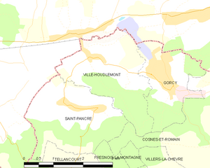
Ville-Houdlémont
- commune in Meurthe-et-Moselle, France
- Country:
- Postal Code: 54730
- Coordinates: 49° 32' 40" N, 5° 38' 54" E
- GPS tracks (wikiloc): [Link]
- Area: 6.09 sq km
- Population: 658


Tellancourt
- commune in Meurthe-et-Moselle, France
- Country:
- Postal Code: 54260
- Coordinates: 49° 30' 29" N, 5° 38' 0" E
- GPS tracks (wikiloc): [Link]
- Area: 3.76 sq km
- Population: 551


Cosnes-et-Romain
- commune in Meurthe-et-Moselle, France
- Country:
- Postal Code: 54400
- Coordinates: 49° 31' 9" N, 5° 42' 40" E
- GPS tracks (wikiloc): [Link]
- Area: 16.23 sq km
- Population: 2652
- Web site: [Link]