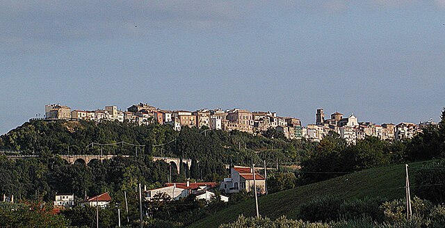
Frisa (Frisa)
.svg)
- Italian comune
 Hiking in Frisa
Frisa, a small town located in the Abruzzo region of Italy, is surrounded by the beautiful landscapes of the Apennine Mountains and offers a variety of hiking opportunities. Although Frisa itself may not be as widely known for hiking as some of the larger destinations, the surrounding areas boast numerous trails that cater to different skill levels.
Hiking Opportunities around Frisa:
-
Scenic Trails: Many trails around Frisa take you through lush forests, vineyards, and olive groves, providing a charming view of the Abruzzo countryside. The trails tend to be well-marked and offer varying degrees of difficulty.
-
Monti della Laga National Park: Just a short drive from Frisa, this national park features rugged terrain and breathtaking vistas. Hikers can enjoy a variety of trails that showcase the region's diverse flora and fauna. Popular routes may lead to waterfalls, panoramic viewpoints, and unique geological formations.
-
Gran Sasso and Monti della Laga National Park: This park, slightly further afield, is one of Italy’s most prominent national parks. It houses the Gran Sasso mountain range, which offers challenging hikes, including routes to Corno Grande, the highest peak in the Apennines.
-
Local Recommendations: If you’re keen on exploring less-traveled paths, consider asking locals for their favorite hikes. The community can often direct you to hidden gems that are not marked on standard hiking maps.
Tips for Hiking in Frisa:
-
Seasonal Conditions: Spring and early autumn are generally the best times for hiking in Abruzzo, as the weather is mild, and the trails are most accessible.
-
Trail Maps: It’s advisable to carry a physical map or GPS device since mobile service may be unreliable in remote areas.
-
Gear: Ensure you have proper hiking boots, weather-appropriate clothing, and enough water and snacks for your hike.
-
Safety First: Always let someone know about your hiking plans and expected return time, especially if hiking alone.
-
Respect Nature: Follow Leave No Trace principles to preserve the natural beauty of the area.
Exploring the hiking trails around Frisa can be a rewarding experience, combining physical activity with the opportunity to immerse yourself in the stunning natural environments of Italy's Abruzzo region.
- Country:

- Postal Code: 66030
- Local Dialing Code: 0872
- Licence Plate Code: CH
- Coordinates: 42° 16' 0" N, 14° 22' 0" E


- GPS tracks (wikiloc): [Link]
- AboveSeaLevel: 237 м m
- Area: 11.49 sq km
- Population: 1737
- Web site: http://www.comune.frisa.ch.it/
- Wikipedia en: wiki(en)
- Wikipedia: wiki(it)
- Wikidata storage: Wikidata: Q51228
- Wikipedia Commons Category: [Link]
- Freebase ID: [/m/0fg2ft]
- GeoNames ID: Alt: [6541227]
- VIAF ID: Alt: [233917238]
- OSM relation ID: [41906]
- ISTAT ID: 069037
- Italian cadastre code: D803
Shares border with regions:


Crecchio
- Italian comune
Hiking in Crecchio
Crecchio is a charming village located in the Abruzzo region of Italy, known for its rich history and picturesque landscapes. While it may not be as widely recognized as some other hiking destinations in Italy, it offers several opportunities for outdoor enthusiasts to explore the beautiful countryside....
- Country:
- Postal Code: 66014
- Local Dialing Code: 0871
- Licence Plate Code: CH
- Coordinates: 42° 17' 48" N, 14° 19' 34" E
- GPS tracks (wikiloc): [Link]
- AboveSeaLevel: 208 м m
- Area: 19.23 sq km
- Population: 2842
- Web site: [Link]


Ortona
- town and municipality in the Province of Chieti, Italy
Hiking in Ortona
Ortona, a charming coastal town in the Abruzzo region of Italy, offers several opportunities for hiking enthusiasts to explore its beautiful landscapes, historical sites, and natural wonders. While Ortona itself is known for its beaches and medieval architecture, the surrounding areas provide a range of hiking trails that cater to various skill levels....
- Country:
- Postal Code: 66026
- Local Dialing Code: 085
- Licence Plate Code: CH
- Coordinates: 42° 21' 20" N, 14° 24' 13" E
- GPS tracks (wikiloc): [Link]
- AboveSeaLevel: 72 м m
- Area: 70.88 sq km
- Population: 23111
- Web site: [Link]
Poggiofiorito
- Italian comune
Hiking in Poggiofiorito
Poggiofiorito is a charming village located in the Abruzzo region of Italy, known for its stunning landscapes and rural charm. While it may not be as internationally recognized as some other hiking destinations in Italy, it offers scenic trails and beautiful nature, making it an appealing choice for those looking to explore off the beaten path....
- Country:
- Postal Code: 66030
- Local Dialing Code: 0871
- Licence Plate Code: CH
- Coordinates: 42° 15' 0" N, 14° 19' 0" E
- GPS tracks (wikiloc): [Link]
- AboveSeaLevel: 299 м m
- Area: 9.95 sq km
- Population: 861
- Web site: [Link]

San Vito Chietino
- Italian comune
Hiking in San Vito Chietino
San Vito Chietino, located in the Abruzzo region of Italy, is a charming coastal town known for its beautiful landscapes, historical sites, and access to the stunning Adriatic Sea. Hiking in this area offers a range of experiences, from coastal trails to inland paths that lead through picturesque villages and natural parks. Here are some highlights of hiking in and around San Vito Chietino:...
- Country:
- Postal Code: 66038
- Local Dialing Code: 0872
- Licence Plate Code: CH
- Coordinates: 42° 18' 0" N, 14° 27' 0" E
- GPS tracks (wikiloc): [Link]
- AboveSeaLevel: 122 м m
- Area: 17 sq km
- Population: 5270
- Web site: [Link]


Lanciano
- Italian comune
Hiking in Lanciano
Lanciano is a charming city in the Abruzzo region of Italy, known for its rich history, beautiful landscapes, and proximity to natural parks, making it a great starting point for hiking enthusiasts....
- Country:
- Postal Code: 66034
- Local Dialing Code: 0872
- Licence Plate Code: CH
- Coordinates: 42° 13' 52" N, 14° 23' 26" E
- GPS tracks (wikiloc): [Link]
- AboveSeaLevel: 265 м m
- Area: 66.94 sq km
- Population: 35002
- Web site: [Link]