Galzignano Terme (Galzignano Terme)
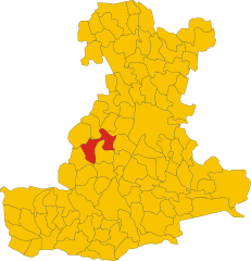
- Italian comune
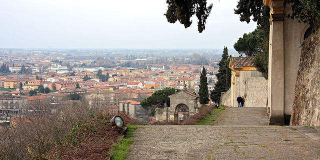
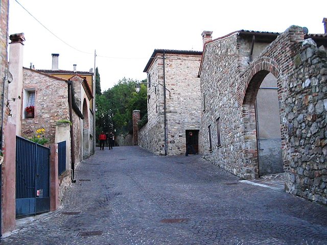
Galzignano Terme is a picturesque town located in the Euganean Hills in the Veneto region of Italy. Known for its thermal baths and beautiful landscapes, the area offers a variety of hiking opportunities for outdoor enthusiasts.
Hiking Trails
-
Euganean Hills Regional Park: This park surrounds Galzignano Terme and is home to numerous trails ranging from easy walks to more challenging hikes. The park is characterized by rolling hills, vineyards, and ancient volcanic formations.
-
Monte della Madonna: This is a popular hiking destination that provides a moderate hike with stunning views from the summit. The trail offers a mixture of forest paths and open areas, making it a great spot for enjoying nature.
-
Sentiero del Buso: A fabulous trail that takes you through scenic areas and offers access to viewpoints overlooking the surrounding vineyards and hills. This route is suitable for families and less experienced hikers.
-
Trail to Monte Calbarina: This hike leads to one of the highest peaks in the Euganean Hills, providing more rigorous terrain and rewarding panoramic views. It is ideal for those looking for a more challenging hike.
Best Time for Hiking
The best times to hike in Galzignano Terme are during spring (April to June) and autumn (September to October), when the weather is mild, and the flora is at its most vibrant. Summers can be hot, while winter months may present challenging conditions due to rain and snow.
What to Bring
- Proper Footwear: Sturdy hiking boots are recommended for the varied terrain.
- Water: Hydrate regularly, especially on warmer days.
- Snacks: Light snacks are great for energy during your hike.
- Map or GPS Device: While trails are marked, having a map or device can help with navigation.
- Sun Protection: Sunglasses and sunscreen are advisable during sunny days.
Local Amenities
Galzignano Terme is well-equipped with accommodations, restaurants, and wellness centers due to its reputation as a spa destination. After a day of hiking, you might enjoy relaxing in one of the local thermal baths to soothe your muscles.
Conclusion
Hiking in Galzignano Terme offers a unique blend of natural beauty, cultural heritage, and wellness experiences. Whether you're seeking a leisurely stroll or a more demanding hike, the region is an excellent option for outdoor adventurers. Don't forget to respect local regulations and preserve the natural environment while enjoying your hikes!
- Country:

- Postal Code: 35030
- Local Dialing Code: 049
- Licence Plate Code: PD
- Coordinates: 45° 18' 29" N, 11° 43' 53" E


- GPS tracks (wikiloc): [Link]
- AboveSeaLevel: 22 м m
- Area: 18.2 sq km
- Population: 4321
- Web site: http://www.galzignanoterme.org
- Wikipedia en: wiki(en)
- Wikipedia: wiki(it)
- Wikidata storage: Wikidata: Q34447
- Wikipedia Commons Category: [Link]
- Freebase ID: [/m/0gk4gc]
- GeoNames ID: Alt: [6542171]
- VIAF ID: Alt: [263379750]
- OSM relation ID: [44631]
- GND ID: Alt: [7650094-9]
- Library of Congress authority ID: Alt: [n2004037767]
- UN/LOCODE: [ITGZT]
- ISTAT ID: 028040
- Italian cadastre code: D889
Shares border with regions:
Baone
- Italian comune
Baone, located in the Veneto region of Italy, is known for its beautiful landscapes and numerous hiking opportunities. The surrounding hills and countryside provide a serene backdrop for both casual and more experienced hikers. Here are some highlights and important information about hiking in Baone:...
- Country:

- Postal Code: 35030
- Local Dialing Code: 0429
- Licence Plate Code: PD
- Coordinates: 45° 15' 0" N, 11° 41' 0" E


- GPS tracks (wikiloc): [Link]
- AboveSeaLevel: 17 м m
- Area: 24.42 sq km
- Population: 3080
- Web site: [Link]


Montegrotto Terme
- Italian comune
Montegrotto Terme, located in the Veneto region of Italy, is well-known for its thermal baths and beautiful natural surroundings, making it a great location for hiking enthusiasts. It is situated at the foot of the Colli Euganei Regional Park, which offers a variety of hiking trails suitable for different skill levels....
- Country:

- Postal Code: 35036
- Local Dialing Code: 049
- Licence Plate Code: PD
- Coordinates: 45° 20' 0" N, 11° 47' 0" E


- GPS tracks (wikiloc): [Link]
- AboveSeaLevel: 11 м m
- Area: 15.37 sq km
- Population: 11448
- Web site: [Link]


Teolo
- Italian comune
Teolo is a charming town located in the Veneto region of Italy, situated near the Euganean Hills, which are known for their beautiful landscapes, rich history, and diverse flora and fauna. Hiking in Teolo offers a variety of trails and paths that cater to different skill levels and preferences....
- Country:

- Postal Code: 35037
- Local Dialing Code: 049
- Licence Plate Code: PD
- Coordinates: 45° 21' 0" N, 11° 40' 0" E


- GPS tracks (wikiloc): [Link]
- AboveSeaLevel: 175 м m
- Area: 31.2 sq km
- Population: 9014
- Web site: [Link]
Cinto Euganeo
- Italian comune
Cinto Euganeo, located in the Colli Euganei Regional Park in Italy, is a delightful destination for hiking enthusiasts. Known for its picturesque landscapes, rolling hills, and lush vegetation, this area offers a variety of trails that cater to different skill levels....
- Country:

- Postal Code: 35030
- Local Dialing Code: 0429
- Licence Plate Code: PD
- Coordinates: 45° 17' 0" N, 11° 40' 0" E


- GPS tracks (wikiloc): [Link]
- AboveSeaLevel: 35 м m
- Area: 19.76 sq km
- Population: 1973
- Web site: [Link]


Vò
- Italian commune
Vò, located in the Veneto region of Italy, offers several hiking opportunities amidst beautiful landscapes and historical sites. The area is known for its rolling hills, vineyards, and charming countryside....
- Country:

- Postal Code: 35030
- Local Dialing Code: 049
- Licence Plate Code: PD
- Coordinates: 45° 20' 0" N, 11° 38' 0" E


- GPS tracks (wikiloc): [Link]
- AboveSeaLevel: 19 м m
- Area: 20.37 sq km
- Population: 3341
- Web site: [Link]


Monselice
- Italian comune
Monselice, located in the Veneto region of Italy, is a charming town that offers a variety of hiking opportunities, particularly in the surrounding Euganean Hills (Colli Euganei). The area is known for its beautiful landscapes, historical sites, and diverse flora and fauna....
- Country:

- Postal Code: 35043
- Local Dialing Code: 0429
- Licence Plate Code: PD
- Coordinates: 45° 14' 0" N, 11° 45' 0" E


- GPS tracks (wikiloc): [Link]
- AboveSeaLevel: 9 м m
- Area: 50.57 sq km
- Population: 17572
- Web site: [Link]


Arquà Petrarca
- Italian comune
Arquà Petrarca is a charming village located in the Euganean Hills of Italy, rich in history and natural beauty, making it an excellent destination for hiking enthusiasts. This picturesque area offers a variety of well-marked trails that allow hikers to explore its stunning landscapes, vineyards, and cultural heritage....
- Country:

- Postal Code: 35032
- Local Dialing Code: 0429
- Licence Plate Code: PD
- Coordinates: 45° 16' 0" N, 11° 43' 0" E


- GPS tracks (wikiloc): [Link]
- AboveSeaLevel: 80 м m
- Area: 12.52 sq km
- Population: 1837
- Web site: [Link]


Battaglia Terme
- Italian comune
Battaglia Terme is a picturesque town in the Province of Padua, Italy, known for its natural hot springs and beautiful landscapes. While it might not be as famous for hiking as some other areas in Italy, it offers a variety of outdoor activities, including hiking, especially through its nearby natural parks and the surrounding countryside....
- Country:

- Postal Code: 35041
- Local Dialing Code: 049
- Licence Plate Code: PD
- Coordinates: 45° 17' 22" N, 11° 46' 47" E


- GPS tracks (wikiloc): [Link]
- AboveSeaLevel: 11 м m
- Area: 6.23 sq km
- Population: 3838
- Web site: [Link]


Torreglia
- Italian comune
Torreglia is a picturesque town located in the Euganean Hills Regional Park in the Veneto region of Italy. It's a great destination for hiking enthusiasts due to its beautiful landscapes, diverse flora and fauna, and historical sites....
- Country:

- Postal Code: 35038
- Local Dialing Code: 049
- Licence Plate Code: PD
- Coordinates: 45° 20' 0" N, 11° 44' 0" E


- GPS tracks (wikiloc): [Link]
- AboveSeaLevel: 23 м m
- Area: 18.85 sq km
- Population: 6119
- Web site: [Link]

