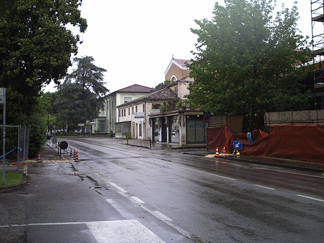
Teolo (Teolo)
.svg)
- Italian comune
 Hiking in Teolo
Teolo is a charming town located in the Veneto region of Italy, situated near the Euganean Hills, which are known for their beautiful landscapes, rich history, and diverse flora and fauna. Hiking in Teolo offers a variety of trails and paths that cater to different skill levels and preferences.
Key Highlights for Hiking in Teolo:
-
Euganean Hills Regional Park: The park is a stunning area with numerous hiking trails. The terrain features rolling hills, woodlands, and panoramic viewpoints. Some well-marked paths make it accessible for both beginners and experienced hikers.
-
Scenic Views: Many trails in the area lead to viewpoints where hikers can enjoy breathtaking vistas of the surrounding hills, vineyards, and even the city of Padua on clear days.
-
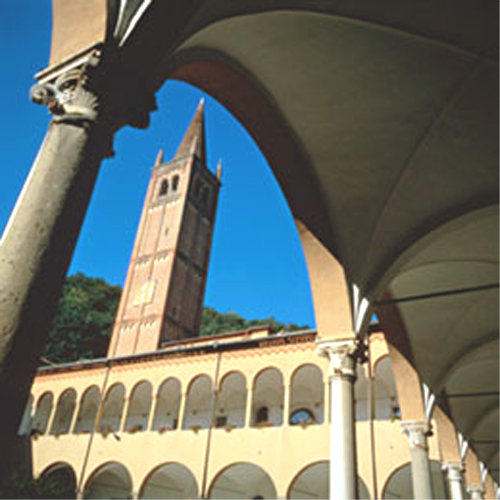
Historical Sites: While hiking in Teolo, you may encounter ancient ruins, churches, and castles. The area is rich in history, and a hike could include stops at places like the remains of the medieval Castle of Ezzelino or the beautiful Abbey of Praglia.
-
Flora and Fauna: The Euganean Hills are home to diverse plant species and wildlife. Birdwatchers and nature enthusiasts will particularly enjoy the variety of ecosystems found in the park.
-
Local Cuisine: After a day of hiking, you can indulge in the local cuisine at nearby trattorias and osterias, featuring traditional Veneto dishes and local wines.
-
Seasonal Considerations: Spring and autumn are ideal for hiking in Teolo, with mild temperatures and colorful landscapes. Summer can be hot, while winter may bring snow in the higher elevations, creating a different hiking experience.
Popular Hiking Routes:
- Monte della Madonna: A rewarding hike that leads to a mountaintop view and is adorned with a shrine.
- Vigodarzere to Teolo: A longer route that offers varied scenery and takes you through both rural and forested areas.
Tips for Hiking in Teolo:
- Wear Appropriate Gear: Good hiking boots and weather-appropriate clothing are essential.
- Stay Hydrated: Carry enough water, especially during summer hikes.
- Navigation: Bring a map or GPS device, as some trails can be less marked.
- Respect Nature: Stay on marked trails to preserve the local ecosystem.
Hiking in Teolo is a great way to immerse yourself in the natural beauty of the Euganean Hills while enjoying the peaceful atmosphere of this picturesque Italian town. Make sure to plan ahead to get the most out of your experience!
- Country:

- Postal Code: 35037
- Local Dialing Code: 049
- Licence Plate Code: PD
- Coordinates: 45° 21' 0" N, 11° 40' 0" E


- GPS tracks (wikiloc): [Link]
- AboveSeaLevel: 175 м m
- Area: 31.2 sq km
- Population: 9014
- Web site: http://www.comune.teolo.pd.it
- Wikipedia en: wiki(en)
- Wikipedia: wiki(it)
- Wikidata storage: Wikidata: Q34455
- Wikipedia Commons Gallery: [Link]
- Wikipedia Commons Category: [Link]
- Freebase ID: [/m/0gk5q0]
- GeoNames ID: Alt: [6536293]
- VIAF ID: Alt: [249378622]
- OSM relation ID: [44706]
- UN/LOCODE: [ITTLL]
- ISTAT ID: 028089
- Italian cadastre code: L100
Shares border with regions:
Cervarese Santa Croce
- Italian comune
Hiking in Cervarese Santa Croce
Cervarese Santa Croce is a charming municipality in the province of Padua, Italy, nestled at the foot of the Euganean Hills. This area offers a variety of hiking opportunities, set against a backdrop of beautiful landscapes, rolling hills, and lush greenery....
- Country:
- Postal Code: 35030
- Local Dialing Code: 049
- Licence Plate Code: PD
- Coordinates: 45° 24' 11" N, 11° 41' 32" E
- GPS tracks (wikiloc): [Link]
- AboveSeaLevel: 30 м m
- Area: 17.71 sq km
- Population: 5779
- Web site: [Link]
Saccolongo
- Italian comune
Hiking in Saccolongo
Saccolongo is a small town located in the Veneto region of Italy, known for its picturesque landscapes and proximity to the beautiful Euganean Hills (Colli Euganei). Hiking in and around Saccolongo can be a rewarding experience, offering a mix of gentle slopes, scenic views, and opportunities to explore the local flora and fauna....
- Country:
- Postal Code: 35030
- Local Dialing Code: 049
- Licence Plate Code: PD
- Coordinates: 45° 24' 0" N, 11° 45' 0" E
- GPS tracks (wikiloc): [Link]
- AboveSeaLevel: 19 м m
- Area: 13.8 sq km
- Population: 4945
- Web site: [Link]

Rovolon
- Italian comune
Hiking in Rovolon
Rovolon is a charming town located in the Veneto region of Italy, not far from the city of Vicenza. Surrounded by the beautiful landscapes of the Colli Euganei, Rovolon offers a variety of hiking opportunities for outdoor enthusiasts....
- Country:
- Postal Code: 35030
- Local Dialing Code: 049
- Licence Plate Code: PD
- Coordinates: 45° 21' 0" N, 11° 40' 0" E
- GPS tracks (wikiloc): [Link]
- AboveSeaLevel: 152 м m
- Area: 27.69 sq km
- Population: 4950
- Web site: [Link]

Galzignano Terme
- Italian comune
Hiking in Galzignano Terme
Galzignano Terme is a picturesque town located in the Euganean Hills in the Veneto region of Italy. Known for its thermal baths and beautiful landscapes, the area offers a variety of hiking opportunities for outdoor enthusiasts....
- Country:
- Postal Code: 35030
- Local Dialing Code: 049
- Licence Plate Code: PD
- Coordinates: 45° 18' 29" N, 11° 43' 53" E
- GPS tracks (wikiloc): [Link]
- AboveSeaLevel: 22 м m
- Area: 18.2 sq km
- Population: 4321
- Web site: [Link]

Vò
- Italian commune
Hiking in Vò
Vò, located in the Veneto region of Italy, offers several hiking opportunities amidst beautiful landscapes and historical sites. The area is known for its rolling hills, vineyards, and charming countryside....
- Country:
- Postal Code: 35030
- Local Dialing Code: 049
- Licence Plate Code: PD
- Coordinates: 45° 20' 0" N, 11° 38' 0" E
- GPS tracks (wikiloc): [Link]
- AboveSeaLevel: 19 м m
- Area: 20.37 sq km
- Population: 3341
- Web site: [Link]
Selvazzano Dentro
- Italian comune
Hiking in Selvazzano Dentro
Selvazzano Dentro is located in the province of Padua in Italy, and while it may not be a well-known hiking destination compared to larger national parks or mountainous regions, there are opportunities for outdoor activities and hiking in the surrounding areas....
- Country:
- Postal Code: 35030
- Local Dialing Code: 049
- Licence Plate Code: PD
- Coordinates: 45° 23' 0" N, 11° 47' 0" E
- GPS tracks (wikiloc): [Link]
- AboveSeaLevel: 18 м m
- Area: 19.52 sq km
- Population: 22903
- Web site: [Link]
Abano Terme
- Italian municipality
Hiking in Abano Terme
Abano Terme, located in the Euganean Hills of northern Italy, is known for its thermal baths and beautiful natural surroundings. While it might not be as renowned for hiking as some other areas in Italy, it does offer several opportunities for walking and exploring the lush landscapes of the Euganean Hills Regional Park. Here are some highlights for hiking in and around Abano Terme:...
- Country:
- Postal Code: 35031
- Local Dialing Code: 049
- Licence Plate Code: PD
- Coordinates: 45° 21' 43" N, 11° 47' 33" E
- GPS tracks (wikiloc): [Link]
- AboveSeaLevel: 14 м m
- Area: 21.41 sq km
- Population: 9950
- Web site: [Link]

Torreglia
- Italian comune
Hiking in Torreglia
Torreglia is a picturesque town located in the Euganean Hills Regional Park in the Veneto region of Italy. It's a great destination for hiking enthusiasts due to its beautiful landscapes, diverse flora and fauna, and historical sites....
- Country:
- Postal Code: 35038
- Local Dialing Code: 049
- Licence Plate Code: PD
- Coordinates: 45° 20' 0" N, 11° 44' 0" E
- GPS tracks (wikiloc): [Link]
- AboveSeaLevel: 23 м m
- Area: 18.85 sq km
- Population: 6119
- Web site: [Link]