Gaujan (Gaujan)

- commune in Gers, France
- Country:

- Postal Code: 32420
- Coordinates: 43° 24' 30" N, 0° 43' 21" E


- GPS tracks (wikiloc): [Link]
- Area: 10.82 sq km
- Population: 112
- Wikipedia en: wiki(en)
- Wikipedia: wiki(fr)
- Wikidata storage: Wikidata: Q772788
- Wikipedia Commons Category: [Link]
- Freebase ID: [/m/03nrpww]
- GeoNames ID: Alt: [6431920]
- SIREN number: [213201411]
- BnF ID: [15255727d]
- INSEE municipality code: 32141
Shares border with regions:

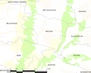
Meilhan
- commune in Gers, France
- Country:
- Postal Code: 32420
- Coordinates: 43° 25' 22" N, 0° 41' 0" E
- GPS tracks (wikiloc): [Link]
- Area: 6.82 sq km
- Population: 83
Molas
- commune in Haute-Garonne, France
- Country:
- Postal Code: 31230
- Coordinates: 43° 23' 59" N, 0° 46' 47" E
- GPS tracks (wikiloc): [Link]
- Area: 10.43 sq km
- Population: 164


Monties
- commune in Gers, France
- Country:
- Postal Code: 32420
- Coordinates: 43° 23' 24" N, 0° 40' 35" E
- GPS tracks (wikiloc): [Link]
- AboveSeaLevel: 545 м m
- Area: 10.55 sq km
- Population: 76

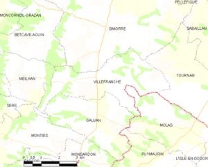
Villefranche
- commune in Gers, France
- Country:
- Postal Code: 32420
- Coordinates: 43° 25' 25" N, 0° 43' 38" E
- GPS tracks (wikiloc): [Link]
- Area: 12.62 sq km
- Population: 143

Monbardon
- commune in Gers, France
- Country:
- Postal Code: 32420
- Coordinates: 43° 22' 54" N, 0° 42' 33" E
- GPS tracks (wikiloc): [Link]
- Area: 6.41 sq km
- Population: 86
Puymaurin
- commune in Haute-Garonne, France
- Country:
- Postal Code: 31230
- Coordinates: 43° 22' 22" N, 0° 45' 54" E
- GPS tracks (wikiloc): [Link]
- Area: 22.24 sq km
- Population: 301
- Web site: [Link]