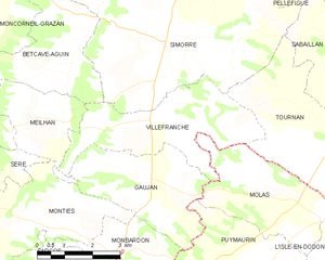
Meilhan (Meilhan)

- commune in Gers, France
- Country:

- Postal Code: 32420
- Coordinates: 43° 25' 22" N, 0° 41' 0" E


- GPS tracks (wikiloc): [Link]
- Area: 6.82 sq km
- Population: 83
- Wikipedia en: wiki(en)
- Wikipedia: wiki(fr)
- Wikidata storage: Wikidata: Q1006317
- Wikipedia Commons Category: [Link]
- Freebase ID: [/m/03nrr42]
- GeoNames ID: Alt: [6432003]
- SIREN number: [213202500]
- BnF ID: [15255836n]
- INSEE municipality code: 32250
Shares border with regions:


Sère
- commune in Gers, France
- Country:
- Postal Code: 32140
- Coordinates: 43° 24' 43" N, 0° 38' 53" E
- GPS tracks (wikiloc): [Link]
- Area: 8.64 sq km
- Population: 78


Betcave-Aguin
- commune in Gers, France
- Country:
- Postal Code: 32420
- Coordinates: 43° 26' 30" N, 0° 41' 29" E
- GPS tracks (wikiloc): [Link]
- Area: 10.19 sq km
- Population: 88


Monties
- commune in Gers, France
- Country:
- Postal Code: 32420
- Coordinates: 43° 23' 24" N, 0° 40' 35" E
- GPS tracks (wikiloc): [Link]
- AboveSeaLevel: 545 м m
- Area: 10.55 sq km
- Population: 76
Gaujan
- commune in Gers, France
- Country:
- Postal Code: 32420
- Coordinates: 43° 24' 30" N, 0° 43' 21" E
- GPS tracks (wikiloc): [Link]
- Area: 10.82 sq km
- Population: 112

Villefranche
- commune in Gers, France
- Country:
- Postal Code: 32420
- Coordinates: 43° 25' 25" N, 0° 43' 38" E
- GPS tracks (wikiloc): [Link]
- Area: 12.62 sq km
- Population: 143


Bellegarde
- commune in Gers, France
- Country:
- Postal Code: 32140
- Coordinates: 43° 25' 29" N, 0° 37' 25" E
- GPS tracks (wikiloc): [Link]
- AboveSeaLevel: 300 м m
- Area: 14.39 sq km
- Population: 176