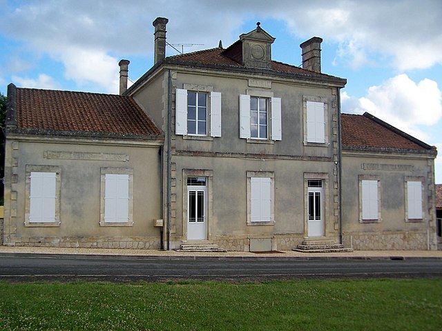
Gensac (Gensac)

- commune in Gironde, France
- Country:

- Postal Code: 33890
- Coordinates: 44° 48' 21" N, 0° 4' 22" E


- GPS tracks (wikiloc): [Link]
- Area: 9.38 sq km
- Population: 808
- Web site: http://gensac.free.fr
- Wikipedia en: wiki(en)
- Wikipedia: wiki(fr)
- Wikidata storage: Wikidata: Q651710
- Wikipedia Commons Category: [Link]
- Freebase ID: [/m/03x_pr_]
- GeoNames ID: Alt: [6432239]
- SIREN number: [213301864]
- BnF ID: [15256238x]
- INSEE municipality code: 33186
Shares border with regions:

Massugas
- commune in Gironde, France
- Country:
- Postal Code: 33790
- Coordinates: 44° 46' 6" N, 0° 5' 9" E
- GPS tracks (wikiloc): [Link]
- Area: 14.41 sq km
- Population: 226


Saint-Quentin-de-Caplong
- commune in Gironde, France
- Country:
- Postal Code: 33220
- Coordinates: 44° 47' 1" N, 0° 7' 53" E
- GPS tracks (wikiloc): [Link]
- Area: 11.27 sq km
- Population: 247


Pessac-sur-Dordogne
- commune in Gironde, France
- Country:
- Postal Code: 33890
- Coordinates: 44° 49' 15" N, 0° 4' 44" E
- GPS tracks (wikiloc): [Link]
- Area: 7.78 sq km
- Population: 479
- Web site: [Link]


Juillac
- commune in Gironde, France
- Country:
- Postal Code: 33890
- Coordinates: 44° 48' 40" N, 0° 2' 24" E
- GPS tracks (wikiloc): [Link]
- AboveSeaLevel: 103 м m
- Area: 5.86 sq km
- Population: 259

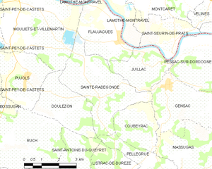
Sainte-Radegonde
- commune in Gironde, France
- Country:
- Postal Code: 33350
- Coordinates: 44° 48' 21" N, 0° 0' 56" E
- GPS tracks (wikiloc): [Link]
- Area: 12.48 sq km
- Population: 469


Coubeyrac
- commune in Gironde, France
- Country:
- Postal Code: 33890
- Coordinates: 44° 47' 6" N, 0° 3' 35" E
- GPS tracks (wikiloc): [Link]
- Area: 5.61 sq km
- Population: 73