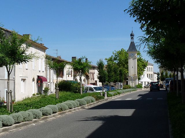
Sainte-Radegonde (Sainte-Radegonde)

- commune in Gironde, France
- Country:

- Postal Code: 33350
- Coordinates: 44° 48' 21" N, 0° 0' 56" E


- GPS tracks (wikiloc): [Link]
- Area: 12.48 sq km
- Population: 469
- Wikipedia en: wiki(en)
- Wikipedia: wiki(fr)
- Wikidata storage: Wikidata: Q581707
- Wikipedia Commons Category: [Link]
- Freebase ID: [/m/03nsb08]
- GeoNames ID: Alt: [6613703]
- SIREN number: [213304686]
- BnF ID: [15256516f]
- INSEE municipality code: 33468
Shares border with regions:


Doulezon
- commune in Gironde, France
- Country:
- Postal Code: 33350
- Coordinates: 44° 47' 32" N, 0° 0' 20" E
- GPS tracks (wikiloc): [Link]
- AboveSeaLevel: 89 м m
- Area: 7.36 sq km
- Population: 257


Juillac
- commune in Gironde, France
- Country:
- Postal Code: 33890
- Coordinates: 44° 48' 40" N, 0° 2' 24" E
- GPS tracks (wikiloc): [Link]
- AboveSeaLevel: 103 м m
- Area: 5.86 sq km
- Population: 259


Pellegrue
- commune in Gironde, France
- Country:
- Postal Code: 33790
- Coordinates: 44° 44' 36" N, 0° 4' 31" E
- GPS tracks (wikiloc): [Link]
- Area: 38.18 sq km
- Population: 1098
- Web site: [Link]


Flaujagues
- commune in Gironde, France
- Country:
- Postal Code: 33350
- Coordinates: 44° 49' 39" N, 0° 2' 11" E
- GPS tracks (wikiloc): [Link]
- Area: 7.8 sq km
- Population: 610

Gensac
- commune in Gironde, France
- Country:
- Postal Code: 33890
- Coordinates: 44° 48' 21" N, 0° 4' 22" E
- GPS tracks (wikiloc): [Link]
- Area: 9.38 sq km
- Population: 808
- Web site: [Link]

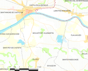
Mouliets-et-Villemartin
- commune in Gironde, France
- Country:
- Postal Code: 33350
- Coordinates: 44° 50' 31" N, 0° 1' 7" E
- GPS tracks (wikiloc): [Link]
- Area: 15.91 sq km
- Population: 1072


Coubeyrac
- commune in Gironde, France
- Country:
- Postal Code: 33890
- Coordinates: 44° 47' 6" N, 0° 3' 35" E
- GPS tracks (wikiloc): [Link]
- Area: 5.61 sq km
- Population: 73