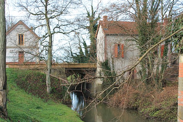
Germigny-l'Exempt (Germigny-l'Exempt)

- commune in Cher, France
- Country:

- Postal Code: 18150
- Coordinates: 46° 55' 5" N, 2° 53' 54" E


- GPS tracks (wikiloc): [Link]
- Area: 28.26 sq km
- Population: 311
- Wikipedia en: wiki(en)
- Wikipedia: wiki(fr)
- Wikidata storage: Wikidata: Q1172603
- Wikipedia Commons Category: [Link]
- Freebase ID: [/m/03mfcvd]
- GeoNames ID: Alt: [6428183]
- SIREN number: [211801014]
- BnF ID: [15249447z]
- INSEE municipality code: 18101
Shares border with regions:

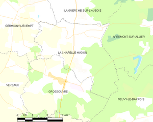
La Chapelle-Hugon
- commune in Cher, France
- Country:
- Postal Code: 18150
- Coordinates: 46° 54' 25" N, 2° 56' 54" E
- GPS tracks (wikiloc): [Link]
- Area: 16.16 sq km
- Population: 394


La Guerche-sur-l'Aubois
- commune in Cher, France
- Country:
- Postal Code: 18150
- Coordinates: 46° 57' 4" N, 2° 56' 51" E
- GPS tracks (wikiloc): [Link]
- Area: 52.7 sq km
- Population: 3322
- Web site: [Link]


Ourouer-les-Bourdelins
- commune in Cher, France
- Country:
- Postal Code: 18350
- Coordinates: 46° 55' 50" N, 2° 47' 3" E
- GPS tracks (wikiloc): [Link]
- Area: 24.64 sq km
- Population: 626
Vereaux
- commune in Cher, France
- Country:
- Postal Code: 18600
- Coordinates: 46° 52' 47" N, 2° 52' 45" E
- GPS tracks (wikiloc): [Link]
- Area: 22.96 sq km
- Population: 143

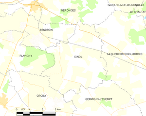
Ignol
- commune in Cher, France
- Country:
- Postal Code: 18350
- Coordinates: 46° 58' 0" N, 2° 50' 47" E
- GPS tracks (wikiloc): [Link]
- Area: 17.67 sq km
- Population: 180

Grossouvre
- commune in Cher, France
- Country:
- Postal Code: 18600
- Coordinates: 46° 52' 43" N, 2° 56' 14" E
- GPS tracks (wikiloc): [Link]
- Area: 15.75 sq km
- Population: 283
Croisy
- commune in Cher, France
- Country:
- Postal Code: 18350
- Coordinates: 46° 56' 20" N, 2° 48' 31" E
- GPS tracks (wikiloc): [Link]
- Area: 12.96 sq km
- Population: 158