Ourouer-les-Bourdelins (Ourouer-les-Bourdelins)

- commune in Cher, France
- Country:

- Postal Code: 18350
- Coordinates: 46° 55' 50" N, 2° 47' 3" E


- GPS tracks (wikiloc): [Link]
- Area: 24.64 sq km
- Population: 626
- Wikipedia en: wiki(en)
- Wikipedia: wiki(fr)
- Wikidata storage: Wikidata: Q1172317
- Wikipedia Commons Category: [Link]
- Freebase ID: [/m/03mfdkt]
- GeoNames ID: Alt: [6613764]
- SIREN number: [211801758]
- BnF ID: [15249521j]
- INSEE municipality code: 18175
Shares border with regions:
Cornusse
- commune in Cher, France
- Country:
- Postal Code: 18350
- Coordinates: 46° 57' 16" N, 2° 43' 51" E
- GPS tracks (wikiloc): [Link]
- Area: 19.61 sq km
- Population: 270

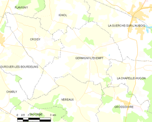
Germigny-l'Exempt
- commune in Cher, France
- Country:
- Postal Code: 18150
- Coordinates: 46° 55' 5" N, 2° 53' 54" E
- GPS tracks (wikiloc): [Link]
- Area: 28.26 sq km
- Population: 311
Vereaux
- commune in Cher, France
- Country:
- Postal Code: 18600
- Coordinates: 46° 52' 47" N, 2° 52' 45" E
- GPS tracks (wikiloc): [Link]
- Area: 22.96 sq km
- Population: 143
Flavigny
- commune in Cher, France
- Country:
- Postal Code: 18350
- Coordinates: 46° 58' 3" N, 2° 48' 4" E
- GPS tracks (wikiloc): [Link]
- AboveSeaLevel: 194 м m
- Area: 13.06 sq km
- Population: 202

Charly
- commune in Cher, France
- Country:
- Postal Code: 18350
- Coordinates: 46° 53' 57" N, 2° 44' 56" E
- GPS tracks (wikiloc): [Link]
- Area: 25.66 sq km
- Population: 253
Croisy
- commune in Cher, France
- Country:
- Postal Code: 18350
- Coordinates: 46° 56' 20" N, 2° 48' 31" E
- GPS tracks (wikiloc): [Link]
- Area: 12.96 sq km
- Population: 158