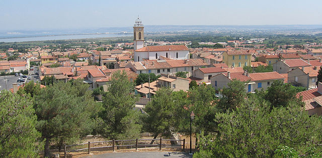
Gignac-la-Nerthe (Gignac-la-Nerthe)
- commune in Bouches-du-Rhône, France
- Country:

- Postal Code: 13180
- Coordinates: 43° 23' 35" N, 5° 14' 8" E


- GPS tracks (wikiloc): [Link]
- Area: 8.64 sq km
- Population: 9063
- Web site: http://www.gignaclanerthe.fr
- Wikipedia en: wiki(en)
- Wikipedia: wiki(fr)
- Wikidata storage: Wikidata: Q473998
- Wikipedia Commons Category: [Link]
- Freebase ID: [/m/02rp8y8]
- GeoNames ID: Alt: [6447130]
- SIREN number: [211300439]
- BnF ID: [15247325w]
- VIAF ID: Alt: [167987520]
- Library of Congress authority ID: Alt: [no00022565]
- PACTOLS thesaurus ID: [pcrt14UrhLXfRu]
- WOEID: [12662097]
- SUDOC authorities ID: [035559179]
- INSEE municipality code: 13043
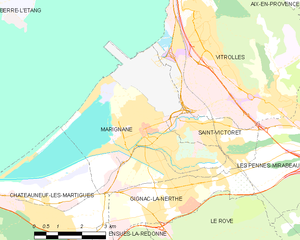
Shares border with regions:


Les Pennes-Mirabeau
- commune in Bouches-du-Rhône, France
Les Pennes-Mirabeau, located in the Provence-Alpes-Côte d'Azur region in southeastern France, is a charming area that offers a variety of hiking opportunities. Nestled near Marseille, it provides a blend of picturesque landscapes, natural parks, and cultural experiences....
- Country:

- Postal Code: 13170
- Coordinates: 43° 24' 36" N, 5° 18' 34" E


- GPS tracks (wikiloc): [Link]
- Area: 33.66 sq km
- Population: 21387
- Web site: [Link]


Marignane
- commune in Bouches-du-Rhône, France
- Country:

- Postal Code: 13700
- Coordinates: 43° 25' 1" N, 5° 12' 53" E


- GPS tracks (wikiloc): [Link]
- AboveSeaLevel: 15 м m
- Area: 23.16 sq km
- Population: 33929
- Web site: [Link]


Châteauneuf-les-Martigues
- commune in Bouches-du-Rhône, France
- Country:

- Postal Code: 13220
- Coordinates: 43° 22' 59" N, 5° 9' 51" E


- GPS tracks (wikiloc): [Link]
- Area: 31.65 sq km
- Population: 15057
- Web site: [Link]


Ensuès-la-Redonne
- commune in Bouches-du-Rhône, France
- Country:

- Postal Code: 13820
- Coordinates: 43° 21' 21" N, 5° 12' 15" E


- GPS tracks (wikiloc): [Link]
- Area: 25.83 sq km
- Population: 5467
- Web site: [Link]


Saint-Victoret
- commune in Bouches-du-Rhône, France
- Country:

- Postal Code: 13730
- Coordinates: 43° 25' 15" N, 5° 14' 0" E


- GPS tracks (wikiloc): [Link]
- Area: 4.73 sq km
- Population: 6550
- Web site: [Link]


Le Rove
- commune in Bouches-du-Rhône, France
- Country:

- Postal Code: 13740
- Coordinates: 43° 22' 9" N, 5° 15' 1" E


- GPS tracks (wikiloc): [Link]
- Area: 22.97 sq km
- Population: 4777
- Web site: [Link]

