
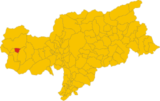
Glurns (Glorenza)
.svg)
- Italian comune
 Hiking in Glurns
Glurns (or Glorenza) is a small historical town located in the South Tyrol region of northern Italy. It's nestled in the Venosta Valley and is known for its charming medieval architecture, stunning mountain scenery, and a rich cultural heritage.
Hiking Opportunities Near Glurns:
-
Venosta Valley Trails:
- The valley is crisscrossed with numerous hiking trails that cater to different skill levels. These routes often offer breathtaking views of the surrounding mountains and picturesque landscapes.
-
Malles Venosta:
- Just a short distance from Glurns, Malles offers trails that lead to scenic viewpoints and nearby natural attractions. The area is less crowded, offering a peaceful hiking experience.
-
Reschen Pass:
- A bit further afield, this area features trails that lead to beautiful lakes and panoramic views. It’s also the Site of the historic Reschen Dam and the submerged church, which adds a unique backdrop to your hike.
-
Vinschgau High Path:
- This long-distance hiking trail offers segments that can be accessed from Glurns. It runs through the South Tyrol region and provides stunning views, historical sites, and diverse flora and fauna.
-
Tartscher Bichl:
- Close to Glurns, this hill offers a gentle hike with a rewarding view of the valley and the Ortler Alps. It’s a great option for families or those looking for a less strenuous hike.
Essentials for Hiking in the Area:
- Equipment: Sturdy hiking boots, weather-appropriate clothing, a reliable backpack, and trekking poles for uneven terrain.
- Maps: Use local hiking maps or apps to stay on track. Information can often be gathered from local tourist offices.
- Water and Snacks: Always carry enough water and energy-packed snacks, particularly during longer hikes.
- Weather: Conditions can change rapidly in the mountains, so check forecasts before heading out.
Best Time to Hike:
Late spring to early fall (May to September) typically offers the best conditions for hiking in the region. Summer months can be warm, so starting early in the day is advisable to avoid the heat.
Local Tips:
- Visit local eateries for traditional Tyrolean cuisine after your hikes.
- Explore the town of Glurns itself, especially its historic walls, to make the most of your visit.
Whether you are a seasoned hiker or a casual walker, the area around Glurns offers fantastic opportunities to immerse yourself in nature while enjoying the beauty of South Tyrol.
- Country:

- Postal Code: 39020
- Local Dialing Code: 0473
- Licence Plate Code: BZ
- Coordinates: 46° 40' 16" N, 10° 33' 25" E


- GPS tracks (wikiloc): [Link]
- AboveSeaLevel: 907 м m
- Area: 13.22 sq km
- Population: 897
- Web site: http://www.comune.glorenza.bz.it/
- Wikipedia en: wiki(en)
- Wikipedia: wiki(it)
- Wikidata storage: Wikidata: Q419357
- Wikipedia Commons Gallery: [Link]
- Wikipedia Commons Category: [Link]
- Freebase ID: [/m/0g9grf]
- GeoNames ID: Alt: [6535900]
- VIAF ID: Alt: [156088112]
- OSM relation ID: [47290]
- GND ID: Alt: [4071900-5]
- archINFORM location ID: [9374]
- Library of Congress authority ID: Alt: [n93081723]
- UN/LOCODE: [ITGNZ]
- ISTAT ID: 021036
- Italian cadastre code: E069
Shares border with regions:


Mals
- Italian comune
Hiking in Mals
Mals, located in the Vinschgau Valley in South Tyrol, Italy, is a fantastic spot for hiking enthusiasts. Surrounded by stunning landscapes, picturesque villages, and a rich cultural heritage, it offers a variety of trails suitable for different skill levels....
- Country:
- Postal Code: 39024
- Local Dialing Code: 0473
- Licence Plate Code: BZ
- Coordinates: 46° 41' 16" N, 10° 32' 48" E
- GPS tracks (wikiloc): [Link]
- AboveSeaLevel: 1051 м m
- Area: 247.43 sq km
- Population: 5225
- Web site: [Link]


Prad am Stilfser Joch
- Italian comune
Hiking in Prad am Stilfser Joch
Prad am Stilfser Joch is a charming village located in the South Tyrol region of Italy, nestled at the entrance to the Stilfser Joch National Park. This area is renowned for its stunning natural landscapes, mountainous terrain, and excellent hiking opportunities. Here are some highlights and tips for hiking in this region:...
- Country:
- Postal Code: 39026
- Local Dialing Code: 0473
- Licence Plate Code: BZ
- Coordinates: 46° 37' 8" N, 10° 35' 29" E
- GPS tracks (wikiloc): [Link]
- AboveSeaLevel: 3375 м m
- Area: 51.49 sq km
- Population: 3474
- Web site: [Link]

Schluderns
- Italian comune
Hiking in Schluderns
Schluderns, located in South Tyrol, Italy, is a charming village surrounded by stunning landscapes and offers a variety of hiking opportunities. The region is characterized by its mountainous terrain, lush forests, and picturesque valleys. Here are some key points to consider when planning a hike in and around Schluderns:...
- Country:
- Postal Code: 39020
- Local Dialing Code: 0473
- Licence Plate Code: BZ
- Coordinates: 46° 39' 55" N, 10° 35' 0" E
- GPS tracks (wikiloc): [Link]
- AboveSeaLevel: 921 м m
- Area: 20.72 sq km
- Population: 1820
- Web site: [Link]


Taufers im Münstertal
- Italian comune
Hiking in Taufers im Münstertal
Taufers im Münstertal, located in the Bavarian Alps in South Tyrol, Italy, offers a stunning backdrop for hiking enthusiasts of all levels. The area is characterized by its picturesque valleys, lush forests, and panoramic mountain views, making it an ideal destination for nature lovers....
- Country:
- Postal Code: 39020
- Local Dialing Code: 0473
- Licence Plate Code: BZ
- Coordinates: 46° 38' 39" N, 10° 27' 48" E
- GPS tracks (wikiloc): [Link]
- AboveSeaLevel: 1240 м m
- Area: 46.27 sq km
- Population: 981
- Web site: [Link]