
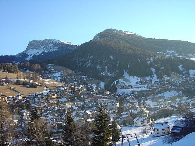
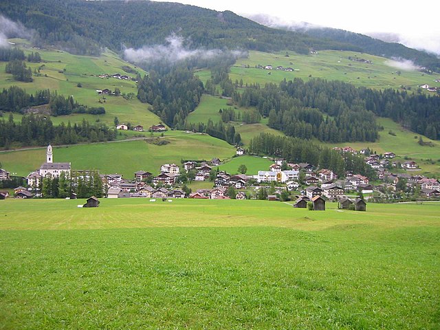
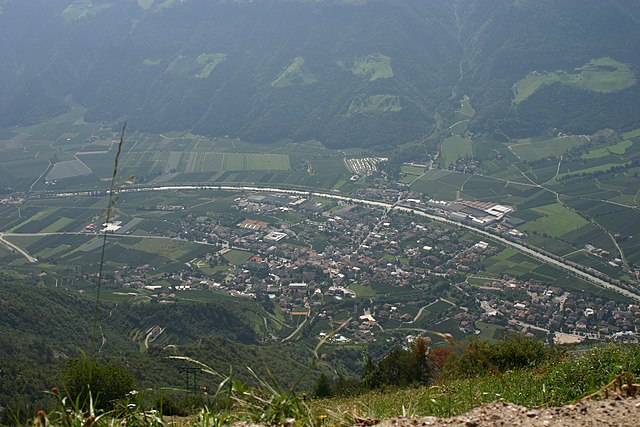
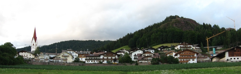
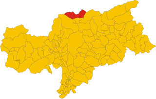
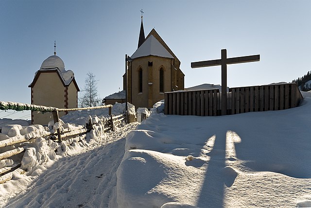
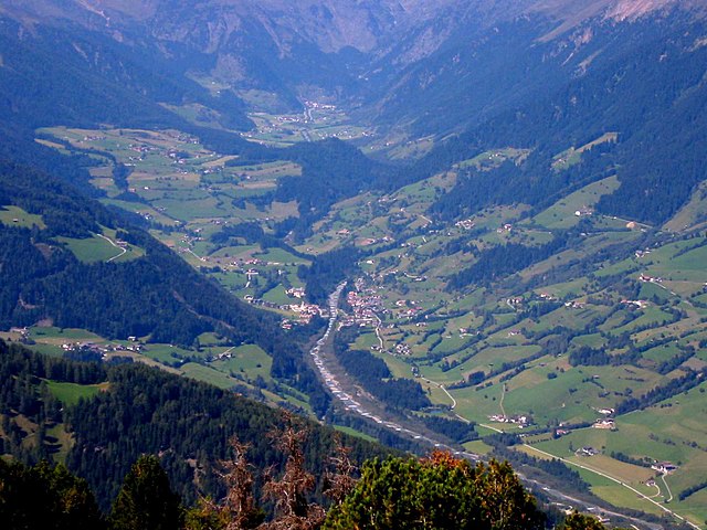
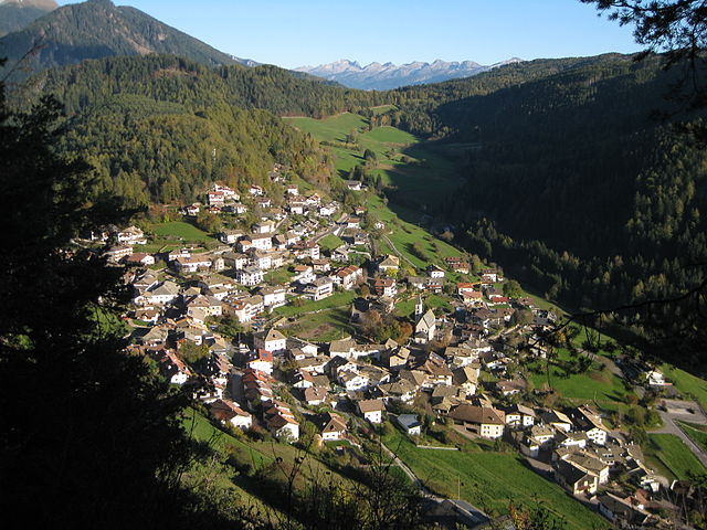
South Tyrol (provincia autonoma di Bolzano)


- autonomous province of Italy
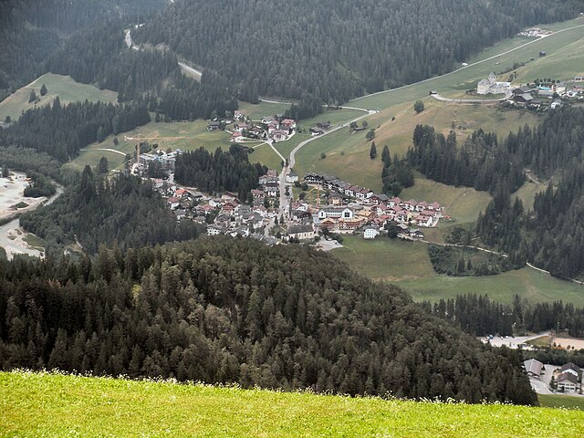
 Hiking in South Tyrol
South Tyrol, located in northern Italy, is a paradise for hikers and outdoor enthusiasts. This stunning region is characterized by its dramatic landscapes, which include the towering peaks of the Dolomites, lush valleys, and picturesque alpine meadows. Here are some key points about hiking in South Tyrol:
1. Diverse Trails:
- Varied Difficulty Levels: South Tyrol offers a wide range of hiking trails suitable for all skill levels, from easy walks suitable for families to challenging high-alpine climbs.
- Well-Marked Paths: Trails are generally well-marked and maintained, making it easy to navigate through the stunning landscapes.
2. Scenic Beauty:
- Dolomites: This UNESCO World Heritage site showcases breathtaking rock formations, with many trails offering panoramic views of iconic peaks like the Tre Cime di Lavaredo and the Marmolada.
- Lakes and Waterfalls: Beautiful alpine lakes, such as Lake Braies and Lake Toblino, provide additional scenic hiking opportunities, often featuring nearby waterfalls.
3. Cultural Experience:
- Bilingual Region: As a part of Italy with a strong Austrian influence, the area has a rich cultural heritage, which is reflected in the architecture, cuisine, and local traditions along the trails.
- Mountain Huts (Rifugi): Along the hiking routes, you’ll find numerous mountain huts that serve traditional Tyrolean cuisine, allowing you to refuel and enjoy the local culture.
4. Guided Tours and Resources:
- Guided Hiking Tours: For those seeking a more structured experience, numerous local guides offer tours that focus on specific areas, themes, or skill levels.
- Visitor Centers: These can provide maps, advice on trails, and information on local flora and fauna.
5. Best Seasons for Hiking:
- Summer (June to September): The most popular hiking season, with the best weather and trail conditions.
- Autumn (October): Offers beautiful fall foliage and fewer crowds, but be mindful of weather changes as it can get colder quickly.
6. Preparation and Safety:
- Gear: Proper hiking boots, weather-appropriate clothing, and a good backpack filled with essentials (water, snacks, first aid kit) are crucial.
- Weather Awareness: Conditions can change rapidly in the mountains, so it’s wise to check the forecast and be prepared for unexpected shifts.
7. Accessibility:
- Transportation: Most trailheads are accessible via public transportation or car, and various options exist to reach popular starting points.
Recommended Hikes:
- Seceda and Alpe di Siusi: Offering gentle slopes with stunning vistas.
- Sella Ronda: A classic tour that encircles the Sella massif, great for experienced hikers.
- Tre Cime di Lavaredo: A must-do for its spectacular views and unique rock formations.
In summary, hiking in South Tyrol offers a blend of natural beauty, cultural richness, and a variety of trails for every adventurer. Whether you're seeking peaceful walks through scenic meadows or challenging hikes up rugged peaks, South Tyrol is sure to provide an unforgettable experience.
- Country:

- Capital: Bolzano
- Postal Code: 39010–39059; 39100
- Local Dialing Code: 0471; 0463; 0474; 0473; 0472
- Licence Plate Code: BZ
- Coordinates: 46° 30' 0" N, 11° 20' 0" E


- GPS tracks (wikiloc): [Link]
- Area: 7400.43 sq km
- Population: 550432
- Web site: http://www.provincia.bz.it/
- Wikipedia en: wiki(en)
- Wikipedia: wiki(it)
- Wikidata storage: Wikidata: Q15124
- Wikipedia Commons Gallery: [Link]
- Wikipedia Commons Category: [Link]
- Wikipedia Commons Maps Category: [Link]
- Freebase ID: [/m/016qwt]
- GeoNames ID: Alt: [3181912]
- BnF ID: [13601510j]
- VIAF ID: Alt: [149551740]
- GND ID: Alt: [4078047-8]
- archINFORM location ID: [3104]
- Library of Congress authority ID: Alt: [n80043529]
- MusicBrainz area ID: [17fc26b3-cf6f-4d9a-a367-b50b4ca201e5]
- SUDOC authorities ID: [053506294]
- Encyclopædia Britannica Online ID: [place/Bolzano-province-Italy]
- Gran Enciclopèdia Catalana ID: [0066135]
- ISNI: Alt: [0000 0001 2348 4130]
- NKCR AUT ID: [ge520032]
- NUTS code: [ITH10]
- YSO ID: [118607]
- Klexikon article ID: [Südtirol]
- NE.se ID: [sydtyrolen]
- ISTAT ID: 021
- ISO 3166-2 code: IT-BZ
Includes regions:


Merano
- Italian comune
Hiking in Merano
Merano, located in South Tyrol, Italy, is a stunning destination for hiking enthusiasts. Nestled in the mountains, it offers a beautiful combination of alpine scenery, Mediterranean climate, and rich cultural heritage. Here are some highlights about hiking in and around Merano:...
- Country:
- Postal Code: 39012
- Local Dialing Code: 0473
- Licence Plate Code: BZ
- Coordinates: 46° 40' 8" N, 11° 9' 50" E
- GPS tracks (wikiloc): [Link]
- AboveSeaLevel: 325 м m
- Area: 26.34 sq km
- Population: 40047
- Web site: [Link]


Brixen
- Italian comune
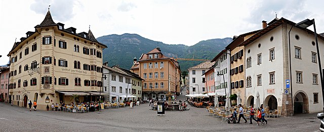
Hiking in Brixen
Brixen, also known as Bressanone, is a charming town located in the South Tyrol region of northern Italy. It's surrounded by the beautiful Dolomites, making it a fantastic destination for hiking enthusiasts. Here are some highlights about hiking in and around Brixen:...
- Country:
- Postal Code: 39042
- Local Dialing Code: 0472
- Licence Plate Code: BZ
- Coordinates: 46° 43' 0" N, 11° 39' 0" E
- GPS tracks (wikiloc): [Link]
- AboveSeaLevel: 560 м m
- Area: 84.7 sq km
- Population: 21688
- Web site: [Link]


Rasen-Antholz
- Italian comune
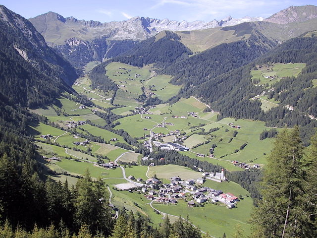
Hiking in Rasen-Antholz
Rasen-Antholz (Rasen-Antholz in German, or Rasun-Anterselva in Italian) is a picturesque valley located in the South Tyrol region of northern Italy, surrounded by the stunning Dolomites. This area is particularly popular for hiking due to its breathtaking landscapes, diverse trails, and natural beauty....
- Country:
- Postal Code: 39030
- Local Dialing Code: 0474
- Licence Plate Code: BZ
- Coordinates: 46° 51' 0" N, 12° 6' 0" E
- GPS tracks (wikiloc): [Link]
- AboveSeaLevel: 1030 м m
- Area: 121.57 sq km
- Population: 2907
- Web site: [Link]


Laives
- Italian comune
Hiking in Laives
Laives (or Leifers in German) is a small town located in the South Tyrol region of northern Italy. It's situated near the city of Bolzano, making it a great base for hikers interested in exploring the stunning scenery of the Dolomites and the surrounding alpine landscape....
- Country:
- Postal Code: 39055
- Local Dialing Code: 0471
- Licence Plate Code: BZ
- Coordinates: 46° 25' 39" N, 11° 20' 26" E
- GPS tracks (wikiloc): [Link]
- AboveSeaLevel: 258 м m
- Area: 24.11 sq km
- Population: 17954
- Web site: [Link]


Eppan an der Weinstraße
- Italian comune
Hiking in Eppan an der Weinstraße
Eppan an der Weinstraße, located in the South Tyrol region of northern Italy, is a beautiful destination for hiking enthusiasts. Nestled amidst vineyards and rolling hills, this area offers a variety of trails suitable for all levels of hikers, from easy walks to more challenging treks. Here are some highlights of hiking in Eppan:...
- Country:
- Postal Code: 39050; 39057
- Local Dialing Code: 0471
- Licence Plate Code: BZ
- Coordinates: 46° 27' 0" N, 11° 16' 0" E
- GPS tracks (wikiloc): [Link]
- AboveSeaLevel: 239 м m
- Area: 59.45 sq km
- Population: 14941
- Web site: [Link]

Urtijëi
- Italian comune
Hiking in Urtijëi
Urtijëi, also known as Ortisei, is a charming village located in the Val Gardena valley in South Tyrol, Italy. It's a popular base for hiking enthusiasts due to its stunning scenery, diverse trails, and proximity to the Dolomites, a UNESCO World Heritage site. Here are some highlights and tips for hiking in the Urtijëi area:...
- Country:
- Postal Code: 39046
- Local Dialing Code: 0471
- Licence Plate Code: BZ
- Coordinates: 46° 34' 0" N, 11° 40' 0" E
- GPS tracks (wikiloc): [Link]
- AboveSeaLevel: 1230 м m
- Area: 24.16 sq km
- Population: 4883
- Web site: [Link]


Sarntal
- Italian comune
Hiking in Sarntal
Sarntal, also known as the Sarntal Valley, is a beautiful hiking destination located in South Tyrol, Italy, just north of Bolzano. This area is known for its stunning landscapes, diverse flora and fauna, and rich cultural heritage. Here are some key points to consider when planning a hiking trip in Sarntal:...
- Country:
- Postal Code: 39058
- Local Dialing Code: 0471
- Licence Plate Code: BZ
- Coordinates: 46° 38' 37" N, 11° 21' 22" E
- GPS tracks (wikiloc): [Link]
- AboveSeaLevel: 2781 м m
- Area: 302.27 sq km
- Population: 7058
- Web site: [Link]

Sexten
- Italian comune
Hiking in Sexten
Sexten, also known as Sesto, is a stunning destination located in the Dolomites of northern Italy. It offers a fantastic range of hiking opportunities for all levels of experience, all surrounded by breathtaking mountain scenery. Here are some key points to consider when hiking in Sexten:...
- Country:
- Postal Code: 39030
- Local Dialing Code: 0474
- Licence Plate Code: BZ
- Coordinates: 46° 42' 0" N, 12° 21' 0" E
- GPS tracks (wikiloc): [Link]
- AboveSeaLevel: 1310 м m
- Area: 80.42 sq km
- Population: 1906
- Web site: [Link]


Bruneck
- Italian comune
Hiking in Bruneck
Bruneck (Brunico in Italian) is a charming town located in South Tyrol, Northern Italy, surrounded by the stunning Dolomites mountain range. It serves as a fantastic base for hiking enthusiasts, offering a variety of trails suitable for all skill levels. Here are some key points to consider when planning your hiking adventure in and around Bruneck:...
- Country:
- Postal Code: 39031
- Local Dialing Code: 0474
- Licence Plate Code: BZ
- Coordinates: 46° 47' 58" N, 11° 56' 3" E
- GPS tracks (wikiloc): [Link]
- AboveSeaLevel: 838 м m
- Area: 45.27 sq km
- Population: 16356
- Web site: [Link]


Salorno
- Italian comune
Hiking in Salorno
Salorno, known as Salurn in German, is a picturesque village located in South Tyrol, Italy. It is nestled at the edge of the Adige Valley and serves as an excellent starting point for various hiking trails that showcase the region's stunning natural beauty....
- Country:
- Postal Code: 39040
- Local Dialing Code: 0471
- Licence Plate Code: BZ
- Coordinates: 46° 14' 0" N, 11° 12' 0" E
- GPS tracks (wikiloc): [Link]
- AboveSeaLevel: 224 м m
- Area: 33.13 sq km
- Population: 3842
- Web site: [Link]


Natz-Schabs
- Italian comune
Hiking in Natz-Schabs
Natz-Schabs, a picturesque region in South Tyrol, Italy, is known for its beautiful landscapes, charming villages, and a wide array of hiking opportunities suitable for all levels of hikers. The area is characterized by rolling hills, lush vineyards, and stunning views of the Alps, making it a perfect destination for outdoor enthusiasts. Here are some highlights and tips for hiking in Natz-Schabs:...
- Country:
- Postal Code: 39040
- Local Dialing Code: 0472
- Licence Plate Code: BZ
- Coordinates: 46° 46' 8" N, 11° 39' 56" E
- GPS tracks (wikiloc): [Link]
- AboveSeaLevel: 772 м m
- Area: 15.96 sq km
- Population: 3187
- Web site: [Link]

Villnöß
- Italian comune
Hiking in Villnöß
Villnöß, or Villnöß Valley, is a beautiful hiking destination located in South Tyrol, Northern Italy. Nestled at the foot of the Dolomites, it offers stunning landscapes, diverse trails, and an opportunity to experience both nature and local culture. Here are some highlights about hiking in this picturesque area:...
- Country:
- Postal Code: 39040
- Local Dialing Code: 0472
- Licence Plate Code: BZ
- Coordinates: 46° 38' 34" N, 11° 40' 42" E
- GPS tracks (wikiloc): [Link]
- AboveSeaLevel: 1132 м m
- Area: 81.38 sq km
- Population: 2603
- Web site: [Link]

Sterzing
- Italian comune
Hiking in Sterzing
Sterzing, or Vipiteno, is a charming town located in the South Tyrol region of Italy, surrounded by the stunning Dolomite mountains. It’s an excellent base for hiking enthusiasts due to its breathtaking scenery and diverse trail options. Here’s a rundown of what you can expect when hiking in Sterzing:...
- Country:
- Postal Code: 39049
- Local Dialing Code: 0472
- Licence Plate Code: BZ
- Coordinates: 46° 53' 35" N, 11° 25' 47" E
- GPS tracks (wikiloc): [Link]
- AboveSeaLevel: 2714 м m
- Area: 32.97 sq km
- Population: 6956
- Web site: [Link]

Naturns
- Italian comune
Hiking in Naturns
Naturns (or Naturno) is a beautiful village located in South Tyrol, Italy, nestled in the Adige Valley, near the Merano region. It’s an excellent destination for hiking enthusiasts, offering a diverse range of trails that cater to various skill levels and preferences....
- Country:
- Postal Code: 39025
- Local Dialing Code: 0473
- Licence Plate Code: BZ
- Coordinates: 46° 39' 1" N, 11° 0' 30" E
- GPS tracks (wikiloc): [Link]
- AboveSeaLevel: 528 м m
- Area: 67.11 sq km
- Population: 5777
- Web site: [Link]


Kurtatsch an der Weinstraße
- Italian comune
Hiking in Kurtatsch an der Weinstraße
Kurtatsch an der Weinstraße, located in the picturesque South Tyrol region of northern Italy, is a beautiful destination for hiking enthusiasts. Nestled among vineyards and rolling hills, this charming village offers stunning landscapes, diverse trails, and a rich cultural experience....
- Country:
- Postal Code: 39040
- Local Dialing Code: 0471
- Licence Plate Code: BZ
- Coordinates: 46° 18' 50" N, 11° 13' 26" E
- GPS tracks (wikiloc): [Link]
- AboveSeaLevel: 333 м m
- Area: 29.27 sq km
- Population: 2235
- Web site: [Link]


Partschins
- Italian comune
Hiking in Partschins
Partschins, also known as Parcines, is a beautiful village located in South Tyrol, Italy, right at the foot of the magnificent Texelgruppe Natural Park. This region offers stunning landscapes, diverse trails, and a unique combination of mountain views and lush valley scenery, making it an excellent destination for hikers of all skill levels....
- Country:
- Postal Code: 39020
- Local Dialing Code: 0473
- Licence Plate Code: BZ
- Coordinates: 46° 41' 3" N, 11° 4' 24" E
- GPS tracks (wikiloc): [Link]
- AboveSeaLevel: 3337 м m
- Area: 55.4 sq km
- Population: 3683
- Web site: [Link]

Kaltern an der Weinstraße
- Italian comune
Hiking in Kaltern an der Weinstraße
Kaltern an der Weinstraße, located in South Tyrol, Italy, is a picturesque village nestled amid vineyards and rolling hills. It’s an excellent destination for hiking enthusiasts, offering a range of trails suitable for different skill levels, along with stunning views of the surrounding landscape, including Lake Kaltern and the impressive Dolomites....
- Country:
- Postal Code: 39052
- Local Dialing Code: 0471
- Licence Plate Code: BZ
- Coordinates: 46° 24' 48" N, 11° 14' 46" E
- GPS tracks (wikiloc): [Link]
- AboveSeaLevel: 425 м m
- Area: 48.04 sq km
- Population: 8046
- Web site: [Link]

Vintl
- Italian comune
Hiking in Vintl
Vintl, or Vintl in German, is a scenic village located in South Tyrol, northern Italy. It's an excellent base for hiking enthusiasts, as the surrounding area offers a variety of trails ranging from easy strolls to challenging mountain hikes....
- Country:
- Postal Code: 39030
- Local Dialing Code: 0472
- Licence Plate Code: BZ
- Coordinates: 46° 48' 54" N, 11° 43' 14" E
- GPS tracks (wikiloc): [Link]
- AboveSeaLevel: 755 м m
- Area: 110.82 sq km
- Population: 3336
- Web site: [Link]

Badia
- Italian comune in South Tyrol
Hiking in Badia
Hiking in Badia, located in the heart of South Tyrol, Italy, offers a unique blend of stunning natural landscapes, rich cultural heritage, and a variety of trails suitable for all skill levels. Here are several important aspects of hiking in this beautiful area:...
- Country:
- Postal Code: 39036
- Local Dialing Code: 0471
- Licence Plate Code: BZ
- Coordinates: 46° 36' 40" N, 11° 53' 40" E
- GPS tracks (wikiloc): [Link]
- AboveSeaLevel: 1315 м m
- Area: 83.18 sq km
- Population: 3491
- Web site: [Link]


Aldein
- Italian comune
Hiking in Aldein
Aldein, located in the South Tyrol region of Northern Italy, is a wonderful destination for hiking enthusiasts. Nestled in the scenic mountains, it offers a variety of trails that cater to different skill levels, from leisurely walks to more challenging treks. Here are some highlights about hiking in Aldein:...
- Country:
- Postal Code: 39040
- Local Dialing Code: 0471
- Licence Plate Code: BZ
- Coordinates: 46° 22' 0" N, 11° 21' 0" E
- GPS tracks (wikiloc): [Link]
- AboveSeaLevel: 1225 м m
- Area: 62.69 sq km
- Population: 1664
- Web site: [Link]

Andrian
- Italian comune
Hiking in Andrian
Hiking in Andrian, a charming village in South Tyrol, Italy, offers a unique blend of stunning landscapes, rich culture, and a variety of trails suitable for different skill levels. Located near Merano, Andrian is surrounded by beautiful vineyards, orchards, and the backdrop of the majestic Alps, making it an ideal destination for outdoor enthusiasts....
- Country:
- Postal Code: 39010
- Local Dialing Code: 0471
- Licence Plate Code: BZ
- Coordinates: 46° 31' 3" N, 11° 13' 53" E
- GPS tracks (wikiloc): [Link]
- AboveSeaLevel: 285 м m
- Area: 4.89 sq km
- Population: 1024
- Web site: [Link]


Altrei
- Italian comune
Hiking in Altrei
Altrei is a charming village located in the South Tyrol region of northern Italy. It is surrounded by stunning natural landscapes, making it a great destination for hiking enthusiasts. Here are some key points about hiking in Altrei:...
- Country:
- Postal Code: 39040
- Local Dialing Code: 0471
- Licence Plate Code: BZ
- Coordinates: 46° 16' 41" N, 11° 22' 0" E
- GPS tracks (wikiloc): [Link]
- AboveSeaLevel: 1635 м m
- Area: 11.06 sq km
- Population: 396
- Web site: [Link]


Hafling
- Italian comune
Hiking in Hafling
Hafling, located in the South Tyrol region of northern Italy, is a stunning destination for hikers, known for its breathtaking landscapes, diverse trails, and striking views of the Alps. Nestled in the mountains near Merano, Hafling offers a unique combination of natural beauty and charming village life, making it an excellent spot for outdoor enthusiasts....
- Country:
- Postal Code: 39010
- Local Dialing Code: 0473
- Licence Plate Code: BZ
- Coordinates: 46° 38' 44" N, 11° 13' 27" E
- GPS tracks (wikiloc): [Link]
- AboveSeaLevel: 1290 м m
- Area: 27 sq km
- Population: 763
- Web site: [Link]

Vöran
- Italian comune
Hiking in Vöran
Vöran, also known as Verano, is a picturesque village located in the South Tyrol region of northern Italy, nestled in the foothills of the Alps. It is a popular destination for hiking enthusiasts due to its stunning natural landscapes, diverse trails, and mild climate....
- Country:
- Postal Code: 39010
- Local Dialing Code: 0473
- Licence Plate Code: BZ
- Coordinates: 46° 36' 17" N, 11° 13' 35" E
- GPS tracks (wikiloc): [Link]
- AboveSeaLevel: 1204 м m
- Area: 22.01 sq km
- Population: 952
- Web site: [Link]


Barbian
- Italian comune
Hiking in Barbian
Barbian, located in the South Tyrol region of northern Italy, is a beautiful destination for hiking enthusiasts. Nestled in the scenic Dolomites, Barbian offers a mix of well-marked trails that vary in difficulty, making it suitable for both beginners and experienced hikers....
- Country:
- Postal Code: 39040
- Local Dialing Code: 0471
- Licence Plate Code: BZ
- Coordinates: 46° 36' 12" N, 11° 31' 17" E
- GPS tracks (wikiloc): [Link]
- AboveSeaLevel: 836 м m
- Area: 24.51 sq km
- Population: 1699
- Web site: [Link]


Prags
- Italian comune
Hiking in Prags
Prags, or Braies, is a beautiful area located in the South Tyrol region of Italy, known for its stunning natural landscapes, particularly the Dolomite Mountains. The focal point of this area is the picturesque Lago di Braies (Pragser Wildsee), a striking alpine lake surrounded by imposing peaks and lush forests....
- Country:
- Postal Code: 39030
- Local Dialing Code: 0474
- Licence Plate Code: BZ
- Coordinates: 46° 43' 0" N, 12° 8' 0" E
- GPS tracks (wikiloc): [Link]
- AboveSeaLevel: 1213 м m
- Area: 90.25 sq km
- Population: 652
- Web site: [Link]

Brenner
- Italian comune
Hiking in Brenner
Brenner, located in South Tyrol, Italy, is a beautiful area for hiking, characterized by its stunning alpine landscapes, diverse flora and fauna, and well-marked trails suitable for all levels of hikers. Here are some key highlights about hiking in Brenner:...
- Country:
- Postal Code: 39041
- Local Dialing Code: 0472
- Licence Plate Code: BZ
- Coordinates: 47° 0' 3" N, 11° 30' 14" E
- GPS tracks (wikiloc): [Link]
- AboveSeaLevel: 1374 м m
- Area: 114.29 sq km
- Population: 2184
- Web site: [Link]
Bronzolo
- Italian comune
Hiking in Bronzolo
Bronzolo, or Bronzolo in Italian, is a charming village located in South Tyrol, Italy. Nestled near the Adige River and surrounded by beautiful rolling hills and vineyards, it offers a fantastic experience for hiking enthusiasts. Here are some highlights about hiking in the Bronzolo area:...
- Country:
- Postal Code: 39051
- Local Dialing Code: 0471
- Licence Plate Code: BZ
- Coordinates: 46° 24' 0" N, 11° 19' 0" E
- GPS tracks (wikiloc): [Link]
- AboveSeaLevel: 263 м m
- Area: 7.54 sq km
- Population: 2798
- Web site: [Link]
Kuens
- Italian comune
Hiking in Kuens
It seems there might be a typo in your request—were you possibly referring to "Kungsleden" in Sweden, or another specific hiking area? If you provide a bit more detail, I can give you the best information possible about hiking in that location. If you meant something else, let me know and I’d be happy to assist!...
- Country:
- Postal Code: 39010
- Local Dialing Code: 0473
- Licence Plate Code: BZ
- Coordinates: 46° 42' 0" N, 11° 10' 12" E
- GPS tracks (wikiloc): [Link]
- AboveSeaLevel: 592 м m
- Area: 1.63 sq km
- Population: 395
- Web site: [Link]

Sand in Taufers
- comune in Nothern Italy
Hiking in Sand in Taufers
Sand in Taufers, or Campo Tures as it is known in Italian, is a picturesque village located in the Ahrntal Valley in South Tyrol, Italy. It's renowned for its stunning natural scenery, rich cultural heritage, and a variety of outdoor activities, particularly hiking. Here are some key points about hiking in this beautiful region:...
- Country:
- Postal Code: 39032
- Local Dialing Code: 0474
- Licence Plate Code: BZ
- Coordinates: 46° 54' 30" N, 11° 57' 37" E
- GPS tracks (wikiloc): [Link]
- AboveSeaLevel: 864 м m
- Area: 163.98 sq km
- Population: 5430
- Web site: [Link]


Freienfeld
- Italian comune
Hiking in Freienfeld
Freienfeld, located in South Tyrol, Italy, is a beautiful area known for its stunning alpine scenery and excellent hiking opportunities. The region offers a mix of gentle walks and challenging trails, catering to hikers of all levels. Here are some highlights you can expect when hiking in Freienfeld:...
- Country:
- Postal Code: 39040
- Local Dialing Code: 0472
- Licence Plate Code: BZ
- Coordinates: 46° 52' 27" N, 11° 29' 10" E
- GPS tracks (wikiloc): [Link]
- AboveSeaLevel: 937 м m
- Area: 95.39 sq km
- Population: 2645
- Web site: [Link]


Kastelbell-Tschars
- Italian comune
Hiking in Kastelbell-Tschars
Kastelbell-Tschars is a picturesque town located in South Tyrol, Italy, surrounded by stunning mountain scenery, making it an ideal destination for hiking enthusiasts. Nestled at the entrance of the Vinschgau Valley, the area offers a variety of hiking trails that cater to different skill levels, from leisurely walks to more challenging routes....
- Country:
- Postal Code: 39020
- Local Dialing Code: 0473
- Licence Plate Code: BZ
- Coordinates: 46° 37' 42" N, 10° 54' 24" E
- GPS tracks (wikiloc): [Link]
- AboveSeaLevel: 587 м m
- Area: 53.79 sq km
- Population: 2311
- Web site: [Link]


Kastelruth
- town and comune in Italy
Hiking in Kastelruth
Kastelruth, located in the beautiful Dolomites region of northern Italy, is a fantastic destination for hiking enthusiasts. The area is known for its stunning landscapes, diverse trails, and charming alpine villages. Here are some highlights and tips for hiking in Kastelruth:...
- Country:
- Postal Code: 39040
- Local Dialing Code: 0471
- Licence Plate Code: BZ
- Coordinates: 46° 34' 0" N, 11° 33' 40" E
- GPS tracks (wikiloc): [Link]
- AboveSeaLevel: 2958 м m
- Area: 117.9 sq km
- Population: 6872
- Web site: [Link]


Tscherms
- Italian comune
Hiking in Tscherms
Tscherms, a picturesque village in South Tyrol, Italy, offers a variety of hiking experiences for outdoor enthusiasts. Nestled near the charming town of Merano, it provides access to beautiful trails set against the stunning backdrop of the South Tyrolean Alps....
- Country:
- Postal Code: 39010
- Local Dialing Code: 0473
- Licence Plate Code: BZ
- Coordinates: 46° 37' 58" N, 11° 8' 49" E
- GPS tracks (wikiloc): [Link]
- AboveSeaLevel: 292 м m
- Area: 6.62 sq km
- Population: 1546
- Web site: [Link]


Kiens
- Italian comune
Hiking in Kiens
Kiens, located in South Tyrol, Italy, is a beautiful destination for hiking enthusiasts. The area is characterized by stunning mountain scenery, lush valleys, and a variety of trails that cater to different skill levels. Here are some highlights of hiking in Kiens:...
- Country:
- Postal Code: 39030
- Local Dialing Code: 0474
- Licence Plate Code: BZ
- Coordinates: 46° 48' 24" N, 11° 50' 24" E
- GPS tracks (wikiloc): [Link]
- AboveSeaLevel: 784 м m
- Area: 33.68 sq km
- Population: 2838
- Web site: [Link]


Cornedo all’Isarco (Karneid)
- Italian comune
Hiking in Cornedo all’Isarco (Karneid)
Karneid, located in South Tyrol, Italy, offers beautiful hiking opportunities amidst stunning mountain landscapes. The region is known for its diverse trails that range from easy walks to challenging treks, making it suitable for hikers of all skill levels....
- Country:
- Postal Code: 39053
- Local Dialing Code: 0471
- Licence Plate Code: BZ
- Coordinates: 46° 30' 0" N, 11° 24' 0" E
- GPS tracks (wikiloc): [Link]
- AboveSeaLevel: 510 м m
- Area: 40.61 sq km
- Population: 3391
- Web site: [Link]


Klausen
- Italian comune in South Tyrol
Hiking in Klausen
Klausen (Chiusa) is a charming town located in South Tyrol, Italy, known for its stunning landscapes, rich history, and excellent hiking opportunities. Nestled in the Val Gardena valley, Klausen offers access to various hiking trails suitable for different skill levels. Here are some highlights about hiking in the area:...
- Country:
- Postal Code: 39043
- Local Dialing Code: 0472
- Licence Plate Code: BZ
- Coordinates: 46° 38' 24" N, 11° 33' 57" E
- GPS tracks (wikiloc): [Link]
- AboveSeaLevel: 523 м m
- Area: 51.29 sq km
- Population: 5211
- Web site: [Link]


Kurtinig an der Weinstraße
- Italian comune
Hiking in Kurtinig an der Weinstraße
Kurtinig an der Weinstraße, located in South Tyrol, Italy, is a beautiful destination for hikers and outdoor enthusiasts. Nestled in a picturesque valley surrounded by vineyards and rolling hills, it offers a variety of hiking opportunities suitable for all levels of experience....
- Country:
- Postal Code: 39040
- Local Dialing Code: 0471
- Licence Plate Code: BZ
- Coordinates: 46° 16' 10" N, 11° 13' 19" E
- GPS tracks (wikiloc): [Link]
- AboveSeaLevel: 212 м m
- Area: 2 sq km
- Population: 664
- Web site: [Link]


Corvara
- Italian comune in South Tyrol
Hiking in Corvara
Corvara, located in the heart of the Dolomites in South Tyrol, Italy, is a stunning destination for hiking enthusiasts. Surrounded by dramatic mountain peaks, lush valleys, and picturesque meadows, it offers a wide variety of hiking experiences suitable for all skill levels. Here’s an overview of what you can expect when hiking in Corvara:...
- Country:
- Postal Code: 39033
- Local Dialing Code: 0471
- Licence Plate Code: BZ
- Coordinates: 46° 33' 1" N, 11° 52' 24" E
- GPS tracks (wikiloc): [Link]
- AboveSeaLevel: 1568 м m
- Area: 38.92 sq km
- Population: 1372
- Web site: [Link]


Graun im Vinschgau
- Italian comune
Hiking in Graun im Vinschgau
Graun im Vinschgau, located in the beautiful Vinschgau Valley of South Tyrol, Italy, is a fantastic destination for hikers. Surrounded by stunning alpine scenery, including the Ortler Alps and the Texel Group Nature Park, it offers a variety of trails suitable for all skill levels. Here are some highlights and tips for hiking in this region:...
- Country:
- Postal Code: 39020
- Local Dialing Code: 0473
- Licence Plate Code: BZ
- Coordinates: 46° 48' 30" N, 10° 32' 34" E
- GPS tracks (wikiloc): [Link]
- AboveSeaLevel: 1520 м m
- Area: 209.65 sq km
- Population: 2381
- Web site: [Link]

Toblach
- Italian comune
Hiking in Toblach
Toblach, located in the South Tyrol region of northern Italy, is a beautiful destination for hikers, thanks to its stunning landscapes and well-marked trails. Here’s an overview of what you can expect when hiking in Toblach:...
- Country:
- Postal Code: 39034
- Local Dialing Code: 0474
- Licence Plate Code: BZ
- Coordinates: 46° 44' 7" N, 12° 13' 20" E
- GPS tracks (wikiloc): [Link]
- AboveSeaLevel: 1241 м m
- Area: 125.42 sq km
- Population: 3346
- Web site: [Link]


Neumarkt, South Tyrol
- Italian comune
Hiking in Neumarkt, South Tyrol
Neumarkt (or Egna in Italian) is a charming town located in South Tyrol, Italy, nestled in the picturesque Adige Valley. This region is surrounded by stunning landscapes, mountains, and vineyards, making it an excellent destination for hiking enthusiasts. Here are some highlights and tips for hiking in the area:...
- Country:
- Postal Code: 39044
- Local Dialing Code: 0471
- Licence Plate Code: BZ
- Coordinates: 46° 19' 4" N, 11° 16' 24" E
- GPS tracks (wikiloc): [Link]
- AboveSeaLevel: 214 м m
- Area: 23.57 sq km
- Population: 5278
- Web site: [Link]
Pfalzen
- Italian comune
Hiking in Pfalzen
Pfalzen, also known as Falzes, is a charming village located in South Tyrol, Italy, nestled in the stunning Dolomites region. It offers a variety of hiking opportunities for all levels of hikers, with beautiful landscapes, scenic views, and a rich natural environment....
- Country:
- Postal Code: 39030
- Local Dialing Code: 0474
- Licence Plate Code: BZ
- Coordinates: 46° 48' 49" N, 11° 52' 59" E
- GPS tracks (wikiloc): [Link]
- AboveSeaLevel: 1022 м m
- Area: 33.13 sq km
- Population: 2783
- Web site: [Link]
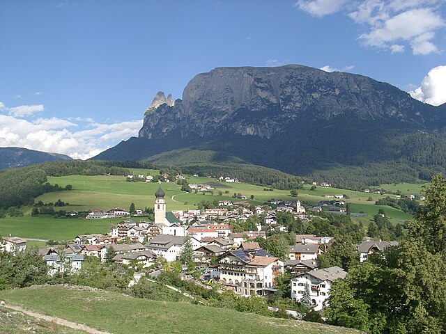

Völs am Schlern
- Italian comune
Hiking in Völs am Schlern
Völs am Schlern, nestled in the heart of South Tyrol, Italy, is an excellent destination for hiking enthusiasts. Its picturesque landscape features stunning views of the Sciliar massif and lush green valleys, making it a perfect spot for both novice and experienced hikers....
- Country:
- Postal Code: 39050
- Local Dialing Code: 0471
- Licence Plate Code: BZ
- Coordinates: 46° 31' 0" N, 11° 30' 5" E
- GPS tracks (wikiloc): [Link]
- AboveSeaLevel: 880 м m
- Area: 43.96 sq km
- Population: 3595
- Web site: [Link]


Franzensfeste
- comune in South Tyrol
Hiking in Franzensfeste
Franzensfeste, located in South Tyrol, Italy, is a fascinating area for hiking enthusiasts. It’s known for its stunning landscapes, rich history, and variety of hiking trails that cater to different skill levels....
- Country:
- Postal Code: 39045
- Local Dialing Code: 0472
- Licence Plate Code: BZ
- Coordinates: 46° 47' 23" N, 11° 36' 36" E
- GPS tracks (wikiloc): [Link]
- AboveSeaLevel: 749 м m
- Area: 61.77 sq km
- Population: 999
- Web site: [Link]
Ahrntal
- Italian comune
Hiking in Ahrntal
Ahrntal, also known as the Aurina Valley, is a stunning destination for hiking enthusiasts located in the South Tyrol region of northern Italy. Nestled in the Zillertal Alps, this area is characterized by its breathtaking landscapes, towering peaks, lush meadows, and pristine valleys....
- Country:
- Postal Code: 39030
- Local Dialing Code: 0474
- Licence Plate Code: BZ
- Coordinates: 46° 59' 49" N, 11° 58' 49" E
- GPS tracks (wikiloc): [Link]
- AboveSeaLevel: 1054 м m
- Area: 187.89 sq km
- Population: 5991
- Web site: [Link]

Gais, South Tyrol
- Italian comune
Hiking in Gais, South Tyrol
Gais, a picturesque village in South Tyrol, Italy, is an excellent destination for hiking enthusiasts. Nestled in the shadow of the stunning Dolomites, the area offers breathtaking landscapes, diverse trails, and a rich cultural heritage. Here’s an overview of what you can expect while hiking in and around Gais:...
- Country:
- Postal Code: 39030
- Local Dialing Code: 0474
- Licence Plate Code: BZ
- Coordinates: 46° 50' 0" N, 11° 57' 0" E
- GPS tracks (wikiloc): [Link]
- AboveSeaLevel: 841 м m
- Area: 60.62 sq km
- Population: 3279
- Web site: [Link]


Gargazon
- Italian comune
Hiking in Gargazon
Gargazon, located in the South Tyrol region of northern Italy, is a wonderful area for hiking enthusiasts. The region is characterized by its stunning landscapes, which include lush forests, rolling hills, and picturesque views of the surrounding mountains, including the Dolomites. Here are some key points about hiking in Gargazon:...
- Country:
- Postal Code: 39010
- Local Dialing Code: 0473
- Licence Plate Code: BZ
- Coordinates: 46° 35' 4" N, 11° 12' 6" E
- GPS tracks (wikiloc): [Link]
- AboveSeaLevel: 267 м m
- Area: 4.91 sq km
- Population: 1688
- Web site: [Link]

Glurns
- Italian comune
Hiking in Glurns
Glurns (or Glorenza) is a small historical town located in the South Tyrol region of northern Italy. It's nestled in the Venosta Valley and is known for its charming medieval architecture, stunning mountain scenery, and a rich cultural heritage....
- Country:
- Postal Code: 39020
- Local Dialing Code: 0473
- Licence Plate Code: BZ
- Coordinates: 46° 40' 16" N, 10° 33' 25" E
- GPS tracks (wikiloc): [Link]
- AboveSeaLevel: 907 м m
- Area: 13.22 sq km
- Population: 897
- Web site: [Link]


La Val
- comune in Northern Italy
Hiking in La Val
La Val, located in the Dolomites of Northern Italy, is a picturesque destination ideal for hiking enthusiasts. This charming valley is part of the South Tyrol province and is known for its stunning landscapes, rich culture, and a wide array of hiking trails suitable for all levels of experience....
- Country:
- Postal Code: 39030
- Local Dialing Code: 0471
- Licence Plate Code: BZ
- Coordinates: 46° 39' 27" N, 11° 55' 26" E
- GPS tracks (wikiloc): [Link]
- AboveSeaLevel: 1353 м m
- Area: 38.92 sq km
- Population: 1387
- Web site: [Link]


Latsch
- Italian comune
Hiking in Latsch
Latsch, located in South Tyrol, Italy, is a fantastic destination for hiking enthusiasts, offering a mix of beautiful landscapes, diverse trails, and stunning views of the surrounding Alps. Here are some highlights and tips for hiking in Latsch:...
- Country:
- Postal Code: 39021
- Local Dialing Code: 0473
- Licence Plate Code: BZ
- Coordinates: 46° 36' 59" N, 10° 51' 26" E
- GPS tracks (wikiloc): [Link]
- AboveSeaLevel: 639 м m
- Area: 78.71 sq km
- Population: 5216
- Web site: [Link]

Algund
- Italian comune
Hiking in Algund
Algund, a picturesque village located near Merano in South Tyrol, Italy, is an excellent destination for hiking enthusiasts. It boasts stunning views of the surrounding mountains and valleys, along with diverse trails catering to different skill levels. Here are some highlights of hiking in Algund:...
- Country:
- Postal Code: 39022
- Local Dialing Code: 0473
- Licence Plate Code: BZ
- Coordinates: 46° 41' 0" N, 11° 8' 0" E
- GPS tracks (wikiloc): [Link]
- AboveSeaLevel: 2600 м m
- Area: 23.68 sq km
- Population: 5042
- Web site: [Link]


Lajen
- Italian comune
Hiking in Lajen
Lajen, or Laion, is a picturesque village located in the South Tyrol region of northern Italy, known for its stunning scenery and outdoor recreational opportunities, including hiking. The area is nestled in the Val Gardena valley, surrounded by the breathtaking Dolomites, a UNESCO World Heritage Site, which offers a wealth of hiking trails for all levels of experience....
- Country:
- Postal Code: 39040
- Local Dialing Code: 0471
- Licence Plate Code: BZ
- Coordinates: 46° 36' 29" N, 11° 33' 56" E
- GPS tracks (wikiloc): [Link]
- AboveSeaLevel: 1093 м m
- Area: 37.53 sq km
- Population: 2675
- Web site: [Link]
Lana
- Italian comune in South Tyrol
Hiking in Lana
Lana, located in South Tyrol, Italy, is a fantastic destination for hiking enthusiasts, offering a diverse range of trails set against stunning alpine scenery. Nestled near the larger town of Merano, Lana provides access to beautiful landscapes, charming villages, and cultural sites....
- Country:
- Postal Code: 39011
- Local Dialing Code: 0473
- Licence Plate Code: BZ
- Coordinates: 46° 37' 0" N, 11° 10' 0" E
- GPS tracks (wikiloc): [Link]
- AboveSeaLevel: 310 м m
- Area: 36.12 sq km
- Population: 12286
- Web site: [Link]


Laas
- Italian comune in South Tyrol
Hiking in Laas
Laas, located in the stunning South Tyrol region of northern Italy, is a small village known for its beautiful landscapes and excellent hiking opportunities. Nestled in the heart of the Alps, Laas boasts a mix of gentle trails and more challenging routes, making it suitable for hikers of all levels....
- Country:
- Postal Code: 39023
- Local Dialing Code: 0473
- Licence Plate Code: BZ
- Coordinates: 46° 37' 4" N, 10° 41' 52" E
- GPS tracks (wikiloc): [Link]
- AboveSeaLevel: 868 м m
- Area: 110.23 sq km
- Population: 4028
- Web site: [Link]


Laurein
- Italian comune
Hiking in Laurein
Laurein, located in the South Tyrol region of northern Italy, offers a unique and picturesque hiking experience. Nestled in the scenic Mendel Pass area, it provides stunning views of the surrounding valleys, mountains, and vineyards. Here are some highlights of hiking in Laurein:...
- Country:
- Postal Code: 39040
- Local Dialing Code: 0463
- Licence Plate Code: BZ
- Coordinates: 46° 27' 16" N, 11° 3' 42" E
- GPS tracks (wikiloc): [Link]
- AboveSeaLevel: 1150 м m
- Area: 13.89 sq km
- Population: 338
- Web site: [Link]

Lüsen
- Italian comune
Hiking in Lüsen
Lüsen, or Lüsen Valley, is a picturesque area located in South Tyrol, Italy, known for its stunning mountain scenery and a variety of hiking trails suitable for all levels of hikers. Situated near the larger town of Brixen (or Bressanone), it is a popular destination for outdoor enthusiasts....
- Country:
- Postal Code: 39040
- Local Dialing Code: 0472
- Licence Plate Code: BZ
- Coordinates: 46° 44' 46" N, 11° 45' 40" E
- GPS tracks (wikiloc): [Link]
- AboveSeaLevel: 962 м m
- Area: 74.41 sq km
- Population: 1545
- Web site: [Link]

Margreid an der Weinstraße
- Italian comune
Hiking in Margreid an der Weinstraße
Margreid an der Weinstraße, located in South Tyrol, Italy, is a picturesque village that offers a great base for hiking enthusiasts. This region is known for its vineyards, beautiful landscapes, and charming views of the surrounding mountains, making it an ideal destination for outdoor activities....
- Country:
- Postal Code: 39040
- Local Dialing Code: 0471
- Licence Plate Code: BZ
- Coordinates: 46° 17' 16" N, 11° 12' 38" E
- GPS tracks (wikiloc): [Link]
- AboveSeaLevel: 241 м m
- Area: 13.86 sq km
- Population: 1295
- Web site: [Link]


Mals
- Italian comune
Hiking in Mals
Mals, located in the Vinschgau Valley in South Tyrol, Italy, is a fantastic spot for hiking enthusiasts. Surrounded by stunning landscapes, picturesque villages, and a rich cultural heritage, it offers a variety of trails suitable for different skill levels....
- Country:
- Postal Code: 39024
- Local Dialing Code: 0473
- Licence Plate Code: BZ
- Coordinates: 46° 41' 16" N, 10° 32' 48" E
- GPS tracks (wikiloc): [Link]
- AboveSeaLevel: 1051 м m
- Area: 247.43 sq km
- Population: 5225
- Web site: [Link]


Mareo
- Italian comune
Hiking in Mareo
Mareo is a charming area in the Asturias region of northern Spain, known for its breathtaking natural landscapes, rich biodiversity, and traditional villages. Hiking in Mareo can be a rewarding experience, offering various trails that cater to hikers of different skill levels. Here are a few key points to consider if you plan on hiking in this area:...
- Country:
- Postal Code: 39030
- Local Dialing Code: 0474
- Licence Plate Code: BZ
- Coordinates: 46° 43' 8" N, 11° 55' 1" E
- GPS tracks (wikiloc): [Link]
- AboveSeaLevel: 1186 м m
- Area: 160.32 sq km
- Population: 3037
- Web site: [Link]
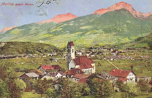

Marling, South Tyrol
- Italian comune
Hiking in Marling, South Tyrol
Marling, located in South Tyrol, Italy, is a charming village that offers a plethora of hiking opportunities amidst stunning Alpine scenery. The region is characterized by its mild climate, diverse landscapes, and beautiful panoramic views, making it an ideal destination for both casual walkers and seasoned hikers....
- Country:
- Postal Code: 39020
- Local Dialing Code: 0473
- Licence Plate Code: BZ
- Coordinates: 46° 39' 9" N, 11° 8' 44" E
- GPS tracks (wikiloc): [Link]
- AboveSeaLevel: 363 м m
- Area: 12.86 sq km
- Population: 2710
- Web site: [Link]


Percha
- Italian comune
Hiking in Percha
Percha, known for its beautiful landscapes and outdoor recreational opportunities, offers a variety of hiking experiences for outdoor enthusiasts. While specific trails and details may vary, here are some general points to consider if you're planning to hike in this area:...
- Country:
- Postal Code: 39030
- Local Dialing Code: 0474
- Licence Plate Code: BZ
- Coordinates: 46° 47' 36" N, 11° 59' 0" E
- GPS tracks (wikiloc): [Link]
- AboveSeaLevel: 972 м m
- Area: 30.36 sq km
- Population: 1550
- Web site: [Link]

Martell
- Italian comune in South Tyrol
Hiking in Martell
Martell is a picturesque valley located in South Tyrol, Italy, known for its breathtaking landscapes, diverse flora and fauna, and excellent hiking trails. Here are some key points to consider if you're planning a hiking trip to Martell:...
- Country:
- Postal Code: 39020
- Local Dialing Code: 0473
- Licence Plate Code: BZ
- Coordinates: 46° 33' 17" N, 10° 46' 50" E
- GPS tracks (wikiloc): [Link]
- AboveSeaLevel: 1312 м m
- Area: 142.8 sq km
- Population: 853
- Web site: [Link]


Mölten
- Italian comune
Hiking in Mölten
Mölten, or Molten, is a lovely village in South Tyrol, Italy, situated on the sunny side of the Adige Valley. It offers a variety of hiking trails that cater to different experience levels, making it an excellent destination for hikers....
- Country:
- Postal Code: 39010
- Local Dialing Code: 0471
- Licence Plate Code: BZ
- Coordinates: 46° 35' 15" N, 11° 15' 18" E
- GPS tracks (wikiloc): [Link]
- AboveSeaLevel: 1140 м m
- Area: 36.95 sq km
- Population: 1676
- Web site: [Link]


Welsberg-Taisten
- Italian comune
Hiking in Welsberg-Taisten
Welsberg-Taisten is a beautiful hiking destination located in the South Tyrol region of northern Italy. Nestled in the Dolomites, it offers a wide range of hiking trails suitable for various skill levels, from easy strolls to challenging ascents. Here are some key points about hiking in this area:...
- Country:
- Postal Code: 39035
- Local Dialing Code: 0474
- Licence Plate Code: BZ
- Coordinates: 46° 45' 28" N, 12° 6' 20" E
- GPS tracks (wikiloc): [Link]
- AboveSeaLevel: 1087 м m
- Area: 46.44 sq km
- Population: 2867
- Web site: [Link]


Montan
- Italian comune
Hiking in Montan
Hiking in Montana offers some of the most stunning landscapes and diverse ecosystems in the United States. With its vast wilderness areas, national parks, and state parks, Montana is a hiker’s paradise. Here are some key highlights and considerations for hiking in Montana:...
- Country:
- Postal Code: 39040
- Local Dialing Code: 0471
- Licence Plate Code: BZ
- Coordinates: 46° 19' 49" N, 11° 18' 1" E
- GPS tracks (wikiloc): [Link]
- AboveSeaLevel: 497 м m
- Area: 19.51 sq km
- Population: 1684
- Web site: [Link]


Moos in Passeier
- human settlement in Italy
Hiking in Moos in Passeier
Moos in Passeier is a picturesque village located in the Passeier Valley of South Tyrol, Italy. It's a great base for hiking enthusiasts who want to explore the stunning natural beauty of the region, which is characterized by majestic mountains, lush meadows, and charming alpine landscapes. Here are some highlights and tips for hiking in and around Moos in Passeier:...
- Country:
- Postal Code: 39013
- Local Dialing Code: 0473
- Licence Plate Code: BZ
- Coordinates: 46° 49' 54" N, 11° 10' 1" E
- GPS tracks (wikiloc): [Link]
- AboveSeaLevel: 1007 м m
- Area: 193.53 sq km
- Population: 2097
- Web site: [Link]


Nals
- Italian comune
Hiking in Nals
Nals, located in South Tyrol, Italy, is a great destination for hiking enthusiasts. Nestled in the picturesque Adige Valley near Bolzano, Nals offers a mix of scenic trails, stunning alpine views, and the unique charm of vineyards and orchards....
- Country:
- Postal Code: 39010
- Local Dialing Code: 0471
- Licence Plate Code: BZ
- Coordinates: 46° 32' 36" N, 11° 12' 22" E
- GPS tracks (wikiloc): [Link]
- AboveSeaLevel: 321 м m
- Area: 12.24 sq km
- Population: 1975
- Web site: [Link]


Welschnofen
- Italian comune
Hiking in Welschnofen
Welschnofen, located in the South Tyrol region of Italy, is a beautiful destination for hiking enthusiasts. Nestled in the Dolomites, this charming village offers a range of trails suited for all levels of hikers, from beginners to experienced adventurers. Here are some highlights of hiking in Welschnofen:...
- Country:
- Postal Code: 39056
- Local Dialing Code: 0471
- Licence Plate Code: BZ
- Coordinates: 46° 25' 44" N, 11° 32' 22" E
- GPS tracks (wikiloc): [Link]
- AboveSeaLevel: 1182 м m
- Area: 51.1 sq km
- Population: 1976
- Web site: [Link]


Deutschnofen
- Italian comune
Hiking in Deutschnofen
Deutschnofen, known as "Naz-Sciaves" in Italian, is a charming village located in the South Tyrol region of northern Italy. Nestled in the stunning Dolomites, it offers a variety of hiking opportunities for enthusiasts of all levels. Here are some highlights of hiking in this beautiful area:...
- Country:
- Postal Code: 39050
- Local Dialing Code: 0471
- Licence Plate Code: BZ
- Coordinates: 46° 24' 51" N, 11° 25' 31" E
- GPS tracks (wikiloc): [Link]
- AboveSeaLevel: 1357 м m
- Area: 112.49 sq km
- Population: 3917
- Web site: [Link]


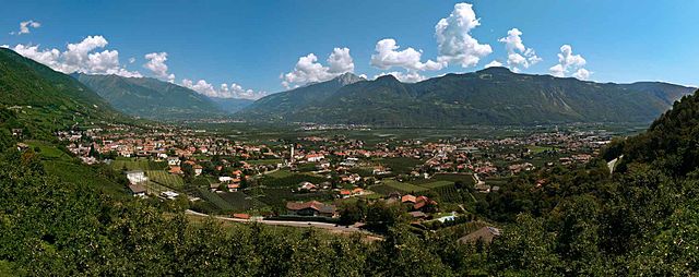
Auer
- comune in South Tyrol, Italy
Hiking in Auer
Auer, a charming village in South Tyrol, Italy, offers a variety of hiking opportunities, making it an excellent destination for outdoor enthusiasts. Nestled in the picturesque landscape of the Dolomites, Auer is surrounded by beautiful mountains, vineyards, and apple orchards, providing a diverse range of hiking experiences....
- Country:
- Postal Code: 39040
- Local Dialing Code: 0471
- Licence Plate Code: BZ
- Coordinates: 46° 20' 49" N, 11° 17' 51" E
- GPS tracks (wikiloc): [Link]
- AboveSeaLevel: 236 м m
- Area: 11.79 sq km
- Population: 3795
- Web site: [Link]

Plaus
- Italian comune
Hiking in Plaus
Plaus is a small commune located in South Tyrol, Italy, nestled in the Adige Valley. This region is known for its beautiful landscapes, charming villages, and a variety of outdoor activities, including hiking. Here are some key points about hiking in and around Plaus:...
- Country:
- Postal Code: 39025
- Local Dialing Code: 0473
- Licence Plate Code: BZ
- Coordinates: 46° 39' 0" N, 11° 2' 0" E
- GPS tracks (wikiloc): [Link]
- AboveSeaLevel: 519 м m
- Area: 4.87 sq km
- Population: 712
- Web site: [Link]


Waidbruck
- Italian comune
Hiking in Waidbruck
Waidbruck, a small village in South Tyrol, Italy, offers some beautiful hiking opportunities, combining stunning alpine scenery with rich cultural experiences. Here are some highlights and tips for hiking in the area:...
- Country:
- Postal Code: 39040
- Local Dialing Code: 0471
- Licence Plate Code: BZ
- Coordinates: 46° 35' 50" N, 11° 31' 51" E
- GPS tracks (wikiloc): [Link]
- AboveSeaLevel: 471 м m
- Area: 2.33 sq km
- Population: 193
- Web site: [Link]

Burgstall, South Tyrol
- Italian comune
Hiking in Burgstall, South Tyrol
Burgstall is a charming village located in South Tyrol, Italy, known for its picturesque landscapes and proximity to the Alps. Hiking around Burgstall offers a fantastic opportunity to explore the diverse terrain and enjoy stunning views....
- Country:
- Postal Code: 39014
- Local Dialing Code: 0473
- Licence Plate Code: BZ
- Coordinates: 46° 36' 34" N, 11° 11' 35" E
- GPS tracks (wikiloc): [Link]
- AboveSeaLevel: 270 м m
- Area: 6.69 sq km
- Population: 1887
- Web site: [Link]


Prad am Stilfser Joch
- Italian comune
Hiking in Prad am Stilfser Joch
Prad am Stilfser Joch is a charming village located in the South Tyrol region of Italy, nestled at the entrance to the Stilfser Joch National Park. This area is renowned for its stunning natural landscapes, mountainous terrain, and excellent hiking opportunities. Here are some highlights and tips for hiking in this region:...
- Country:
- Postal Code: 39026
- Local Dialing Code: 0473
- Licence Plate Code: BZ
- Coordinates: 46° 37' 8" N, 10° 35' 29" E
- GPS tracks (wikiloc): [Link]
- AboveSeaLevel: 3375 м m
- Area: 51.49 sq km
- Population: 3474
- Web site: [Link]


Prettau
- Italian comune
Hiking in Prettau
Prettau, located in the Ahrntal Valley of South Tyrol, Italy, is a fantastic destination for hiking enthusiasts. The area offers breathtaking landscapes, including majestic mountains, lush valleys, and crystal-clear streams. Here are some highlights for hiking in Prettau:...
- Country:
- Postal Code: 39030
- Local Dialing Code: 0474
- Licence Plate Code: BZ
- Coordinates: 47° 2' 25" N, 12° 6' 24" E
- GPS tracks (wikiloc): [Link]
- AboveSeaLevel: 1475 м m
- Area: 86.36 sq km
- Population: 547
- Web site: [Link]

Proveis
- Italian comune
Hiking in Proveis
Proveis, a small village in the Trentino region of Italy, offers some stunning hiking opportunities surrounded by the natural beauty of the Dolomites. Here are some highlights to consider if you're planning to hike in this area:...
- Country:
- Postal Code: 39040
- Local Dialing Code: 0463
- Licence Plate Code: BZ
- Coordinates: 46° 28' 36" N, 11° 1' 21" E
- GPS tracks (wikiloc): [Link]
- AboveSeaLevel: 1420 м m
- Area: 18.37 sq km
- Population: 267
- Web site: [Link]

Ratschings
- town and commune in Italy
Hiking in Ratschings
Ratschings, located in the South Tyrol region of northern Italy, is a fantastic destination for hiking enthusiasts. The area is known for its stunning alpine scenery, diverse trails, and a variety of outdoor activities. Here are some highlights of hiking in Ratschings:...
- Country:
- Postal Code: 39040
- Local Dialing Code: 0472
- Licence Plate Code: BZ
- Coordinates: 46° 52' 0" N, 11° 18' 0" E
- GPS tracks (wikiloc): [Link]
- AboveSeaLevel: 976 м m
- Area: 203.29 sq km
- Population: 4471
- Web site: [Link]


Ritten
- Italian comune
Hiking in Ritten
Ritten, also known as Renon, is a picturesque area located in South Tyrol, Italy, just outside of Bolzano. It offers a fantastic hiking experience with its stunning landscapes, diverse trails, and panoramic views of the Dolomites. Here are some highlights and tips for hiking in Ritten:...
- Country:
- Postal Code: 39054
- Local Dialing Code: 0471
- Licence Plate Code: BZ
- Coordinates: 46° 32' 29" N, 11° 27' 26" E
- GPS tracks (wikiloc): [Link]
- AboveSeaLevel: 1154 м m
- Area: 111.36 sq km
- Population: 7892
- Web site: [Link]
Riffian, South Tyrol
- Italian comune
Hiking in Riffian, South Tyrol
Riffian, a picturesque village in the South Tyrol region of northern Italy, offers some fantastic opportunities for hiking enthusiasts. Nestled in the mountains, Riffian is surrounded by stunning landscapes, lush meadows, and dense forests, making it an excellent starting point for various hiking trails....
- Country:
- Postal Code: 39010
- Local Dialing Code: 0473
- Licence Plate Code: BZ
- Coordinates: 46° 42' 0" N, 11° 11' 0" E
- GPS tracks (wikiloc): [Link]
- AboveSeaLevel: 504 м m
- Area: 35.94 sq km
- Population: 1357
- Web site: [Link]


Mühlbach
- Italian comune in South Tyrol
Hiking in Mühlbach
Mühlbach, located in South Tyrol, Italy, is a charming village that serves as an excellent gateway for hiking enthusiasts. The region is characterized by stunning landscapes, picturesque mountain views, and a well-connected network of trails that cater to various hiking abilities. Here are some highlights for hiking in the Mühlbach area:...
- Country:
- Postal Code: 39037
- Local Dialing Code: 0472
- Licence Plate Code: BZ
- Coordinates: 46° 47' 48" N, 11° 40' 3" E
- GPS tracks (wikiloc): [Link]
- AboveSeaLevel: 777 м m
- Area: 83.82 sq km
- Population: 3081
- Web site: [Link]


Rodeneck
- Italian comune
Hiking in Rodeneck
Rodeneck (or Rodengo) is a charming village in South Tyrol, Italy, located near Bressanone/Brixen. It's an excellent destination for hiking enthusiasts, offering a variety of trails that cater to different skill levels, from leisurely walks to more challenging hikes....
- Country:
- Postal Code: 39037
- Local Dialing Code: 0472
- Licence Plate Code: BZ
- Coordinates: 46° 47' 0" N, 11° 41' 0" E
- GPS tracks (wikiloc): [Link]
- AboveSeaLevel: 885 м m
- Area: 29.62 sq km
- Population: 1230
- Web site: [Link]


Innichen
- comune in South Tyrol (Italy)
Hiking in Innichen
Innichen, known as San Candido in Italian, is a picturesque village located in the South Tyrol region of northern Italy. It’s surrounded by the stunning Dolomites, offering a plethora of hiking opportunities for all skill levels. Here are some key points to consider if you're planning a hiking trip to Innichen:...
- Country:
- Postal Code: 39038
- Local Dialing Code: 0474
- Licence Plate Code: BZ
- Coordinates: 46° 43' 57" N, 12° 16' 43" E
- GPS tracks (wikiloc): [Link]
- AboveSeaLevel: 1175 м m
- Area: 79.85 sq km
- Population: 3317
- Web site: [Link]


Jenesien
- Italian comune
Hiking in Jenesien
Jenesien, or San Genesio in Italian, is a lovely village located on the southern slopes of the Alps, just above the city of Bolzano in South Tyrol, Italy. It's known for its stunning views, rich history, and a plethora of hiking trails that cater to all skill levels. Here are some key highlights and tips if you're considering hiking in Jenesien:...
- Country:
- Postal Code: 39050
- Local Dialing Code: 0471
- Licence Plate Code: BZ
- Coordinates: 46° 32' 5" N, 11° 19' 47" E
- GPS tracks (wikiloc): [Link]
- AboveSeaLevel: 1000 м m
- Area: 68.84 sq km
- Population: 3045
- Web site: [Link]

Schluderns
- Italian comune
Hiking in Schluderns
Schluderns, located in South Tyrol, Italy, is a charming village surrounded by stunning landscapes and offers a variety of hiking opportunities. The region is characterized by its mountainous terrain, lush forests, and picturesque valleys. Here are some key points to consider when planning a hike in and around Schluderns:...
- Country:
- Postal Code: 39020
- Local Dialing Code: 0473
- Licence Plate Code: BZ
- Coordinates: 46° 39' 55" N, 10° 35' 0" E
- GPS tracks (wikiloc): [Link]
- AboveSeaLevel: 921 м m
- Area: 20.72 sq km
- Population: 1820
- Web site: [Link]


Olang
- Italian comune
Hiking in Olang
Olang, also known as Valdaora, is a picturesque village located in the South Tyrol region of northern Italy, nestled in the Dolomites. This area is renowned for its stunning landscapes, rich culture, and diverse hiking opportunities. Here's what you need to know about hiking in Olang:...
- Country:
- Postal Code: 39030
- Local Dialing Code: 0474
- Licence Plate Code: BZ
- Coordinates: 46° 45' 37" N, 12° 1' 46" E
- GPS tracks (wikiloc): [Link]
- AboveSeaLevel: 1048 м m
- Area: 49.08 sq km
- Population: 3174
- Web site: [Link]


Unsere Liebe Frau im Walde-St. Felix
- Italian comune
Hiking in Unsere Liebe Frau im Walde-St. Felix
Unsere Liebe Frau im Walde-St. Felix is a picturesque village located in the South Tyrol region of Italy, surrounded by stunning natural scenery, making it a fantastic destination for hiking enthusiasts. The area is characterized by its beautiful landscapes, including rolling hills, dense forests, and majestic mountains, providing a diverse range of hiking opportunities for all skill levels....
- Country:
- Postal Code: 39010
- Local Dialing Code: 0463
- Licence Plate Code: BZ
- Coordinates: 46° 29' 39" N, 11° 7' 49" E
- GPS tracks (wikiloc): [Link]
- AboveSeaLevel: 1315 м m
- Area: 27.63 sq km
- Population: 769
- Web site: [Link]

Stilfs
- Italian comune
Hiking in Stilfs
Stilfs, also known as Stilfs or Stelvio, is a charming village located in the South Tyrol region of northern Italy. It serves as a fantastic gateway for hiking enthusiasts looking to explore the beautiful and diverse landscapes of the nearby Stelvio National Park. Here are some highlights of hiking in and around Stilfs:...
- Country:
- Postal Code: 39020
- Local Dialing Code: 0473
- Licence Plate Code: BZ
- Coordinates: 46° 35' 52" N, 10° 32' 45" E
- GPS tracks (wikiloc): [Link]
- AboveSeaLevel: 1311 м m
- Area: 141.63 sq km
- Population: 1150
- Web site: [Link]


Ulten
- Italian comune
Hiking in Ulten
Hiking in Ulten, which is located in South Tyrol (Südtirol), northern Italy, offers a fantastic experience for outdoor enthusiasts. The region is characterized by its stunning alpine scenery, lush valleys, and a rich diversity of flora and fauna. Here’s what you need to know about hiking in Ulten:...
- Country:
- Postal Code: 39016
- Local Dialing Code: 0473
- Licence Plate Code: BZ
- Coordinates: 46° 32' 54" N, 11° 0' 15" E
- GPS tracks (wikiloc): [Link]
- AboveSeaLevel: 1190 м m
- Area: 208.12 sq km
- Population: 2871
- Web site: [Link]


Schlanders
- Italian comune
Hiking in Schlanders
Schlanders, located in the South Tyrol region of northern Italy, offers a wonderful hiking experience amid stunning alpine scenery. Surrounded by the impressive peaks of the Ortler Alps and near the beautiful Vinschgau Valley, this area is ideal for both novice and experienced hikers....
- Country:
- Postal Code: 39028
- Local Dialing Code: 0473
- Licence Plate Code: BZ
- Coordinates: 46° 37' 42" N, 10° 46' 5" E
- GPS tracks (wikiloc): [Link]
- AboveSeaLevel: 720 м m
- Area: 115.17 sq km
- Population: 6181
- Web site: [Link]

San Martin de Tor
- Italian comune
Hiking in San Martin de Tor
San Martin de Tor, located in the Dolomites of Northern Italy, is an excellent destination for hiking enthusiasts. The area is known for its stunning landscapes, rich cultural heritage, and a variety of trails that cater to different skill levels. Here are some highlights and tips for hiking in and around San Martin de Tor:...
- Country:
- Postal Code: 39030
- Local Dialing Code: 0474
- Licence Plate Code: BZ
- Coordinates: 46° 40' 54" N, 11° 53' 53" E
- GPS tracks (wikiloc): [Link]
- AboveSeaLevel: 1127 м m
- Area: 75.94 sq km
- Population: 1744
- Web site: [Link]

Terlan
- Italian comune
Hiking in Terlan
Terlan, located in South Tyrol, Italy, is a beautiful destination for hiking enthusiasts. Nestled at the foothills of the Alps and surrounded by vineyards and rolling hills, Terlan offers a variety of trails suitable for all levels, from leisurely walks to challenging mountain hikes....
- Country:
- Postal Code: 39018
- Local Dialing Code: 0471
- Licence Plate Code: BZ
- Coordinates: 46° 31' 56" N, 11° 14' 49" E
- GPS tracks (wikiloc): [Link]
- AboveSeaLevel: 250 м m
- Area: 18.57 sq km
- Population: 4391
- Web site: [Link]


Tramin an der Weinstraße
- Italian comune
Hiking in Tramin an der Weinstraße
Tramin an der Weinstraße, also known as Termeno sulla Strada del Vino, is a picturesque village in South Tyrol, northern Italy, famous for its wine production and stunning landscapes. The area is surrounded by vineyards, rolling hills, and mountains, making it an excellent destination for hiking enthusiasts....
- Country:
- Postal Code: 39040
- Local Dialing Code: 0471
- Licence Plate Code: BZ
- Coordinates: 46° 20' 29" N, 11° 14' 32" E
- GPS tracks (wikiloc): [Link]
- AboveSeaLevel: 276 м m
- Area: 19.44 sq km
- Population: 3383
- Web site: [Link]

Sëlva
- Italian comune
Hiking in Sëlva
Sëlva, known as Selva di Val Gardena, is a picturesque village located in the Dolomites of northern Italy, particularly popular for its stunning landscapes and diverse hiking trails. The Dolomites are a UNESCO World Heritage site, making hiking in this region an unforgettable experience....
- Country:
- Postal Code: 39048
- Local Dialing Code: 0471
- Licence Plate Code: BZ
- Coordinates: 46° 33' 17" N, 11° 45' 37" E
- GPS tracks (wikiloc): [Link]
- AboveSeaLevel: 1563 м m
- Area: 56.24 sq km
- Population: 2621
- Web site: [Link]


Terenten
- Italian comune
Hiking in Terenten
Terenten, a picturesque village located in the South Tyrol region of northern Italy, offers stunning landscapes, fresh air, and a variety of hiking trails suitable for all levels of experience. Here are some key points about hiking in Terenten:...
- Country:
- Postal Code: 39030
- Local Dialing Code: 0472
- Licence Plate Code: BZ
- Coordinates: 46° 49' 48" N, 11° 46' 58" E
- GPS tracks (wikiloc): [Link]
- AboveSeaLevel: 1210 м m
- Area: 42.16 sq km
- Population: 1753
- Web site: [Link]

Schnals
- Italian comune
Hiking in Schnals
Schnals, located in the South Tyrol region of Italy, is a picturesque valley that offers stunning landscapes and diverse hiking opportunities. Nestled in the Ötztal Alps, it is a popular destination for outdoor enthusiasts, especially those who enjoy alpine hiking....
- Country:
- Postal Code: 39020
- Local Dialing Code: 0473
- Licence Plate Code: BZ
- Coordinates: 46° 42' 0" N, 10° 55' 0" E
- GPS tracks (wikiloc): [Link]
- AboveSeaLevel: 1317 м m
- Area: 209.84 sq km
- Population: 1231
- Web site: [Link]


Feldthurns
- Italian comune
Hiking in Feldthurns
Feldthurns (or Velthurns) is a quaint village located in South Tyrol, Italy, known for its stunning landscapes and excellent hiking opportunities. Nestled within the foothills of the Alps, it provides access to various trails that cater to different skill levels, making it an excellent destination for both novice hikers and seasoned trekkers....
- Country:
- Postal Code: 39040
- Local Dialing Code: 0472
- Licence Plate Code: BZ
- Coordinates: 46° 40' 1" N, 11° 35' 50" E
- GPS tracks (wikiloc): [Link]
- AboveSeaLevel: 851 м m
- Area: 24.58 sq km
- Population: 2873
- Web site: [Link]


Vadena
- Italian comune
Hiking in Vadena
Vadena, located in the South Tyrol region of northern Italy, is a lesser-known but beautiful area that offers a variety of hiking opportunities. Here’s an overview of what to expect when hiking in this region:...
- Country:
- Postal Code: 39051
- Local Dialing Code: 0471
- Licence Plate Code: BZ
- Coordinates: 46° 25' 0" N, 11° 18' 0" E
- GPS tracks (wikiloc): [Link]
- AboveSeaLevel: 243 м m
- Area: 15.22 sq km
- Population: 1015
- Web site: [Link]

St. Leonhard in Passeier
- Italian comune
Hiking in St. Leonhard in Passeier
St. Leonhard in Passeier is a picturesque village located in the South Tyrol region of northern Italy, nestled within the Ötztal Alps. It's renowned for its stunning alpine scenery, rich cultural heritage, and a variety of outdoor activities, making it an excellent destination for hikers of all skill levels. Here are some highlights of hiking in this area:...
- Country:
- Postal Code: 39015
- Local Dialing Code: 0473
- Licence Plate Code: BZ
- Coordinates: 46° 48' 46" N, 11° 14' 45" E
- GPS tracks (wikiloc): [Link]
- AboveSeaLevel: 689 м m
- Area: 89.03 sq km
- Population: 3551
- Web site: [Link]


St. Lorenzen
- Italian comune
Hiking in St. Lorenzen
St. Lorenzen, located in the picturesque region of South Tyrol in northern Italy, offers a variety of hiking opportunities suitable for all skill levels. The area is known for its stunning natural landscapes, including mountains, forests, and charming meadows, making it an excellent destination for outdoor enthusiasts....
- Country:
- Postal Code: 39030
- Local Dialing Code: 0474
- Licence Plate Code: BZ
- Coordinates: 46° 47' 7" N, 11° 54' 29" E
- GPS tracks (wikiloc): [Link]
- AboveSeaLevel: 810 м m
- Area: 51.46 sq km
- Population: 3889
- Web site: [Link]


Tirol, South Tyrol
- Italian comune
Hiking in Tirol, South Tyrol
Hiking in Tirol (Austria) and South Tyrol (Italy) offers an incredible experience, showcasing stunning landscapes, diverse flora and fauna, and a rich cultural heritage. Here's an overview of what to expect in both regions:...
- Country:
- Postal Code: 39019
- Local Dialing Code: 0473
- Licence Plate Code: BZ
- Coordinates: 46° 41' 28" N, 11° 9' 15" E
- GPS tracks (wikiloc): [Link]
- AboveSeaLevel: 594 м m
- Area: 25.62 sq km
- Population: 2456
- Web site: [Link]


St. Martin in Passeier
- Italian comune
Hiking in St. Martin in Passeier
Hiking in St. Martin in Passeier, located in South Tyrol, Italy, offers a stunning opportunity to explore the natural beauty of the Passeier Valley. The region is known for its picturesque landscapes, charming villages, and a variety of hiking trails suitable for different skill levels....
- Country:
- Postal Code: 39010
- Local Dialing Code: 0473
- Licence Plate Code: BZ
- Coordinates: 46° 47' 2" N, 11° 13' 38" E
- GPS tracks (wikiloc): [Link]
- AboveSeaLevel: 600 м m
- Area: 29.99 sq km
- Population: 3233
- Web site: [Link]


St. Pankraz
- Italian comune
Hiking in St. Pankraz
St. Pankraz, located in the picturesque region of South Tyrol in Italy, offers a range of hiking opportunities for outdoor enthusiasts of all levels. Here are some key highlights about hiking in St. Pankraz:...
- Country:
- Postal Code: 39010
- Local Dialing Code: 0473
- Licence Plate Code: BZ
- Coordinates: 46° 35' 10" N, 11° 5' 9" E
- GPS tracks (wikiloc): [Link]
- AboveSeaLevel: 735 м m
- Area: 63.17 sq km
- Population: 1549
- Web site: [Link]


Santa Cristina Gherdëina
- Italian comune
Hiking in Santa Cristina Gherdëina
Santa Cristina Gherdëina, located in the Dolomites of northern Italy, is a beautiful destination for hiking enthusiasts. The stunning landscape, dramatic peaks, and vibrant alpine scenery provide an incredible backdrop for a variety of hiking trails, suitable for all skill levels. Here are some highlights and tips if you’re considering hiking in this region:...
- Country:
- Postal Code: 39047
- Local Dialing Code: 0471
- Licence Plate Code: BZ
- Coordinates: 46° 33' 47" N, 11° 43' 56" E
- GPS tracks (wikiloc): [Link]
- AboveSeaLevel: 1428 м m
- Area: 31.92 sq km
- Population: 1961
- Web site: [Link]


Schenna
- Italian comune
Hiking in Schenna
Schenna, located near Merano in South Tyrol, Italy, is a great destination for hiking enthusiasts. The region is known for its breathtaking alpine scenery, charming villages, and well-maintained hiking trails suitable for all levels, from beginners to experienced hikers....
- Country:
- Postal Code: 39017
- Local Dialing Code: 0473
- Licence Plate Code: BZ
- Coordinates: 46° 41' 24" N, 11° 11' 11" E
- GPS tracks (wikiloc): [Link]
- AboveSeaLevel: 600 м m
- Area: 48.13 sq km
- Population: 2918
- Web site: [Link]

Mühlwald
- Italian comune
Hiking in Mühlwald
Mühlwald, located in South Tyrol, Italy, offers beautiful hiking opportunities set against a stunning backdrop of the Eastern Alps. The region is known for its lush landscapes, diverse flora and fauna, and well-marked trails that cater to various skill levels, from easy walks to challenging mountain hikes. Here are some highlights of hiking in Mühlwald:...
- Country:
- Postal Code: 39030
- Local Dialing Code: 0474
- Licence Plate Code: BZ
- Coordinates: 46° 53' 25" N, 11° 51' 30" E
- GPS tracks (wikiloc): [Link]
- AboveSeaLevel: 1229 м m
- Area: 104.79 sq km
- Population: 1437
- Web site: [Link]


Tisens
- Italian comune
Hiking in Tisens
Tisens, a charming village located in South Tyrol, Italy, is a fantastic destination for hiking enthusiasts. Nestled in the mountains near Merano, it offers a variety of stunning trails that cater to different skill levels. Here’s what you can expect from hiking in Tisens:...
- Country:
- Postal Code: 39010
- Local Dialing Code: 0473
- Licence Plate Code: BZ
- Coordinates: 46° 33' 56" N, 11° 10' 10" E
- GPS tracks (wikiloc): [Link]
- AboveSeaLevel: 635 м m
- Area: 38.13 sq km
- Population: 1979
- Web site: [Link]
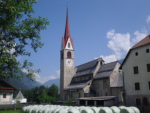
Tiers
- Italian comune in South Tyrol
Hiking in Tiers
Tiers (or Tires) is a charming village located in the Dolomites of South Tyrol, Italy, and offers an abundance of hiking opportunities. Here are some highlights about hiking in that area:...
- Country:
- Postal Code: 39050
- Local Dialing Code: 0471
- Licence Plate Code: BZ
- Coordinates: 46° 28' 5" N, 11° 31' 37" E
- GPS tracks (wikiloc): [Link]
- AboveSeaLevel: 1028 м m
- Area: 42.18 sq km
- Population: 987
- Web site: [Link]

Truden im Naturpark
- Italian comune
Hiking in Truden im Naturpark
Truden im Naturpark, located in the South Tyrol region of northern Italy, is a beautiful destination for hiking enthusiasts. It is nestled within the larger Rosengarten-Latemar Nature Park, which offers diverse landscapes, including lush forests, meadows, and stunning mountain views....
- Country:
- Postal Code: 39040
- Local Dialing Code: 0471
- Licence Plate Code: BZ
- Coordinates: 46° 19' 19" N, 11° 20' 59" E
- GPS tracks (wikiloc): [Link]
- AboveSeaLevel: 719 м m
- Area: 20.56 sq km
- Population: 1027
- Web site: [Link]


Taufers im Münstertal
- Italian comune
Hiking in Taufers im Münstertal
Taufers im Münstertal, located in the Bavarian Alps in South Tyrol, Italy, offers a stunning backdrop for hiking enthusiasts of all levels. The area is characterized by its picturesque valleys, lush forests, and panoramic mountain views, making it an ideal destination for nature lovers....
- Country:
- Postal Code: 39020
- Local Dialing Code: 0473
- Licence Plate Code: BZ
- Coordinates: 46° 38' 39" N, 10° 27' 48" E
- GPS tracks (wikiloc): [Link]
- AboveSeaLevel: 1240 м m
- Area: 46.27 sq km
- Population: 981
- Web site: [Link]


Pfitsch
- Italian comune
Hiking in Pfitsch
Pfitsch is a beautiful valley located in South Tyrol, Italy, known for its stunning landscapes, charming villages, and excellent hiking opportunities. The area is part of the larger Stubai Valley and offers a variety of trails suitable for different skill levels, from gentle walks to challenging hikes....
- Country:
- Postal Code: 39040
- Local Dialing Code: 0472
- Licence Plate Code: BZ
- Coordinates: 46° 54' 0" N, 11° 28' 0" E
- GPS tracks (wikiloc): [Link]
- AboveSeaLevel: 948 м m
- Area: 142.12 sq km
- Population: 3071
- Web site: [Link]


Gsies
- Italian comune
Hiking in Gsies
Gsies, located in the South Tyrol region of northern Italy, is a picturesque valley surrounded by the stunning Dolomites and offers a variety of hiking opportunities. Here are some highlights and tips for hiking in Gsies:...
- Country:
- Postal Code: 39035
- Local Dialing Code: 0474
- Licence Plate Code: BZ
- Coordinates: 46° 46' 6" N, 12° 10' 46" E
- GPS tracks (wikiloc): [Link]
- AboveSeaLevel: 1305 м m
- Area: 110.14 sq km
- Population: 2329
- Web site: [Link]


Vahrn
- Italian comune
Hiking in Vahrn
Vahrn, located in South Tyrol, Italy, is a charming village surrounded by stunning natural landscapes, making it a great destination for hiking enthusiasts. The area is characterized by its picturesque mountain scenery, rolling hills, and vineyards, offering various trails suitable for hikers of all levels....
- Country:
- Postal Code: 39040
- Local Dialing Code: 0472
- Licence Plate Code: BZ
- Coordinates: 46° 44' 20" N, 11° 38' 15" E
- GPS tracks (wikiloc): [Link]
- AboveSeaLevel: 671 м m
- Area: 70.34 sq km
- Population: 4546
- Web site: [Link]


Niederdorf, South Tyrol
- Italian comune
Hiking in Niederdorf, South Tyrol
Niederdorf, located in the beautiful South Tyrol region of northern Italy, is a charming village surrounded by picturesque landscapes, making it a great destination for hiking enthusiasts. The area offers a variety of hiking trails that cater to different skill levels, from leisurely walks to challenging hikes....
- Country:
- Postal Code: 39039
- Local Dialing Code: 0474
- Licence Plate Code: BZ
- Coordinates: 46° 44' 16" N, 12° 10' 22" E
- GPS tracks (wikiloc): [Link]
- AboveSeaLevel: 1154 м m
- Area: 18.03 sq km
- Population: 1605
- Web site: [Link]
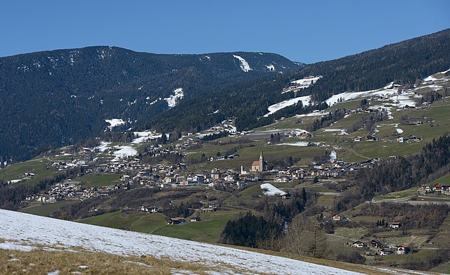

Villanders
- Italian comune
Hiking in Villanders
Villanders, located in South Tyrol, Italy, is a picturesque village that offers a variety of hiking opportunities amidst stunning alpine scenery. Here are some highlights for hiking in this area:...
- Country:
- Postal Code: 39043
- Local Dialing Code: 0472
- Licence Plate Code: BZ
- Coordinates: 46° 37' 51" N, 11° 32' 13" E
- GPS tracks (wikiloc): [Link]
- AboveSeaLevel: 880 м m
- Area: 43.95 sq km
- Population: 1853
- Web site: [Link]


Bolzano
- Italian comune in South Tyrol
Hiking in Bolzano
Bolzano, located in the northern part of Italy in the South Tyrol region, offers stunning hiking opportunities amidst the picturesque backdrop of the Dolomites and surrounding mountains. Here are some highlights and tips for hiking in Bolzano:...
- Country:
- Postal Code: 39100
- Local Dialing Code: 0471
- Licence Plate Code: BZ
- Coordinates: 46° 30' 0" N, 11° 21' 0" E
- GPS tracks (wikiloc): [Link]
- AboveSeaLevel: 232 м m
- Area: 52.29 sq km
- Population: 106951
- Web site: [Link]
Shares border with regions:
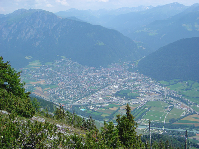
Graubünden
- canton of Switzerland
Hiking in Graubünden
The Canton of Grisons, or Graubünden, is a breathtaking region in Switzerland known for its stunning landscapes, diverse hiking trails, and rich cultural heritage. Here are some highlights of hiking in this beautiful area:...
- Country:

- Capital: Chur
- Licence Plate Code: GR
- Coordinates: 46° 45' 0" N, 9° 30' 0" E
- GPS tracks (wikiloc): [Link]
- AboveSeaLevel: 585 м m
- Area: 7105.39 sq km
- Web site: [Link]

Province of Belluno
- one of seven provinces in the Italian region Veneto
Hiking in Province of Belluno
The Province of Belluno, located in the Veneto region of northern Italy, is a spectacular destination for hiking enthusiasts. This province is predominantly covered by the Dolomites, a UNESCO World Heritage site known for its stunning landscapes, unique geological formations, and rich biodiversity. Here are some key points about hiking in the Province of Belluno:...
- Country:
- Capital: Belluno
- Postal Code: 32010–32047; 32100
- Local Dialing Code: 0437; 0439; 0436; 0435
- Licence Plate Code: BL
- Coordinates: 46° 8' 27" N, 12° 12' 56" E
- GPS tracks (wikiloc): [Link]
- Area: 3677 sq km
- Population: 209550
- Web site: [Link]

Province of Sondrio
- province of Italy
Hiking in Province of Sondrio
The Province of Sondrio, located in northern Italy's Lombardy region, is a stunning destination for hiking enthusiasts. Known for its diverse landscapes, which include the impressive Alps, lush valleys, and picturesque villages, Sondrio offers a wide range of hiking trails suitable for all levels of experience....
- Country:
- Capital: Sondrio
- Postal Code: 23100, 23010-23038
- Licence Plate Code: SO
- Coordinates: 46° 21' 37" N, 9° 56' 38" E
- GPS tracks (wikiloc): [Link]
- Area: 3211.9 sq km
- Web site: [Link]
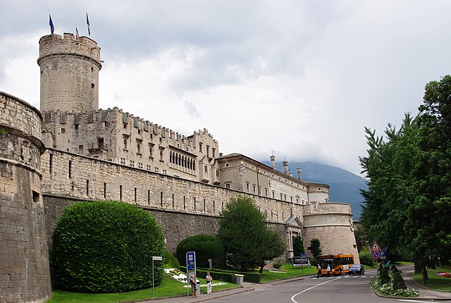
Trentino
- autonomous province of Italy
Hiking in Trentino
Hiking in Trentino, a region in northern Italy, offers a stunning array of landscapes, from the majestic Dolomites to picturesque valleys, dense forests, and serene lakes. Here are some highlights and essentials for hiking in this beautiful region:...
- Country:
- Capital: Trento
- Postal Code: 38010-38023-38089; 38121–38123
- Local Dialing Code: 0465; 0464; 0463; 0462; 0461; 0439
- Licence Plate Code: TN
- Coordinates: 46° 26' 44" N, 11° 10' 23" E
- GPS tracks (wikiloc): [Link]
- Area: 6207 sq km
- Population: 447359
- Web site: [Link]


Tyrol
- federal state in western Austria
Hiking in Tyrol
Tyrol, located in the Austrian Alps, is a paradise for hiking enthusiasts, offering a diverse array of trails that cater to all skill levels. The landscape is characterized by stunning mountain vistas, lush valleys, sparkling lakes, and charming alpine villages, making it a perfect setting for outdoor activities....
- Country:

- Capital: Innsbruck
- Coordinates: 47° 16' 0" N, 11° 24' 0" E
- GPS tracks (wikiloc): [Link]
- AboveSeaLevel: 605 м m
- Area: 12647.71 sq km
- Population: 739002
- Web site: [Link]


Salzburg
- state of Austria
Hiking in Salzburg
Salzburg, located in Austria, is renowned for its stunning alpine landscapes and rich cultural heritage, making it a fantastic destination for hiking enthusiasts. Here are some highlights and tips for hiking in the state of Salzburg:...
- Country:
- Capital: Salzburg
- Coordinates: 47° 46' 1" N, 13° 21' 51" E
- GPS tracks (wikiloc): [Link]
- AboveSeaLevel: 827 м m
- Area: 7156.03 sq km
- Population: 545742
- Web site: [Link]