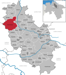
Gnarrenburg (Gnarrenburg)
- municipality of Germany
Gnarrenburg, located in Lower Saxony, Germany, is a quaint village surrounded by beautiful countryside, offering opportunities for hiking enthusiasts. The area features scenic trails that wind through forests, fields, and near water bodies, making it ideal for nature lovers.
Hiking Trails
While Gnarrenburg itself may not have extensive marked hiking trails, you can explore nearby areas, such as the surrounding forests and the picturesque landscapes typical of the region. Some potential hiking options include:
-
Local Forests: You can find several small forested areas near Gnarrenburg. These provide peaceful hiking experiences with the opportunity to enjoy local wildlife.
-
Nature Reserves: Consider exploring nature reserves nearby, where you can take well-marked hiking trails that vary in difficulty.
-
Walking Paths: There are numerous walking paths in the area that are suitable for casual hiking. These paths often connect various points of interest in the countryside.
Tips for Hiking in Gnarrenburg
- Maps and Apps: It's advisable to bring a physical map or use a hiking app to track your route, as some trails may not be well-marked.
- Weather Prepareation: Check the weather forecast before heading out, and dress in layers to accommodate changing temperatures.
- Water and Snacks: Always bring enough water and snacks, especially if you plan on hiking for an extended period.
- Footwear: Wear sturdy hiking boots to ensure comfort and support on varied terrain.
Nearby Attractions
While hiking, consider exploring nearby attractions such as small local farms, charming villages, or any local historical sites. Engaging with the local culture can enhance your hiking experience.
Conclusion
Hiking around Gnarrenburg can be a delightful experience, especially if you appreciate serene nature settings and the beauty of the Lower Saxony countryside. Whether you're a beginner or a seasoned hiker, you will find pleasant trails and opportunities to enjoy the outdoors.
- Country:

- Postal Code: 27442
- Local Dialing Code: 04763
- Licence Plate Code: ROW
- Coordinates: 53° 23' 0" N, 9° 0' 0" E


- GPS tracks (wikiloc): [Link]
- AboveSeaLevel: 10 м m
- Area: 123.23 sq km
- Population: 9222
- Web site: http://www.gnarrenburg.de
- Wikipedia en: wiki(en)
- Wikipedia: wiki(de)
- Wikidata storage: Wikidata: Q503947
- Wikipedia Commons Category: [Link]
- Freebase ID: [/m/0cjdpt]
- Freebase ID: [/m/0cjdpt]
- Freebase ID: [/m/0cjdpt]
- GeoNames ID: Alt: [2919692]
- GeoNames ID: Alt: [2919692]
- GeoNames ID: Alt: [2919692]
- VIAF ID: Alt: [248952381]
- VIAF ID: Alt: [248952381]
- VIAF ID: Alt: [248952381]
- OSM relation ID: [1050510]
- OSM relation ID: [1050510]
- OSM relation ID: [1050510]
- GND ID: Alt: [4021384-5]
- GND ID: Alt: [4021384-5]
- GND ID: Alt: [4021384-5]
- WOEID: [652940]
- WOEID: [652940]
- WOEID: [652940]
- Historical Gazetteer (GOV) ID: [GNAURGJO43MJ]
- Historical Gazetteer (GOV) ID: [GNAURGJO43MJ]
- Historical Gazetteer (GOV) ID: [GNAURGJO43MJ]
- German municipality key: 03357016
- German municipality key: 03357016
- German municipality key: 03357016
Shares border with regions:


Vollersode
- municipality of Germany
Vollersode is a tranquil village located in Lower Saxony, Germany, offering a delightful setting for hiking enthusiasts. The region is characterized by its picturesque landscapes, lush green countryside, and well-marked trails that weave through forests, fields, and along rivers....
- Country:

- Postal Code: 27729
- Local Dialing Code: 04793
- Licence Plate Code: OHZ
- Coordinates: 53° 20' 0" N, 8° 55' 0" E


- GPS tracks (wikiloc): [Link]
- AboveSeaLevel: 20 м m
- Area: 46.37 sq km
- Population: 2813
- Web site: [Link]
Holste
- municipality of Germany
Holste, located in various parts of the world, might refer to a specific region, or it could be a misspelling or abbreviation. Assuming you are referring to hiking in a general region or area named Holste, here's a general overview of what you might expect in such a location based on typical hiking terrains....
- Country:

- Postal Code: 27729
- Local Dialing Code: 04748
- Licence Plate Code: OHZ
- Coordinates: 53° 22' 0" N, 8° 49' 59" E


- GPS tracks (wikiloc): [Link]
- AboveSeaLevel: 27 м m
- Area: 35.37 sq km
- Population: 1365
- Web site: [Link]

